2027 Most Affordable Online Geographic Information Systems (GIS) Degree Programs

Co-Founder and Chief Data Scientist
Choosing an online geographic information systems degree is not just a tuition decision. It is a career-path decision: Do you need a full undergraduate foundation, a faster graduate credential, or a specialized program that helps you move into analytics, planning, environmental work, agriculture, or geospatial technology?
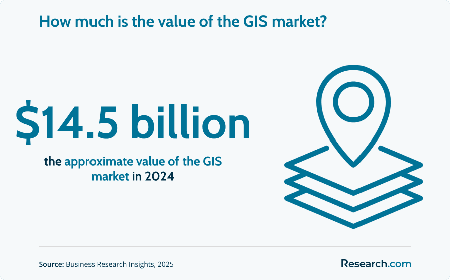
GIS matters because organizations now rely on location-based data to plan cities, monitor environmental change, manage infrastructure, respond to disasters, route logistics, and make business decisions. The global GIS market is valued at $14.5 billion, and employers need people who can turn spatial data into useful maps, models, dashboards, and recommendations.
This guide explains how affordable online GIS degree programs work, what they cost, how long they take, which schools offer lower-cost options, and how to judge whether a program fits your goals. You will also learn how to compare bachelor’s and master’s options, what courses and specializations to expect, what career paths are available, and what mistakes to avoid before enrolling.
Quick answer: Are affordable online GIS degree programs worth it?
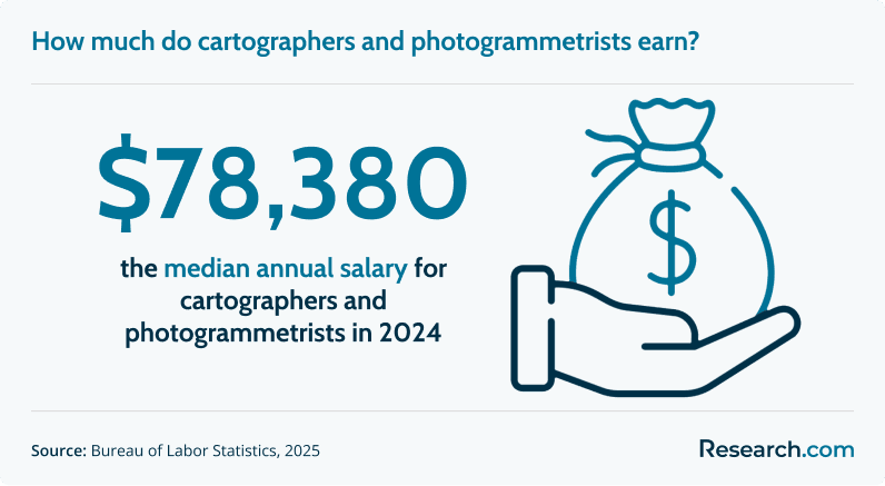
Affordable online GIS programs can be worth it for students who want technical, data-focused careers without relocating or pausing work. A GIS degree can prepare graduates for roles such as GIS analyst, cartographer, remote sensing analyst, urban planning specialist, environmental data analyst, and geospatial developer. The median annual salary for cartographers and photogrammetrists is $78,380, and the field is projected to add 1,000 job openings annually over the next decade.
The best value usually comes from an accredited program with reasonable tuition, strong GIS software training, project-based coursework, and opportunities to build a portfolio. A bachelor’s degree is typically best for students without a four-year degree, while a master’s program is often better for professionals who already hold a bachelor’s degree and want to pivot into GIS or specialize quickly.
What are the main benefits of affordable online geographic information systems programs?
- Career flexibility: GIS skills apply across government, environmental consulting, agriculture, transportation, public health, utilities, real estate, logistics, and technology.
- Practical impact: Graduates can support work in disaster response, sustainable land use, infrastructure planning, conservation, food systems, and community health.
- Strong earning potential: Cartographers and photogrammetrists have a median annual salary of $78,380, with higher pay possible in specialized industries and advanced roles.
- Online accessibility: Remote programs let working adults, military learners, parents, and career changers complete GIS coursework without moving to campus.
- Portfolio development: Many online GIS programs use labs and applied projects that can become work samples for employers.
What should you expect from an affordable online GIS degree program?
An affordable online GIS program should teach more than map production. Strong programs train students to collect, clean, manage, analyze, visualize, and explain spatial data. You should expect coursework in spatial analysis, cartography, geodatabases, remote sensing, data modeling, and GIS software.
Most programs use tools such as ArcGIS and QGIS, along with virtual labs, cloud-based data platforms, recorded lectures, discussion boards, and project assignments. The strongest courses ask students to solve realistic problems, such as identifying flood-risk zones, mapping service gaps, analyzing agricultural land use, or designing web maps for public decision-making.
Online learning can be rigorous. Students need discipline, reliable technology, and time for lab work. GIS assignments often require troubleshooting data, projections, software tools, and analysis outputs, so a good program should provide faculty access, technical support, and clear project expectations.
| What you study | Why it matters in GIS work |
| Spatial analysis | Helps you identify patterns, relationships, risks, and opportunities based on location. |
| Cartography and geovisualization | Teaches you to communicate geographic information clearly, accurately, and ethically. |
| Geodatabase management | Builds the data-management skills needed for large projects and organizational GIS systems. |
| Remote sensing | Prepares you to interpret satellite, drone, and aerial imagery for environmental, agricultural, and planning uses. |
| Programming and automation | Supports advanced work in workflow automation, web mapping, and geospatial application development. |
Where can graduates of affordable online GIS programs work?
GIS graduates work anywhere location data affects decisions. Local, state, and federal agencies use GIS for zoning, transportation planning, emergency response, public works, public health, and environmental protection. Private-sector employers use GIS for site selection, logistics, market analysis, utilities, telecommunications, real estate development, insurance, and energy.
Scientific and technical consulting firms also hire GIS professionals to help clients understand land use, infrastructure, natural hazards, environmental change, and resource management. For students who want work that blends technology with real-world problem-solving, GIS can provide a practical bridge between data, geography, and decision-making.
How much can you earn after an affordable online GIS degree?
The median annual salary for cartographers and photogrammetrists is $78,380. Entry-level GIS technician or GIS analyst roles may pay less, while senior analysts, developers, project managers, and specialists in high-paying industries can earn more. The top-paying industries include oil and gas extraction, where GIS professionals have an average salary of $135,250.
Salary depends on role, location, employer type, software skills, programming ability, portfolio quality, degree level, and years of experience. An affordable program can improve return on investment by reducing upfront cost while still providing access to the technical training needed for GIS roles.
- Most Affordable Online Geographic Information Systems Degree Programs for 2027
- How long does an affordable online GIS degree take?
- How do online GIS programs compare with campus programs?
- What does an affordable online GIS degree cost?
- What financial aid options are available for GIS students?
- What are the admission requirements for online GIS programs?
- What courses are included in an online GIS degree?
- What GIS specializations can students choose?
- How should you choose the best affordable online GIS program?
- What careers can you pursue with a GIS degree?
- Can management skills strengthen a GIS career?
- What is the GIS job market like?
- How do internships and industry partnerships help GIS students?
- How do interdisciplinary skills improve GIS career options?
- Are affordable online GIS programs accredited and recognized?
Most Affordable Online Geographic Information Systems Degree Programs for 2027
How do we rank schools?
Research.com builds rankings to help students compare education options using transparent, data-informed criteria. Our ranking process is explained in our methodology, which outlines how we evaluate schools and programs.
Our analysis uses the IPEDS database for institutional information, Peterson's database and its Distance Learning Licensed Data Set for online program details, the College Scorecard for cost and outcome indicators, and the National Center for Education Statistics for current higher education data.
1. Arkansas State University - Bachelor of Science in GIS and Precision Agriculture
Arkansas State University offers an online Bachelor of Science in GIS and Precision Agriculture for students who want to apply geospatial tools to modern farming and land management. The program connects GIS with agricultural technology, including data from drones, GPS, and sensors.
This degree is a strong fit for learners interested in crop optimization, resource efficiency, environmental monitoring, and sustainable agriculture. Graduates can use spatial data to support agricultural businesses, conservation efforts, and land-use decisions.
- Program Length: 120 credit hours
- Specializations: None
- Required Credits to Graduate: 120
- Cost per Credit: $314
- Accreditation: Higher Learning Commission (HLC)
2. Western Illinois University - Bachelor of Science in Geographic Information Science
Western Illinois University offers a Bachelor of Science in Geographic Information Science that combines GIS theory with practical spatial analysis training. Students study cartography, remote sensing, spatial databases, and applied GIS methods.
The program is useful for students who want broad preparation for public-sector, private-sector, or technical GIS roles. Hands-on work through the university's GIS Center can help learners connect classroom concepts to mapping, analysis, planning, and resource-management projects.
- Program Length: 120 semester hours
- Required Credits to Graduate: 120
- Cost per Credit Hour: $325.27 (in-state undergraduate)
- Accreditation: Higher Learning Commission (HLC)
3. South Dakota State University - Bachelor of Science in Geographic Information Sciences
South Dakota State University provides a Bachelor of Science in Geographic Information Sciences for students who want a scientific and analytical approach to location-based data. The curriculum emphasizes spatial statistics, remote sensing, data modeling, and geographic problem-solving.
This option may appeal to students interested in conservation, research, environmental monitoring, intelligence, and advanced geospatial analysis. Graduates leave with skills for interpreting spatial patterns and supporting evidence-based decisions.
- Program Length: 4 years
- Required Credits to Graduate: 120
- Cost per Credit: $359.85
- Accreditation: Higher Learning Commission (HLC)
4. Liberty University - Master of Science in Geographic Information Systems
Liberty University offers an online Master of Science in Geographic Information Systems with concentrations in Cartography and Remote Sensing and Environmental and Urban Planning. The program is designed for students who want graduate-level preparation in spatial analysis, visual communication, and earth observation.
Coursework can support careers involving satellite imagery, environmental analysis, planning, mapping, and geospatial project leadership. This master’s degree is best suited to students who already have a bachelor’s degree and want focused GIS specialization.
- Program Length: 1.5 years
- Concentrations: Cartography and Remote Sensing ; and Environmental and Urban Planning
- Required Credits to Graduate: 36
- Cost per Credit: $565
- Accreditation: Southern Association of Colleges and Schools Commission on Colleges (SACSCOC)
5. Troy University - Bachelor of Science in Geographic Information Sciences
Troy University offers a Bachelor of Science in Geographic Information Sciences with an applied focus. The program is built for students who want to use GIS in operational settings such as public safety, surveying, municipal services, business, and infrastructure planning.
Students learn core GIS concepts while building practical skills in spatial data management and analysis. Graduates can pursue roles that require accurate mapping, workflow support, and location-based decision-making.
- Program Length: 120 credit hours
- Specializations: None (Offers a related minor in GIS)
- Required Credits to Graduate: 120
- Total Annual Tuition: $9,312 (in-state); $18,624 (out-of-state)
- Accreditation: Southern Association of Colleges and Schools Commission on Colleges (SACSCOC)
6. UMass Global - Master of Science in Geographic Information Systems and Data Analytics
UMass Global offers a Master of Science in Geographic Information Systems and Data Analytics for students who want to combine spatial analysis with broader data analytics. The program blends GIS, programming, statistical analysis, and data interpretation.
This graduate option may be a good match for professionals interested in market analysis, public health mapping, smart city work, location intelligence, or advanced analytics roles that require both spatial and quantitative skills.
- Program Length: As few as 18 months
- Required Credits to Graduate: 36
- Cost per Credit: $750
- Accreditation: Western Association of Schools and Colleges (WASC) Senior College and University Commission (WSCUC)
7. University of Arizona - Bachelor of Science in Geographic Information Systems Technology (GIST)
The University of Arizona offers an online Bachelor of Science in Geographic Information Systems Technology (GIST) with a strong technical focus. Students study GIS software, programming, web mapping, database design, and system implementation.
This program is well suited for learners who want to work as GIS analysts, GIS developers, GIS administrators, or technical geospatial specialists. Its emphasis on tools and infrastructure can help students prepare for roles that support the back-end and front-end systems behind spatial decision-making.
- Program Length: 4 years
- Required Credits to Graduate: 120
- Cost per Credit: $525
- Accreditation: Higher Learning Commission (HLC)
8. Arizona State University - Bachelor of Science in Geographic Information Science
Arizona State University offers an online Bachelor of Science in Geographic Information Science for students who want to use spatial data to examine social, environmental, and planning challenges. The curriculum emphasizes analysis, modeling, and applied geographic problem-solving.
This degree can support careers in government, nonprofits, consulting, environmental work, and private-sector analytics. Students interested in climate change, urbanization, infrastructure, and equity-related spatial questions may find this program especially relevant.
- Program Length: 7.5 weeks per class
- Required Credits to Graduate: 120
- Cost per Credit: $640
- Accreditation: Higher Learning Commission (HLC)
How long does it take to complete an affordable online GIS degree?
Completion time depends on degree level, transfer credits, enrollment status, and course scheduling. Online GIS programs often allow full-time or part-time study, which helps working students balance school with employment and family responsibilities.
| Degree option | Typical credit requirement | Common completion timeline | Best for |
| Online bachelor’s in GIS | About 120 credit hours | 4 years full time; often 5 to 6 years part time | Students starting college, transfer students without a four-year degree, and learners who want broad undergraduate preparation |
| Online master’s in GIS | Usually 30 to 36 credit hours | As little as 12 to 18 months full time; commonly about two years part time | Career changers and professionals who already have a bachelor’s degree and want focused geospatial training |
There are currently over 12,790 cartographers and photogrammetrists in the U.S., and the field is projected to have 1,000 job openings annually over the next decade. A shorter program is not automatically better, though. Choose the timeline that lets you learn the software, complete meaningful projects, and graduate with work samples you can show employers.
How does an affordable online GIS degree compare to an on-campus program?
An accredited online GIS degree can offer the same academic credential as a campus-based program. The key difference is delivery: online students complete lectures, labs, discussions, and projects remotely, while campus students attend in-person classes and may have easier access to physical labs or local networking events.
Like affordable online animation degree programs, online GIS programs can be effective when they include hands-on software training, applied assignments, faculty feedback, and portfolio-building projects. The format matters less than the quality of the curriculum and the evidence of skills you can produce.
| Factor | Online GIS program | Campus GIS program |
| Flexibility | Usually better for working adults and students who cannot relocate. | Better for students who prefer fixed schedules and face-to-face structure. |
| Cost considerations | May reduce commuting, relocation, and campus-related expenses. | May include additional housing, transportation, or campus costs. |
| Hands-on learning | Uses virtual labs, cloud software, remote data projects, and online collaboration. | May include in-person labs, fieldwork, and direct access to campus equipment. |
| Networking | Often connects students with working professionals in different regions. | Can offer local networking, campus events, and in-person faculty access. |
| Best fit | Self-directed students who need schedule flexibility. | Students who learn best through in-person interaction and structured routines. |
Before choosing either format, confirm accreditation, software access, lab requirements, internship options, and whether online students receive the same academic and career support as campus learners.
What is the average cost of an affordable online GIS degree program?
Costs vary by school, residency status, degree level, fees, technology requirements, and transfer credit policies. Affordable online bachelor’s programs may cost $20,000 to $40,000 for the full degree at some public universities. Online master’s programs are usually shorter and may range from $15,000 to $30,000.
Do not compare programs by tuition alone. A lower per-credit rate can still become expensive if a school accepts few transfer credits, requires extra fees, or extends your time to graduation. A higher-priced program may be more valuable if it offers stronger software training, relevant specializations, employer connections, and projects that improve your job prospects.
GIS can also be compared with related online technology and professional programs. Students weighing costs across fields may want to review affordable online master’s in business law options or the cheapest online data analytics degree programs to understand how GIS tuition compares with other career-oriented online credentials.
| Cost factor | What to check before enrolling |
| Tuition model | Is tuition charged per credit, per term, or by residency status? |
| Fees | Are there online learning fees, technology fees, graduation fees, or lab fees? |
| Software access | Does tuition include access to GIS platforms, or must students purchase licenses? |
| Transfer credits | How many credits can you transfer, and will they reduce your total cost? |
| Time to completion | Can the program schedule help you graduate efficiently without overloading yourself? |
| Career value | Does the program help you build a portfolio, earn experience, and connect with employers? |
The median annual salary of $78,380 for cartographers and photogrammetrists makes cost control important. The less debt you take on, the easier it is for a GIS salary to produce a favorable return on investment.
What financial aid options are available for students in affordable online GIS programs?
Students in accredited online GIS degree programs are often eligible for many of the same aid options as campus students. Financial aid can reduce out-of-pocket costs, but eligibility depends on the school, program type, enrollment level, and student circumstances.
- Federal student aid: Complete the Free Application for Federal Student Aid (FAFSA) to determine eligibility for federal grants, work-study opportunities, and federal loans.
- School-based scholarships: Universities may offer awards for online learners, geography students, STEM students, transfer students, or students with strong academic records.
- Departmental scholarships: Geography, environmental science, agriculture, planning, or technology departments may have funding for GIS-related students.
- Professional association awards: Organizations connected to geography, geospatial intelligence, surveying, planning, or environmental work may offer competitive scholarships.
- Employer tuition assistance: Working professionals should ask whether their employer reimburses coursework related to data analysis, planning, technology, logistics, engineering, or environmental work.
- Military and veteran benefits: Eligible service members and veterans may use education benefits, including GI Bill® benefits, for approved online programs.
Contact each school’s financial aid office before applying. Ask for a total cost estimate, not just tuition, and request details about aid eligibility for online students specifically.
What are the prerequisites for enrolling in an affordable online GIS program?
Admission requirements differ for undergraduate and graduate programs. A bachelor’s program is designed for students starting or completing an undergraduate degree. A master’s program is for students who already have a bachelor’s degree and want advanced or career-changing GIS preparation.
Bachelor’s degree admission requirements
Online bachelor’s programs usually require standard undergraduate application materials. Requirements vary, but applicants commonly need:
- High school diploma or GED: This is the basic requirement for undergraduate admission.
- Minimum GPA: Many universities expect a minimum high school GPA, often around a 2.5 on a 4.0 scale, though standards differ by institution.
- Transcripts: Applicants submit official high school transcripts and transcripts from any colleges previously attended.
- Standardized test policy: Some schools are test-optional, so SAT or ACT scores may not be required.
- Transfer review: Students with prior college credit should ask how previous coursework applies to general education and major requirements.
Master’s degree admission requirements
Online GIS master’s programs often welcome applicants from different undergraduate majors. This makes GIS an accessible option for career changers, especially compared with fields that require a tightly prescribed academic background, such as the pathway described in guides about aquatic biologist education requirements.
- Accredited bachelor’s degree: Applicants generally need a completed four-year degree from an accredited institution.
- Minimum undergraduate GPA: Many programs look for a 3.0 GPA, though some may consider professional experience or conditional admission.
- Letters of recommendation: Schools may request academic or professional references who can speak to your readiness for graduate work.
- Statement of purpose: Applicants typically explain why they want GIS training and how the degree supports their goals.
- Prerequisite knowledge: Some programs may recommend or require basic statistics, geography, programming, or computer skills.
What courses are typically in an affordable online GIS degree program?
GIS courses teach students how to understand spatial relationships, manage geographic data, and communicate location-based insights. The best programs balance software training with analytical thinking, data quality, ethics, and applied problem-solving.
Some GIS programs also combine technical and leadership-oriented learning, similar to how an affordable online MSN MBA dual degree program blends professional disciplines for applied decision-making. In GIS, that blend may involve analytics, public policy, environmental science, planning, or business operations.
Core GIS courses
- Introduction to GIS: Covers spatial data types, coordinate systems, projections, map layers, and basic GIS software workflows.
- Cartography and geovisualization: Focuses on map design, visual hierarchy, labeling, color choices, and responsible data communication.
- Spatial analysis and modeling: Teaches methods for identifying patterns, measuring relationships, modeling scenarios, and answering location-based questions.
- Geodatabase design and management: Builds skills in organizing, storing, maintaining, and querying spatial datasets.
- Remote sensing and image analysis: Introduces satellite, drone, and aerial imagery interpretation for environmental, agricultural, and planning applications.
- Web GIS: Explores interactive maps, online GIS platforms, dashboards, and public-facing spatial applications.
- GIS programming: May include Python or scripting to automate workflows, clean data, and develop custom tools.
Why spatial thinking matters
GIS is not simply the technical act of making a map. Strong GIS professionals know how to ask spatial questions: Where is a problem concentrated? What features are connected? Which sites are most suitable? How might a pattern change over time?
This applied focus differs from some fields where training may lean more heavily toward theory, such as the academic preparation described in resources on economist requirements. GIS coursework is usually built around software, data, and real-world analysis.
Students should expect exposure to both proprietary and open-source tools. QGIS holds 5.87% of the desktop GIS market share, and learning multiple platforms can make graduates more adaptable. Local governments employ over 5,310 professionals in this field, making public-sector GIS a major career pathway for students who develop strong applied skills.
What specializations are available in affordable online GIS programs?
GIS specializations help students connect technical skills to a specific career direction. A general GIS degree can prepare you for many roles, but a focused track can make your portfolio more relevant to employers in planning, environmental work, public safety, agriculture, energy, or data science.
| Specialization area | What you learn | Career fit |
| Urban and regional planning | Land-use analysis, transportation mapping, zoning, population modeling, and infrastructure planning. | City planning departments, consulting firms, transportation agencies, and development organizations. |
| Environmental science and conservation | Habitat mapping, climate-related spatial analysis, natural resource monitoring, and conservation planning. | Environmental agencies, nonprofits, conservation organizations, and consulting firms. |
| Emergency management and public safety | Hazard mapping, evacuation planning, emergency routing, disaster response, and real-time spatial data use. | Emergency management offices, public safety agencies, and local governments. |
| Remote sensing | Satellite imagery, drone data, aerial photographs, image classification, and environmental monitoring. | Agriculture, defense, environmental monitoring, energy, and research organizations. |
| GIS development and programming | Automation, custom GIS tools, web maps, spatial databases, and application development. | Technology companies, GIS teams, utilities, government agencies, and consulting firms. |
| Geospatial data science | Spatial statistics, predictive modeling, machine learning, and large-scale location data analysis. | Analytics teams, public health, smart city initiatives, market analysis, and research settings. |
Scientific and environmental GIS
Students with interests in ecology, geology, water resources, agriculture, or conservation can use GIS to study spatial patterns in the natural world. For example, someone researching how to become a paleontologist may also see how GIS can support site mapping, fossil distribution analysis, and field data organization.
Technical GIS tracks
Students who enjoy coding, systems, and software may prefer GIS development, web GIS, or geospatial data science. These paths can lead to roles that build tools, automate analysis, manage spatial databases, and create interactive mapping applications.
Specialization can influence earnings. Industries such as energy and federal government roles can pay more than some entry-level GIS positions, and oil and gas extraction offers an average salary of $135,250 for GIS professionals.
How should you choose the best affordable online GIS degree program?
The best affordable GIS program is not always the cheapest or the highest ranked. It is the program that fits your background, career goal, budget, schedule, and learning needs. Lists of the best GIS programs can be useful starting points, but your final decision should be based on fit and evidence.
Step 1: Decide whether you need a bachelor’s or master’s degree
| Choose this path | If your situation is | Why it may make sense |
| Bachelor’s in GIS | You do not already have a four-year degree. | It provides broad undergraduate education plus core GIS training. |
| Master’s in GIS | You already have a bachelor’s degree in any field. | It can help you pivot, specialize, or move toward advanced GIS work faster. |
| GIS certificate | You need targeted skills but may not need a full degree. | It can be a lower-commitment option, especially for professionals adding GIS to an existing career. |
Step 2: Look for portfolio-building coursework
Employers want proof that you can work with spatial data. A strong program should help you graduate with projects that show your ability to analyze data, build maps, explain results, and solve real problems.
- Project-based courses: Look for assignments that use real datasets and produce portfolio-ready work.
- Software access: Confirm whether students use ArcGIS Pro, QGIS, web mapping tools, database tools, or programming environments.
- Relevant specialization: Match concentrations to your intended career area, such as planning, remote sensing, agriculture, or geospatial data science.
- Faculty experience: Review whether instructors have applied GIS, research, or industry experience.
- Career support: Ask about internships, employer projects, resume support, portfolio reviews, and alumni outcomes.
- Accreditation: Choose an institution with recognized accreditation so your degree is more likely to be accepted by employers and other schools.
Questions to ask before applying
- Will my diploma or transcript identify the program as online?
- What GIS software and data platforms are included in tuition?
- How many hours per week should I expect to spend on labs and projects?
- Can I transfer credits, and how will they affect my graduation timeline?
- Does the curriculum include Python, web GIS, remote sensing, or database work?
- Are online students eligible for internships, research projects, and career services?
- What portfolio pieces will I have by graduation?
The GIS market was valued at $14.5 billion in 2024, but market size alone should not drive your decision. Focus on whether the program helps you develop marketable, demonstrable skills.
What career paths are available for graduates of affordable online GIS degree programs?
A GIS degree can lead to careers in mapping, analytics, planning, software, environmental work, transportation, public safety, agriculture, and geospatial data management. Graduates of an affordable online geosciences degree may work in related science-based settings, but GIS graduates are especially focused on location intelligence and spatial data tools.
Common GIS roles
| Role | Main responsibilities | Useful skills |
| GIS technician | Updates maps, cleans datasets, digitizes features, supports analysts, and maintains GIS records. | Data entry accuracy, GIS software, quality control, map editing. |
| GIS analyst | Analyzes spatial data, creates maps and reports, supports planning and operational decisions. | Spatial analysis, databases, cartography, communication. |
| Cartographer | Designs maps for navigation, planning, publishing, research, or public communication. | Cartographic design, data visualization, accuracy, layout tools. |
| Remote sensing analyst | Interprets imagery from satellites, drones, and aircraft to monitor land, resources, or hazards. | Image analysis, classification, environmental interpretation, remote sensing software. |
| GIS developer | Builds mapping tools, automates workflows, designs web GIS applications, and supports GIS systems. | Programming, Python, databases, APIs, web mapping. |
| Geospatial data scientist | Combines GIS with statistics, modeling, machine learning, and large spatial datasets. | Programming, analytics, spatial statistics, data storytelling. |
| GIS project manager | Leads GIS teams, manages budgets, coordinates deliverables, and communicates with stakeholders. | Project management, leadership, GIS expertise, client communication. |
If you are new to the field, start by understanding what a GIS analyst does, because analyst roles are a common entry point and can lead to technical, managerial, or specialized positions.
GIS vs. data science vs. geography
GIS focuses on the “where” in data. Data science is broader and may analyze many types of data without a geographic component. Geography may include human, physical, cultural, and environmental study, with GIS as one of many tools. Students who choose GIS are usually choosing an applied technical path centered on spatial data, maps, models, and location-based decisions.
Can management skills strengthen a GIS career?
Management skills can help GIS professionals move beyond individual contributor roles into project leadership, team supervision, consulting, operations, and strategy. As GIS projects become more complex, employers may value professionals who can manage budgets, communicate with stakeholders, coordinate multidisciplinary teams, and translate technical findings into business or policy decisions.
Students interested in leadership may compare GIS training with programs such as the cheapest engineering management online master’s programs. While GIS provides spatial expertise, management education can support advancement into roles that require both technical judgment and organizational leadership.
What is the job market for graduates with an affordable online GIS degree?
The job market for GIS graduates is stable and specialized. Cartographers and photogrammetrists are projected to grow by 6% over the next decade, and there are projected to be 1,000 job openings annually. These numbers point to steady demand for professionals who can produce reliable spatial analysis and manage geospatial data.
Job titles can be confusing. Government labor data often groups roles under “cartographers and photogrammetrists,” while employers may post openings under titles such as GIS analyst, GIS technician, geospatial analyst, GIS specialist, remote sensing analyst, or mapping technician. Entry-level titles may not reflect the full earning potential of the field, especially for professionals who later move into development, remote sensing, data science, project management, or specialized industry roles.
Current trends also affect GIS careers. Employers increasingly expect GIS professionals to understand data management, automation, web mapping, remote sensing, and cross-functional communication. AI and automation may reduce some repetitive mapping tasks, but they also increase demand for professionals who can validate data, design workflows, interpret spatial results, and explain uncertainty to decision-makers.
What do graduates say about affordable online GIS degree programs?
- "I had a full-time job in another field and needed a way to retrain without leaving work. The online GIS program let me study at night and on weekends, and the projects were directly connected to real problems. I accepted a GIS analyst position before my official graduation date." - Will
- "I started the program thinking GIS meant making maps. The programming and web mapping courses changed my direction completely. My capstone was an interactive map of local food pantry resources, and it helped me realize I wanted to work on the development side of GIS." - Kate
- "With two children at home, commuting to campus was not realistic. Online courses gave me a path to finish my degree after bedtime and around family responsibilities. It required discipline, but it made the goal possible." - Leo
How do internships and industry partnerships improve GIS career outcomes?
Internships, employer-sponsored projects, and industry partnerships can turn GIS coursework into career evidence. Students who work with real datasets, client problems, and professional feedback often graduate with stronger portfolios and a clearer understanding of workplace expectations.
When comparing programs, ask whether online students can participate in internships, capstones, research labs, government projects, or consulting-style assignments. These experiences can help students practice project scoping, data cleaning, analysis, visualization, and stakeholder communication.
Some GIS careers also benefit from adjacent digital skills. For example, students interested in interactive environments, simulation, or 3D spatial applications may explore related training through online game development degree programs, especially when geospatial visualization overlaps with immersive media or interactive design.
How do interdisciplinary skills improve GIS career options?
GIS becomes more powerful when paired with subject-matter knowledge. Employers often need professionals who understand both spatial tools and the context behind the data. Environmental science, public health, agriculture, logistics, urban planning, geology, emergency management, and business analytics can all strengthen GIS career preparation.
Interdisciplinary skills help graduates ask better questions and interpret results more responsibly. A GIS professional working in public health, for instance, needs to understand access, population patterns, privacy, and health systems. A GIS professional in conservation needs ecological context. A GIS professional in agriculture needs land, soil, crop, and resource-management knowledge.
Students who want broader scientific context may compare GIS with adjacent programs such as online biochemistry degrees. The goal is not to collect unrelated credentials, but to build a coherent skill set that connects GIS with a field where spatial decisions matter.
Are affordable online GIS programs accredited and recognized by employers?
Accreditation is one of the first quality checks for any online GIS degree. Institutional accreditation signals that a college or university meets recognized academic standards, which can affect transfer credit, graduate school admission, employer acceptance, and financial aid eligibility.
Industry recognition is also important, but it is not the same as accreditation. Employers may look for evidence that a program teaches current GIS tools, uses applied projects, has experienced faculty, connects with industry partners, and produces graduates with strong portfolios. Review course descriptions, software lists, capstone requirements, internship access, and alumni feedback before enrolling.
Students comparing quality standards across technology-related programs may also examine how fast-changing fields evaluate online learning, such as a fast online health informatics master’s degree. In any technical field, the strongest programs keep curricula aligned with current tools, data practices, and employer expectations.
Common mistakes to avoid when choosing an online GIS degree
| Mistake | Better approach |
| Choosing only by lowest tuition | Compare total cost, transfer credits, fees, software access, graduation timeline, and career support. |
| Ignoring accreditation | Confirm that the institution is properly accredited before applying or accepting aid. |
| Assuming all GIS programs teach the same tools | Review whether courses include ArcGIS, QGIS, remote sensing, web GIS, databases, and programming. |
| Overlooking portfolio value | Choose programs with applied projects, capstones, internships, or work samples you can show employers. |
| Picking a specialization too early | Learn core GIS first, then choose a track that matches your target roles and industries. |
| Relying only on rankings | Use rankings as a starting point, then evaluate fit, cost, curriculum, flexibility, and outcomes. |
| Assuming salary outcomes are guaranteed | Treat salary data as a benchmark and build marketable skills that improve your competitiveness. |
Key Insights
- Affordable online GIS degrees can offer strong value: The median annual salary for cartographers and photogrammetrists is $78,380, so keeping tuition low can improve return on investment.
- Degree level matters: A bachelor’s degree is the better fit if you do not already hold a four-year degree; a master’s degree is usually more efficient for career changers or professionals seeking specialized GIS skills.
- Accreditation is nonnegotiable: Choose an accredited institution so your degree is more likely to be recognized by employers, graduate schools, and financial aid systems.
- Portfolio quality can matter as much as the school name: Employers want evidence that you can analyze spatial data, build maps, use GIS software, and explain findings clearly.
- The job outlook is steady: Cartographers and photogrammetrists are projected to grow by 6% over the next decade, with 1,000 projected job openings annually.
- Specialization can improve career focus: Remote sensing, geospatial data science, GIS programming, emergency management, agriculture, planning, and environmental GIS can lead to different roles and salary paths.
- GIS is strongest when paired with context: Combining GIS with management, public health, environmental science, agriculture, logistics, or programming can make your skills more useful in real workplaces.
- Public-sector opportunities are significant: Local governments employ over 5,310 professionals in this field, making government a major pathway for GIS graduates.
- The broader market is large: The GIS market is valued at $14.5 billion, which reflects the growing role of location intelligence across industries.
References:
- Business Research Insights. (2024, January). GIS market size, share, & COVID-19 impact analysis, by component (software, data, and services), by function (mapping, surveying, telematics and navigation, and location-based services), by end-user (agriculture, oil & gas, architecture, engineering, and construction, transportation, utilities, mining, government, healthcare, retail, and others), and regional forecasts, 2024-2032. Retrieved May 21, 2024, from Business Research Insights.
- Enlyft. (n.d.). QGIS market share and competitor report. Retrieved May 21, 2024, from https://enlyft.com/tech/products/qgis
- U.S. Bureau of Labor Statistics. (n.d.). OES profile. Retrieved May 21, 2024, from BLS.
- U.S. Bureau of Labor Statistics. (2023, September 6). Cartographers and photogrammetrists. Occupational Outlook Handbook. Retrieved May 21, 2024, from BLS.
Other Things You Should Know About Online Geographic Information Systems (GIS) Degree Programs
In 2027, some of the most affordable online GIS degree programs are offered by institutions like the University of West Florida, the University of Texas at Dallas, and Southern New Hampshire University. These programs provide cost-effective options while maintaining quality education and are available to students worldwide.
Choosing the most affordable online GIS degree programs in 2027 can significantly reduce educational expenses, which is ideal for students on a budget. These programs often offer flexible schedules, allowing students to balance work and study, and can provide access to current GIS technology and software, ensuring up-to-date skills in the field.