
2027 Fastest Online Geographic Information Systems (GIS) Degree Programs

Co-Founder and Chief Data Scientist
Did you know the median annual salary for surveying and mapping technicians—often serving as GIS technicians—was $51,940 in May 2024? With employment for these roles projected to grow 6% from 2023 to 2033—faster than average—GIS expertise is in rising demand.
This article explores the fastest online undergraduate GIS pathways for 2025, detailing program length, cost, and accreditation, so you can launch your GIS career efficiently and strategically, maximizing your return on time and investment.
What are the benefits of completing the fastest online geographic information systems (GIS) degree program?
- Median GIS technician salary of $51,940 per year offers strong earning potential early in career.
- GIS technician roles are expected to grow 6% from 2023–33, indicating healthy demand and job security.
- Career paths span environmental management, urban planning, transportation, and public health, showcasing GIS’s versatility.
What can I expect from the fastest online geographic information systems (GIS) degree program?
Completing an accelerated online GIS program equips you with in-demand skills in spatial analysis, cartography, and remote sensing, all delivered through interactive, project-based courses. Expect hands-on training with industry-standard software like ArcGIS and QGIS, plus real-world data projects that build your portfolio. You’ll graduate ready to map, analyze, and visualize geographic data for roles in government, utilities, environmental consulting, and beyond—fast.
Where can I work with a geographic information systems (GIS) degree?
Graduates of fast-track online GIS programs find careers across both public and private sectors, applying spatial insights to transportation planning, natural resource management, and emergency services. Top-employing industries include:
- Surveying & Mapping Services: Core GIS applications in mapmaking and land boundary analysis.
- Architectural & Engineering Services: Support design and planning with spatial data.
- Local Government (Excluding Education & Hospitals): Urban planning, infrastructure maintenance, and zoning.
- State Government: Environmental monitoring, resource management, and public safety.
- Oil & Gas Extraction: Pipeline routing, site selection, and environmental impact analysis.
In which states are GIS skills most in demand? Here are the top states by number of surveying and mapping technicians employed (2023):
- Texas: 9,139 jobs
- Florida: 6,684 jobs
- California: 4,085 jobs
How much can I make with a geographic information systems (GIS) degree?
According to the U.S. Bureau of Labor Statistics, the median annual wage for surveying and mapping technicians—many of whom hold GIS credentials—was $51,940 in May 2024. Salaries as reported by other platforms include:
- Zippia: Average GIS Analyst salary is $63,718/year.
- Salary.com: Median GIS Analyst salary is $91,726/year.
- ZipRecruiter: National average for GIS Specialists is $80,582/year.
- Indeed: Average GIS Analyst salary is $71,029/year.
- PayScale: Average GIS Analyst salary is $64,272/year.
- Glassdoor: National average GIS Analyst salary is $55K - $89K/yr.
- Fastest Online Geographic Information Systems (GIS) Degree Programs for 2027 List of Programs
- How long does it take to complete the fastest online geographic information systems (GIS) degree program? Program Duration
- How does an online geographic information systems (GIS) degree compare to an on-campus program? Online vs Campus
- What is the average cost of the fastest online geographic information systems (GIS) degree program? Program Cost
- What are the financial aid options for students enrolling in the fastest online geographic information systems (GIS) degree program? Financial Aid
- What are the prerequisites for enrolling in the fastest online geographic information systems (GIS) degree program? Admission Requirements
- What courses are typically in the fastest online geographic information systems (GIS) degree program? What courses are typically in the fastest online geographic information systems (GIS) degree program?
- What types of specializations are available in geographic information systems (GIS) degree programs? What types of specializations are available in geographic information systems (GIS) degree programs?
- How do you choose the best among the fastest geographic information systems (GIS) degree programs? How do you choose the best among the fastest geographic information systems (GIS) degree programs?
- What career paths are available for graduates of geographic information systems (GIS) degree programs? What career paths are available for graduates of geographic information systems (GIS) degree programs?
- What is the job market like for graduates of the fastest online geographic information systems (GIS) degree? Job Outlook
- How does an accelerated online GIS degree compare to a computer science accelerated degree? How does an accelerated online GIS degree compare to a computer science accelerated degree?
- What challenges should students anticipate in an accelerated online GIS program? What challenges should students anticipate in an accelerated online GIS program?
- How Can Interdisciplinary Synergies Amplify GIS Career Prospects? How Can Interdisciplinary Synergies Amplify GIS Career Prospects?
Fastest Online Geographic Information Systems (GIS) Degree Programs for 2027
Choosing a fast online GIS program is usually a practical career decision: you want usable mapping, spatial analysis, remote sensing, and geospatial data skills without spending unnecessary time in school. The right program can help you move into GIS technician, analyst, mapping, planning, environmental, public safety, utilities, transportation, or geospatial intelligence work faster than a traditional campus-only pathway.
This guide is built for students, working adults, military-affiliated learners, career changers, and professionals who need a quicker route into geographic information systems. You will learn which online GIS programs can be completed fastest, how certificates compare with bachelor’s degrees, what they cost, what admissions requirements to expect, what courses matter most, and how to judge whether a program is worth your time and money.
The programs below include accredited U.S. institutions and focus on online GIS certificates, nano-credentials, and bachelor’s degree pathways. Some options can be completed in months, while full bachelor’s degrees generally take longer but provide a broader academic foundation.
Quick answer: What is the fastest online GIS degree or credential?
The fastest options are usually online GIS certificates or short geospatial credentials rather than full bachelor’s degrees. Among the programs listed here, Troy University’s online GIS certificate is the shortest listed pathway at about 4 months, followed by American Public University System’s Undergraduate NanoCert in Geospatial Intelligence and Northern Arizona University’s online GIS certificate at about 6 months. Full online bachelor’s programs in GIS or geospatial sciences typically require 120 credits and are designed around a 4-year full-time timeline.
| Fastest-fit option | Best for | Typical trade-off |
| Short GIS certificate or NanoCert | Professionals who already have college experience or need targeted GIS skills quickly | Faster and less expensive, but narrower than a full degree |
| Graduate GIS certificate | Bachelor’s degree holders who want advanced GIS training | Strong specialization, but may require prior undergraduate preparation |
| Online bachelor’s in GIS or geospatial sciences | Students who need a complete undergraduate credential for long-term career mobility | More comprehensive, but usually takes 4 years full-time |
How these programs were evaluated
Research.com uses a structured ranking methodology designed to compare academic programs using credible education data and institutional information. For online GIS programs, the most important factors include accreditation, delivery format, program length, credit requirements, tuition, academic reputation, and practical alignment with GIS careers.
Core data sources include the IPEDS database from the National Center for Education Statistics, which provides institutional data for U.S. colleges and universities. We also use Peterson's database, including distance learning data, to assess online availability and program scope.
Cost and outcome context is also informed by the College Scorecard database. Rankings should be used as a starting point, not a final decision. Before enrolling, confirm tuition, course rotation, transfer policies, and online availability directly with the school.
Fastest online GIS programs at a glance
| Rank | School and program | Credential type | Estimated duration | Credits | Cost listed | Accreditation |
| 1 | Troy University – Online GIS Certificate Program | Certificate | ~4 months | 12 credits | $424/credit | SACSCOC |
| 2 | American Public University System – Undergraduate NanoCert in Geospatial Intelligence | Undergraduate NanoCert | ~6 months | 9 credits | $350/credit standard rate | HLC |
| 3 | Northern Arizona University – Online GIS Certificate | Certificate | ~6 months | 15 credits | $345/credit | HLC |
| 4 | Eastern Michigan University – Online Graduate Certificate in Geographic Information Systems | Graduate certificate | ~1 year full-time | 12 credits | $668/credit | HLC |
| 5 | University of Florida – Online GIS Certificate, Urban & Regional Planning | Certificate | ~12–15 months | 12 credits | $675/credit estimated | SACSCOC |
| 6 | University of West Florida – Online Graduate Certificate in Geographic Information Science | Graduate certificate | ~1 year full-time | 12 credits | $630/credit | SACSCOC |
| 7 | Farmingdale State College – B.S. in Geographic Information Systems | Bachelor’s degree | 4 years full-time | 120 credits | $295/credit in-state | MSCHE |
| 8 | Kennesaw State University – B.S. in Geospatial Sciences | Bachelor’s degree | 4 years full-time | 120 credits | $190/credit in-state | SACSCOC |
| 9 | Old Dominion University – B.S. in Geography, GIS Concentration | Bachelor’s degree | 4 years full-time | 120 credits | $408/credit in-state | SACSCOC |
| 10 | University of North Alabama – B.S. in Geographic Information Science | Bachelor’s degree | 4 years full-time | 120 credits | $340/credit in-state | SACSCOC |
1. Troy University – Online GIS Certificate Program
Troy University is a public university with roots dating to 1887, when it began as Troy State Normal School. The institution has expanded from teacher preparation into a broad public university serving students through campuses, sites, and online programs. Its online GIS certificate is the quickest listed option, making it a strong fit for learners who want a compact, skills-focused credential rather than a full degree.
- Program cost: $424/credit
- Program duration: ~4 months, accelerated through four 1-month courses
- Total credits: 12 credits
- Accreditation: SACSCOC, Southern Association of Colleges and Schools Commission on Colleges
2. American Public University System – Undergraduate NanoCert in Geospatial Intelligence
American Public University System is a private, for-profit online university system headquartered in Charles Town, West Virginia. It began in 1991 as American Military University and has a long history of serving military-affiliated and adult learners. Its geospatial intelligence NanoCert is one of the shortest online pathways for students who want targeted exposure to geospatial intelligence concepts.
- Program cost: $350/credit, standard rate
- Program duration: ~6 months, accelerated schedule
- Total credits: 9 credits
- Accreditation: HLC, Higher Learning Commission
3. Northern Arizona University – Online GIS Certificate
Northern Arizona University is a public research institution founded in 1899 in Flagstaff, Arizona. The university is known for programs connected to sustainability, earth sciences, environmental study, and Indigenous partnerships. Its online GIS certificate is designed for students who want a relatively fast credential with more credits than the shortest certificate options.
- Program cost: $345/credit
- Program duration: ~6 months, three 8-week courses
- Total credits: 15 credits
- Accreditation: HLC, Higher Learning Commission
4. Eastern Michigan University – Online Graduate Certificate in Geographic Information Systems
Eastern Michigan University is a public university in Ypsilanti, Michigan, founded in 1849 as Michigan State Normal School. Now a comprehensive institution serving more than 13,000 students, EMU offers programs across education, business, technology, health sciences, and other areas. Its online graduate GIS certificate is best suited for students who already hold a bachelor’s degree and want a focused graduate-level credential.
- Program cost: $668/credit
- Program duration: ~1 year, full-time
- Total credits: 12 credits
- Accreditation: HLC, Higher Learning Commission
5. University of Florida – Online GIS Certificate, Urban & Regional Planning
The University of Florida is a flagship public land-grant research university in Gainesville, Florida, established in 1853. UF is widely recognized for research activity and for strong academic offerings across engineering, business, health, agriculture, and related fields. Its online GIS certificate is connected to urban and regional planning, making it especially relevant for students interested in planning, land use, public policy, or community development applications.
- Program cost: $675/credit, estimated
- Program duration: ~12–15 months
- Total credits: 12 credits
- Accreditation: SACSCOC, Southern Association of Colleges and Schools Commission on Colleges
6. University of West Florida – Online Graduate Certificate in Geographic Information Science
The University of West Florida is a public university in Pensacola, Florida, founded in 1963 as part of Florida’s state university system. UWF serves Northwest Florida and offers online options across several fields, including STEM, business, and education. Its graduate certificate in geographic information science is a practical choice for bachelor’s degree holders who want to strengthen technical GIS qualifications in about a year of full-time study.
- Program cost: $630/credit
- Program duration: ~1 year, full-time
- Total credits: 12 credits
- Accreditation: SACSCOC, Southern Association of Colleges and Schools Commission on Colleges
7. Farmingdale State College (SUNY) – B.S. in Geographic Information Systems
Farmingdale State College is a public SUNY institution on Long Island, New York, founded in 1912. It began as an agricultural school and has developed into a career-oriented college with applied programs in technology, business, health sciences, and related disciplines. Its GIS bachelor’s degree is not as fast as a certificate, but it provides a complete undergraduate pathway for students who want a full degree credential.
- Program cost: $295/credit, in-state
- Program duration: 4 years, full-time
- Total credits: 120 credits
- Accreditation: MSCHE, Middle States Commission on Higher Education
8. Kennesaw State University – B.S. in Geospatial Sciences
Kennesaw State University is a public university in metropolitan Atlanta, Georgia, founded in 1963 as a junior college in Cobb County. It has grown into Georgia’s third-largest university, enrolling over 40,000 students across two campuses. The B.S. in Geospatial Sciences is a full undergraduate option for students who want broader training in geospatial methods rather than a short certificate.
- Program cost: $190/credit, in-state
- Program duration: 4 years, full-time
- Total credits: 120 credits
- Accreditation: SACSCOC, Southern Association of Colleges and Schools Commission on Colleges
9. Old Dominion University – B.S. in Geography, GIS Concentration
Old Dominion University is a public research university in Norfolk, Virginia, established in 1930 as the Norfolk Division of the College of William & Mary. The university became independent in 1962 and is known for programs in engineering, oceanography, business, and online education. Its geography bachelor’s degree with a GIS concentration may appeal to students who want a broader geography foundation with GIS-focused coursework.
- Program cost: $408/credit, in-state
- Program duration: 4 years, full-time
- Total credits: 120 credits
- Accreditation: SACSCOC, Southern Association of Colleges and Schools Commission on Colleges
10. University of North Alabama – B.S. in Geographic Information Science
The University of North Alabama is based in Florence and traces its origins to 1830 with the founding of LaGrange College. As Alabama’s oldest public four-year university, UNA has expanded into a comprehensive institution offering programs across business, education, sciences, and other disciplines. Its B.S. in Geographic Information Science is a full undergraduate option for students who want structured GIS training within a bachelor’s degree plan.
- Program cost: $340/credit, in-state
- Program duration: 4 years, full-time
- Total credits: 120 credits
- Accreditation: SACSCOC, Southern Association of Colleges and Schools Commission on Colleges
How long does it take to complete a fast online GIS program?
The shortest online GIS credentials can take only a few months, while full bachelor’s programs usually follow a 4-year full-time plan. In this ranking, the fastest listed program is about 4 months, and several certificate options are designed around about 6 months to ~1 year of study.
Other accelerated GIS certificates outside the ranked list show similar timelines. California State University, Fullerton’s online GIS certificate can be completed in eight months of coursework, while the University of Florida’s GIS certificate is structured for 12–16 months depending on course availability and elective choices.
| Credential path | Typical completion time mentioned | When it makes sense |
| Short undergraduate GIS certificate or NanoCert | ~4 months to ~6 months | You need targeted GIS skills quickly and do not necessarily need a degree |
| Graduate GIS certificate | ~1 year full-time | You already have a bachelor’s degree and want advanced geospatial training |
| Planning-focused GIS certificate | ~12–15 months or 12–16 months | You want GIS training tied to urban planning, public administration, or land-use work |
| Bachelor’s degree in GIS, geography, or geospatial sciences | 4 years full-time | You need a complete undergraduate credential and broader career flexibility |
For bachelor’s degree students more broadly, NCES data show that 44% of first-time students complete within 48 months or less. Among students under age 24, half graduate within 45 months. A wider view of completion patterns shows first-time bachelor’s degree earners averaging 49 months, while associate degree recipients average 21 months for certificates and 37 months for associate degrees.
If your goal is speed, a certificate is usually the more efficient route. If your goal is long-term academic mobility, a bachelor’s degree is more comprehensive. Students comparing timelines across technical fields may also find it useful to review how long engineering degrees usually take, since engineering pathways are often longer and more sequential than GIS certificate programs.
Online GIS degree vs. on-campus GIS program: Which is better?
An online GIS credential can be a strong alternative to campus study when the institution is regionally accredited, the curriculum includes practical GIS tools, and the program provides access to faculty support, geospatial software, digital libraries, and career services. For many working adults, online delivery is the difference between enrolling now and delaying school.
The main difference is not the diploma format. It is the learning environment. Online GIS students need reliable technology, comfort with independent learning, and the discipline to complete technical labs without regular in-person supervision. Campus students may benefit from face-to-face networking, fieldwork, and lab access, but they give up some scheduling flexibility.
| Factor | Online GIS program | On-campus GIS program |
| Schedule | Better for working adults, caregivers, military learners, and students outside the campus area | Better for students who prefer a fixed class schedule and in-person accountability |
| Hands-on learning | Can include virtual labs, GIS software, remote projects, and online collaboration | May offer easier access to field equipment, in-person labs, and campus research spaces |
| Cost structure | May reduce room, board, commuting, and relocation costs | May involve housing, transportation, parking, and campus-based fees |
| Networking | Depends heavily on virtual events, faculty responsiveness, and online student communities | Often stronger for spontaneous peer interaction and local employer connections |
| Best fit | Self-directed students who need flexibility | Students who want in-person labs, campus life, and direct faculty interaction |
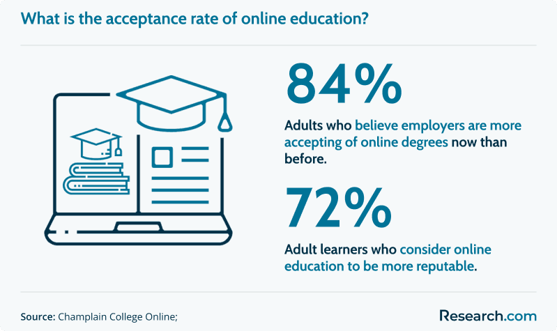
Public perception of online learning has also shifted. Survey data cited in the original source material report that 84% of adults say employers are more open to online degrees now, and 72% view virtual learning as equally reputable. Still, employer acceptance depends on program credibility, not just delivery mode.
If you are comparing short online credentials in very different fields, Research.com also covers options such as the shortest online phlebotomy technician certificate training program. The comparison can help you understand how fast certificates vary by discipline, hands-on requirements, and employer expectations.
What does a fast online GIS program cost?
Cost depends on the credential level, residency status, number of credits, technology fees, software access, and whether you qualify for financial aid. A short 9-credit or 12-credit certificate may cost far less than a 120-credit bachelor’s degree, but it also offers a narrower credential.
For accelerated GIS certificates, the 2023–24 average tuition and fees for Geographic Information Science and Cartography vocational programs was $7,115 for in-state students and $16,822 for out-of-state students. For full bachelor’s programs in GIS-related fields, the cited undergraduate tuition figure is $25,900 annually, with reported rates of $11,288 for in-state students and $25,900 for non-residents.
Those figures show why residency and credential type matter. A 12-credit or 15-credit certificate can be a lower-risk way to build GIS skills before committing to a full degree. By comparison, an affordable online computer science degree may involve a broader and often more expensive technology curriculum, with average online CS programs cited at about $22,000–$24,000 per year.
Nationwide, the average net price for full-time undergraduates, after grants and scholarships, was $14,900 in 2022–23. Because accelerated GIS certificates may require as few as 12–15 credits, the total program investment can be under $9,000 for in-state students in some cases.
| Cost factor | Why it matters | Question to ask before enrolling |
| Per-credit tuition | Short programs can still become expensive if the per-credit rate is high | What is the total tuition for all required credits? |
| Residency status | In-state and out-of-state rates can differ substantially | Do online students pay in-state, out-of-state, or a separate online rate? |
| Software and technology | GIS work may require specialized software, hardware, or cloud access | Are GIS software licenses included in tuition or charged separately? |
| Fees | Online, technology, graduation, and student service fees can change the real price | What fees are mandatory for online students? |
| Transfer credit | Transfer credits can reduce the cost and time of bachelor’s completion | How many credits can I transfer, and how will they apply? |
The following graphic highlights the tuition gap between in-state and out-of-state undergraduate rates, with $11,288 compared to $25,900 annually. It also helps explain why shorter GIS certificates, including options as low as $7,115 in-state, may reduce the total cost of geospatial training.
What financial aid is available for online GIS students?
Financial aid eligibility depends on the school, credential level, enrollment status, and whether the program is approved for federal aid. Degree programs are more commonly aid-eligible than short non-degree certificates, so students should confirm aid eligibility before applying.
NCES data cited in the original source material show that 72% of students received some form of financial aid in 2019–20, and 40% received federal Pell Grants. Common funding sources include:
- Federal Pell Grants: Need-based aid for eligible undergraduates, with awards up to $7,395 per year for low-income students.
- Federal student loans: Subsidized and unsubsidized federal loans may be available for eligible students; the average loan amount was $6,800 per borrower in 2021–22.
- State grants and scholarships: State aid varies by location and program; in 2022, state aid funded over $14 billion across public institutions.
- Institutional scholarships: Colleges may offer need-based or merit-based aid; 85% of full-time freshmen at four-year schools received institutional aid in 2020–21.
- Federal Work-Study: Eligible students may receive subsidized part-time work opportunities; the average award was $2,000 per student in 2019–20.
- Private scholarships and loans: Foundations, employers, professional associations, and lenders may offer additional funding, though terms vary widely.
Before borrowing, compare the total program cost with realistic job outcomes. A short certificate may be easier to pay for out of pocket, while a bachelor’s degree may provide broader access to aid but require a larger total investment.
Students evaluating quick credentials in other technical fields may also compare funding approaches for programs such as the fastest sterile processing technician certificate programs. The same principle applies: verify aid eligibility and total cost before assuming a short program is automatically affordable.
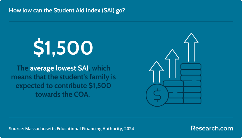
The graphic below shows an average lowest Student Aid Index (SAI) of $1,500, indicating the family contribution used in aid calculations. A low SAI can make grants, scholarships, and subsidized aid especially important for reducing out-of-pocket costs.
What are the usual admissions requirements for fast online GIS programs?
Admissions requirements vary by credential level. Undergraduate certificates and bachelor’s programs usually require high school completion, while graduate certificates generally require a bachelor’s degree. Because GIS includes technical mapping, data, and spatial analysis work, schools may also expect math readiness and basic computer skills.
- High school diploma or GED from an accepted institution for undergraduate entry
- Minimum GPA, often around 2.5 on a 4.0 scale for competitive programs
- ACT or SAT scores in some cases, such as a composite ACT ≥ 20 or SAT equivalent
- Basic computer literacy, including comfort with Microsoft Office or similar tools
- Math placement or diagnostic testing, especially for college-level algebra readiness
- Official transcripts from previous institutions
- English proficiency documentation for international applicants when required
- Recommended introductory coursework in geography, information technology, or related areas for some certificates
If you are not yet ready for a specialized GIS program, a broader pathway such as one of Research.com’s fast track online general studies programs may help you complete foundational credits before narrowing into GIS, geography, data, or technology-focused study.
What courses do fast online GIS programs usually include?
Strong GIS programs combine map design, spatial data, remote sensing, databases, field data collection, and automation. The best curriculum is not just software training; it should teach you how to ask spatial questions, manage data quality, choose the right analysis method, and communicate results clearly.
GIS coursework can also support broader information systems career paths, especially when students pair geospatial tools with database, analytics, programming, or business systems knowledge.
| Course area | What you learn | Why employers care |
| Introduction to GIS | Spatial data basics, geodatabases, layers, coordinate systems, and map creation | Builds the foundation for nearly every GIS role |
| Cartography and map design | Symbolization, visual hierarchy, labeling, and clear map communication | Helps turn analysis into maps that decision-makers can understand |
| Remote sensing fundamentals | Aerial and satellite image acquisition, processing, classification, and interpretation | Supports environmental, agriculture, defense, and land-use applications |
| Spatial data analysis | Pattern detection, spatial statistics, suitability analysis, and modeling | Prepares students for analyst-level problem solving |
| GIS database management | SQL, geodatabase design, data integrity, and spatial queries | Improves accuracy and scalability in GIS projects |
| GIS programming and automation | Python, ModelBuilder, workflow automation, and tool customization | Helps graduates work faster and handle larger datasets |
| Field methods and GPS applications | Data collection, GPS tools, field protocols, and quality control | Connects digital mapping with real-world location data |
| Capstone project | Applied GIS work for a realistic client, community, agency, or research problem | Creates portfolio evidence for job applications |
The chart below highlights in-demand GIS specialist skills, including GPS at 10%, Python at 8.3%, and data collection at 7.5%. Those skills align closely with field methods, GPS applications, GIS programming, and applied project courses.
What GIS specializations are available?
GIS is no longer limited to basic digital mapmaking. Students can specialize in analytics, remote sensing, programming, geospatial intelligence, spatial databases, web mapping, planning, environmental applications, or drone-supported data collection. If you want a broader scan of program choices, Research.com’s guide to the best online GIS degree programs can help you compare options beyond speed alone.
Students from nontechnical backgrounds can still move into advanced technical fields with the right preparation. A similar transition appears in computing pathways such as an online master’s in computer science for non-CS majors, where prerequisite planning and bridge coursework can matter as much as program format.
- GIS analysis and modeling: Focuses on spatial statistics, network analysis, geostatistical modeling, and decision support for planning, environmental management, and infrastructure work.
- Remote sensing: Covers aerial and satellite imagery, classification, spectral analysis, and change detection for monitoring land, water, vegetation, development, or disasters.
- Cartography and visualization: Emphasizes map design, visual communication, storytelling, and publication-quality mapping.
- Spatial databases: Develops skills in geodatabase architecture, SQL, data quality, and management of complex geographic datasets.
- Programming for GIS: Builds scripting ability in Python or R so students can automate workflows, customize tools, and connect GIS with other systems.
- Web GIS: Teaches interactive web maps, APIs, JavaScript libraries, and cloud-based mapping applications.
- Geospatial intelligence and UAS/drones: Applies location intelligence to security, defense, emergency response, and drone-based mapping projects.
How to choose the best fast online GIS program
The best program is not always the shortest one. A 4-month certificate can be ideal for a working professional who needs GIS skills immediately, but it may not be enough for a student who needs a bachelor’s degree for career advancement. Use the following decision process before enrolling.
- Define your goal first. Decide whether you need a quick certificate, a graduate credential, or a full bachelor’s degree.
- Confirm institutional accreditation. Regional accreditation protects credit transfer, academic credibility, and employer recognition.
- Match courses to job postings. Look for GIS software, spatial analysis, databases, Python, GPS, remote sensing, and capstone work.
- Check course rotation. A program advertised as fast may take longer if required courses are offered only once per year.
- Ask about software access. Confirm whether GIS software licenses, cloud tools, and technical support are included.
- Compare total cost, not just tuition. Include fees, software, books, hardware, and transfer credit policies.
- Review career support. Ask whether online students receive resume help, portfolio support, internships, employer events, and alumni access.
| Question to ask | Why it matters |
| Is the institution regionally accredited? | Accreditation affects credibility, transferability, and aid eligibility. |
| Can I finish in the advertised timeline? | Some programs depend on course sequencing and term availability. |
| Does the program include applied projects? | GIS hiring often depends on portfolio evidence, not coursework alone. |
| Will I learn Python, databases, or automation? | Technical depth can improve competitiveness for analyst and developer roles. |
| Are online students eligible for the same services as campus students? | Career support, tutoring, library access, and advising can affect completion. |
| Can credits apply to a future degree? | A certificate is more valuable if credits can stack into a bachelor’s or graduate program. |
Some students combine GIS with broader interdisciplinary study. If you want a flexible foundation before specializing, you may also compare accelerated liberal arts degree online options and then add GIS, data, planning, or environmental coursework.
What careers can you pursue with GIS training?
GIS graduates and certificate holders can work in government, utilities, transportation, environmental consulting, public safety, planning, natural resources, agriculture, defense, logistics, and technology. The career path often begins with data collection and map production, then moves into analysis, automation, application development, and program leadership.
This progression has some overlap with the data scientist career path: entry-level work builds technical fluency, intermediate roles require stronger analysis and automation, and senior roles combine strategy, communication, and project leadership.
| Role | Typical responsibilities | Skills that help |
| GIS Technician | Collects data, edits layers, creates maps, checks spatial accuracy, and supports analysts | ArcGIS, QGIS, GPS, data entry, quality control |
| GIS Analyst | Performs spatial analysis, builds models, interprets patterns, and prepares reports | Spatial statistics, databases, Python, cartography |
| GIS Specialist | Handles specialized GIS functions such as remote sensing, web GIS, or geodatabase management | Remote sensing, web maps, SQL, automation |
| GIS Developer | Builds GIS applications, APIs, scripts, dashboards, and custom geospatial tools | Python, JavaScript, R, APIs, cloud platforms |
| GIS Manager | Manages GIS teams, project portfolios, budgets, data standards, and stakeholder needs | Leadership, project management, enterprise GIS, communication |
| GIS Director or Chief Geospatial Officer | Sets enterprise geospatial strategy and connects GIS work to organizational goals | Strategic planning, governance, executive communication, cross-functional leadership |
Career guides such as GIS Careers: A Mixed Bag of Opportunity emphasize that GIS opportunities vary by sector, location, and technical depth. The chart below shows that the federal government hires roughly 63% of geographers, followed by educational services at 13%, state government at 8%, and professional, scientific, and technical services at 7%.
What is the job market like for GIS graduates?
GIS skills remain useful across public and private sectors because organizations rely on location data to plan infrastructure, monitor risk, manage land and resources, respond to disasters, optimize transportation, and analyze service areas. The strongest opportunities often go to candidates who combine GIS knowledge with databases, scripting, remote sensing, field data collection, or domain expertise.
As of May 2024, the U.S. Bureau of Labor Statistics reported 59,700 jobs for surveying and mapping technicians. Employment for these technicians is projected to grow 6% from 2023 to 2033, which is faster than the average for all occupations. The median annual wage for surveying and mapping technicians was $51,940 in May 2024.
Geographer roles, which often require advanced GIS and spatial analysis skills, included 6,800 positions in 2023 and are projected to grow 3% through 2033. GIS-related work also appears in utilities, transportation, government, natural resources, and surveying and mapping services, where more than 30% of technicians work. A broader overview of the field is available in Discover Data Science’s guide to geographic information system careers.
Accelerated online GIS degree vs. accelerated computer science degree
GIS and computer science can both lead to technical careers, but they train students for different problems. GIS focuses on location-based data, mapping, spatial patterns, remote sensing, and geospatial decision-making. Computer science focuses more broadly on software systems, algorithms, programming, architecture, and computing theory.
If you want to build software products, a computer science accelerated degree may provide a stronger foundation. If you want to analyze where things happen, how places change, and how location affects decisions, GIS is the more direct fit.
| Comparison point | Accelerated GIS pathway | Accelerated computer science pathway |
| Main focus | Spatial data, mapping, remote sensing, and location intelligence | Software development, systems, algorithms, and computing foundations |
| Common tools | ArcGIS, QGIS, GPS tools, spatial databases, Python, web maps | Programming languages, development frameworks, databases, operating systems |
| Best for | Planning, environment, government, utilities, transportation, public safety, geospatial intelligence | Software engineering, systems development, application development, data platforms |
| Potential overlap | GIS programming, geospatial apps, spatial databases, web mapping | Geospatial software, mapping platforms, data engineering, analytics tools |
What challenges should students expect in an accelerated online GIS program?
Accelerated GIS programs move quickly, and the technical workload can surprise students who expect a simple mapmaking course. You may need to learn software tools, spatial concepts, data cleaning, coordinate systems, remote sensing, and analysis methods in compressed terms.
- Time pressure: Short terms leave less room to fall behind, especially when labs require multiple steps.
- Technology demands: GIS software may require a capable computer, stable internet, and comfort with troubleshooting.
- Independent learning: Online students must be proactive about asking questions, attending virtual office hours, and using tutorials.
- Data complexity: Real geospatial datasets can be messy, incomplete, or difficult to project and analyze correctly.
- Limited in-person fieldwork: Some programs may offer fewer opportunities for hands-on field collection or equipment use.
- Portfolio building: Completing courses is not enough; students should save polished maps, analyses, scripts, and capstone work.
Students comparing technical online programs may notice similar issues in fields such as software engineering. Research.com’s guide to the cheapest software engineering degree online explains why planning for workload, technology access, and support services matters in accelerated technical study.
Do fast online GIS programs offer career support?
Many online GIS programs provide career services, but the quality and depth vary. Students should not assume that “online” automatically means less support, but they should verify exactly what services are available to remote learners.
Useful career support may include resume reviews, GIS portfolio feedback, LinkedIn profile guidance, mock interviews, employer panels, virtual career fairs, internship referrals, alumni networking, and help translating coursework into job-ready project examples. For GIS students, portfolio support is especially important because employers often want to see maps, dashboards, analysis outputs, scripts, or applied projects.
Career support also matters if you plan to connect GIS with another field. For example, students exploring healthcare data, population mapping, facility planning, or public health analytics may compare GIS with programs such as the fastest masters health informatics degree online.
How interdisciplinary skills can strengthen GIS career prospects
GIS becomes more valuable when paired with another domain. A student who understands GIS and environmental science can support conservation or climate work. A GIS analyst with transportation knowledge can help model routes, congestion, and infrastructure needs. A professional who combines GIS with healthcare administration can support service area planning, emergency preparedness, and resource allocation.
This is why interdisciplinary planning matters. If your career goal is sector-specific, choose GIS electives, projects, and internships that connect to that industry. Students interested in healthcare leadership, for example, may also compare a healthcare administration degree online with GIS coursework or certificates to build a more specialized profile.
Common mistakes to avoid when choosing a fast online GIS program
| Mistake | Why it can hurt you | Better approach |
| Choosing only the shortest program | The fastest credential may not include the tools or projects employers expect | Compare curriculum, software, projects, and career outcomes alongside duration |
| Ignoring accreditation | Unaccredited programs can create problems with credit transfer, financial aid, and employer trust | Confirm regional accreditation before applying |
| Looking only at tuition per credit | Fees, software, books, and equipment can change the real cost | Ask for the full cost of attendance for online students |
| Assuming all online courses are asynchronous | Live sessions or scheduled labs may conflict with work or family responsibilities | Ask whether courses are synchronous, asynchronous, or mixed |
| Skipping portfolio development | A transcript alone may not prove GIS ability to employers | Save polished maps, dashboards, analyses, scripts, and capstone deliverables |
| Not checking course availability | A required course offered infrequently can delay graduation | Request a term-by-term completion plan before enrolling |
| Assuming salary outcomes are guaranteed | Pay varies by role, location, industry, experience, and technical depth | Use salary data as context, then research local job postings and employer expectations |
What graduates say about fast online GIS programs
- Soraya: "The accelerated format helped me finish in less than a year. I built practical skills in cartography and remote sensing, then used them to support municipal planning map work. Online study gave me the flexibility to stay focused while turning my interest in GIS into a real career step."
- Dax: "Earning my GIS certificate online changed how I approached technical work. The data projects were hands-on, the feedback was useful, and virtual office hours made the program feel connected even at a distance. It was challenging, but the structure kept me engaged."
- Valerie: "The online GIS program helped me move forward professionally. I practiced ArcGIS workflows on my own schedule and applied spatial analysis to real projects right away. Being able to study while managing work and family responsibilities made the program realistic for me."
Additional Research.com resources for comparing accelerated online programs
If you are still comparing career directions, it can help to review how fast online credentials differ across fields. GIS is highly technical and spatial-data focused, while other accelerated programs may emphasize healthcare, software, computing, liberal arts, or general education requirements.
- Fast online phlebotomy technician certificate programs
- Fast sterile processing technician certificate programs
- Fast online general studies degree programs
- Fast online liberal arts degree programs
- Affordable online computer science degrees
- Best accelerated online computer science degree programs
- Affordable online software engineering degrees
- Accelerated online master’s in health informatics programs
- Accelerated online healthcare administration degree programs
Key Insights
- The fastest online GIS options are usually certificates or NanoCerts, not bachelor’s degrees. Troy University’s listed program can be completed in about 4 months, while several other certificate options take about 6 months to ~1 year.
- A full GIS or geospatial sciences bachelor’s degree typically requires 120 credits and a 4-year full-time plan, but it offers broader academic preparation than a short certificate.
- Accreditation is nonnegotiable. Look for regional accreditation such as SACSCOC, HLC, or MSCHE before comparing speed or tuition.
- Cost varies sharply by credential type and residency. The cited 2023–24 average for Geographic Information Science and Cartography vocational programs was $7,115 in-state and $16,822 out-of-state.
- The best GIS curriculum includes more than basic mapmaking. Prioritize spatial analysis, databases, Python or automation, GPS, remote sensing, web GIS, and applied projects.
- Online GIS can be respected by employers when the school is reputable, accredited, and academically comparable to campus programs. The bigger question is whether you can handle technical online labs independently.
- GIS career options span technician, analyst, specialist, developer, manager, and director roles. Stronger outcomes often come from combining GIS with programming, databases, remote sensing, or a domain such as planning, environment, utilities, transportation, or public safety.
- Do not choose a program based on speed alone. Ask about course rotation, software access, transfer credit, portfolio support, total fees, and online student career services before enrolling.
References:
- American Public University System. Undergraduate NanoCert in Geospatial Intelligence.
- Arizona State University. Undergraduate GIS Certificate Minor Map.
- Bureau of Labor Statistics. Surveying and Mapping Technicians.
- Bureau of Labor Statistics. Surveyors.
- North Carolina State University. Geospatial Academics Courses.
- Community College of Philadelphia. Geographic Information Systems Proficiency Certificate.
- College Tuition Compare. Geographic Information Science and Cartography.
- College Tuition Compare. Geographic Information Science and Cartography Vocational Program Costs.
- Discover Data Science. Guide to Geographic Information System Careers.
- Eastern Michigan University. Graduate Certificate in Geographic Information Systems.
- Farmingdale State College. Department of Geography Overview.
- Florida GeoPlan, University of Florida. Online GIS Certificate.
- Geopsy Research. Exploring GIS Career Paths in Demand Opportunities.
- Kennesaw State University. B.S. in Geospatial Sciences.
- LinkedIn. You’re Interested in a GIS Career—How Do I Do It?
- University of Louisville. Applied Geospatial Technologies Certificate.
- Mapscaping. Career Path in Geographic Information Systems (GIS).
- Mapscaping. GIS Careers: A Mixed Bag of Opportunity.
- Monroe Community College. Geospatial Information Science and Technology Certificate Program.
- Northern Arizona University. Online Geographic Information Systems Certificate.
- NCES. IPEDS Trend Generator for Surveying & Mapping Technicians.
- NCES. Financial Aid Trends, July 26 2023.
- NCES. Fast Facts.
- Old Dominion University. B.S. in Geography, GIS Concentration.
- PayScale. Geographic Information Systems (GIS) Analyst Salary.
- Salary.com. GIS Analyst Salary Benchmark.
- Troy University. GIS Certificate.
- University of North Alabama. B.S. in Geographic Information Science.
- University of West Florida. Geographic Information Science Certificate Online.
- ZipRecruiter. Geographic Information Systems Specialist Salary.
- Zippia. GIS Analyst Jobs Salary.
- Zippia. GIS Analyst Salary.
Other Things You Should Know About the Fastest Online Geographic Information Systems (GIS) Degree Programs
A fast-paced online GIS degree program in 2027 allows students to quickly acquire skills in geographic analysis and spatial data management. This accelerated learning can lead to earlier career advancement and cost savings, as students spend less time enrolled and incur fewer tuition expenses.
In many cases, yes. Universities often allow you to apply up to 12–15 credits from a completed GIS certificate toward a related bachelor’s degree in Geography or GIS. To qualify, you typically must maintain a minimum GPA (often around 3.0) in your certificate courses and ensure they align with your degree’s curriculum requirements. Always verify your institution’s transfer policies with an academic advisor before enrolling.


