2027 Best Online GIS Certificate

Co-Founder and Chief Data Scientist
With 56,000 new analyst jobs projected over the next decade, the demand for geospatial skills is exploding. Yet, many of those entry-level roles ask for hands-on experience that a traditional bachelor's degree alone doesn't provide.
While many fields have specialized credentials, the GIS certificate is uniquely powerful for bridging this specific gap. To help you make the right choice, our career planning experts with over 10 years of experience have created this comprehensive guide. We'll show you exactly how the best online GIS certificate programs equip you with the practical skills and project portfolio to get hired.
What are the benefits of getting an online GIS certificate?
- It prepares you for a rapidly growing job market, with 56,000 new GIS analyst positions projected over the next decade, while traditional geographer roles are declining.
- It unlocks strong earning potential, with an average starting salary around $75,000 for GIS analysts.
- It offers the flexibility to gain these valuable skills from anywhere, fitting into your life without requiring you to relocate or commute.
What can I expect from an online GIS certificate?
You can expect an intensive, project-based curriculum that focuses on mastering industry-standard software. The entire goal is to move you from theory to practice, fast. You won't just be reading textbooks; you'll be working with data, building maps, and performing spatial analysis from week one.
And let's be clear about the online format. A common worry is that online programs are somehow less credible. That's simply not the case anymore. Employers care about an institution's reputation and, more importantly, the skills you can demonstrate. The best online GIS certificate programs are rigorous, highly structured, and respected in the industry.
Think of it as a skills-first credential. A bachelor's degree provides broad theoretical knowledge, and a master's degree is often geared toward research. A certificate is a targeted, professional tool designed to make you job-ready. You graduate with a portfolio that proves you can do the work.
Where can I work with an online GIS certificate?
An online GIS certificate opens doors to analyst and technician roles across a surprising number of sectors. While government and engineering are major employers, the ability to analyze location-based data is a valuable skill in many fields. Based on employment data for cartographers and photogrammetrists, key sectors include:
- Local and State Government: The largest employers, making up 45% of the workforce, with roles in urban planning, public works, and emergency services.
- Architectural and Engineering Services: This sector accounts for 18% of jobs, focusing on infrastructure projects, site selection, and environmental impact assessment.
- Management and Technical Consulting: Employing 7% of the workforce, these firms use GIS for market analysis, logistics planning, and strategic advising for private companies.
- Federal Government: Making up 4% of jobs, federal roles often involve national security, resource management, and large-scale environmental monitoring.
How much can I make with an online GIS certificate?
Salaries vary based on your specialization, location, and the industry you enter. This credential is a powerful tool for securing a professional role with a clear ladder for advancement and higher earnings.
Based on current salary data, the following roles demonstrate the earning potential for skilled GIS professionals:
- GIS Solutions Architect: $145,963 per year
- GIS Data Scientist: $122,738 per year
- GIS Consultant: $120,527 per year
- GIS Application Developer: $86,148 per year
- GIS Analyst: $75,010 per year (average)
- List of the Best Online GIS Certificate Programs for 2027 List of Programs
- How long does it take to complete an online GIS certificate program? Completion Time
- How does an online GIS certificate program compare to an on-campus program? How does an online GIS certificate program compare to an on-campus program?
- What is the average cost of an online GIS certificate program? Program Cost
- What are the financial aid options for students enrolling in an online GIS certificate program? Financial Aid
- What are the prerequisites for enrolling in an online GIS certificate program? What are the prerequisites for enrolling in an online GIS certificate program?
- What courses are typically in an online GIS certificate program? What courses are typically in an online GIS certificate program?
- What types of specializations are available in an online GIS certificate program? Specializations
- How to Choose the Best Online GIS Certificate Program How to Choose the Best Online GIS Certificate Program
- What career paths are available for graduates of an online GIS certificate program? Career Paths
- What is the job market for graduates of an online GIS certificate program? Job Market
Best Online GIS Certificate Programs for 2027
Choosing an online GIS certificate is usually a practical career decision: you want geospatial skills that employers recognize, but you may not want to commit to a full master’s degree. The right program can help you learn mapping software, spatial analysis, database management, cartographic design, and project-based GIS workflows while continuing to work or study from home.
This guide is designed for recent graduates, working professionals, analysts, planners, environmental specialists, engineers, public health professionals, and career changers who want a shorter route into geographic information systems. You will learn which online GIS certificate programs stand out, how long they take, what they cost, what courses to expect, how online programs compare with campus options, and how to judge whether a certificate is worth the investment.
If you are comparing credentials across fields, the decision process is similar to weighing NCE vs NCMHCE for counseling licensure: the best choice depends on your career goal, the credential’s recognition, and whether the training matches the role you want.
Quick Answer: Is an Online GIS Certificate Worth It?
An online GIS certificate can be worth it if you already have a bachelor’s degree or professional experience and need focused geospatial training without enrolling in a full graduate degree. Strong programs typically teach GIS software, spatial data management, cartography, spatial analysis, and applied project work. They are especially useful for people moving into GIS analyst, GIS technician, planning, environmental analysis, public health mapping, or geospatial data roles.
The best option is not always the cheapest or fastest certificate. Look for regional accreditation, current technical coursework, portfolio-building assignments, online student support, and a clear path into jobs or further graduate study.
How We Rank Schools
Because certificates still require a meaningful investment of time and money, Research.com evaluates programs using transparent education and institutional data. Our review draws from sources such as the IPEDS database, Peterson's database, the College Scorecard database, and The National Center for Education Statistics.
These datasets help us compare online GIS certificate programs across academic quality, cost, institutional credibility, and student-focused factors. You can read more about how Research.com evaluates schools on our methodology page.
Online GIS Certificate Programs at a Glance
| School | Program | Credits | Cost | Best Fit |
| PennState World Campus | Postbaccalaureate Certificate in Geographic Information Systems | 12 | $1,037 per credit | Students who may later apply certificate credits to a master’s program |
| Ohio University | Online GIS Certificate: GIS & Cartography | 12 | $518 in-state; $540 out-of-state per credit | Beginners who want GIS fundamentals and cartographic design |
| North Carolina State University | Graduate Certificate in Geographic Information Systems | 12 | $568.33 in-state; $1,751.56 out-of-state per credit | Professionals considering a future geospatial master’s degree |
| Oregon State University | Graduate Certificate in GIScience | 19 | $582 per credit | Working adults seeking a broader GIScience curriculum |
| Northeastern University | Graduate Certificate in Geographic Information Systems | 16 quarter credits | $919 per quarter credit | Students interested in spatial databases and applied GIS projects |
| Georgia State University | Professional Certificate in Geographic Information Systems | 14 | $450 per credit | Learners focused on urban, environmental, policy, or public health applications |
| East Tennessee State University | Graduate Certificate in Geographic Information Systems | 12 | $835.50 per credit | Students who want online, in-person, or hybrid flexibility |
| University of Maine | Online Graduate Certificate in Geographic Information Systems | 15 | $626 per credit | Students who want programming and spatial analysis in the core curriculum |
| University of Denver | Certificate of Advanced Study in Geographic Information Systems | 24 quarter credits | $859 per quarter credit | Learners who want electives in areas such as remote sensing or web GIS |
| Marshall University | Graduate Certificate in Geospatial Information Science | 12 | $534.75 per credit | Students combining GIS with biology, environmental science, or a related master’s field |
1. PennState World Campus - Postbaccalaureate Certificate in Geographic Information Systems
Penn State World Campus offers a GIS certificate built around practical use of modern geospatial mapping tools. A major advantage is academic stackability: certificate credits can be applied toward Penn State’s Master of Geographic Information Systems degree, which may appeal to students who want to start with a shorter credential before deciding on graduate school.
- Program Length: 10-week terms
- Required Credits to Graduate: 12
- Cost per Credit: $1,037
- Accreditation: Middle States Commission on Higher Education (MSCHE)
2. Ohio University - Online GIS Certificate: GIS & Cartography
Ohio University provides a fully online certificate for students who may be new to GIS. The program emphasizes both geographic information systems and cartographic communication, making it a practical fit for learners who want to build a foundation in map design, spatial thinking, and GIS tools over three semesters.
- Program Length: 3 semesters
- Required Credits to Graduate: 12
- Cost per Credit: $518 (In-State); $540 (Out-of-State)
- Accreditation: Higher Learning Commission (HLC)
3. North Carolina State University - Graduate Certificate in Geographic Information Systems
The graduate certificate at North Carolina State University is designed for students who want applied and analytical GIS training across professional settings. It can also serve as a first step toward the university’s Master of Geospatial Information Science and Technology program, which makes it useful for learners testing whether a longer graduate pathway fits their goals.
- Program Length: Varies (typically 2-3 semesters)
- Required Credits to Graduate: 12
- Cost per Credit: $568.33 (In-State); $1,751.56 (Out-of-State)
- Accreditation: Southern Association of Colleges and Schools Commission on Colleges (SACSCOC)
4. Oregon State University - Graduate Certificate in GIScience
Oregon State University offers an online GIScience certificate through the College of Earth, Ocean, and Atmospheric Sciences. The program is well suited for working professionals who need flexibility but still want academically rigorous coursework that can connect to related master’s programs.
- Program Length: Varies (typically 3-4 terms)
- Required Credits to Graduate: 19
- Cost per Credit: $582
- Accreditation: Northwest Commission on Colleges and Universities (NWCCU)
5. Northeastern University - Graduate Certificate in Geographic Information Systems
Northeastern University combines GIS concepts with applied experience using industry-standard hardware and software. Students learn to work with spatial databases and GIS workflows that can support decisions in fields such as healthcare, public safety, environmental management, and operations planning.
- Program Length: 6 - 12 Months
- Required Quarter Credits to Graduate: 16
- Cost per Quarter Credit: $919
- Accreditation: New England Commission of Higher Education (NECHE)
6. Georgia State University - Professional Certificate in Geographic Information Systems
Georgia State University connects GIS training with applied social, urban, environmental, and policy questions. Its Atlanta professional network may be especially useful for students interested in public planning, public health, transportation, local government, or community-focused spatial analysis.
- Program Length: 2 semesters
- Required Credits to Graduate: 14
- Cost per Credit: $450
- Accreditation: Southern Association of Colleges and Schools Commission on Colleges (SACSCOC)
7. East Tennessee State University - Graduate Certificate in Geographic Information Systems
East Tennessee State University offers online, campus-based, and hybrid options, giving students more control over how they complete the certificate. Coursework uses current geospatial technology and is designed to count toward the Educational Achievement component of the official GISP Certification portfolio.
- Program Length: 2 semesters
- Required Credits to Graduate: 12
- Cost per Credit: $835.50
- Accreditation: Southern Association of Colleges and Schools Commission on Colleges (SACSCOC)
8. University of Maine - Online Graduate Certificate in Geographic Information Systems
The University of Maine offers a graduate certificate for students from varied academic and professional backgrounds. Its curriculum includes required work in information systems programming and spatial analysis, which can help students build both technical and analytical GIS foundations.
- Program Length: Varies (typically 3-4 semesters)
- Required Credits to Graduate: 15
- Cost per Credit: $626
- Accreditation: New England Commission of Higher Education (NECHE)
9. University of Denver - Certificate of Advanced Study in Geographic Information Systems
The University of Denver offers a fully online GIS graduate certificate with project-based training. Students can pursue deeper study through electives in areas such as remote sensing, internet mapping, and digital image processing, making the program attractive to learners who want specialization rather than only a general GIS overview.
- Program Length: 9 months
- Specializations: Public Health; Conservation; Disaster Management; and Web GIS
- Required Quarter Credits to Graduate: 24
- Cost per Quarter Credit: $859
- Accreditation: Higher Learning Commission (HLC)
10. Marshall University - Graduate Certificate in Geospatial Information Science
Marshall University provides graduate-level study in GIS, remote sensing, and spatial data analysis for students who want to add geospatial skills to an existing academic or professional direction. The certificate may also fit students pursuing a master’s degree in a related field such as Biology or Environmental Science.
- Program Length: 1 year
- Required Credits to Graduate: 12
- Cost per Credit: $534.75
- Accreditation: Higher Learning Commission (HLC)
How Long Does It Take to Complete an Online GIS Certificate Program?
Most online GIS certificate programs can be completed in about 9 to 12 months when taken on a full-time or accelerated schedule. Students who study part time while working often take 18 to 24 months, depending on course availability, term length, and whether the program requires a final project.
Speed matters, but it should not be the only factor. A student looking for the shortest GIS degree online may prioritize quick completion, while a working professional may need a slower pace to build a stronger portfolio and apply new skills on the job.
Choosing the Right Pace
| Student Type | Better Timeline | Why It May Make Sense |
| Recent graduate | 9 to 12 months | A shorter program can help you build a portfolio and apply for GIS technician or analyst roles sooner. |
| Full-time employee | 18 to 24 months | A part-time pace can reduce burnout and give you more time to connect assignments to your current job. |
| Career changer | Varies by background | If you are new to technical software or data analysis, a slower program may give you more time to master tools. |
| Future master’s student | Depends on credit transfer | A stackable certificate may be worthwhile if credits can later count toward a graduate degree. |
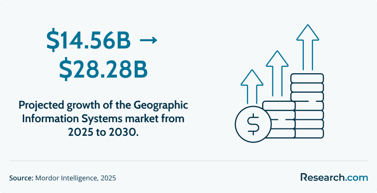
The broader GIS market is projected to grow from $14.56 billion to $28.28 billion by 2030, which helps explain why many students are using certificates to enter or move up within the geospatial field.
How Does an Online GIS Certificate Compare to an On-Campus Program?
At a reputable university, an online GIS certificate can be academically comparable to an on-campus certificate when it uses the same curriculum, faculty standards, assignments, and institutional accreditation. The main differences usually involve delivery format, networking style, technology access, schedule flexibility, and total cost.
Employers generally focus on the school, the skills you can demonstrate, and the quality of your portfolio rather than whether you completed coursework online or in a classroom. Still, students should verify that the transcript or certificate comes from the accredited university and that online students receive the same academic support as campus students.
Online vs. Campus GIS Certificate
| Factor | Online GIS Certificate | On-Campus GIS Certificate |
| Schedule | Often better for working adults and students outside the school’s region | Better for learners who prefer fixed class times and face-to-face structure |
| Networking | Requires more intentional outreach through virtual office hours, discussion boards, and alumni contacts | May offer easier access to campus events, labs, and local employer visits |
| Learning environment | Works well for self-directed students comfortable with digital tools | Works well for students who want in-person instruction and immediate classroom interaction |
| Technology access | Students should confirm software, licenses, cloud tools, and technical support before enrolling | Students may have direct access to campus labs and hardware |
| Career signal | Can show employers that you can manage technical work independently | Can support local networking if the campus is near your target job market |
What Online Learning Signals to Employers
Completing a rigorous online GIS program can demonstrate more than technical knowledge. It can also show self-management, written communication, problem-solving, remote collaboration, and the ability to learn complex software independently.
For professionals deciding between formats, the comparison can resemble evaluating COTA vs OTA in occupational therapy: both routes can be legitimate, but the better choice depends on work setting, independence, credential requirements, and long-term goals.
What Is the Average Cost of an Online GIS Certificate Program?
Based on the programs reviewed here, many online GIS certificates fall between $11,000 and $16,000 in total tuition. Individual programs may cost less or more depending on credit requirements, residency status, quarter-credit pricing, fees, and whether students already qualify for employer or university support.
The listed tuition is only one part of the decision. Students should also consider software access, required technology, books, application fees, graduation fees, and whether certificate credits can later apply to a master’s degree.
How to Think About ROI
A certificate can be a strong investment when it helps you qualify for roles that require GIS software skills, spatial analysis experience, or a project portfolio. Comparing a certificate cost near $15,000 with an average starting salary of $75,010 may suggest a favorable return, but salary outcomes are never guaranteed. They depend on location, prior experience, industry, portfolio strength, and the specific job title.
The same ROI logic applies in other career-focused credential decisions, such as comparing NHA vs PTCB for pharmacy technician certification, where the right credential can influence job access and advancement.
Cost Factors Students Often Miss
- Residency pricing: Some public universities charge different rates for in-state and out-of-state students.
- Credit systems: Quarter credits and semester credits are not always directly comparable, so evaluate total program cost.
- Software requirements: Ask whether GIS software licenses are included or billed separately.
- Stackable credits: A more expensive certificate may be more valuable if every credit can apply to a relevant master’s program.
- Time away from work: Accelerated programs can be efficient, but they may be difficult to manage with full-time employment.
What Financial Aid Options Are Available for Online GIS Certificate Students?
Graduate certificates are often treated differently from full degree programs, so students should not assume that traditional federal financial aid through FAFSA will apply. Funding rules vary by institution and program, which makes it important to speak directly with the financial aid office before enrolling.
Employer Tuition Assistance
If you are currently employed, start with your employer’s professional development or tuition assistance policy. GIS skills can support planning, logistics, environmental reporting, infrastructure analysis, site selection, public health mapping, and data-driven decision-making, so frame your request around business value. You can also review GISCI Endorsing Organizations to see whether your employer or target organizations support GIS professional certification.
Private Loans
Some private lenders offer financing for certificate and professional development programs. Before borrowing, compare interest rates, repayment terms, fees, deferment options, and total repayment cost. A lower monthly payment is not always the least expensive option over time.
University Scholarships and Payment Plans
Contact the university’s financial aid or continuing education office and ask whether certificate students qualify for scholarships, installment plans, employee discounts, alumni discounts, military benefits, or departmental awards. Payment plans can be especially helpful for students who do not want to borrow the full cost upfront.
Questions to Ask Before Paying
- Does this certificate qualify for any federal, institutional, employer, military, or private funding?
- Are GIS software licenses included in tuition?
- Are there separate technology, application, or graduation fees?
- Can certificate credits be applied to a graduate degree later?
- What happens financially if I need to pause or withdraw from a course?
What Are the Prerequisites for Enrolling in an Online GIS Certificate Program?
Most graduate-level online GIS certificates require a bachelor’s degree from an accredited institution, but the degree usually does not need to be in geography, computer science, or engineering. Many successful GIS students come from environmental science, public health, social science, planning, natural resources, business, public administration, geology, and related fields.
Students with a background such as the shortest online geosciences degree may already have useful preparation in earth systems, spatial thinking, and data interpretation, but non-geoscience majors can also succeed if they are comfortable learning technical tools.
Common Admission Expectations
- Bachelor’s degree: Most programs expect applicants to have completed a four-year degree at an accredited college or university.
- Computer readiness: You should be comfortable installing software, managing files, using spreadsheets, and learning new platforms.
- Analytical ability: GIS work requires pattern recognition, data interpretation, and careful problem-solving.
- Basic quantitative comfort: Advanced math may not be required for every certificate, but you should be willing to work with data and spatial measurements.
- Clear career purpose: A strong application often explains why GIS fits your professional goals.
What Courses Are Typically Included in an Online GIS Certificate Program?
A strong online GIS certificate should teach both conceptual foundations and hands-on technical skills. The best programs do more than introduce mapping; they help students collect, manage, analyze, visualize, and communicate spatial information for real decisions.
Core GIS Courses to Expect
- Introduction to GIS and Geospatial Concepts: Students learn how geographic information systems organize, analyze, and display location-based data.
- Spatial Data Acquisition and Management: Coursework covers how to find, create, clean, store, and maintain spatial datasets.
- Cartography and Data Visualization: Students learn how to design accurate, readable, and persuasive maps for different audiences.
- Principles of Spatial Analysis: Courses teach methods for identifying relationships, patterns, clusters, trends, and geographic relationships.
- Capstone or Portfolio Project: Many programs require a final applied project that can be used to show employers practical GIS ability.
Modern Skills That Matter in 2027
Basic GIS coursework is no longer enough for many competitive roles. Look for programs that introduce cloud-based GIS platforms, Python scripting, spatial databases, SQL, web mapping, remote sensing, and data visualization. These skills can help graduates compete for roles that involve automation, dashboards, location intelligence, and interdisciplinary data analysis.
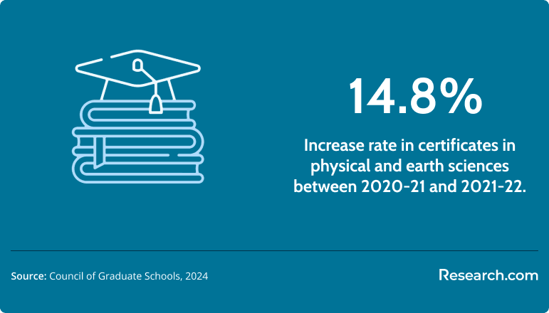
Interest in technical certificate education has grown, with a 14.8% increase in related science certificates recently. That makes curriculum quality especially important: a certificate should give you a current skill set, not only a general overview of GIS terminology.
Students exploring interdisciplinary career acceleration may also compare GIS with other professional pathways, such as learning how to become a nurse practitioner without a BSN degree, where the central question is whether a shorter route still meets professional standards.
What Types of Specializations Are Available in an Online GIS Certificate Program?
Some online GIS certificates are generalist programs, while others allow students to focus on a specific professional application. A specialization can be useful when it connects your GIS training to your existing degree, industry experience, or target job title.
Environmental Analysis
This focus uses GIS for conservation, natural resource management, land-use analysis, geology, ecology, and climate-related work. It is a strong match for students with backgrounds in biology, geology, environmental science, or natural resources.
Urban & Regional Planning
This option applies GIS to transportation, zoning, infrastructure, housing, public works, emergency planning, and community development. It often fits students with experience in public administration, civil engineering, sociology, policy, or planning.
Web & Mobile GIS Development
A more technical specialization may cover interactive web maps, mobile data collection, custom GIS applications, scripting, and cloud tools. It can be a good choice for students who enjoy programming or want to work closer to the technology side of GIS.
Public Health, Conservation, Disaster Management, and Web GIS
Programs such as the University of Denver certificate list specializations in Public Health; Conservation; Disaster Management; and Web GIS. These tracks can help students align GIS training with a clear sector rather than pursuing a broad credential without a target use case.
How to Choose a Specialization
| Choose This Focus | If You Want To Work In | Key Skills to Look For |
| Environmental Analysis | Conservation, natural resources, environmental consulting, geology | Remote sensing, land-use mapping, spatial modeling |
| Urban & Regional Planning | Local government, transportation, infrastructure, housing, public works | Network analysis, demographic mapping, planning datasets |
| Web & Mobile GIS Development | Technology, software, field data collection, dashboards | Web GIS, Python, SQL, cloud GIS, application development |
| Public Health or Disaster Management | Epidemiology, emergency management, risk analysis, response planning | Spatial statistics, hazard mapping, population data analysis |
Cloud deployment in GIS is growing at 16.5% annually, so students interested in technical advancement may benefit from tracks that include web GIS, automation, spatial databases, and cloud-based workflows. Related technical fields, including fast track bachelor's programs in space studies online, also use location-aware and spatial data skills in advanced applications.
How to Choose the Best Online GIS Certificate Program
The best online GIS certificate is the one that fits your current experience, target career, budget, schedule, and future education plans. Rankings can help you build a shortlist, but they should not replace a careful program-by-program review.
Step-by-Step Selection Framework
- Verify institutional accreditation. Confirm that the university is regionally accredited by an organization recognized through CHEA. Accreditation matters for employer confidence, credit transfer, and academic quality.
- Review the curriculum beyond course titles. Look for hands-on GIS labs, spatial analysis, cartography, database work, Python, SQL, cloud GIS, web mapping, and a final portfolio or capstone project.
- Check whether credits are stackable. If you may pursue a master’s degree later, ask whether certificate credits can transfer into a related graduate program.
- Evaluate online support. Confirm that online students receive technical support, library access, advising, tutoring, faculty office hours, and career services.
- Study career outcomes. Ask where graduates work, what roles they pursue, and whether the department can connect you with alumni or employer partners.
- Compare total cost, not only tuition. Include fees, software, books, travel if required, and the opportunity cost of your study schedule.
Common Mistakes to Avoid
| Mistake | Why It Can Hurt You | Better Approach |
| Choosing only the cheapest program | Low tuition is not helpful if the curriculum is outdated or support is weak. | Compare cost alongside skills taught, accreditation, faculty, and portfolio value. |
| Ignoring accreditation | An unrecognized credential may limit credit transfer and employer trust. | Verify regional accreditation before applying. |
| Assuming every online program is flexible | Some programs have fixed live sessions, strict course sequences, or limited start dates. | Ask about weekly workload, synchronous requirements, and course rotation. |
| Skipping the portfolio question | GIS hiring often depends on proof of skill, not just a certificate title. | Choose a program with applied projects you can show to employers. |
| Overlooking software access | GIS tools can be expensive or technically demanding. | Confirm license coverage, hardware requirements, and technical support. |
Questions to Ask Admissions or Program Advisors
- Are the online courses taught by the same faculty who teach campus GIS courses?
- What GIS platforms and software will I use?
- Does the program include Python, SQL, web GIS, remote sensing, or cloud-based GIS?
- Will I graduate with a portfolio project?
- Can credits transfer into a master’s degree?
- What support is available if I struggle with software installation or technical assignments?
- Where do graduates typically work?
What Career Paths Are Available After an Online GIS Certificate?
An online GIS certificate can prepare graduates for several roles that involve mapping, spatial data, location intelligence, and geospatial analysis. It is not limited to one job title. Graduates may work in government, environmental consulting, engineering, transportation, utilities, public health, logistics, emergency management, real estate, agriculture, or technology.
For a broader look at possible roles, Research.com’s guide to geographic information systems jobs explains how GIS skills connect to different career paths.
Entry-Level Roles
Many graduates begin as GIS technicians, GIS analysts, mapping technicians, cartographic assistants, or geospatial data specialists. These roles often involve cleaning spatial data, building maps, maintaining databases, running basic analyses, and supporting project teams.
Mid-Career Progression
With experience, professionals may move into GIS developer, GIS project manager, remote sensing analyst, geospatial analyst, planning analyst, or database-focused roles. At this stage, employers often look for stronger automation, database, project management, and communication skills.
Senior and Specialized Roles
Experienced GIS professionals may become GIS managers, solutions architects, geospatial consultants, technical leads, or senior analysts. Some research, leadership, or highly specialized roles may prefer or require a master’s degree, but a certificate can still be a strong foundation for technical growth.
Where GIS Jobs Are Concentrated
GIS jobs exist across the country, but employment and salary patterns vary by state and industry. The states with the highest employment levels for cartographers and photogrammetrists are Texas, California, and Colorado. Top-paying states include California, Washington, and Connecticut.
What Is the Job Market for Online GIS Certificate Graduates?
The labor market for GIS-related skills is strong, particularly for workers who can combine spatial analysis with data management, programming, web mapping, and domain knowledge. Employment for cartographers and photogrammetrists is projected to grow 6% faster than the national average, and about 56,000 new analyst jobs are projected over the next decade.
GIS is not limited to technology hubs. Demand appears in state and local government, environmental organizations, utilities, transportation, defense, public health, engineering, telecommunications, agriculture, and private consulting. Students who begin with online geography degrees can use a GIS certificate to add a more technical credential to their academic background.
Current Trends Affecting GIS Careers
- GeoAI and automation: Employers increasingly value professionals who can use geospatial data with automated workflows, analytics, and AI-supported tools.
- Cloud-based GIS: Organizations are moving mapping, data sharing, dashboards, and field collection into cloud environments.
- Cross-disciplinary hiring: GIS skills are useful in public health, climate work, infrastructure, logistics, emergency response, and business intelligence.
- Portfolio-based screening: Employers often want to see maps, dashboards, analysis projects, and examples of real spatial problem-solving.
- Remote and hybrid work: Online collaboration skills can be valuable because GIS teams may work across offices, agencies, and field locations.
Career Satisfaction
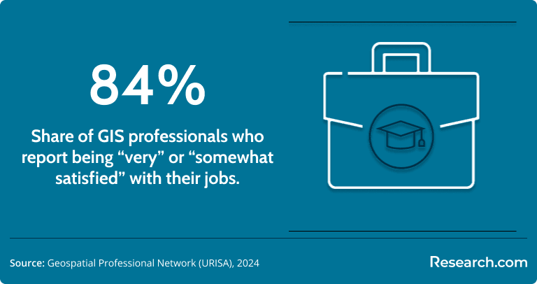
GIS work can be appealing because it combines technology, data, visual communication, and real-world problem-solving. Many professionals work on concrete issues such as flood risk, transportation planning, habitat conservation, disease mapping, infrastructure management, or emergency response. According to the data cited in this guide, 84% of GIS professionals report being satisfied with their jobs.
What Graduates Say About Online GIS Certificate Programs
-
: "My geology coursework gave me the science background, but job postings in resource management kept asking for software experience I did not have. The online certificate helped me turn theory into applied GIS work. My final project used seismic data for a fault line analysis, and that portfolio piece became the main reason I was hired as a GIS technician at an environmental consulting firm.
Marcus"
-
: "As a civil engineering lead, I could see that our firm needed stronger tools for infrastructure modeling and site selection. A full master’s degree was not realistic with my schedule, so the online certificate was the practical option. I learned Python scripting for geospatial tasks in the evening and started using it at work almost immediately, which helped me automate mapping workflows and move into a higher-level role.
Rohan"
-
: "I had worked as a lab technician in biotech, but I wanted to analyze patterns at a larger scale instead of only producing lab results. The certificate gave me a way to shift toward data without starting over. The online discussions with students from other technical fields were more useful than I expected, and I now work as a geospatial analyst for a public health research institute modeling epidemiological data.
Zelia"
Key Insights
- An online GIS certificate is best for students who already have a degree or professional background and need targeted geospatial skills without committing to a full graduate program.
- Most programs take about 9 to 12 months full time or 18 to 24 months part time, but the right pace depends on your work schedule, technical background, and portfolio goals.
- Total tuition for many reviewed programs falls between $11,000 and $16,000, but students should also account for fees, software, credit transfer value, and employer tuition support.
- Regional accreditation is non-negotiable. It helps protect the value of the credential and supports credit transfer if you later pursue a master’s degree.
- The strongest programs include applied projects and current technical skills such as Python, SQL, web GIS, cloud GIS, spatial databases, remote sensing, and data visualization.
- Online programs can be a strong option for working adults, but students should verify software access, technical support, course format, and career services before enrolling.
- GIS careers span government, environmental science, public health, transportation, utilities, planning, logistics, engineering, and technology, so specialization should match your target industry.
- Do not choose based on ranking alone. Compare curriculum, cost, faculty expertise, portfolio opportunities, stackable credits, and graduate outcomes before applying.
References:
- Bureau of Labor Statistics. (2024). Cartographers and photogrammetrists. U.S. Department of Labor, Occupational Outlook Handbook. Retrieved October 13, 2025, from https://www.bls.gov/ooh/architecture-and-engineering/cartographers-and-photogrammetrists.htm
- Bureau of Labor Statistics. (2024). Geographers. U.S. Department of Labor, Occupational Outlook Handbook. Retrieved October 13, 2025, from https://www.bls.gov/ooh/life-physical-and-social-science/geographers.htm
- Bureau of Labor Statistics. (2024, May). Occupational employment and wages, May 2023: Cartographers and photogrammetrists (17-1021). U.S. Department of Labor. Retrieved October 13, 2025, from https://www.bls.gov/oes/2023/may/oes171021.htm
- Bureau of Labor Statistics. (2024, May). Occupational employment and wages, May 2023: Geographers (19-3092). U.S. Department of Labor. Retrieved October 13, 2025, from https://www.bls.gov/oes/2023/may/oes193092.htm
- Council of Graduate Schools. (2024, March). Graduate enrollment and degrees: 2013–2023. Retrieved October 13, 2025, from https://cgsnet.org/wp-content/uploads/2024/03/Graduate-Enrollment-and-Degrees-1.2.pdf
- Data USA. (2024). Surveyors, cartographers, & photogrammetrists. Retrieved October 13, 2025, from https://datausa.io/profile/soc/surveyors-cartographers-photogrammetrists
- GeoProfessional Network. (2024). Executive summary 2024. Retrieved October 13, 2025, from https://cdn.ymaws.com/thegpn.org/resource/resmgr/documents/publications/executivesummary2024.pdf
- Mordor Intelligence. (2025). Geographic information system (GIS) market – Growth, trends, and forecast (2025–2030). Retrieved October 13, 2025, from https://www.mordorintelligence.com/industry-reports/geographic-information-system-market
- ONET OnLine. (2025). Cartographers and photogrammetrists (17-1021.00). National Center for ONET Development. Retrieved October 13, 2025, from https://www.onetonline.org/link/summary/17-1021.00
- ONET OnLine. (2025). Geographers (19-3092.00). National Center for ONET Development. Retrieved October 13, 2025, from https://www.onetonline.org/link/summary/19-3092.00
- Project Geospatial. (2024). The GeoAI revolution: Charting the 2030 geospatial workforce landscape. Retrieved October 13, 2025, from https://projectgeospatial.org/geospatial-frontiers/the-geoai-revolution-charting-the-2030-geospatial-workforce-landscape
- ZipRecruiter. (2025). Geographer salary. Retrieved October 13, 2025, from https://www.ziprecruiter.com/Salaries/Geographer-Salary#TableView
- ZipRecruiter. (2025). GIS analyst salary. Retrieved October 13, 2025, from https://www.ziprecruiter.com/Salaries/Gis-Analyst-Salary#TableView
- ZipRecruiter. (2025). GIS cartographer salary. Retrieved October 13, 2025, from https://www.ziprecruiter.com/Salaries/GIS-Cartographer-Salary#TableView; related BLS overview: https://www.bls.gov/ooh/architecture-and-engineering/cartographers-and-photogrammetrists.htm
Other Things You Should Know About Online GIS Certificate Programs
Some 2027 online GIS certificates require a practicum, internship, or capstone project instead of a final exam. Common requirements include supervised fieldwork, a portfolio, or a project using ArcGIS or QGIS, with submission deadlines set by the issuing college or department.
Online GIS certificate programs in 2027 utilize a mix of virtual labs, interactive software, and project-based learning. These methods help students gain hands-on experience by simulating real-world GIS applications, thus successfully bridging the gap between theory and practice.
Prerequisites for enrolling in a 2027 online GIS certificate program often include a basic understanding of geographical concepts and proficiency in computer skills. Some programs may require a bachelor’s degree or relevant work experience. It's important to check specific program requirements as they can vary.
In 2027, the University Consortium for Geographic Information Science (UCGIS) and other recognized academic bodies often accredit online GIS certificate programs. Accreditation ensures that programs meet educational standards and provide relevant training in geographic information systems.