2027 Best Online Bachelor's in Geosciences With Scientific Writing and Mapping Training

Co-Founder and Chief Data Scientist
Professionals in geosciences often confront the challenge of mastering scientific writing and spatial mapping while balancing ongoing fieldwork or employment. With 45% of adult learners enrolling in online degree programs according to the National Center for Education Statistics' 2024 report, flexibility has become a critical factor in education strategy. This trend signals a shift in how geosciences students can integrate advanced communication and GIS skills without pausing career momentum.
Yet, ensuring these competencies align with employer expectations remains complex. This article examines the best online bachelor's programs emphasizing scientific writing and mapping training, guiding readers to programs that optimize skill acquisition alongside practical accessibility.
Key Things You Should Know
- Graduates with scientific writing and mapping skills enter a job market where 8% annual growth in geoscience technician roles concentrated in energy and environmental sectors demands precise data communication, raising employability but narrowing versatile role options.
- Employers overwhelmingly favor candidates with GIS proficiency integrated into geosciences curricula, linking spatial analysis mastery to a 15% salary premium, yet few programs balance this with in-depth scientific writing, creating a skills-gap tradeoff.
- Programs requiring extensive hands-on mapping software training increase time-to-degree by an average of 6 months and cost by 12%, disproportionately affecting working adults seeking expedited career transition paths versus traditional students.
What is an online bachelor's in geosciences?
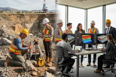
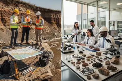
An online bachelor's degree in geosciences with scientific writing training delivers a blend of analytical and communication skills tailored to distinct applied settings. Mastery in interpreting geological, climatological, and hydrological data merges with clear reporting to non-specialist audiences, a requirement increasingly emphasized by employers. For instance, a mining company geoscientist must produce rigorous soil analyses and visual maps that align with regulatory standards, while environmental policy roles demand concise explanations of climate risks.
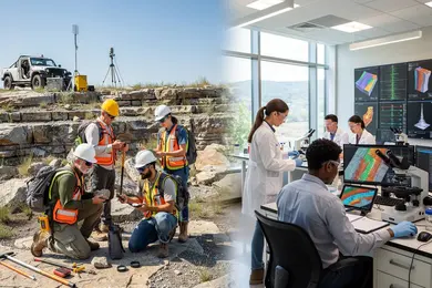
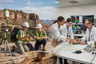
The practical challenge for online geosciences bachelor's programs with mapping and data analysis lies in compensating for limited hands-on lab exposure. Programs often incorporate virtual labs or arrange local fieldwork opportunities, yet prospective students should critically assess how these experiences reflect real-world expectations. Aligning coursework with in-person internships or cooperative placements remains essential to bridging online study with workforce readiness.
Employment projections show a modest 3% growth for geoscientists over a decade, paired with a median wage near $99,240 indicating stable demand. This underlines the need for graduates to combine specialized GIS software skills with effective scientific communication to retain a competitive edge in data-driven sectors.
Individuals pivoting careers or advancing within environmental sciences might also consider salary benchmarks from related fields, such as the SLP salary for comparative insight into interdisciplinary compensation dynamics.
How do online and campus geosciences degrees compare?
Choosing between online geosciences degrees versus campus programs comparison involves weighing significant trade-offs in practical experience and network access that directly impact employability. Campus programs integrate hands-on lab work, field mapping, and direct equipment use, skills employers demand for roles in environmental consulting or geological surveying. Graduates with online degrees must proactively obtain remote or local internships to compensate for the limited tactile training and face-to-face mentorship common on campus.
Employers prioritize applied skills such as scientific writing and geospatial mapping, not solely theoretical knowledge. Campus students benefit from easier collaboration on group projects and internships due to proximity to faculty networks and industry hubs. Conversely, online learners face challenges securing equivalent experiential learning independently, which affects job market readiness and can extend job searches.
The median salary for geoscientists is $99,240, with top-tier professionals earning over $161,260, a reflection of the premium placed on technical competence integrated with academic credentials. For individuals balancing work or family, online degrees offer necessary flexibility but require commitment to independently secure critical practical training.
Decisions between online and on-campus geosciences education should align with specific career goals. Fieldwork-intensive roles generally necessitate campus training, while remote data interpretation or research positions may accept online degrees if candidates showcase equivalent technical and communication skills.
Prospective students exploring this pathway can also consider the cheapest online data science masters programs for complementary skills that enhance employability in data-driven geosciences roles.
What accreditation should geosciences programs have?
Regional accreditation remains the essential baseline for geosciences programs, with recognized agencies like the Higher Learning Commission or Middle States Commission on Higher Education ensuring credit transferability and workforce relevance. Specialized accreditation from organizations such as ABET, while not a universal requirement, can differentiate programs for students targeting careers in applied geospatial analysis or scientific mapping, fields where technical rigor and industry alignment are non-negotiable.
Employment projections from the U.S. Bureau of Labor Statistics indicate a 5% growth in demand for cartographers and photogrammetrists through 2032, a rate exceeding average job market expansion. This growth places a premium on programs that integrate validated scientific writing instruction and hands-on experiences with current GIS software-skills frequently mandated by federal agencies and established GIS firms. Lack of recognized accreditation or insufficient technical training often results in significant retraining delays or limited hiring prospects, especially in compliance-heavy environments.
For professionals evaluating accreditation standards for online geosciences degrees, the practical implications include smoother transitions into specialized roles that require nuance in spatial data interpretation and scientific communication. Selecting accredited programs minimizes risk of credentialing gaps that can hamper strategic pivots or advancement. Prospective students balancing flexibility with credibility may also consider related pathways such as online exercise science degrees, which share similar scrutiny in regional accreditation requirements and workforce integration.
What courses are in a geosciences degree with writing and mapping?
Success in geosciences increasingly depends on the ability to convert complex geological data into actionable insights through clear scientific writing and precise mapping. Programs integrating scientific writing and mapping courses in geosciences programs equip students with skills beyond fieldwork, focusing on communication tools essential in environmental consulting, government, and energy sectors. A graduate who can visualize spatial data effectively and prepare technical reports stands out in multidisciplinary teams.
Core courses support this dual focus and include:
- Introduction to Geospatial Analysis using ArcGIS or QGIS for accurate spatial data creation and interpretation
- Integrated Scientific Writing emphasizing technical vocabulary, data visualization, and organizing field research
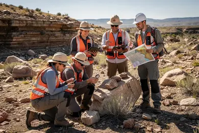
- Field Methods in Geology for practical mapping and data collection relevant to mining, hydrology, or urban planning
- Remote Sensing to analyze satellite imagery for resource management
- Advanced Cartography concentrating on map design, scale, and thematic layering tailored to audience needs
For example, environmental consultancies expect geoscientists to present jargon-free impact assessments from raw measurements, bridging technical complexity with stakeholder clarity. This capacity influences employability, especially as real-world roles demand combining data expertise with effective communication.
Tradeoffs involve accessibility and cost; Fort Hays State University's online Applied Geology program charges approximately $3,975.75 per semester, a competitive price point compared with many on-campus STEM programs. This affordability enhances feasibility for working professionals, a consideration aligned with recent analyses on the mechanical engineering degree market emphasizing cost-efficient STEM education pathways.
What admissions requirements do online geosciences programs have?
Admission into online geosciences bachelor's programs hinges on more than transcripts and diplomas; it demands measurable readiness to engage with rigorous, technical coursework. Foundations in algebra, chemistry, and earth science are baseline requirements, but the increasing integration of GIS and remote sensing means proficiency in computing and spatial analysis is essential for staying competitive. Applicants lacking this technical background often face extended study time and higher costs, which can impact overall return on investment.
Beyond academic prerequisites, programs typically require clear statements of purpose and recommendation letters that attest to a candidate's analytical skills and persistence, especially in STEM contexts. These elements serve as proxies for the aptitude necessary to succeed in data-intensive GIS courses, which now comprise 30-40 credit hours focused on scientific writing, cartography, and geospatial analysis.
This curriculum reflects a labor market prioritizing professionals who can synthesize technical GIS expertise with articulate scientific communication-critical in fields like environmental consulting and urban planning. Employers expect graduates to not only process and visualize data but also translate findings effectively to diverse stakeholders.
Prospective students should critically evaluate their quantitative abilities and self-discipline for independent online learning, as these factors significantly influence program completion and employability. Online learning's flexibility comes with tradeoffs: without prior GIS experience, students may incur longer pathways and increased financial burdens while striving to meet workforce expectations.
How long does an online geosciences degree take?
Completing an online geosciences bachelor's degree often extends beyond the nominal four-year timeline, especially for students juggling work or personal commitments. Flexible scheduling and part-time options, while accommodating, frequently prolong program durations to five or six years. This extension has real consequences: delayed entry into professional roles and added financial burden. Programs accredited by regional bodies typically require 120 to 130 credit hours including critical competencies like scientific writing and cartographic analysis, aligning with employer expectations for both theoretical understanding and applied skills.
Fieldwork, internships, and lab experiences present distinct challenges in fully online settings. Some programs mitigate this through local partnerships or brief residencies, but the necessity of these components can be a major factor in overall completion time. For working professionals pivoting to geosciences, asynchronous coursework provides scheduling flexibility but demands strong self-discipline to avoid elongating graduation timelines.
With 14 fully online geology and 9 earth sciences bachelor's degrees available in the U.S., students have options tailored to specialization and pacing preferences. However, the practical tradeoff often lies between accelerated completion and comprehensive skill acquisition valued in the job market. Missed credits or abrupt schedule changes can significantly extend degree duration, escalating opportunity costs.
- Plan realistically for 120-130 credit hours including capstone projects
- Account for field-based requirements and local residency options
- Balance flexibility with disciplined pacing to minimize delays
How much does an online geosciences bachelor's cost?
The cost of online bachelor's degrees in geosciences often forces students to weigh tuition expenses against practical career outcomes. With total tuition ranging from $40,000 to $80,000, this wide variation depends heavily on residency status and institution type. Public universities charge between $300 and $500 per credit in-state, while out-of-state and private schools may exceed $700 per credit. These rates increase the financial burden, especially when programs require extended durations to accommodate hands-on training in scientific writing and mapping software.
Beyond tuition, students face additional expenses such as geospatial software licenses, specialized fieldwork equipment, and capable computing hardware-non-negligible costs that directly affect total program investment and completion timelines. Those currently employed might find significant savings by utilizing employer tuition assistance, which can offset high costs and improve access to reputable programs.
Salary disparities after graduation illustrate the value of a full bachelor's degree. Geoscientists earn an average $92,040 annually, while related roles like geological and petroleum technicians typically garner $51,130 but often require only associate degrees or certificates. This gap signals employer preference for candidates with comprehensive academic preparation, including technical and communication skills.
- Budget realistically for tuition, software, and hardware, factoring in possible extended program length.
- Leverage employer tuition assistance when available to reduce net costs.
- Consider whether an associate degree's lower cost matches your long-term earnings expectations compared to a bachelor's degree.
Ultimately, choosing a geosciences bachelor's program should balance upfront investment against improved employability in sectors like energy and environmental consulting, where proficiency in scientific writing and mapping tools is routinely expected.
What jobs can you get with a geosciences bachelor's?
Holding a bachelor's in geosciences opens pathways to entry-level roles such as environmental consultant, geological technician, hydrogeologist assistant, and mapping specialist, where employers often accept this degree as the terminal credential. However, advancing into supervisory or research roles, especially in academia or specialized fields, typically requires graduate education. For example, a geological technician at a state survey applies scientific writing and GIS mapping daily to support environmental assessments and regulatory compliance.
Employment spans industries with distinct expectations: environmental consulting emphasizes geospatial modeling and remediation reporting; energy sectors rely on bachelor's-level expertise for exploration data analysis without demanding advanced degrees; meanwhile, public agencies prioritize strong technical writing and mapping skills for natural resource management. Candidates should carefully align job searches with employers explicitly offering bachelor's-level positions to navigate credential preferences and avoid unseen barriers.
Key technical competencies such as GIS integration and scientific communication directly enhance employability by enabling graduates to transform complex field data into clear, actionable reports. Although broader earth science programs may lack this specificity, geosciences graduates who hone these applied skills meet employer demands more effectively.
Deciding to pursue an online geosciences bachelor's degree should factor in these tradeoffs between accessible technical roles and the limitations around research or leadership opportunities without further advanced study.
What salary can geosciences graduates expect?
Geosciences graduates face distinct tradeoffs in salary and employment stability depending on their sector and skill set. While median salaries hover near $100,000, entry-level roles in government or environmental consulting typically start between $60,000 and $70,000, providing foundational training in mapping and scientific writing. More advanced positions in natural resource exploration or energy sectors can surpass six figures, but candidates must weigh the volatility of commodity-driven industries against steadier but lower-paying federal or nonprofit roles.
Employment growth, projected at about 3% through 2034, stems largely from increasing needs in climate change analysis, hazard mitigation, and sustainable management. However, geographic and sectoral variations remain significant. For example, field experts in oil and gas often encounter boom-bust cycles, whereas federal agency employees benefit from more consistent, if limited, funding.
Mastery of scientific communication-particularly regulatory-compliant reporting and spatial data interpretation-offers a measurable competitive advantage. Those lacking these skills risk slower progression and fewer contract opportunities. Professionals who integrate technical expertise with strong communication typically secure consulting or research roles with greater influence and job security.
- Median salary near $100,000 with a 3% employment growth forecast
- Entry level: $60,000-$70,000 in government and environmental consulting
- Experienced roles often exceed six figures in resource exploration and energy
- Sector tradeoffs: volatility in oil and gas vs. stability in federal/nonprofit jobs
- Essential skills: scientific writing and spatial data interpretation
What certifications or licenses may geosciences graduates need?
Professional licensure remains a critical gatekeeper for geosciences graduates pursuing roles with decision-making authority, particularly in environmental consulting, mining, and public sector resource management. The Professional Geoscientist (PG) license requires a bachelor's degree in geosciences or related fields, documented experience under a licensed professional, and passing a multipart examination focused on technical competencies and ethical standards. Without this credential, opportunities in government agencies, academia, and engineering firms are often limited to subordinate roles.
Complementary certifications such as Geographic Information Systems Professional (GISP) and Certified Mapping Scientist (CMS) build on core skills in GIS programming and cartography, which have become increasingly integral due to employer demand for geospatial computing expertise. Bachelor's programs now typically include 15-20 credits in GIS and interactive mapping to meet this need. These certifications enhance prospects in urban planning, energy sectors, and environmental monitoring, where spatial analysis dictates project outcomes.
Specialized credentials related to data science and remote sensing-centered on platforms like ESRI's ArcGIS or programming languages such as Python and R-are often essential for more technical geoscience positions. Graduates lacking these skills risk falling short of job requirements in advanced roles.
Employers use licensure and certifications not only as quality assurance but also to minimize liability on public projects. Consequently, non-licensed professionals may remain confined to data collection or entry tasks rather than meaningful analytical or supervisory responsibilities. This tradeoff requires upfront investment in time and fees but directly influences salary potential and long-term job security.
- PG licensure mandates education, supervised work, and rigorous examination focused on ethics and technical knowledge.
- GISP and CMS certifications validate in-demand digital mapping and geospatial programming skills.
- Data science credentials tied to ArcGIS, Python, or R are increasingly prerequisites in specialized geoscience roles.
- Without licenses or certifications, roles often restrict career mobility and strategic influence.
Other Things You Should Know About Geosciences
The decision depends on your career goals. Programs emphasizing GIS and mapping skills provide practical, directly employable skills highly valued in environmental consulting, urban planning, and resource management. However, if you aim for research or roles requiring comprehensive geosciences knowledge, a broader program may offer better theoretical foundations. Prioritize GIS training if your target employers list technical mapping and spatial analysis among essential qualifications.
Scientific writing and mapping courses demand distinct workflows: writing requires extended drafting and revision phases, while mapping involves software proficiency and project-based assignments. Online learners must allocate significant time for iterative writing feedback and mastering mapping tools like ArcGIS. Understanding these demands early helps balance your schedule and prevents underestimating the technical skill-building workload compared to purely lecture-based courses.
Most online geosciences bachelor’s programs accept up to 90 transfer credits toward the 120-credit degree, but many require at least 30 credits completed in residence. Upper-division geology, GIS, and writing-intensive major courses are usually not transferable from community colleges.
References
- What Does the Future Demand Look Like for Applied Geoscientists? https://www.aegweb.org/index.php
- Salary Information https://www.geolsoc.org.uk/Geology-Career-Pathways/Careers/Salary-Information.html
- How to become a Geoscientist in Ireland https://www.gsi.ie/en-ie/education/life-as-a-geoscientist/Pages/Where-to-study-in-Ireland.aspx
- Geology - ABET https://www.abet.org/accreditation/new-and-developing-program-areas/geology/
- Environmental Geoscience, BSc (Hons) https://www.swansea.ac.uk/undergraduate/courses/biosciences-geography-physics/geography/bsc-environmental-geoscience/
- Best Online GIS Degree Programs, Up to Date for 2026 http://www.gisdegrees.org/programs/online
- Frequently Asked Questions https://www.americangeosciences.org/licensure/faq/
- Membership Categories and Requirements - American Institute of Professional Geologists https://aipg.org/page/MembershipCategoriesandRequirements
- Online Geoscience Degrees: Top Schools and All Programs in 2026 https://www.gisdegree.org/online/geoscience-degrees/
- Bachelor of Science in Geoscience https://uafs.edu/programs/bachelors/geoscience.php