2027 Best Online Geosciences Degrees for Remote Sensing Careers

Co-Founder and Chief Data Scientist
Professionals aiming to transition into remote sensing within geosciences often encounter rigid program schedules and limited access to specialized online degrees aligned with current industry demands. The National Center for Education Statistics reports a 12% increase in adult enrollment in online STEM-related programs since 2023, revealing a growing preference for flexible, career-focused education.
This shift signifies a need for programs that combine technical rigor with accessibility, enabling mid-career students to gain proficiency without sacrificing employment or relocating. This article evaluates the best online geosciences degrees tailored for remote sensing careers, offering actionable guidance on program selection to optimize learning outcomes and career mobility.
Key Things You Should Know
- Online geosciences programs emphasizing remote sensing often deprioritize in-person fieldwork, reducing hands-on skill acquisition critical for EPA and USGS roles, imposing a re-skilling burden post-graduation.
- Employment growth in remote sensing specialties is projected at 12% by 2030 per Bureau of Labor Statistics, but employers prioritize candidates with integrated GIS and data analytics credentials, driving credential stacking.
- Cost differentials driven by program length and lab access fees vary widely; programs under 24 months lower opportunity costs but may lack depth in advanced sensor technologies increasingly required by industry standards.
What is an online geosciences degree with a focus on remote sensing?
Choosing an online geosciences degree program with a remote sensing specialization involves weighing practical challenges against workforce prospects. Graduates must master technical skills in satellite and sensor data analysis while managing limited hands-on access to field instruments, often relying on simulated or hybrid learning to compensate. Typical tasks include calibrating multi-spectral imagery for soil condition assessment and building geospatial flood prediction models using GIS and remote sensing software. Students pursuing the best remote sensing certificates within online geosciences courses should expect rigorous training on industry-standard platforms, scripting for automation, and case studies oriented toward immediate job relevance.
Employers prioritize proficiency in data acquisition, spatial analytics, and interpretation across sectors such as environmental consulting, agriculture, and government surveillance. Success in remote formats demands reliable high-speed internet and the ability to navigate virtual labs and cloud-based datasets effectively. Workforce-oriented programs often differentiate between preparing technical analysts, who require strong programming capabilities, and managerial roles focused on policy impact and data-driven decision-making.
Prospective students seeking advanced education options may consult resources like the geology online degree listings for strategic program selection. Matching educational investments with long-term career trajectories requires understanding both the operational limitations of remote learning and the sustained demand for specialists skilled in integrating complex spatial data into actionable insights.
How can an online geosciences degree prepare me for remote sensing careers?
Employers demand proficiency in Geographic Information Systems (GIS), programming languages such as Python or R, and industry-standard remote sensing software like ENVI or ERDAS Imagine, skills that an online geosciences degree designed for remote sensing jobs specifically cultivates. Practical exposure to multispectral and hyperspectral data handling through virtual labs or project-based coursework aligns closely with workplace expectations in sectors like environmental services and defense. Graduates who have engaged in radar remote sensing coursework, for example, are better equipped for real-time terrain analysis or disaster response roles-scenarios where precision and timely data interpretation impact operational success.
The skills gained from geosciences degrees for remote sensing careers extend beyond technical ability to encompass understanding sensor physics and signal acquisition processes, which influence decision-making quality in complex environments. However, program rigor and the currency of teaching technology vary widely, making it essential for prospective students to vet curricula carefully to avoid outdated methods that could hinder employability.
Financially, programs such as Penn State's Remote Sensing and Earth Observation Graduate Certificate charge $1,048 per credit for 2026-27, amounting to $12,572 per semester for full loads. This cost is a significant investment demanding evaluation against potential employer reimbursement or industry certification advantages. Reliable computer systems and internet connectivity are notable requirements given the data-intensive nature of remote sensing workflows.
Careful consideration of these factors is crucial when determining the true value of an online geosciences degree for remote sensing jobs. For a broader perspective on affordable educational routes, prospective students might explore the cheapest data science masters in USA, which can provide comparative cost insights relevant to geospatial analytics training.
Which types of remote sensing jobs can I get with an online geosciences degree?
Remote sensing career opportunities with an online geosciences degree require practical familiarity with data acquisition, spatial analysis, and interpreting spectral imagery, not just academic knowledge. For example, agricultural remote sensing technicians leverage these skills to optimize crop health, while disaster management roles demand rapid evaluation of flood or wildfire data to aid emergency responses. Such roles reflect sector-specific functions that challenge graduates to continuously adapt to multi-source data integration-from satellites to drones-and evolving AI-driven image processing tools.
Remote sensing job roles in the United States geosciences sector often distinguish themselves by employer expectations and labor market segmentation. Federal and defense agencies tend to prioritize higher pay and active security clearances, whereas environmental consulting offers broader geographic flexibility but faces seasonal contract fluctuations. This divide impacts job stability and professional development pathways, important considerations for candidates weighing options.
Financial investment in a remote sensing-focused online master's varies widely across 36 U.S. programs, with tuition spanning approximately $10,500 to $92,914 annually. These differences correlate strongly with program prestige, research connections, and industry ties-factors that influence employability and career trajectory more than credential alone. Prospective students should also compare the unique costs and benefits of programs when considering a strategic shift.
Those evaluating degrees should also review complementary offerings such as online library science programs that can support data management expertise, further enhancing their market readiness.
What accreditation and program quality standards should online geosciences schools meet?
Accreditation remains a decisive factor shaping the employability of graduates from online geosciences programs. Regional accreditation from recognized U.S. bodies such as the Middle States Commission on Higher Education or the Western Association of Schools and Colleges is not only a baseline for program credibility but also determines access to federal financial aid. More crucially, quality criteria for remote sensing degree programs demand integration of professional endorsements, for instance from the American Geosciences Institute or the GIS Certification Institute, which attest to curriculum relevance in geospatial data analysis and remote sensing technologies.
Programs aligned with standards from the U.S. Geological Survey and NASA, featuring practical satellite imagery interpretation, GIS, and GEOINT, better prepare students for roles in environmental monitoring or defense intelligence. The University of Maryland's online GIS and GEOINT master's ranking as #2 for 2025 exemplifies how program recognition correlates with up-to-date technical training. Access to software licenses and simulations is essential; lacking these often results in graduates with theoretical knowledge but insufficient operational capabilities, which hiring managers in urban planning or disaster response explicitly avoid.
Choices lacking these accreditations and rigorous quality markers lead to narrower job prospects and lower salaries. Many applicants overlook the operational tradeoff between a cheaper option and the long-term value of employer-recognized credentials. For those also comparing technical fields, insights on mechanical engineering online degree pathways signal how affordability and accreditation interplay in program selection.
How do online geosciences programs compare with on-campus options for remote sensing?
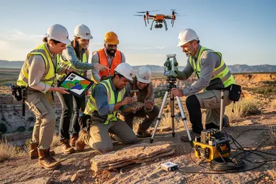
Success in remote sensing careers hinges on access to hands-on experience that online geosciences programs often cannot fully provide. While remote degrees offer scheduling flexibility, the absence of specialized labs and fieldwork reduces exposure to critical skills like UAV operation and sensor calibration. Employers in environmental consulting, aerospace, and government agencies prioritize candidates who demonstrate proficiency with industry-standard tools through direct application.
Affordability is a tangible consideration: the University of North Texas offers notably lower in-state tuition, ranging from $7,200 to $10,900, making it an accessible option for many. However, choosing a less expensive online program without embedded practical training risks producing graduates underprepared for technical demands commonly encountered in the field.
Students pursuing remote learning must actively forge internship opportunities or local collaborations to gain indispensable field experience. On-campus programs typically streamline this integration through established partnerships with labs and agencies, accelerating workforce readiness.
Career trajectories also diverge based on program format. On-campus graduates frequently transition directly into roles requiring comprehensive technical expertise, whereas online graduates often start in data-focused positions that necessitate supplementary training. Hybrid or low-residency formats can offer a pragmatic compromise, balancing cost, flexibility, and experiential learning to better align with employer expectations.
What courses and technical skills are taught in remote sensing-focused geosciences programs?
Remote sensing programs within geosciences address a critical workforce need: producing graduates capable of managing complex spatial data under real-world constraints. Employers expect proficiency not only in tools like ENVI, ArcGIS, and ERDAS Imagine but also fluency in Python or R to automate workflows and tailor analyses for diverse datasets. For example, environmental agencies rely on these skills to monitor deforestation or urban sprawl efficiently, demanding reproducibility and accuracy in large-scale projects.
Technical training extends beyond image interpretation to include photogrammetry and LiDAR, which are vital for terrain modeling in infrastructure or natural resource management. Understanding sensor characteristics and limitations-such as radar and thermal imaging-ensures professionals can select appropriate data collection methods and apply rigorous calibration and error assessment protocols, directly impacting project validity and regulatory compliance.
Financial considerations also weigh heavily in decision-making. Institutions like the University of Northern Iowa offer access to specialized software and hardware but at in-state tuition costs ranging from $9,100-$13,600. Prospective students must balance these expenses against employment sectors' expectations and job market realities.
- Key skills include satellite imagery analysis, spatial data modeling, and geostatistical processing.
- Programming in Python or R supports automation and integration with large geospatial databases.
- Proficiency in sensor technology and data quality assessment is essential for credible outcomes.
What are the typical admission requirements for online geosciences degrees in remote sensing?
Admission into online geosciences degrees with a remote sensing focus typically favors applicants who demonstrate solid quantitative and scientific skills, denoted by high school completion or equivalent credentials with a GPA threshold around 2.5 to 3.0. Preference is often given to candidates holding previous STEM qualifications, which can translate to advanced standing or a smoother pathway through technically demanding curricula.
While standardized tests have become optional for many lower-level programs, competitive graduate offerings may still require SAT, ACT, or GRE scores, reflective of the analytical demands encountered when interpreting geospatial data. Work experience in sectors like environmental consulting, GIS, or government agencies significantly strengthens an applicant's profile, bridging academic theory and real-world application.
Letters of recommendation and personal statements serve as crucial components to assess both technical aptitude and directional fit; aligning program selection with specific career ambitions in fields such as energy versus urban planning can markedly influence both admission success and post-graduation employability.
Tuition costs vary sharply by residency status, with Indiana University Bloomington charging in-state tuition between $9,300 and $13,900 and out-of-state fees rising to $40,100. This divergence underscores a major financial consideration affecting return-on-investment calculations for prospective students.
Technical readiness, including dependable internet and familiarity with specialized geospatial software, is a baseline requirement due to the computational intensity and remote delivery format of these programs.
How long do online geosciences degrees take and what do they cost?
Completion time for online geosciences degrees directly impacts labor market positioning amid a shrinking workforce. With nearly 27% of geoscientists expected to retire by 2029, creating a shortfall of approximately 130,000 professionals, accelerated degree timelines provide a distinct advantage. Associate and certificate programs typically span about two years, offering quicker entry but limited depth.
Bachelor's degrees, essential for most remote sensing roles, average four years though some accelerated tracks reduce this to three years through heavier course loads or transfer credits. Master's degrees, requiring an additional one to two years, are increasingly vital for specialized positions in environmental consulting or government sectors.
Cost disparities reflect the educational investment and access to technology. Public in-state tuition ranges roughly from $300 to $600 per credit, pushing total bachelor's costs to $36,000-$72,000, while private programs can exceed $1,000 per credit, sometimes justifying their higher price via advanced remote sensing labs. For working professionals balancing employment, a prolonged timeline may be necessary, though this reduces competitive edge. Employers favor graduates who can demonstrate applied expertise in GIS, satellite imagery, and data interpretation combined with solid geosciences fundamentals.
- Program durations: associate (2 years), bachelor's (4 years, accelerated possible), master's (1-2 years)
- Tuition estimates: $20,000+ for certificates, $36,000-$72,000 for public bachelor's, higher for private
- Workforce forecast: 27% retirement by 2029, with a shortfall near 130,000 geoscientists
What is the salary potential and job outlook for remote sensing professionals?
Remote sensing roles offer a wide salary range, typically $65,000 to $95,000 annually, with senior-level positions in government or industry exceeding $110,000. However, salary potential correlates strongly with sector and experience. For instance, environmental consulting positions provide more entry-level openings but often lower pay, whereas defense and aerospace demand specialized expertise and offer higher salaries but limited vacancies.
Most employers mandate proficiency in GIS software, data analysis, and satellite image processing, commonly requiring a master's degree. Boston University's MS in Remote Sensing & Geospatial Sciences, structured around roughly eight courses, meets this standard by combining spatial data analytics with sensor technology. Yet students must weigh the sizable investment in graduate education against the relatively modest initial salary uplift.
Mid-career professionals pivoting into remote sensing often need to learn tools like ENVI or ERDAS Imagine and secure relevant project experience to compete. Certain industries such as urban planning or agriculture can yield quicker salary progression due to steady data demand, contrasting with longer-term trajectories in academia or federal agencies.
Geographical concentration of job opportunities in cities like Washington D.C. and Denver underscores the need for candidates to consider remote or hybrid work flexibility and prioritize programs offering practical capstone projects and strong industry networks to improve employability.
How do I choose the best online geosciences program for a remote sensing career?
Effective remote sensing education demands programs that prioritize specialized, fully online credentials directly focused on relevant skills. For example, certificates incorporating GIS software, satellite data analysis, and earth observation techniques enable graduates to apply knowledge without extensive delay. Programs requiring frequent campus presence or lacking targeted curricula risk leaving students with gaps in practical expertise, limiting job flexibility.
Faculty connections and access to current industry projects strongly influence outcome quality. Professionals in environmental consulting benefit most from curricula integrating real-time satellite data, while urban planners require emphasis on spatial modeling tools. These distinctions reflect divergent employer expectations and sector-specific competencies that shape workforce readiness.
Flexibility remains vital for working professionals balancing education with employment or family demands. Fully asynchronous programs removing geographic and scheduling barriers facilitate mid-career upskilling without disruption. Prospective students should verify job placement rates and employer satisfaction metrics to confirm tangible career impact.
Hands-on experience with industry-standard software is pivotal, as most employers expect practical familiarity. Equally important is whether programs support stacking credentials-from certificates through advanced degrees-enhancing long-term career durability in geosciences.
- Deeply specialized remote sensing courses provide faster workforce entry but may reduce breadth.
- Employer-linked applied projects improve relevancy for distinct geosciences sectors.
- Asynchronous formats optimize accessibility but require strong learner self-discipline.
Other Things You Should Know About Geosciences
A master's degree is often preferred for advanced remote sensing roles, especially those involving data analysis, modeling, or research leadership. Many employers require graduate-level education for positions that go beyond technical tasks into project management or specialized application areas. If you aim for rapid career growth or roles at federal agencies and research institutions, prioritizing a program offering a robust graduate curriculum with practical remote sensing applications is essential.
Employers in geosciences prioritize candidates who demonstrate hands-on experience with remote sensing software and real-world datasets. Online degrees heavy on theory but light on applied labs or fieldwork can limit immediate job readiness. When evaluating programs, prioritize those incorporating virtual labs, field simulations, or project-based learning, as these improve practical competence and align with workforce expectations.
Yes. In the United States, the strongest signal is institutional accreditation from a Department of Education-recognized regional accreditor. For geosciences, programmatic accreditation is less common, so employers usually look for accredited schools plus coursework in GIS, remote sensing, and earth data analysis.
Part-time study offers flexibility but often extends the time needed to build competencies critical for competitive remote sensing roles. Extended timelines can delay entry or advancement in this fast-evolving field, where staying current with technology and software is vital. Prospective students should weigh whether their circumstances support the longer learning curve or if full-time enrollment would better accelerate skill acquisition and employer engagement.
References
- Occupation Profile for Remote Sensing Scientists and Technologists | CareerOneStop https://www.careeronestop.org/Toolkit/Careers/Occupations/occupation-profile.aspx
- Geoinformatics and Remote Sensing Applications and Development in Geology https://www.gisvisionindia.com/geoinformatics-and-remote-sensing-applications-and-development-course-in-geology/
- Understanding Academic Accreditation for Online Universities https://www.qahe.org/article/understanding-academic-accreditation-for-online-universities/
- How to Become a Remote Sensing Analyst - GISDegree.org https://www.gisdegree.org/careers/remote-sensing-analyst/
- Accreditation Guide - Quality Online Schools | Sora Schools https://soraschools.com/blog/accreditation-a-parents-guide-to-quality-online-schools
- Are Online Degrees Accredited? How to Identify Quality Distance Learning Programs https://www.umassglobal.edu/blog-news/online-degrees-accredited-identify-quality-distance-learning-programs
- Remote Sensing, geoInformation and Visualization | Master https://www.uni-potsdam.de/en/studium/what-to-study/master/remote-sensing
- Geographic Information Science Degree Programs Online | GIS Degrees https://www.gisdegrees.org/programs/geographic-information-science
- What does a Remote Sensing Analyst do? Career Overview, Roles, Jobs | NSPS https://careercenter.nsps.us.com/career/remote-sensing-analyst
- Regionally Accredited Online Colleges: What You Need to Know | Tiffin University https://go.tiffin.edu/blog/regionally-accredited-online-colleges-what-you-need-to-know/