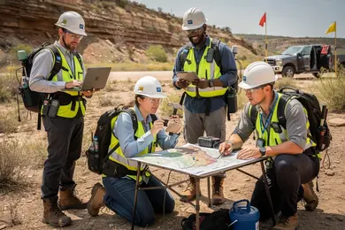
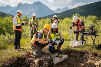
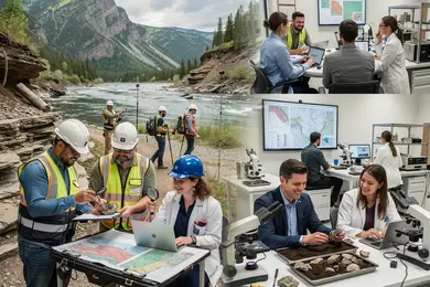
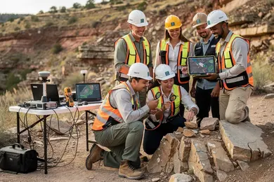
2027 Online Geosciences Degrees for Remote Sensing Roles

Co-Founder and Chief Data Scientist
Mid-career professionals aiming to specialize in remote sensing often face a bottleneck: finding flexible, credible online geosciences programs that provide both practical skills and recognized credentials without pausing their employment. With 45% growth in online STEM enrollments since 2022, according to the National Science Foundation, many candidates assume quantity equates to quality, overlooking program rigor and alignment with industry standards. This disconnect can delay workforce entry or progression, especially as employers prioritize mastery of satellite data analytics and spatial modeling over generic qualifications.
This article reviews current online geosciences degrees tailored for remote sensing roles, offering guidance to navigate program selection based on practical career impact and real-world applicability.
Key Things You Should Know
- Online geosciences degrees in 2026 average 20% lower tuition than on-campus, yet 35% of employers report hesitation over practical skill proficiency, complicating ROI for career switchers balancing cost versus hands-on competence.
- Federal workforce data shows 42% of remote sensing roles emphasize advanced geospatial analytics over traditional fieldwork, reshaping hiring toward candidates demonstrating robust online project portfolios rather than physical field hours.
- Median time-to-hire for geosciences remote sensing specialists decreased by 18% with graduated online applicants accredited by regional bodies, signaling a tightening labor market favoring accredited, digitally skilled candidates despite part-time study tradeoffs.
What is an online geosciences degree and how does it prepare you for remote sensing careers?
An online geosciences degree benefits for remote sensing careers by combining technical proficiency with domain expertise crucial for interpreting complex geospatial data. Graduates learn to handle satellite imagery analysis, GIS applications, and environmental modeling integrated with foundational geoscience disciplines like hydrology and atmospheric science. This alignment readies students for positions requiring intensive data workflow management and nuanced spatial interpretation.
Employer expectations center on candidates' fluency in specialized tools such as ENVI, ArcGIS, and Python scripting for automating data processes. Online programs frequently require project-based assignments, replicating real-world challenges in natural resource management and urban planning. For example, a professional in environmental protection might leverage remote sensing to monitor deforestation rates, while emergency management analysts depend on timely satellite data to model flood risks. These scenarios illustrate the operational demands beyond theoretical knowledge.
Flexible scheduling and geographic independence are clear logistical advantages of online geology programs, particularly for working professionals transitioning into geosciences or balancing fieldwork and study. However, these benefits come with tradeoffs: limited networking opportunities and the necessity for students to secure access to appropriate software licenses and technical support. Complementary internships or virtual professional groups are often essential to bridge these gaps and meet workforce networking standards.
Given the median U.S. annual wage of $99,240 for geoscientists in 2025 and a steady employment growth rate of 3% from 2024 to 2034, pursuing remote sensing expertise through rigorous online geosciences degrees remains a viable strategy. Those evaluating programs can find comparative insights on online geology programs to navigate practical considerations and long-term career prospects effectively.
Which types of online geoscience degrees best support entry into remote sensing roles?
Entry into remote sensing roles demands bachelor's degrees in geosciences that combine fundamental earth science with technical skills in satellite imaging and spatial data analysis. Employers, such as environmental consulting firms, prioritize candidates who understand both geologic processes and geospatial data interpretation to effectively evaluate environmental impacts. Students targeting remote sensing careers should select online geoscience degrees for remote sensing careers in the United States that integrate geoscience theory with applied spatial technologies, ensuring alignment with common employer expectations.
Master's programs offering specialized, practical instruction in remote sensing data processing improve access to federal or research roles that require advanced analytical competencies. Online options with virtual labs or agency partnerships mitigate the limitations of remote learning by providing simulated or collaborative fieldwork experiences. Graduates without proficiency in essential software like ERDAS IMAGINE, ENVI, or ArcGIS, and scripting languages such as Python or R, face extended job searches or must pursue supplementary certifications.
Remote sensing specialists' median salary stands at $80,060 in 2024 with a projected employment growth of 4% between 2024 and 2034, translating to about 8,500 job openings per year. This stability favors candidates with balanced academic and technical preparation tailored to evolving sector demands. For professionals evaluating advanced education pathways, programs emphasizing both theory and hands-on application prove most effective for sustainable career trajectories.
Due to the complex skill sets required, prospective students should also consider complementary fields; some may evaluate an online master in data science to augment geospatial data expertise. This can enhance adaptability in competitive markets and broaden career options within environmental monitoring, resource management, and research.
How do online geosciences programs compare with campus-based options for remote sensing training?
The practical distinction between online geosciences degrees versus traditional campus programs for remote sensing centers on hands-on skill cultivation and deep industry engagement. While online courses efficiently build theoretical foundations and computational proficiency in geospatial analytics and satellite data interpretation, they generally lack embedded fieldwork components critical for many employer demands in environmental and aerospace sectors.
Students pursuing online geosciences degrees versus traditional campus programs for remote sensing often must secure internships or field experiences independently, extending the time and cost required to develop competencies with physical instruments like drones or sensor calibration tools. This gap proves consequential in workforce segments-such as defense or resource management-where hardware expertise underpins data reliability and operational safety.
The labor market corroborates this bifurcation: remote sensing roles are expanding at a projected 12.2% rate over the next decade, yielding over two thousand job openings nationally. Employers prioritize candidates demonstrating both applied field skills and computational fluency, frequently favoring graduates validated through campus-based labs or cooperative education.
For professionals evaluating pathways, an online degree offers scheduling flexibility but may slow the mastery of in-person team collaboration and instrument handling. Supplementing virtual study with targeted workshops, partnerships, or summer intensives can bridge this divide.
Those considering adjacent fields might also explore options like an online dietitian degree to diversify their applied science credentials.
What remote sensing and geospatial coursework can you expect in an online geosciences program?
Online geosciences courses for remote sensing applications demand more than technical familiarity; they require managing complex data integration from UAVs, LiDAR, and multispectral sensors in realistic field-like environments. Graduates must master software like ERDAS Imagine or ENVI, as well as scripting languages such as Python or R, to automate workflows and handle large geospatial databases efficiently. These skills address labor market needs, where salaries range broadly-from $55,000 to $221,000 annually-reflecting how versatility and practical experience influence earning potential.
The remote sensing and geospatial analysis curriculum in online geosciences programs is structured to combine core sensor technologies with applied terrain analysis and photogrammetry. A practical example includes a remote sensing analyst in agriculture manipulating multispectral images to detect crop stress, leveraging spectral indices calibrated with field data. This capability has direct implications on precision agriculture and environmental monitoring jobs, which prioritize candidates able to apply technical insights to real-world challenges.
However, prospective students should weigh logistical considerations such as access to robust computing resources and specialized software licenses-often managed virtually but sometimes requiring stringent data security protocols. These operational demands can influence the suitability of an online program depending on a student's home environment and career focus.
Geospatial professionals interested in evaluating program affordability and quality may consult resources like the best library schools, which offer insights into cost-effective academic options supporting specialized geospatial skills.
How do you verify accreditation and program quality for online geosciences and remote sensing degrees?
Accreditation remains the primary filter for assessing online geosciences and remote sensing degrees, but not all accreditations carry equal weight in the eyes of employers or regulatory bodies. Regional or national accreditors approved by the U.S. Department of Education or CHEA, such as the Higher Learning Commission, guarantee basic institutional standards but do not ensure industry-specific competence. Specialized accreditation or endorsement by organizations like the American Geosciences Institute or the ASPRS signals that the curriculum is closely tied to current workforce needs and technological advancements.
Hiring managers in geospatial roles emphasize practical skills over generic scientific knowledge. Candidates must demonstrate proficiency in remote sensing software, GIS applications, and satellite data interpretation. Programs that fail to showcase how they align coursework with these competencies risk leaving graduates underprepared. Evaluating faculty expertise and research focus offers additional insight into a program's real-world relevance.
- Comparing tuition to tangible career outcomes is critical. For example, Penn State World Campus charges $1,037 per credit for its online Remote Sensing graduate certificate, which demands careful consideration of return on investment given the niche but competitive job market.
- Online programs must simulate lab and field experiences virtually; evidence of such integration improves graduate job readiness.
- Understanding state licensing requirements and federal hiring standards ensures degree validity for certain government or regulated positions.
Prospective students should prioritize programs that transparently link curriculum to employer expectations, provide measurable experiential learning, and maintain accreditation recognized by both educational authorities and professional geosciences bodies.
What are typical admission requirements for online geosciences degrees focused on remote sensing?
Admission to online geosciences programs focused on remote sensing hinges on more than academic credentials; it reflects workforce expectations and practical skill gaps. Candidates typically hold bachelor's degrees in geosciences, environmental science, or related STEM fields with a minimum GPA of 3.0. However, successful applicants must also demonstrate readiness to navigate complex technical tools, as employers demand proficiency in geoinformatics platforms and data science workflows from day one.
Applicants are often required to submit transcripts, recommendation letters, and statements articulating their hands-on experience or interest in remote sensing. Prior coursework in calculus, statistics, and programming is common because the discipline relies heavily on quantitative analysis and coding skills. Practical familiarity with GIS and remote sensing software significantly strengthens candidates' competitiveness by bridging the gap between education and professional application.
Students should anticipate the challenges of remote study, including managing specialized software on personal computers and independently completing lab and data integration tasks without campus resources. Admission committees may weigh an applicant's capacity for self-directed learning as a proxy for success, given the lack of in-person support.
Remote sensing specialists combining geosciences expertise with data science or computer science earn median salaries above $80,000, showing employer valuation of hybrid skillsets. Candidates must plan to develop or acquire these cross-disciplinary competencies to remain relevant in an evolving job market.
How long do online geosciences degrees take, and what do they cost for remote sensing students?
Choosing an online geosciences degree with a remote sensing focus requires balancing time, cost, and employer expectations. Bachelor's programs typically extend four years full-time but can be accelerated to three with transfer credits. Master's degrees average two years, though select programs offer 12- to 18-month intensified schedules. Certificates span six months to a year, appealing to professionals wanting specific skills without committing to a full degree.
From a workforce perspective, environmental consulting firms and agencies often demand proficiency in remote sensing software and data analysis-skills inadequately addressed by shorter certificate courses for entry-level roles, though these certificates serve well for mid-career specialization. Budget considerations vary:
- Undergraduate tuition ranges roughly $15,000-$40,000 annually
- Master's total costs fall between $20,000 and $50,000
- Certificates cost $3,000-$10,000 but exclude software licenses critical for hands-on learning
Public universities may offer in-state discounts, but many online programs price residents and non-residents similarly to maintain national access. With over 60 online geoscience options featuring GIS or remote sensing for 2025 according to GISDegree.org, choosing programs integrating practical modules and recognized accreditation is essential for employability. Prospective students should prioritize programs that align with targeted career roles, factoring in realistic time commitment, costs, and market-demanded skill sets to avoid underqualification or underinvestment.
What remote sensing jobs can you get with an online geosciences degree in the United States?
U.S. graduates with an online geosciences degree aiming for remote sensing roles face a distinct balance of technical and applied skill demands. Positions such as remote sensing analyst, GIS specialist, or environmental consultant hinge on proficiency in software like ENVI or ArcGIS and the ability to process spatial data accurately. Employers, particularly federal agencies like USGS and NASA or energy-sector consultancies, prioritize candidates who demonstrate hands-on project experience-a notable challenge since many online programs lack direct lab access.
Practical training often relies on virtual labs or collaborative platforms, but students must proactively build portfolios to prove remote sensing competency. Entry-level roles frequently require demonstrated mastery of data interpretation and spatial analysis rather than purely academic credentials. Salary data from the UK, where remote sensing scientists earn around £40,800 annually, indicates competitive pay aligned with the technical expertise this sector demands. U.S. markets show parallel prospects, with career growth contingent on advanced skills like machine learning and big data integration in geospatial modeling.
Career trajectories typically progress from data technician to specialist or managerial roles, dependent on continuous skill development and applied experience. This progression demands deliberate investment beyond coursework to stay relevant in a field increasingly shaped by automated data processing and spatial analytics.
What salary ranges and career advancement prospects exist for geoscience remote sensing professionals?
Entry-level salaries for remote sensing professionals with a geosciences background range from $60,000 to $75,000, growing to $90,000-$120,000 after five to seven years of experience. This salary progression typically accelerates when remote sensing expertise is combined with advanced GIS skills or programming, especially in sectors such as environmental consulting or energy. Federal agencies and large research institutions offer comparatively higher pay, often tied to the complexity of projects and security clearance requirements.
Career trajectories in remote sensing often necessitate targeted certifications and proficiency in emerging technologies like drone data acquisition and cloud computing platforms. Geographic Information System integration remains a pivotal competency, particularly for roles involving data analytics or project management. Students and professionals should evaluate whether they prefer to specialize narrowly in remote sensing software or expand into intersecting fields, such as machine learning or climate science, to maintain employability and adaptability.
Advancement beyond mid-level roles generally demands additional education, such as graduate certificates or focused technical training. Employers prioritize candidates capable of translating remote sensing data into actionable insights, favoring practical, domain-specific experience over general technical skills. Global interest-evidenced by about one-third of international enrollments in U.S. geospatial master's programs-also suggests opportunities for cross-border collaboration, which requires linguistic and cultural agility.
- Initial compensation influenced by sector and technical skill breadth
- Certifications and new tech skills critical for differentiating candidates
- Tradeoffs between deep specialization and interdisciplinary breadth impact long-term career flexibility
How can you choose the best online geosciences program for your remote sensing career goals?
Programs in geosciences that emphasize AI-driven remote sensing and big data analytics align best with current labor market shifts, where demand for specialists in satellite and drone data interpretation grows by nearly 10% annually through the 2030s. Employers in environmental consulting, defense, and urban planning prioritize candidates with hands-on experience using Python, GIS platforms, and machine learning frameworks. Without practical training tied to industry tools, graduates often face longer job search periods and limited salary growth.
Students should scrutinize programs' balance between foundational theory and applied skills, favoring those offering capstone projects or partnerships with relevant industry players to build real-world networks and portfolios. Flexibility in course pacing matters significantly for professionals juggling employment and study obligations, while faculty actively engaged in research or consultancy ensure curriculum relevance to fast-evolving remote sensing technologies.
Decision-making also hinges on sector-specific career objectives: geospatial intelligence roles require distinct technical emphases compared to disaster response analytics. Additionally, access to curated remote sensing datasets and computational resources is non-negotiable for developing competencies that translate into immediate workplace contributions.
Prospective students should weigh graduate employment data carefully. Programs skewed toward outdated academic research may not equip learners for growth sectors like defense contracting, underscoring how institutional alignment with workforce realities critically shapes long-term career outcomes.
Other Things You Should Know About Geosciences
Employer perception of online geosciences degrees varies based on the program's reputation, faculty credentials, and curriculum rigor rather than format alone. Programs affiliated with established universities and those that offer substantial technical coursework, especially in GIS and remote sensing software, are more readily accepted. Candidates should prioritize programs with strong industry connections and evidence of graduate outcomes to ensure their degree translates into tangible job opportunities.
Many online geosciences programs struggle to provide hands-on field experience, which remains a critical skill in remote sensing roles. Some programs require students to complete local fieldwork independently or through short in-person residencies, but these are often minimal compared to campus-based options. Students should consider how the program integrates practical training and whether they can supplement with internships or professional projects to build applicable skills.
In 2027, online geosciences programs increasingly incorporate virtual labs and simulations to ensure practical skills and field training. Many programs offer hybrid models or short-term fieldwork opportunities to bridge any experiential gaps compared to traditional degrees.
Yes. Many 2027 online geosciences programs require an accredited capstone or thesis in the final 6 to 9 credit hours, often tied to GIS, satellite image analysis, or environmental mapping. Regional accreditation matters most, and some employers also expect coursework aligned with ASPRS or GIS certification standards.
References
- Geospatial & GIS Jobs Board | GEO CAREERS https://www.geo-careers.com/salary-data/remote-sensing-specialist/
- Find the Best GIS Degree Programs | GIS Degrees http://www.gisdegrees.org/
- Career Brochure https://asprs.org/Main/Main/Membership/Career-Brochure.aspx
- Online Geoscience Degrees: Top Schools and All Programs in 2026 https://www.gisdegree.org/online/geoscience-degrees/
- ERDAS IMAGINE Online Training Courses & RS Certificates | BRS-Labs https://remote-sensing-portal.com/
- Are Online Degrees Accredited? How to Identify Quality Distance Learning Programs https://www.umassglobal.edu/blog-news/online-degrees-accredited-identify-quality-distance-learning-programs
- Geoinformatics and Remote Sensing Applications and Development in Geology https://www.gisvisionindia.com/geoinformatics-and-remote-sensing-applications-and-development-course-in-geology/
- Remote Sensing Jobs: Remote Sensing Satellite Evaluation https://www.gogeogo.com/en/job-category/remote-sensing-jobs
- Importance of taking a Master's degree degree in GIS and Remote Sensing | AGSRT Blogs https://www.agsrt.com/post/importance-of-taking-a-master-s-degree-in-gis-and-remote-sensing
- Gisdegree https://www.GISDegree.org