2027 Online Geosciences Degrees With Strong Remote Sensing Training

Co-Founder and Chief Data Scientist
Professionals seeking to pivot into remote sensing within geosciences face a demanding challenge: mastering sophisticated satellite data analysis without sacrificing ongoing career or personal commitments. Increasingly, accessibility and flexibility dictate program choice, with the National Center for Education Statistics reporting a 12% surge in adult learners enrolling in fully online STEM-related degrees since 2023. This shift reflects growing pressure for education to align with diverse life circumstances and rapid technological advancement. Navigating this landscape requires discerning programs that offer rigorous remote sensing curricula alongside adaptable delivery models.
This article identifies online geosciences degrees emphasizing remote sensing training that balance academic depth, scheduling flexibility, and career relevance to guide informed enrollment decisions.
Key Things You Should Know
- Remote sensing specialization in geosciences degrees correlates with 18% higher initial salary offers but typically extends program length by 6-12 months, impacting total cost and time-to-employment, per 2024 NCES data.
- Employers prioritize candidates with hands-on satellite data proficiency and cloud processing skills, creating a talent bottleneck as only 35% of remote programs offer advanced applied labs, influencing hiring competitiveness.
- Federal workforce projections indicate a 22% surge in demand for remote sensing analysts through 2030, pressuring students to balance accelerated credentialing against acquiring in-demand GIS and machine learning competencies.
What is an online geosciences degree with a strong remote sensing focus?
An online geosciences degree with remote sensing specialization demands more than foundational theory; it requires graduates to deliver precise, scalable environmental and industrial solutions through advanced spatial analysis and programming. Employers prioritize candidates skilled in handling multispectral satellite imagery and large geospatial datasets to optimize energy site selection or assist federal agencies in disaster response. These real-world applications illustrate the imperative of combining core geosciences disciplines with applied remote sensing techniques in online geosciences programs.
The projected growth of the global geospatial analytics market from $119.9 billion in 2024 to $209.4 billion by 2029 with an 11.9% CAGR underscores urgent workforce demands. However, students must weigh tradeoffs intrinsic to remote delivery: limited hands-on fieldwork and equipment access are often offset by virtual labs, case studies, and remote geospatial database access, emphasizing programming literacy in Python or R to automate data workflows effectively.
Key operational realities for candidates include:
- Mastery of spatial analysis software such as GIS integrated with programming to translate raw sensor data into actionable insights
- Avoiding theoretical overload in favor of applied methodologies meeting employer expectations for environmental monitoring and resource management
- Verifying curriculum focus on remote sensing techniques in online geosciences programs that reflect current industry tools and challenges
Those investigating advanced options should consider how geosciences programs with remote sensing components align with their career goals and technical capabilities. For a comparative perspective on complex analytic disciplines, resources like the data science doctorate online offer insight into quantitative demands parallel in geospatial analytics.
How do online geosciences degrees compare with campus programs for remote sensing training?
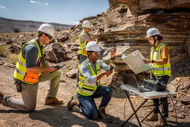
Students pursuing online geosciences degree programs with remote sensing specialization encounter a critical gap between theoretical knowledge and hands-on experience. While virtual labs effectively teach spatial analysis, GIS software, and digital image processing, they rarely provide direct interaction with the hardware essential for roles in environmental consulting or government mapping. Employers prioritize candidates who can operate drones, satellites, and ground sensors in real-world scenarios.
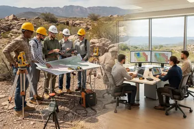
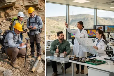
Campus programs incorporate structured fieldwork and access to specialized equipment, preparing graduates for immediate job responsibilities. In contrast, online students must independently arrange local internships or workshops, adding time and cost that can delay completion. This logistical friction highlights a key tradeoff: flexibility versus integrated practical training.
Considering a 5% occupational growth projected by the U.S. Bureau of Labor Statistics for geoscientists and related remote sensing roles through 2033, applied skills significantly influence employability. Online learners who obtain targeted field experience can match campus graduate outcomes, otherwise face competitive disadvantages in hiring markets.
For individuals balancing work and education in remote locations, online degrees offer adaptability but require careful planning to secure essential applied experience. Campus programs appeal to recent graduates aiming for streamlined entry into the workforce with embedded remote sensing field training.
Prospective students evaluating these routes should weigh practical reality against career goals. Those interested in a data science degree might find parallels in training tradeoffs and workforce demands.
Which accredited U.S. schools offer online geoscience degrees emphasizing remote sensing?
Online geoscience degrees with remote sensing specialization target an essential skill set: interpreting spatial data for sectors like agriculture, environmental monitoring, and military intelligence. Institutions such as the University of Arizona offer programs that emphasize satellite data analysis and GIS, aligning curriculum with employer demands for technical proficiency in remote sensing. Similarly, accredited U.S. schools offering online geoscience programs with remote sensing, including Mississippi State University's certificate, combine theory with hands-on radar and LiDAR interpretation-skills critical for forestry and urban planning roles.
The practical challenge for students lies in managing advanced software labs and data processing alongside flexible schedules. Programs address this through asynchronous classes and remote lab access, facilitating skill development without geographic barriers. Employers prioritize candidates adept at handling large geospatial datasets with programming languages like Python or R, especially for disaster response or regulatory compliance roles where precise satellite imagery interpretation can be mission-critical.
Accreditation by organizations such as ABET or the Geological Society of America signals curriculum quality and workforce relevance. International data underlines market value: remote sensing scientists in the UK earn around £40,800 annually, suggesting that graduates with these competencies maintain global competitiveness. Prospective students evaluating this path should also review related fields, like an online library science degree, to enhance interdisciplinary data management expertise.
What core courses and technical skills are taught in remote sensing-focused geoscience programs?
Remote sensing techniques in Geosciences programs prioritize technical skills essential for practical application rather than solely theoretical knowledge. Graduates must master spatial data analysis, sensor technology, and geospatial information systems (GIS) with proficiency in satellite and aerial imagery processing, spectral signature interpretation, and radiometric correction. Core technical skills for Geosciences remote sensing include operating software such as ENVI, ERDAS IMAGINE, and open-source QGIS to convert raw sensor data into actionable insights for fields like environmental monitoring, mineral exploration, and urban planning.
Applied coursework integrates machine learning algorithms with lidar data interpretation and digital image classification, enabling students to tackle real-world problems like quantifying deforestation using multispectral indices (e.g., NDVI) and change detection methods. Statistical programming in Python or R further automates workflows, enhancing efficiency and reducing errors.
Workforce demands emphasize candidates able to manage extensive geospatial datasets, address sensor limitations, and produce validated reports tailored to policymaking or resource management needs. Given the high costs of specialized software and hardware, programs also introduce cost-effective cloud computing options that align with current industry trends in scalability and affordability.
According to the Arizona State University Center for the Study of Higher Education (2024), online STEM students achieve comparable early-career earnings with 20-25% lower total education cost compared with on-campus peers, making an affordable library science degree online a relevant comparative example of strategic financial decisions in technical education pathways.
What software, data tools, and labs will I use in online remote sensing training?
Proficiency in industry-standard GIS and image processing software such as ArcGIS Pro, ENVI, and QGIS is essential for remote sensing roles within geosciences, with ArcGIS Pro consistently prioritized by employers in resource management and urban planning. The reliance on open satellite imagery datasets from USGS Earth Explorer and NASA's LandViewer during training allows candidates to handle authentic temporal and spatial data, a critical skill set for land cover classification and vegetation monitoring tasks.
Students face practical constraints like software licensing fees and limited laptop processing power, which many programs address by providing temporary licenses or cloud-based access to institutional servers. Cloud platforms such as Google Earth Engine enable handling of large geospatial datasets and support machine learning workflows, reducing hardware barriers and aligning training with real-world data processing demands.
Typical coursework involves complex workflows-preprocessing Sentinel-2 or Landsat 8 imagery, performing radiometric corrections, applying supervised classification algorithms, and validating outputs against ground truth data. These hands-on experiences cultivate capabilities in multisource data fusion and spatial analytics under project timelines that mirror workplace pressures.
Between 2016 and 2024, Penn State's Online Geospatial Education enrolled over 7,000 students globally, indicating rising demand for scalable, applied remote sensing education that extends beyond theory into operational problem-solving relevant to employer expectations.
What are the typical admission requirements for online geosciences degrees with remote sensing?
Admission to online geosciences degrees with a focus on remote sensing demands more than general academic credentials; it requires demonstrable proficiency in quantitative and technical skills essential for spatial data work. Candidates typically hold bachelor's degrees in geosciences, environmental science, geography, engineering, or related STEM fields, maintaining minimum GPA thresholds near 3.0. Preference is given to applicants with coursework in calculus, statistics, and programming-skills critical for manipulating and interpreting complex datasets. Practical experience in GIS software or remote sensing tools, even at a foundational level, is often decisive for admission committees balancing theory and hands-on capability.
GRE scores are seldom mandatory, but specialized certifications or documented work in geospatial technology can offset gaps in formal education, particularly for international students or competitive cohorts. Employers increasingly expect graduates to handle raw Earth observation data effectively, reflecting a workforce shortage in remote sensing competencies that the 2024 Geospatial World-GeoBuiz report quantifies as a majority skill gap. This dynamic means programs filter not only for academic rigor but also for practical, certifiable skills.
Strong professional recommendations and a focused statement of purpose that ties career goals to real-world applications-such as natural resource management or urban planning-enhance candidate viability. The hybrid format of many programs, combining asynchronous online coursework with mandatory in-person labs or fieldwork, requires students capable of self-directed learning alongside hands-on technical training, a balance reflecting the multifaceted demands of remote sensing roles across environmental consulting and disaster response sectors.
How long do these online programs take, and what do they cost to complete?
Online geosciences degrees with remote sensing specialization demand a strategic balance between program length and market relevance. Accelerated bachelor's programs leveraging transfer credits can shorten traditional timelines to 2.5-3 years but require disciplined course management, especially for working professionals. Master's degrees typically span 18 to 24 months, with pacing flexibility more critical for those aiming to integrate study with employment.
Cost considerations are significant. Public in-state tuition ranges from $150 to $600 per credit, while private and out-of-state rates often double, pushing bachelor's degree expenses to as high as $72,000. Master's programs charging per credit translate to $7,500-$21,600 tuition, excluding additional fees for remote sensing software and course materials that can add $1,000-$3,000. This cost structure necessitates weighing accelerated completion against financial sustainability.
Employers prioritize candidates with practical analytical experience applying remote sensing in sectors like environmental monitoring or urban planning. Degrees extending beyond three years risk lagging behind rapid advancements in geospatial software and data analytics skills. For professionals targeting government or research roles, programs with clear certification pathways add upfront cost but reduce long-term career hurdles.
What careers can I pursue with an online geosciences degree specializing in remote sensing?
Employers in government agencies such as NASA and the USGS seek remote sensing analysts capable of handling multispectral and radar data for critical tasks like natural disaster assessment and land use mapping. This demand reflects a broader industry trend where growth in Earth observation and geospatial services, valued at $19.6 billion globally, translates into expanding job opportunities with an annual growth rate exceeding 9%.
Remote sensing roles span diverse sectors including agriculture, which depends on satellite data for crop health monitoring and precision farming, and urban planning, where geospatial analysis supports infrastructure and transportation strategies. These positions typically require technical proficiency with software such as ENVI and ArcGIS, coupled with coding skills in Python or R to automate workflows, indicating a clear employer preference for hybrid analytical and programming capabilities.
The practical challenges remote sensing professionals encounter often involve reconciling heterogeneous datasets to preserve accuracy in resource management decisions. Consequently, successful candidates are those who engage in continuous learning through advanced coursework or certifications embedded in online geosciences programs focusing on remote sensing.
Salary ranges of $60,000 to $90,000 for early- to mid-career professionals validate the economic rationale for pursuing this specialization, but prospective students should carefully assess programs for rigorous curricula, opportunities for applied projects, and employer network strength to mitigate competitive entry barriers in this specialized job market.
What salaries and job outlook can remote sensing and geospatial geoscientists expect?
Remote sensing and geospatial geoscientists face a complex salary landscape shaped by sector and expertise levels. Median annual wages commonly range from $65,000 to $95,000, yet advanced roles-especially within government or specialized private firms-can surpass $110,000. This variation underscores a significant tradeoff between stable but lower-paying regulatory or academic jobs and higher-paying, often relocation-dependent positions in metropolitan or defense-related hubs.
The field is projected to grow about 10% through 2032, fueled by demands in climate modeling, natural resource management, and disaster response. Employers typically expect candidates to combine formal education with hands-on experience in remote sensing software and data analytics. Credentials alone are rarely sufficient; portfolio evidence and proven spatial data manipulation skills frequently determine employability.
For professionals navigating a career pivot into geosciences, the decision between lengthy degree programs versus shorter, targeted certifications hinges on context. For example, an environmental scientist shifting into remote sensing may find NASA's Applied Remote Sensing Training (ARSET) program and a curated project portfolio provide a faster entry point than a master's degree required for many federal roles.
Successful candidates also demonstrate adaptability to evolving satellite technologies and interdisciplinary collaboration. While specialization pays, the cost is often flexibility in geography and continuous skill updating, necessary to remain competitive amid AI-driven advancements in image processing.
How can I evaluate and choose a reputable online geoscience program for remote sensing?
Remote sensing programs in geosciences must be vetted for more than just curriculum-they should reflect employer expectations for current software like ENVI and ArcGIS Pro and incorporate applied training, including virtual labs. Programs that lack faculty experience in emerging technologies such as UAV imaging or AI-driven analysis may leave students underprepared for rapidly evolving job demands.
Working professionals targeting government geospatial roles must confirm their chosen degree aligns with credentialing standards recognized by bodies like the American Geosciences Institute. Besides technical content, career support elements like internships and industry partnerships materially affect employment outcomes and should weigh heavily in program selection.
For students bound by geography or schedules, online and hybrid formats have measurably improved access and diversity-minority participation in these programs grew from roughly 11% in 2011 to nearly 20% recently. However, flexibility can introduce challenges in credit transfer and timely degree completion, especially for part-time enrollees.
Cost and time investment must be scrutinized alongside employer tuition reimbursement limits to avoid unexpected financial burdens. Evaluating alumni employment specifically in remote sensing roles is crucial, as general geoscience job placement rates may not reflect relevant workforce integration.
Other Things You Should Know About Geosciences
Students should learn GIS and remote sensing software used in map analysis and image processing, especially ArcGIS Pro and QGIS. Many 2027 programs also expect basic Python for data handling, plus experience with ENVI or ERDAS Imagine for satellite imagery classification, raster analysis, and change detection.
A broader geosciences degree may provide wider foundational knowledge in areas like geology and hydrology but can dilute remote sensing expertise, potentially reducing immediate job readiness in that niche. Conversely, a focused remote sensing track strengthens technical and analytical skills highly sought in geospatial analysis roles but may limit flexibility for non-remote sensing positions. For career pivoters targeting GIS or satellite data roles, prioritizing specialized training is advisable to match employer expectations more closely.
Employer recognition depends more on the program's accreditation, the rigor of technical coursework, and demonstrated software proficiency rather than delivery mode alone. Online degrees from accredited institutions with strong project-based assessments are generally accepted, though some sectors like government mapping agencies may prefer candidates with in-person lab experience or internships. Applicants should emphasize portfolio quality and applicable certifications alongside their degree during job applications to mitigate any biases.
References
- Geospatial and Remote Sensing Applications for M&E Training Course https://upskilldevelopment.com/geospatial-and-remote-sensing-applications-for-m-e-training-course
- Petroleum Geosciences and Remote Sensing https://www.sharjah.ac.ae/academics/degree/undergraduate/petroleum-geosciences-and-remote-sensing
- ERDAS IMAGINE Online Training Courses & RS Certificates | BRS-Labs https://remote-sensing-portal.com/
- 6 Top Careers in Geospatial Technology | UT Permian Basin Online https://online.utpb.edu/about-us/articles/gis-geospatial/6-top-careers-in-geospatial-technology
- Online Geoscience Degrees: Top Schools and All Programs in 2026 https://www.gisdegree.org/online/geoscience-degrees/
- Career Brochure https://asprs.org/Main/Main/Membership/Career-Brochure.aspx
- Geographic Information Science Degree Programs Online | GIS Degrees https://www.gisdegrees.org/programs/geographic-information-science
- Geoinformatics and Remote Sensing Applications and Development in Geology https://www.gisvisionindia.com/geoinformatics-and-remote-sensing-applications-and-development-course-in-geology/
- Geospatial & GIS Jobs Board | GEO CAREERS https://www.geo-careers.com/salary-data/remote-sensing-specialist/
- Geospatial and Remote Sensing Analysis https://tess-lab.org/resources/geospatial-and-remote-sensing-analysis/