2027 Best Online Geosciences Degrees for Earth Observation Careers

Co-Founder and Chief Data Scientist
Professionals aiming to pivot into earth observation roles often confront the challenge of balancing employment with acquiring specialized skills in remote sensing and spatial analysis. Traditional, on-campus Geosciences programs rarely accommodate working adults' schedules, creating a bottleneck for career advancement. Data from the National Center for Education Statistics reveal that over 40% of post baccalaureate enrollments now occur online, signaling a shift toward flexible, accessible learning models critical for this field's evolving demands.
This article evaluates the best online geosciences degrees tailored for earth observation careers, focusing on programs that align with workforce needs, flexible delivery, and practical applicability to solve these tradeoffs effectively.
Key Things You Should Know
- Programs emphasizing remote sensing skills show 23% higher early-career job placement in Earth observation roles, per 2024 US Bureau of Labor Statistics data; prioritizing these competencies accelerates entry into competitive federal and private sector positions.
- Employers increasingly prefer candidates with integrated coding and data analytics expertise alongside terrestrial and atmospheric knowledge, creating a workforce tension that signals multi-disciplinary degrees yield stronger mid-career advancement.
- Online programs averaging 18 months and costing 40% less than on-campus equivalents reduce financial barriers but risk limited fieldwork exposure, impacting practical readiness for geospatial technology roles demanding hands-on experience.
What is an online geosciences degree for Earth observation, and who is it right for?
Choosing an online geosciences degree focused on Earth observation requires balancing practical skill acquisition against the limitations of remote study. While these programs provide critical expertise in remote sensing, satellite data analysis, and GIS, the lack of traditional fieldwork demands self-motivation and resourcefulness in mastering quantitative methods and managing large spatial datasets. This pathway is especially suited for professionals seeking flexible scheduling or those transitioning into a data-intensive role within environmental consulting, natural resource management, or infrastructure planning.
Employment trends indicate steady demand: the U.S. Bureau of Labor Statistics projects a 5% growth rate for geoscientist roles from 2022 to 2032, equating to roughly 2,200 new positions annually. Opportunities largely stem from environmental protection and infrastructure resilience efforts, which prioritize specialists who can interpret spatial data effectively.
Prospective students should weigh the necessity of developing practical GIS software skills independently, given many online formats lack hands-on labs. Employers tend to emphasize proficiency in remote sensing applications, spatial analysis, and data visualization, which aligns with roles in applied research, policy advisory, or operational monitoring across government, research, and private sectors.
For those evaluating options, consulting the best GIS graduate programs can clarify which schools excel in delivering the specialized technology skills integral to the best online geosciences programs for earth observation professionals.
This route remains a pragmatic choice for learners prioritizing tech-driven Earth systems expertise over traditional field experience, factoring in the regional and scheduling flexibility critical to many working adults.
How do online geosciences programs compare with on-campus options for Earth observation careers?
Choosing between an online geosciences degree versus on-campus programs for Earth observation pivots majorly on practical experience and workforce networking. While remote learners gain solid theoretical grounding and proficiency in data analysis, GIS, and remote sensing software through virtual labs, they face limitations in accessing high-end instrumentation and fieldwork critical to sectors like environmental consulting. For instance, mastering UAV payload operations or satellite calibration often requires hands-on exposure rarely replicable online.
The projected retirement of 27% of the geoscience workforce by 2029 amplifies demand for candidates demonstrating applied skills, a gap in purely virtual curricula without strong internship or local partnership integration. Employers seek proficiency in platforms like ENVI and ERDAS, yet they also value nuanced mission planning and hardware familiarity demanding in-person training. This contrast illustrates the tradeoffs inherent when comparing online and traditional geosciences education for Earth observation careers.
Ultimately, remote students must actively augment academic work with tangible field experience and professional networking to meet these expectations. Key success factors include disciplined time management and targeted pursuit of external applied opportunities to offset on-campus program advantages.
For those evaluating environmental engineering schools online as part of their broader educational strategy, resources like environmental engineering schools online offer comparative insights into affordable pathways blending remote study with practical relevance.
Which types of online geosciences degrees best prepare you for Earth observation roles?
Choosing online geosciences degrees for earth observation careers requires weighing practical skills against academic structures and workforce expectations. Programs emphasizing remote sensing, GIS, environmental data analysis, and spatial statistics directly address employer demands, especially in agencies tackling climate monitoring or disaster response. Candidates fluent in Python or R alongside these tools are immediately more competitive.
For career changers, degrees offering project-based learning that simulate applied Earth observation tasks-such as land-use change detection or resource forecasting-reduce the gap between classroom theory and operational expertise critical in environmental consulting or federal roles. The best online geosciences programs for remote sensing and earth monitoring integrate rigorous quantitative coursework and geospatial technology certifications, improving job readiness and early productivity.
Students must also assess graduation rates and cost efficiency. Data revealing geology bachelor's programs charging about $6,885 annually with graduation rates exceeding 80% and 20-year net ROI over $500,000 illustrate the tangible economic benefits of well-structured curricula that avoid sacrificing rigor for accessibility. Degrees lacking these practical elements frequently impose extra training costs and delay workforce entry, undermining return on time and tuition investment.
Beyond subject matter expertise, prospective students pursuing this path should consider how programs align with their career pivots or advancement needs, balancing tuition with outcome metrics and technical relevance. Those interested in complementary fields might explore what is library science to strategize interdisciplinary skills that can augment geospatial and environmental analysis capabilities.
What accreditation and institutional quality standards should online geosciences programs in the U.S. meet?
Regional accreditation recognized by the U.S. Department of Education or the Council for Higher Education Accreditation remains the essential threshold for online geosciences programs in the U.S. Without this, graduates face significant barriers when pursuing roles that demand validated expertise, such as positions with the U.S. Geological Survey or contractors requiring security clearances. Institutional quality and faculty consistency directly influence whether degrees carry the credibility necessary for earth observation careers.
Programmatic accreditation from bodies like ABET is rarer but offers distinct advantages for earth sciences engineers focused on geospatial tools or remote sensing technology. Prospective students should evaluate if programs update curricula to include geospatial data analysis, satellite imaging technologies, and environmental regulations-core competencies sought by employers operating within natural resource management or environmental monitoring sectors.
Cost is another critical factor. Programs aligned with regional accreditation often charge under $300 per credit hour, with some public universities offering in-state online tuition between $112 and $130. This pricing structure impacts long-term return on investment, especially for workforce professionals pivoting into geosciences without accumulating excessive debt. Given these considerations, verifying transparent graduation rates and job placement data is advisable before enrollment.
For those assessing whether to pursue an advanced degree, it is valuable to understand related fields; for example, do you need a masters to be a librarian discusses similar credentialing nuances applicable across disciplines.
Ultimately, students who overlook U.S. institutional quality standards for online geosciences degrees risk limiting their professional options due to employer skepticism of non-accredited credentials and outdated coursework.
What core courses and specializations are included in online geosciences Earth observation curricula?
Proficiency in remote sensing, GIS, and spatial data analysis forms the core operational skillset demanded by Earth observation employers. Graduates must navigate complex datasets from satellite imagery and environmental models while applying programming in Python or R to manage real-world analytical workflows. This practical expertise is indispensable in scenarios like rapid aerial damage assessments after natural disasters, where the ability to integrate near-real-time satellite feeds with field data directly influences decision quality and timeliness.
Specialization tracks often focus on climate impact, natural resource management, or urban planning, reflecting employer needs tied to sector growth driven by climate and agricultural applications. However, program effectiveness hinges on access to applied projects or internships, as foundational theory alone is insufficient for workforce readiness.
Mastery of industry-standard software such as ENVI or QGIS is a significant barrier; these platforms are essential yet challenging without structured instruction. Candidates who can navigate cloud-based big data platforms and implement machine learning to monitor environmental changes hold a distinct advantage.
- The sector has seen over 20% growth in demand for these competencies recently.
- Success requires balancing technical skill acquisition with practical application under real-world constraints.
- Employers seek professionals fluent in integrated EO data workflows for timely, actionable insights.
For detailed workforce analysis and tailored curriculum recommendations, consult research.com.
What are typical admission requirements and application materials for online geosciences degrees?
The admission criteria for online geosciences programs often hinge on a bachelor's degree in geosciences or a STEM-related field paired with a minimum GPA near 3.0. However, applicants with significant professional experience-especially mid-career individuals-may find programs offering alternative pathways prioritizing work history or certifications over strict undergraduate major alignment. This shift reflects employer emphasis on practical skills and career readiness rather than narrow academic backgrounds.
While GRE requirements have lessened post-2024, some institutions maintain them as part of holistic assessment. Candidates should anticipate submitting multiple recommendation letters emphasizing preparedness for graduate study, alongside a statement of purpose articulating clear vocational objectives and program fit. A current resume or CV detailing fieldwork, lab competencies, and relevant software skills remains standard, underscoring the technical proficiency expected by hiring managers.
Online program structures with asynchronous coursework and rolling admissions directly address the scheduling challenges of full-time professionals. For example, Ohio University's Master of Science in Geological Sciences caters specifically to practitioners balancing work and education, illustrating a broader sector trend. This flexibility, while pragmatic, requires students to proactively document technical abilities and construct compelling career narratives to meet selective admissions criteria.
Given the lack of campus interaction, direct engagement with admissions advisors through virtual sessions is critical to clarify nuanced requirements and deadlines, ensuring applications are complete without costly delays. Such preparation substantially impacts employability outcomes in geosciences careers where practical skills and demonstrable knowledge remain paramount.
How long do online geosciences programs take, and what do they cost to complete?
Choosing an online geosciences pathway requires balancing time investment with career objectives, particularly when weighing workforce demands against educational depth. Associate degrees or certificates typically span 18 to 24 months and suit professionals targeting faster skill acquisition for roles like environmental consulting, where GIS proficiency and timely completion carry significant weight. Bachelor's degrees extend closer to four years but offer broader foundational knowledge. Master's programs, often lasting one to two years, cater to specialized research or advanced technical positions but necessitate managing a longer absence from employment or opting for accelerated formats with intensive workloads.
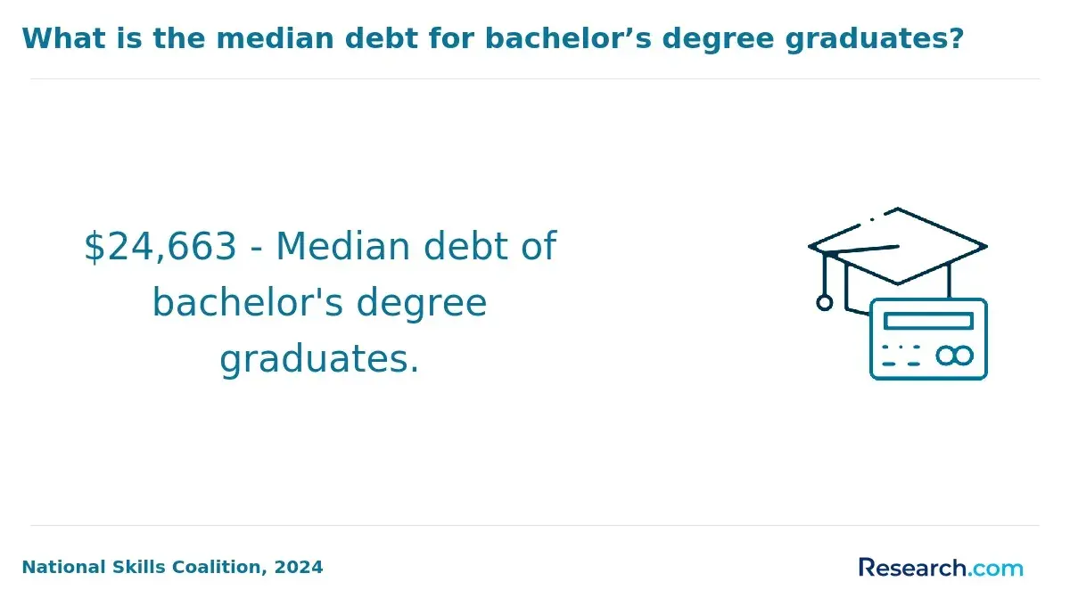
Costs range widely: undergraduate tuition often falls between $15,000 and $40,000 in-state, while graduate degrees can escalate to $50,000, especially when factoring in additional expenses for essential software or remote sensing tools that add $500 to $1,500 annually. These financial considerations compound when programs stretch longer due to part-time pacing favored by full-time workers. Thus, candidates must weigh immediate earnings loss against credential value over time.
For example, a working environmental consultant aiming to shift into a GIS analyst role must evaluate if a condensed certificate pathway suffices or if a multi-year bachelor's degree better supports long-term advancement. Employer expectations prioritize strong technical competencies paired with reasonable time-to-completion, making program flexibility and pacing crucial factors in decision-making. The University of Aberdeen's research confirms a global pivot toward accessible, specialized Earth observation training designed for diverse learner needs beyond campus constraints.
What careers can you pursue in Earth observation with an online geosciences degree?
Prioritizing practical expertise over theoretical breadth is essential when pursuing an online geosciences degree focused on earth observation. Federal agencies such as USGS and NASA look for candidates skilled in satellite data interpretation for climate monitoring and disaster response, while industry roles demand proficiency in multispectral image analysis to support mining and water resource projects.
A remote sensing analyst at an environmental consultancy exemplifies this tradeoff, requiring both solid earth science fundamentals and advanced software skills to deliver actionable deforestation impact reports. Simultaneously, government positions require integrating earth observation data with predictive modeling for policy and emergency management decisions.
For candidates weighing online programs, consider these factors:
- Access to applied learning or internships remains limited remotely, impacting hands-on experience crucial for certain specialized roles.
- Technical proficiency in platforms like ENVI and ArcGIS is often a minimum employer expectation, highlighting the need for programs that deeply balance theory with technical training.
- Annual tuition can vary widely, with some top-tier programs charging up to $62,456 (CollegeHippo, 2025), making return on investment a critical issue.
- Entry-level salaries range roughly $55,000 to $75,000, with senior positions earning up to $120,000, varying by sector and geography.
Ultimately, prospective students must weigh employer expectations against program structure and cost, understanding that geosciences careers in earth observation hinge on nuanced skills, applied experience, and strategic educational choices.
What are the salary ranges and job outlook for Earth observation and remote sensing professionals?
Salary trajectories in earth observation and remote sensing within the U.S. clearly differentiate by role and sector, with entry-level technicians earning around $55,000 and seasoned analysts or project managers surpassing $110,000 annually. These figures are supported by data from the U.S. Bureau of Labor Statistics and industry surveys. In particular, geospatial data scientists and specialized engineers in federal agencies, environmental consulting, and defense command the highest wages due to the advanced technical demands and strategic importance of their work.
Employment growth mirrors the average at roughly 7% through 2032 but is uneven across sectors. For example, environmental monitoring and natural resource management show robust expansion driven by climate challenges and regulatory shifts, while traditional oil and gas roles contract or plateau. Professionals who blend satellite data expertise with AI analytics enjoy faster recruitment and premium salaries.
However, educational accessibility complicates entry. Only about 24 fully online earth science degree programs exist globally, presenting a significant barrier for remote learners. Accreditation, practical GIS and remote sensing experience, and internships are pivotal hiring criteria often missing from newer online offerings. This creates a tension between accessibility and comprehensive training for prospective students.
Those pivoting into earth sciences should prioritize programs with strong industry ties or certification pathways to offset gaps common in academic-only curricula. This practical alignment can directly influence employability and salary outcomes.
How can you evaluate and choose the best online geosciences program for your goals?
Geosciences programs that tightly integrate remote sensing, GIS, and data science skills meet the evolving labor market demands where handling large geospatial datasets and deploying machine learning on environmental data are critical. Employers, especially in government and resource management, prioritize graduates with demonstrable proficiency in interpreting satellite imagery or applying predictive analytics via cloud-based GIS systems.
Accreditation and faculty involvement in active research or consulting directly influence how well theoretical content is paired with practical skills. Prospective students should target programs offering access to real-world datasets rather than exclusively classroom-based theory, as those lacking hands-on experience risk encountering barriers when entering technical roles.
Flexibility is a key factor for working professionals balancing study and employment. Asynchronous courses combined with reliable technical support mitigate common barriers to completing coursework. Programs demonstrating graduate placement above 70% in geospatial or Earth observation roles better signal alignment with employer needs and industry trends.
Tuition cost must be weighed against tangible career outcomes. Some higher-priced options deliver valuable networks and internships, while others provide cost-efficient curricula that equip students for market-relevant skills with less financial burden. Strategic selection depends on individual skill gaps, career objectives, and resource constraints.
- Integration of geospatial analytics and data science is non-negotiable for market relevance
- Hands-on experience with satellite or GIS platforms is essential for employability
- Program flexibility and post-graduation placement rates reveal practical student support and employer alignment
- Cost-benefit analysis should prioritize return on investment over brand alone
Other Things You Should Know About Geosciences
Field experience is valuable but not strictly required to complete an online geosciences degree focused on Earth observation. Many programs compensate for practical skills through virtual labs, simulations, and remote data analysis assignments. However, applicants lacking field exposure should prioritize programs offering substantial hands-on components or partnerships with local research centers to gain essential practical skills, as employers expect graduates to demonstrate competence with real-world data collection and interpretation.
Many online geosciences degrees require a capstone, thesis, or final project to graduate, often in the last 1–2 terms. For earth observation tracks, the project usually uses GIS, remote sensing, or satellite data analysis and may need approval from a faculty adviser before registration.
Programs integrating research projects provide crucial experience interpreting complex Earth observation datasets, improving employability among research-oriented employers. Coursework-only degrees offer faster completion and less time-intensive commitments but may leave graduates underprepared for roles requiring independent project management. For students aiming at advanced positions or graduate study, programs with mandatory research deliver a competitive advantage despite the greater time and effort investment.
References
- Best Online Geoscience Courses and Programs | edX https://www.edx.org/learn/geosciences
- Explore Earth Science Degrees and Career Skills https://careers.earthsciencescanada.com/where-can-you-learn/
- Careers in the Earth Sciences https://earthsciences.dartmouth.edu/undergraduate/careers-earth-sciences
- Bachelor's Degree in Geosciences | UT San Antonio | Undergraduate Program in Geosciences | Earn Your Degree in Geosciences https://future.utsa.edu/programs/undergraduate/geosciences/
- Charlotte https://www.geolsoc.org.uk/Geology-Career-Pathways/Careers/Career-Profiles/Remote-Sensing-Profile.html
- Study pathways — Earth Observation Australia https://www.eoa.org.au/study
- Study Geosciences in Germany - My GUIDE https://www.myguide.de/en/study-mathematics-natural-sciences-in-germany/study-geosciences-in-germany/
- Earth Observation Jobs (with Salaries) - SEEK https://au.seek.com/earth-observation-jobs
- Navigating Institutional Accreditation—How to Get it and Keep it https://changinghighered.com/navigating-institutional-accreditation-process/
- Online Geoscience Degrees: Top Schools and All Programs in 2026 https://www.gisdegree.org/online/geoscience-degrees/