2027 Online Geosciences Degrees With Strong Resource Monitoring Training

Co-Founder and Chief Data Scientist
Resource monitoring specialists often confront the urgent need to analyze vast environmental datasets while operating under tight project deadlines and shifting regulatory demands. The transition to online geosciences degrees addresses these pressures by offering flexible pathways for professionals balancing ongoing work and education. According to the National Center for Education Statistics, over 40% of graduate students enrolled in 2024 selected primarily online programs, revealing a decisive shift toward remote learning driven by career mobility and accessibility barriers.
This trend notably impacts how aspiring geoscientists plan their education amid workforce demands for interdisciplinary expertise and real-time environmental data handling. This article evaluates online geosciences degrees emphasizing resource monitoring skills, guiding readers toward programs aligned with practical career objectives and situational constraints.
Key Things You Should Know
- Only 27% of U.S. geosciences employers report online degrees as equally credible to on-campus ones, pressuring candidates toward hybrid models despite higher personal costs for access and networking opportunities, per AGI 2024.
- Resource monitoring expertise drives 14% annual job growth in environmental consulting, but 58% of online programs omit advanced sensor analytics, reducing workforce readiness for top-tier geoscience roles, per BLS latest data.
- Median online geosciences degree program costs rose 9.8% since 2023, imposing timing and debt constraints that deter midcareer pivots despite growing employer demand for monitoring proficiency in sustainability sectors.
What is an online geosciences degree with a focus on resource monitoring?
An online geosciences degree with resource monitoring specialization directs learners toward applied technical skills essential for managing natural resource inventories amid tightening environmental regulations. Unlike broader geosciences tracks, these programs prioritize expertise in remote sensing, GIS mapping, and environmental data analysis to support precise, real-time assessments of water, mineral, and energy availability. Graduates must competently handle specialized software and hydrogeology modeling to respond to workforce demands in mining, environmental consulting, and government oversight.
Employers increasingly seek candidates who can translate satellite imagery and pollutant tracking into actionable insights on ecosystem health. For instance, a resource analyst tasked with monitoring watershed conditions must deliver accurate data to balance extraction activities against conservation policies, reflecting operational challenges faced in environmental agencies.
The median wage for geoscientists with resource monitoring skills is $99,240, accompanied by a steady 3% job growth outlook from 2024 to 2034. Distance learning geosciences programs focused on environmental resource management offer flexibility but require verification of access to practical GIS labs or internships that critically shape employability.
Prospective students should weigh factors such as faculty expertise and industry connections that emphasize hands-on data evaluation and policy relevance in curricula, bridging graduation with job readiness. For a broader perspective on advanced study options, including how this pathway compares to a data science doctorate online, consider program quality relative to career goals.
How do online geosciences degrees compare with campus programs for field and lab work?
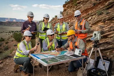
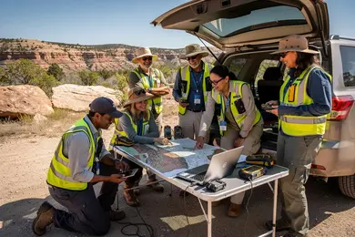
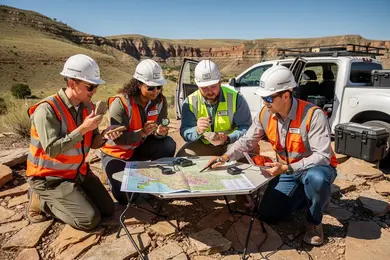
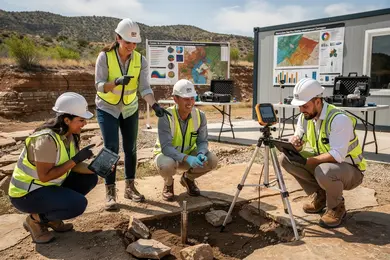
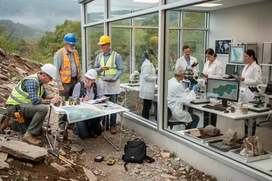
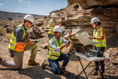
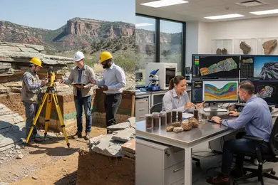
Online geosciences degrees with practical field experience remain limited compared to campus programs, which sustain consistent hands-on training through extended field camps, sample collection, and supervised laboratory work. This contrast notably affects job readiness for positions demanding physical field skills or lab competency. A comparison of lab training in online versus campus geosciences programs reveals that most online options emphasize virtual simulations, remote sensing data interpretation, and digital modeling-effective for data analytics but insufficient for tactile proficiency with geological equipment and natural environments.
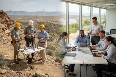
Employers in resource monitoring increasingly expect candidates to combine practical site experience with strong analytical capabilities. This demand aligns with a growing market dedicated to environmental monitoring, where ESG data spending escalates from $1.6 billion in 2020 to a projected $2.8 billion by 2027. Graduates lacking hands-on exposure often require supplementary training or are confined to office roles focused on data interpretation rather than field responsibilities.
Professionals should critically assess whether an online program integrates local fieldwork, industry collaborations, or lab residencies to mitigate these deficits. Without such integration, supplementing education through internships or cooperative education is necessary to meet employer expectations for comprehensive skills in geosciences.
For those seeking an environmental engineering online degree, balancing theoretical knowledge with applied field opportunities is essential to avoid gaps that could hinder entry into practical resource monitoring roles.
Which types of online geosciences degrees best prepare students for resource monitoring careers?
Online geosciences degrees with resource management specialization that focus narrowly on hydrologic modeling, environmental geology, and GIS applications offer the clearest route to roles centered on water resource management and contamination tracking. Employers seek candidates proficient in data acquisition and real-time monitoring systems, skills often embedded in programs emphasizing these specialties. Choosing degrees without targeted resource monitoring components can limit readiness for technical roles requiring hands-on experience with virtual labs or remote data collection.
For practical context, hydrology-focused online degrees train students in groundwater assessment and watershed management, directly supporting infrastructure planning and compliance tasks. The U.S. Bureau of Labor Statistics reports a median wage of $92,710 for hydrologists, with top earners exceeding $134,000, signifying strong labor market relevance for quantitative environmental analysis and sustainability skills. Integrating field data and capstone projects on monitoring technology enhances employability compared to more generalist geosciences pathways.
Prospective students seeking the best geosciences programs for resource monitoring careers should evaluate curricula that align with industry certifications in water quality, soil analysis, and GIS software proficiency. This alignment is critical for transitioning into roles requiring detailed environmental reporting and regulatory risk assessments, especially within environmental consulting and public water agencies.
Those considering a strategic shift or advancement may also explore interdisciplinary options such as a library science degree, which can complement geosciences expertise by strengthening data management skills crucial for environmental data-intensive roles.
What accreditation and program quality standards matter for online geosciences degrees?
Accreditation standards for online geosciences degree programs directly influence graduate employability and long-term career feasibility. Programmatic accreditation from ABET ensures graduates meet technical competency requirements vital for jobs involving precise resource monitoring and environmental assessment. Complementary regional accreditation governs eligibility for federal aid and graduate studies, shaping overall return on investment. Selecting a program without these accreditations risks underpreparedness and limited career advancement.
Key program quality indicators for online geosciences training include comprehensive curricula covering remote sensing, GIS applications, and geochemical analysis. These focus areas reflect employer demands, especially in environmental consulting. However, purely online programs often struggle to offer adequate hands-on fieldwork, a mismatch with employer preferences for candidates with validated practical experience. Developing structured fieldwork or industry partnerships is thus essential to bridge this gap.
Cost-to-benefit tradeoffs are significant. For example, Southern New Hampshire University's online BS in Geosciences charges approximately $320 per credit, totaling $38,400 for 120 credits-25-35% below average in-state tuition at U.S. public universities. Reduced tuition expands access but may limit experiential opportunities crucial for natural resource roles. Prospective students must weigh cheaper programs' lower expenses against the potential value loss in applied training.
Graduate outcome tracking further differentiates programs. Successful placements within agencies like the EPA, USGS, or private firms indicate alignment with evolving industry standards, including emerging tools like drone surveying and machine learning for data analysis. Without such oversight, curricula risk becoming outdated.
Students should also explore pathways in related fields; for instance, veterans considering an electrical engineering degree online for veterans may find complementary skill integration beneficial alongside geosciences expertise.
What core courses and technical skills are taught in resource monitoring-focused curricula?
Resource monitoring curricula in geosciences prioritize technically rigorous skills critical for managing complex environmental systems. This focus often means tradeoffs in breadth: students gain depth in remote sensing technologies such as multispectral and hyperspectral imaging but may miss broader foundational geology topics. Practical applications require proficiency in software tools like ArcGIS, ENVI, and Python, enabling efficient geospatial data interpretation and automation rarely addressed by traditional programs.
Field and virtual training emphasize real-world constraints-such as limited access to remote sites-preparing students for operational realities in resource management. Crucially, successful candidates synthesize heterogeneous datasets into reports usable by policymakers and stakeholders, a skill set that commands attention in employers like the U.S. Geological Survey, which has expanded its remote-sensing training offerings extensively.
Quantitative reasoning in statistical and time-series analysis underpins tasks like monitoring aquifer depletion, demonstrating how data must be cross-validated with field measurements for reliable intervention strategies. Integrating environmental policy and resource economics ensures technical outcomes align with regulatory frameworks and economic feasibility, a balancing act essential to advancing credible, actionable assessments.
- Specialized technical training narrows but sharpens the focus on resource monitoring competencies
- Software literacy and data automation are prerequisites for employability in this sector
- Strong communication complements technical expertise to translate complex data for decision-makers
Prospective students should weigh the narrower technical scope against program demands and clarify whether workforce goals prioritize hands-on geospatial analytics and policy integration over generalist geological knowledge.
What are typical admission requirements and prerequisites for online geosciences programs?
Online geosciences programs demand a robust quantitative and scientific foundation, which directly affects admission and subsequent career readiness. Candidates typically require a high school diploma with coursework in algebra, geometry, calculus, physics, and chemistry. Bachelor's programs often expect familiarity with earth sciences or geography, as many employers value early exposure to these core concepts before advancing to specialized skills like resource monitoring.
At the graduate level, applicants usually must hold a relevant bachelor's degree with competencies in statistics, programming languages such as Python or R, and Geographic Information Systems (GIS). These technical skills align with the shifting demands of resource monitoring professions, where practical experience with remote sensing tools is increasingly prioritized. For instance, NASA Earthdata/ARSET's wide-reaching online trainings-engaging over 100,000 users globally-illustrate the sector's emphasis on applied remote sensing expertise.
Individuals without a direct geosciences background face extended pathways due to prerequisite courses, which can increase time to degree but directly enhance employability in fields like environmental consulting or land management. Employers favor candidates demonstrating operational knowledge of GIS software and spatial data analysis over purely theoretical learning.
International applicants must navigate additional hurdles such as English proficiency verification and credential equivalency, which may impact enrollment timing. Working professionals should weigh these preparatory requirements against their career stage, balancing the cost of prerequisite completion with immediate workplace applicability in roles that demand advanced monitoring capabilities.
How long do online geosciences degrees take and what do they typically cost?
Online geosciences degrees require careful scrutiny beyond duration and tuition, given the field's evolving technical demands. Associate programs typically conclude in 2 years, bachelor's in 3 to 4 years, and master's add 1 to 2 years, but part-time online formats or integrated internships can extend both time and cost. For example, a working professional might weigh enrolling in a longer bachelor's program at $30,000-$60,000 tuition with minimal hands-on components against a pricier accelerated master's that includes fieldwork and industry placements, directly affecting employability in resource monitoring roles.
Employers in resource monitoring emphasize candidates who merge foundational geosciences with applied skills in mineral and water resource analysis. This is reinforced by a notable 16% increase in global mining exploration budgets to $13-14 billion from 2020 to 2024, driving demand for graduates versed in critical mineral extraction and environmental monitoring technologies.
However, few online programs integrate comprehensive fieldwork, delaying practical skill acquisition crucial for many roles. Additionally, specialized lab kits or software access, often excluded from standard tuition, add hidden costs. Therefore, students must critically evaluate curriculum rigor, hands-on opportunities, and total investment, recognizing these factors as pivotal in positioning oneself competitively within the resource monitoring sector.
What careers can you pursue in resource monitoring with an online geosciences degree?
Graduates with an online geosciences degree specializing in resource monitoring enter a labor market shaped by increasingly stringent international climate disclosure mandates. Over 130 countries have implemented or are developing regulatory frameworks that require precise environmental data reporting, intensifying demand for professionals adept at integrating satellite imagery, remote sensing, and compliance standards into decision-support tools.
Typical roles-such as environmental compliance officers, GIS specialists, or resource analysts-require not only technical skill in managing vast geospatial datasets but also the ability to navigate complex, cross-jurisdictional regulatory landscapes. For instance, an energy-sector resource analyst must reconcile operational efficiency with compliance, delivering timely geospatial insights that align with evolving IFRS Foundation/ISSB standards.
Employers prioritize candidates with demonstrated competence in climate modeling, legal interpretation of environmental regulations, and expertise in data analytics software. Professionals must also commit to ongoing learning given rapid regulatory changes. Career trajectories may focus on niche areas like carbon accounting or infrastructure risk assessment, demanding specialized knowledge beyond general geosciences education.
Students and working professionals should weigh these labor market demands against program rigor and curriculum relevance, especially regarding practical exposure to regulatory regimes and data integration techniques.
What salary ranges and job outlook can geoscience and resource monitoring graduates expect?
Starting salaries for graduates in geoscience and resource monitoring typically range from $55,000 to $85,000, with experienced professionals earning between $90,000 and $130,000. Higher salaries tend to cluster in sectors like energy and advanced technology, where expertise in AI, UAV data, and big data analytics directly affects operational value. Conversely, environmental consulting and government roles generally offer compensation closer to the lower end.
The 9% projected growth for this field over the next decade reflects rising demand driven by expanded environmental regulations and an increase in commercial earth-observation satellites. Over 60% of new satellites now carry specialized sensors for environmental and resource monitoring tasks, emphasizing the importance of integrating diverse geospatial data. For example, a field technician shifting focus toward UAV data integration may command an added salary premium of $10,000 to $20,000. However, achieving proficiency in these interdisciplinary technologies often requires investments in ongoing training beyond traditional geoscience curricula, which can present time and financial challenges for students.
Employers increasingly expect candidates to have practical skills in AI-powered data processing and cloud-based geospatial platforms. Without these, even those with strong foundational knowledge may find job options limited. Targeted certifications or internships demonstrating applied technology integration alongside core skills are essential to stand out and enhance long-term employability in this evolving labor market.
How can students evaluate and choose a reputable online geosciences program in the U.S.?
Choosing an online geosciences program without rigorous accreditation is a critical misstep that can hinder employability, especially given the projected U.S. shortage of over 130,000 geoscience specialists by 2034, based on the American Geosciences Institute's 2024 workforce data. Accreditation by bodies like ABET ensures curricula are aligned with stringent academic and professional benchmarks, which directly supports readiness for roles demanding resource monitoring skills in federal agencies and environmental consulting firms.
Programs featuring applied components such as GIS, remote sensing, and data analytics provide a competitive edge, as these skills dominate current labor market requirements. For example, students aiming for hydrology roles should prioritize programs offering watershed modeling and water quality assessment modules, reflecting high-demand functions in environmental monitoring.
Key decision factors include:
- Alignment with relevant industry certifications and curriculum updates capturing technological advancements
- Availability and quality of internships with resource-focused agencies, as practical experience often decisively influences hiring
- Faculty expertise in applied geosciences and demonstrable graduate employment metrics supported by independent labor market data
Programs emphasizing general geosciences topics without explicit resource monitoring content risk limiting career prospects amid an acute skills shortage documented by the American Geosciences Institute survey. Prospective students should critically evaluate institutional claims by cross-referencing government labor statistics and industry reports to ground their choice in verifiable evidence.
Other Things You Should Know About Geosciences
Employers differentiate programs based on the depth of technical training and research exposure. Online offerings without rigorous data analysis or geospatial technology components often signal insufficient preparation for resource monitoring jobs. Prospective students should seek programs that emphasize applied GIS, remote sensing, and environmental data management within their curricula. This technical rigor directly influences employability and eligibility for advanced roles in monitoring natural resources.
Yes, adding relevant certifications-such as in GIS, environmental compliance, or water quality monitoring-significantly enhances job market competitiveness. Online degrees alone may not cover all niche regulatory or technical skills employers require. Prioritize certifications aligned with your target job sector to offset any gaps in the degree program's scope. This strategy boosts practical expertise and signals commitment to specialized aspects of resource monitoring.
Students should learn GIS, remote sensing, and statistical software such as ArcGIS Pro, QGIS, Google Earth Engine, and Python or R. Strong programs also use satellite imagery, GPS, and sensor-data platforms for hydrology, land-use, and environmental monitoring projects.
References
- Are Online Degrees Accredited? How to Identify Quality Distance Learning Programs https://www.umassglobal.edu/blog-news/online-degrees-accredited-identify-quality-distance-learning-programs
- The Geological Society - Degree Accreditation https://www.geolsoc.org.uk/education-and-resources/universities/university-degree-accreditation/
- Online Geoscience Degrees: Top Schools and All Programs in 2026 https://www.gisdegree.org/online/geoscience-degrees/
- Best Online Geoscience Courses and Programs | edX https://www.edx.org/learn/geosciences
- Careers in Geoscience: Environment https://www.aig.org.au/education/careers-in-geoscience/careers-in-geoscience-environment/
- What Does the Future Demand Look Like for Applied Geoscientists? https://www.aegweb.org/index.php
- ThisIsGeoscience - Geoscience Salaries https://www.thisisgeoscience.com/the-resources/geoscience-salaries
- Geology - ABET https://www.abet.org/accreditation/new-and-developing-program-areas/geology/
- Geoscience Careers https://education.americangeosciences.org/resources/geoscience-careers/
- Successful delivery of Pilot Training on Open Science and Research Dat https://www.skills4eosc.eu/participate/skills4eosc-training-courses