2027 Online Geosciences Degrees With Strong Mapping and Geospatial Training

Co-Founder and Chief Data Scientist
Professionals navigating rapidly evolving environmental and resource challenges need advanced mapping and geospatial skills that mirror real-world demands-yet finding flexible education options that fit irregular schedules remains a persistent barrier. The National Center for Education Statistics reported an 8% rise in online graduate enrollments in STEM fields between 2022 and 2024, reflecting a growing shift toward accessible remote learning for adult learners balancing career and personal commitments. This shift signals a critical opportunity: geosciences students can now seek programs that blend rigorous spatial analysis training with flexible delivery models, essential for timely career pivots and upward mobility.
This article identifies online geosciences degree programs with robust mapping and geospatial curricula designed to meet these precise workforce and accessibility needs.
Key Things You Should Know
- Geospatial specialization in online geosciences degrees boosts employability, with the U.S. Bureau of Labor Statistics projecting a 15% job growth in mapping and GIS roles by 2031, demanding proficiency in advanced spatial analysis tools.
- Programs emphasizing hands-on geospatial labs face cost and access tradeoffs: higher tuition and limited synchronous course availability hinder mid-career professionals seeking rapid credentialing within 18 months.
- Employer surveys from the American Geosciences Institute reveal 62% prioritize candidates with integrated mapping and geospatial internships, making program connections to industry partnerships a key factor in graduate job placement.
What is an online geosciences degree with a focus on mapping and geospatial technology?
Professionals seeking to integrate technical expertise with geological knowledge must weigh the practical constraints of online geosciences degrees with mapping specialization. These programs equip students to operate advanced geospatial technology-such as GIS, GPS, and remote sensing-essential for spatial data analysis and accurate environmental assessments. However, access to required computing power and licensed software can complicate remote learning, often necessitating program-supported virtual labs.
Real-world tasks, like evaluating groundwater contamination, demand proficiency in overlaying multiple spatial datasets, blending geospatial technology training in online geosciences programs with domain-specific insight. Employers in sectors like energy, environmental consulting, and urban planning increasingly require these hybrid skills to address complex challenges including climate modeling and infrastructure development.
Graduates must also navigate stringent data standards, metadata management, and legal compliance, especially in consulting or public agencies. The U.S. Bureau of Labor Statistics projects a 5% job growth for geoscientists through 2032, exceeding the average for all occupations-highlighting an elevated demand for candidates versed in both geosciences and geospatial technologies.
For students considering advanced academic routes, comparing options such as an online PhD in data science may offer complementary pathways integrating spatial data expertise with broader analytical capabilities.
How do online geosciences programs compare with campus-based options for mapping and GIS training?
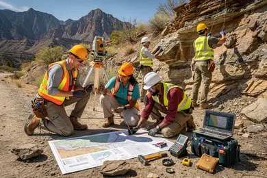
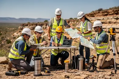
Online geosciences programs for mapping and GIS training increasingly parallel campus-based offerings in technical rigor and access to platforms like ArcGIS and QGIS, yet they typically underdeliver on essential fieldwork components. Campus-based geosciences degrees with geospatial technology often include direct field training and hands-on use of surveying equipment, which remain critical for roles requiring precise spatial data collection. Graduates lacking this practical experience may face hiring challenges in disciplines such as environmental consulting that demand field validation alongside GIS proficiency.
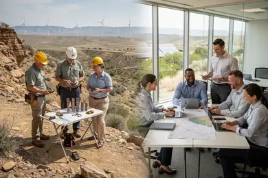
Employers emphasize demonstrable GIS skills and verified project outcomes over how education was delivered, disadvantaging fully online students without local or supplemental field exposure. Meanwhile, remote-friendly sectors like urban planning or resource management show greater acceptance of online credentials due to the digitally focused workflows. To mitigate gaps, online students should target volunteer work, internships, or hybrid programs that incorporate short residencies or regional partnerships for applied training.
These tradeoffs affect career trajectory and earning potential: geoscientists earn a median annual wage of $104,560 with the top 10% surpassing $187,540, reflecting premium valuations of advanced field competencies. Prospective candidates assessing an environmental engineering degree online would benefit from scrutinizing how programs balance theoretical knowledge with accessible avenues for hands-on experience to meet employer expectations.
For detailed options emphasizing cost-efficiency, review environmental engineering degree online programs offered today.
Which types of online geosciences degrees offer the strongest mapping and geospatial preparation?
Online geosciences degrees with advanced mapping techniques distinctively equip candidates to meet employer expectations, especially when programs offer focused GIS or geospatial science tracks. Such specialized curricula emphasize applied skills in spatial data analysis, remote sensing, and cartography software like Esri ArcGIS and QGIS, critical for roles requiring hands-on geospatial competence. For instance, environmental consultants conducting site assessments gain immediate advantage from degrees that integrate GIS labs and current industry tools, enhancing job readiness.
In contrast, generalist geosciences degrees, even online, often fall short in delivering the depth required for spatial data integration roles. Employers look beyond broad knowledge, valuing demonstrable abilities in spatial database management, geoprocessing automation, and geostatistical analysis, capabilities embedded mainly in well-structured GIS-specific tracks. When evaluating the best online geosciences programs for geospatial analysis, prospective students should weigh these practical distinctions carefully.
Program accessibility and real-world application also matter. Penn State World Campus's enrollment surpassing 7,000 students underscores scalability and employer recognition for programs with internships or capstone projects centered on geospatial solutions. Students juggling work should prioritize flexible asynchronous formats paired with virtual labs to refine mapping skills in realistic scenarios.
Those assessing educational pivots in geosciences may also find complementary insights by exploring an exercise science degree online, as evaluating program structure and workforce alignment across disciplines can inform more strategic choices.
What accreditation and program quality standards matter for online geosciences and GIS degrees?
Accreditation by a regional body recognized by the U.S. Department of Education remains the baseline requirement for online geosciences degrees accreditation standards in the United States, directly impacting program legitimacy and employer recognition. Programs that also meet criteria from organizations like ABET or the Geological Society of America provide more rigorous preparation by embedding essential GIS and spatial analysis competencies. For professionals targeting government or environmental consulting roles, this specialized accreditation unlocks access to internships and hands-on training critical for immediate job readiness.
Quality criteria for online GIS and geospatial programs include integrating current industry GIS software such as ArcGIS or QGIS into the curriculum. Without practical, applied experience using these platforms, graduates face hurdles in roles that demand proficiency in spatial data modeling and resource management-common in energy, urban planning, and environmental monitoring sectors. Employers expect not only theoretical knowledge but also demonstrated skills through lab work or virtual simulations that replicate real-world scenarios.
Prospective students should balance tuition costs, which range from $66,000 to $85,000 for an accredited online environmental geoscience bachelor's degree, against median salaries exceeding $100,000. This alignment underscores the importance of enrolling in accredited programs with strong employer networks, as poor alignment can limit eligibility for certifications and licensure. Working professionals assessing cheapest online computer science degree options will find parallels in weighing program cost-effectiveness alongside career outcomes.
Evaluating faculty expertise and program flexibility is crucial for students needing to manage work commitments. Project-based learning that mimics field conditions accelerates skill acquisition and reduces time-to-productivity in highly technical roles. Additionally, clear articulation agreements with four-year or graduate institutions can significantly influence educational and career trajectories, especially in a specialized and evolving job market.
What courses and technical skills are typically included in mapping- and GIS-focused geoscience curricula?
Technical proficiency in spatial data and GIS software is a baseline expectation for geosciences roles that engage with mapping, environmental analysis, or infrastructure planning. Core competencies include mastery of Esri ArcGIS and QGIS platforms alongside the ability to program in languages like Python and R, enabling automation and effective handling of complex geospatial datasets. Practical experience with Global Positioning System (GPS) technology and surveying methods is crucial where accurate field data acquisition impacts project outcomes, as seen in disaster response or urban development initiatives.
Specialized coursework in spatial statistics and geostatistics sharpens the ability to detect meaningful patterns within geospatial data, a skill increasingly valued in sectors such as precision agriculture or public health. Meanwhile, database administration knowledge-particularly around SQL and cloud spatial databases-addresses the operational challenges of managing extensive government or commercial GIS infrastructures.
The geospatial analytics sector's rapid growth-from about $95 billion to over $144 billion in five years-translates into demand for graduates who combine hands-on GIS technical skills with analytical judgment to solve practical problems, like optimizing utility networks or climate impact modeling. However, students should consider the significant learning curve tied to mastering both the software tools and analytical frameworks, recognizing that employers value demonstrated applied skills over theoretical knowledge alone.
What software, fieldwork alternatives, and lab components are used in online mapping and geospatial training?
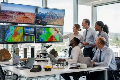
Online geosciences programs increasingly prioritize industry-standard tools such as Esri ArcGIS Pro, QGIS, and ENVI to align graduate competencies with contemporary employer needs. Over 70% of accredited programs require a comprehensive GIS course, ensuring spatial data handling proficiency, while around 40% embed remote sensing as a mandatory element, demonstrating the field's technical expectations. Graduates typically engage in complex spatial modeling, layered mapping, and live data integration-skills essential for roles in urban planning, environmental consulting, and resource management.
The absence of traditional fieldwork is offset by virtual labs, drone simulation, and interactive remote sensing data, presenting a practical tradeoff: students gain advanced software proficiencies but lack hands-on sample collection experience. This shift demands heightened self-discipline and technical troubleshooting to meet professional standards.
Programs leverage cloud-based platforms like ArcGIS Online, providing access to current satellite data without geographic constraints; however, successful participation requires robust internet connections (minimum 25 Mbps) and capable home computing environments to prevent workflow disruptions.
Practical coursework often involves case-based assignments such as flood risk analysis through digital elevation models, mirroring employer project scenarios. This approach enhances job-readiness but places the onus on students to reconcile limited field exposure with strong analytic and software operation skills.
What are the typical admission requirements, time to completion, and tuition costs for these online degrees?
Admission to online geosciences degrees demands more than credentials; it requires navigating selective criteria balancing academics and professional experience. Graduate programs often expect a bachelor's degree plus proof of math, science, or geography coursework, while many waive standardized tests like the GRE if applicants offer relevant work history or prior credits. This reflects employer-driven preferences for applied skills, particularly in mapping and geospatial analysis domains.
Program duration varies notably: bachelor's degrees require 120-130 credits typically completed full-time in four years, but part-time or accelerated paths may extend this up to six years. Master's degrees usually involve 30-36 credits and are structured for professionals, allowing completion in 18-24 months, though juggling employment can push this timeline to three years. Coursework demands hands-on proficiency with geospatial software, remote sensing, and cartography, necessitating consistent project and lab engagement that impacts pacing.
Tuition pricing remains stable despite inflation pressures. For example, Liberty University's online graduate GIS tuition rose less than 5% over a decade, charging $600-$665 per credit hour for civilians and $310 for military students in 2026-2027. This affordability is critical for candidates funding independently or relying on employer support, with master's programs costing roughly $18,000 to $24,000 excluding fees. Prospective students must weigh these costs against potential salary gains in sectors like environmental consulting or urban planning, where certified mapping expertise often translates to clear hiring advantages.
What careers can you pursue with an online geosciences degree emphasizing mapping and geospatial analysis?
Careers in geosciences with a focus on mapping and geospatial analysis demand precise expertise in geographic information system (GIS) technologies, combining technical and domain-specific knowledge. Employers-ranging from government agencies to defense contractors-expect candidates capable of managing complex spatial datasets to inform regulatory compliance and strategic decisions.
One practical application exemplifies this: urban infrastructure planning relies on geospatial analysts to integrate terrain data and existing utilities, optimizing development projects while minimizing environmental impact. Environmental consultants similarly depend on satellite imagery and terrain models to detect resource depletion and assess natural hazards.
Stackable credentials and microcredentials are increasingly embedded in top graduate GIS programs, providing modular pathways that appeal to working professionals unwilling to pause their careers. More than half of leading online GIS certificates in 2026 offer these flexible options, reflecting market demand for ongoing upskilling aligned with rapid software evolution and industry standards.
However, candidates must navigate continuous certification requirements and employer preferences, which often prioritize candidates who can merge geospatial proficiency with broader geosciences insight and project management skills. This blend influences salary potential and long-term career trajectory.
What salary ranges and job outlook can geoscience and GIS-focused graduates expect in the U.S.?
Entry-level salaries for geoscience and GIS graduates in the U.S. generally range from $50,000 to $70,000, with mid-career professionals earning between $80,000 and $100,000 or more depending on specialization and geographic location. Job growth in this sector is projected at approximately 5% over the next decade, driven largely by demand in environmental consulting, energy, and government roles.
GIS specialists can reach over $90,000 by developing advanced skills in spatial analysis, remote sensing, or applying data science techniques, but pay varies notably by field-urban planning and public health employments often contend with public sector budget constraints. Graduates lacking proficiency in coding or machine learning face tougher competition.
Tradeoffs are apparent in real-world job choices:
- Positions in oil and gas typically offer higher starting salaries but limit geographic mobility.
- Environmental agency roles provide more stability but slower salary growth.
- Tech and public health sectors require rapid skill acquisition yet offer diverse project experiences and transferable expertise.
Diversity remains a challenge: women comprised about 24% of the geoscience workforce in 2023, indicating ongoing inclusion gaps. Flexible and online educational pathways aim to expand access and could gradually influence workforce composition and culture.
Strategic career planning should balance skill-building, market demand, and sector-specific realities to navigate entry barriers and adapt to evolving geoscience labor markets.
How can prospective students evaluate and choose a reputable online geosciences program in this field?
Career shifts within geosciences demand programs that tightly align training with current labor-market realities, especially as UAS technician roles grow rapidly. Candidates should prioritize advanced instruction in GIS software, remote sensing, and UAV operation to remain competitive. Insufficient exposure to these practical skills risks leaving graduates unprepared for sectors like surveying, agriculture, or infrastructure inspection, where aerial data and mapping are now standard.
Evaluate programs based on their industry connections and accreditation status, ensuring students gain relevant, hands-on experiences rather than relying on outdated theory. Faculty engagement with evolving geospatial technologies also signals curriculum relevance. Graduate employment data, particularly placement rates in geospatial roles, offer critical insight into a program's tangible career impact.
Pragmatically, flexible delivery options and modular course structures benefit working professionals transitioning from traditional surveying to UAV data analysis by minimizing income disruption. Access to virtual labs or equipment rentals further supports skill acquisition without significant upfront investments. Certification pathways integrated within coursework enhance field readiness and employer appeal.
Students should carefully weigh these factors against their career goals, recognizing that programs emphasizing credential accumulation over measurable job outcomes may not justify time or expense. Successful pivots rest on mastering specialized tools alongside foundational geosciences knowledge, reflecting both employer expectations and the dynamic technical landscape.
Other Things You Should Know About Geosciences
Online geosciences degrees with strong geospatial training usually require disciplined self-study due to technical content and software proficiency demands. Working professionals must allocate consistent weekly hours for complex GIS assignments and data analysis, which may exceed time spent in traditional lecture-based courses. Prioritizing programs with flexible pacing and asynchronous options helps manage these challenges, especially when balancing career and family obligations.
Yes, prioritizing programs that integrate industry-recognized GIS certification improves employability in mapping-focused roles. Certification demonstrates practical proficiency trusted by employers and can offset the absence of fieldwork in online formats. Students seeking direct career impact should select programs with embedded or co-offered GIS credential options rather than degrees lacking explicit technical certification pathways.
A strong program should include ArcGIS Pro or QGIS, remote sensing software such as ENVI or ERDAS Imagine, and access to virtual or downloadable lab datasets. Many employers also expect training in GPS data collection, cartography, spatial analysis, and geospatial data management.
References
- Find the Best GIS Degree Programs | GIS Degrees http://www.gisdegrees.org/
- 8. Recruiting, Retaining, and Promoting Success of Undergraduate Students with Emphasis on Students Underrepresented in the Geosciences https://www.americangeosciences.org/change/sections/recruitment/
- Which software is used for GIS https://orionterrametrics.co.ke/blog/which-software-is-used-for-gis/
- 5 Best GIS Tools for Better Geospatial Mapping https://energy-oil-gas.com/news/5-best-gis-tools-for-better-geospatial-mapping/
- UNIGIS Salzburg - GIS online study for working professionals https://unigis.at/en/
- 8 things Geoscientists should know about Geoscience in schools https://geoscienceforthefuture.com/8-things-geoscientists-should-know-about-geoscience-in-schools/
- Greener Careers https://greenercareers.co.uk/blog/what-are-gis-jobs-explore-roles-in-mapping-data-and-environment-work
- 13 Free GIS Software Options: Map the World in Open Source - GIS Geography https://gisgeography.com/free-gis-software/
- Best Accredited Online Universities in 2025 https://www.study.eu/article/best-accredited-online-universities
- Education Partner Directory https://thegpn.org/page/educationalpartners