2027 First Geosciences Roles for Data-Driven Environmental Professionals

Co-Founder and Chief Data Scientist
Struggling to secure your first role in geosciences amidst accelerating demands for advanced data analytics skills is a common, high-stakes challenge. With nearly 40% of geosciences employers reporting critical talent shortages in data-driven expertise-according to the U.S. Bureau of Labor Statistics-the pressure to merge domain knowledge with proficiency in machine learning and spatial data processing intensifies. This mismatch often stalls early career progression and complicates transitions from adjacent technical fields.
Meanwhile, expanding access to flexible online programs, as Pew Research highlights, enables more adult learners to upskill without pausing employment, reshaping enrollment strategies and timing for workforce entry. This article identifies emerging entry roles and educational pathways that align practical skill development with real employer expectations in geosciences data careers.
Key Things You Should Know
- US Bureau of Labor projects 9% growth in geosciences data roles by 2030, yet entry-level jobs demand advanced machine learning skills, forcing candidates to invest 12+ additional months in specialized training, delaying workforce entry.
- Employers prioritize interdisciplinary experience combining geosciences and environmental informatics, with 68% of 2024 industry hires requiring proficiency in both fields, intensifying competition among applicants lacking cross-domain credentials.
- Federal and state funding cuts to traditional field research programs redirected toward remote sensing analytics shift geosciences roles towards data synthesis, reducing hands-on experience opportunities and complicating skill acquisition pathways for newcomers.
What are data-focused geoscience roles for early-career environmental professionals?
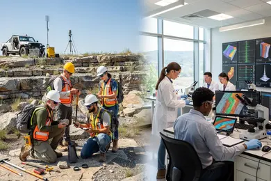
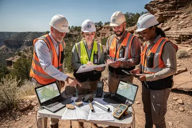
Data-focused geoscience roles for early-career environmental professionals in North America emphasize both domain expertise and advanced data handling capabilities. Positions such as environmental data scientists, remote sensing analysts, geospatial data specialists, and climate modelers require deep proficiency in programming languages like Python or R and Geographic Information Systems (GIS). Employers expect candidates who transform complex datasets into actionable intelligence that directly influences policy, resource management, or hazard mitigation.
For example, an environmental data scientist within a state agency may analyze air quality time-series data to detect pollution hotspots, applying machine learning validated by extensive historical datasets. Conversely, remote sensing analysts in the energy sector monitor pipeline integrity using real-time satellite data integrated with geographic databases. These illustrate practical distinctions in data application and required technical skills.
Early-career professionals must balance geoscience depth against computational breadth. While geological principles remain foundational, market demand favors those with strong data engineering and visualization skills to facilitate cross-disciplinary collaboration. This dynamic is critical for entry-level environmental data analyst roles in North American geosciences.
According to May 2024 U.S. Bureau of Labor Statistics, computer and information research scientists-including many environmental data scientists-earn a median annual wage of $145,080, with employment projected to grow 23% through 2033. Practical employability stems from opportunities with real-world datasets in environmental monitoring or government programs, emphasizing data cleaning, model validation, and communication skills. Without these, new professionals face difficulties meeting operational readiness standards.
These realities underscore why early-career environmental professionals seeking roles in geosciences should consider positions emphasizing data analysis and environmental modeling in North America. Those assessing educational pathways will benefit from knowing what can you do with an environmental studies degree to align skills with employer expectations.
What education and skills do you need for data-driven geoscience careers?
Data-driven geoscience careers increasingly demand a blend of foundational earth science knowledge and applied skills in data analysis and geospatial technology. Employers prioritize candidates who combine a bachelor's or higher degree in geosciences, environmental science, or related STEM fields with verified competencies in data science, Python or R programming, and GIS software. The core expectation involves managing extensive datasets, performing statistical modeling, and leveraging remote sensing to generate actionable insights for environmental management. This intersection of skills often determines employability and wage potential in a competitive labor market.
Practical experience remains a critical factor for career progression or pivoting, typically gained through internships or cooperative education. A geoscientist working in climate adaptation, for instance, may deploy machine learning models on satellite data to forecast flood risks-highlighting the necessity of integrating earth science expertise with programming capabilities. Conversely, professionals in mineral exploration emphasize 3D geological modeling and spatial analysis, illustrating how specialization affects tool proficiencies and job requirements. Understanding these nuances helps tailor educational choices effectively.
Employers emphasize versatility and measurable skills, as reflected in the U.S. Bureau of Labor Statistics median wage of $99,240 and a modest employment growth forecast. Despite this, demand for experts skilled in environmental protection and data-driven climate strategies remains steady. Those weighing an investment in a data-driven environmental geosciences education requirements path should also consider cost-efficient options like an environmental engineering online degree, which can provide a practical, affordable gateway to relevant technical competencies.
Which geoscience degree pathways best prepare you for environmental data roles?
Geoscience degree pathways that integrate quantitative methods, programming, and geospatial analysis most effectively prepare candidates for environmental data roles. Degrees focusing on environmental data science, geospatial science, or geoinformatics better align with employer expectations than traditional geology or earth science alone. Employers increasingly prioritize practical skills in Python scripting, machine learning, and GIS platforms for environmental data analysis degree programs, often offering salaries 25-40% above roles lacking such expertise.
For example, environmental consulting firms handling large satellite imagery datasets demonstrate clear preference for graduates with hands-on Python and GIS credentials over generic geoscience holders. Students pursuing geosciences training for data-driven environmental careers should confirm their curricula include applied projects and access to industry-standard datasets or spatial modeling software to avoid critical skill gaps.
Tradeoffs include balancing foundational geoscience knowledge with proficiency in computational tools, as well as considering program location and workload intensity. Traditional degrees without explicit data components generally require additional certifications or self-directed learning, which may delay employment and reduce initial earning potential. Conversely, degrees structured around computational skills offer faster entry into technical roles but may sacrifice some breadth.
Those evaluating diverse academic pathways must weigh these factors carefully. This includes reviewing whether supplemental credentials or research-led training can effectively compensate for less focused programs. For insights into related fields, understanding if is a masters in library science worth it provides context on specialized degree valuation across disciplines.
How do online geoscience programs compare to campus options for data-focused careers?
Students pursuing an online geosciences degree program for environmental data careers must weigh significant tradeoffs between flexibility and practical immersion. While online curricula provide broad theoretical knowledge in GIS, remote sensing, and programming beneficial for working professionals, they often fall short on experiential learning critical for data-driven roles, especially within federal agencies such as NASA or NOAA. Campus-based programs excel in embedding collaborative, hands-on projects, fieldwork, and access to specialized equipment, which remain crucial for meeting employer expectations and securing competitive positions.
For example, a mid-career professional pivoting into climate data science is more likely to succeed through campus-oriented programs that integrate in-person cohort collaboration and real-world data analysis aligned with federal agency demands. Conversely, fields like environmental consulting may accept fully online credentials if the roles emphasize data visualization or model validation without stringent applied research requirements.
Key factors for consideration include:
- Balancing access to internships and lab work against the need for schedule and geographic flexibility
- The potential impact of limited peer and mentor interaction on skill development
- Cost implications relative to employer value placed on hands-on experience
- Whether hybrid programs can bridge gaps for subfields requiring specialized equipment or field data collection
Addressing these considerations with clear alignment to career goals will optimize outcomes. Prospective students should also explore options for affordable online computer science degree pathways to complement geosciences skills in analytics and programming, such as those found at affordable online computer science degree resources.
Deliberating campus versus online geosciences education for data-driven professionals ultimately hinges on the balance between skill applicability and real-world engagement opportunities required by target employers.
What coursework and technical tools are taught in geoscience programs using big environmental data?
Programs in geosciences that emphasize big environmental data require proficiency in specialized quantitative skills such as geostatistics, spatial analysis, and remote sensing. These competencies enable graduates to interpret complex datasets drawn from climate models, hazard records, and satellite imagery-skills increasingly demanded by employers assessing environmental risks.
For instance, a wildfire risk analyst operating in the western U.S. must integrate historic fire occurrences with up-to-date satellite data and climate projections using GIS tools, Python automation, and statistical models to forecast fire spread and intensity accurately.
Core coursework typically includes Geographic Information Systems (GIS), programming languages like Python and R, and cloud computing platforms designed for massive geospatial data management. Mastery of software such as ArcGIS, QGIS, and Google Earth Engine is expected, alongside effective data visualization to communicate actionable insights to decision-makers. Graduates lacking strong coding or statistical rigor often face challenges meeting job requirements, reflecting a clear workforce preference for candidates fluent in multi-source data workflows.
Hands-on labs focused on disaster risk assessment prepare students to handle practical scenarios, aligning with labor projections signaling 1,400 new geoscientist positions nationally over a decade. Programs that overlook these evolving data-intensive demands risk producing graduates with limited employability in a landscape increasingly shaped by climate risk and hazard analysis priorities.
How long do geoscience programs take, and what do they typically cost in the U.S.?
Choosing a geoscience educational path demands weighing time-to-entry against market expectations for technical expertise and salary growth. Bachelor's degrees generally require four years, with in-state public tuition ranging from $30,000 to $60,000 and private programs from $60,000 to over $120,000. Master's degrees add roughly two years, with tuition costs typically between $20,000 and $50,000, impacting both upfront financial burden and the ability to meet employer demands for advanced quantitative and lab skills, especially in specialties like hydrogeology focused on groundwater modeling.
Entry-level roles often accept bachelor's holders into technician or assistant positions, but these roles offer slower advancement and lower earning potential. Professionals aiming for mid-level specialist roles in water resources usually require a master's degree, reflected in annual salaries between $65,000 and $95,000, with experienced individuals exceeding $100,000. This underscores the practical premium of postgraduate study despite its cost and duration.
Students juggling work or budget constraints might consider public institutions' lower tuition, yet face potential schedule delays from limited course availability. Accelerated master's programs condense study into 12 to 18 months but increase tuition and academic intensity. Balancing these factors is essential for those seeking to optimize educational investment against long-term career returns in geosciences.
What are typical entry-level job titles, industries, and work settings for geoscience data specialists?
Data specialist roles in entry-level geoscience jobs tend to cluster around titles like Environmental Data Analyst, Geospatial Data Technician, and Earth Science GIS Specialist. These positions require specific technical proficiency in spatial analysis, remote sensing, and environmental modeling combined with applied domain knowledge. Employers, including government agencies such as the U.S. Environmental Protection Agency and environmental consulting firms, prioritize candidates capable of handling complex datasets and translating them into clear, actionable insights for stakeholders without technical backgrounds.
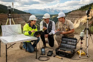
Work environments differ notably, ranging from fully remote setups utilizing cloud-based platforms to hybrid or on-site roles within environmental laboratories or utility companies managing infrastructure risk. For example, a remote geospatial analyst might analyze satellite data for a client addressing soil contamination, reducing the necessity for frequent field visits-highlighting real tradeoffs between fieldwork and data analytics in these roles.
Employer expectations also emphasize fluency in programming languages like Python and R and familiarity with GIS software such as ArcGIS or QGIS, making technical adaptability key. Internships or cooperative education experiences demonstrating applied skills significantly enhance job prospects in this competitive sector.
Salary data collected from Indeed reveals typical base pay ranges between $90,000 and $145,000 for remote geoscience data roles, reflecting demand for professionals who effectively combine environmental expertise with advanced analytics. This compensation landscape underscores the importance of continuous technical skill development alongside domain knowledge for sustained employability.
What starting salaries and long-term earning potential can geoscience data professionals expect?
Entry-level salaries for geoscience data professionals in the U.S. typically range from $60,000 to $80,000, influenced heavily by employer type and location. Federal agencies and private environmental consulting firms tend to offer compensation near the upper boundary, while academic and nonprofit roles generally start closer to the $60,000 mark. For those focused on fields such as climate resilience modeling or resource exploration analytics-both experiencing strong demand-salaries can grow to $120,000 or more within 8 to 12 years.
Career trajectories differ markedly by sector. Environmental consulting delivers quicker financial returns but often requires extended hours and travel, which can impact work-life balance. Federal jobs usually ensure steadier advancement but may cap salary increases without advanced technical expertise or leadership roles. Geographic flexibility also plays a role, as metropolitan areas with climate adaptation initiatives offer pay premiums, whereas rural or field-based roles may provide lower base pay offset by travel stipends or hazard allowances.
Employers frequently prioritize advanced skills in GIS, Python, and machine learning. Obtaining certifications in these areas typically results in a 10-15% salary premium. Candidates evaluating this field should weigh trade-offs between immediate income, sector stability, and long-term skill acquisition to align educational choices with realistic earning potential and career sustainability.
Are there certifications, licenses, or professional credentials for geoscientists in data-heavy roles?
Licenses and certifications in geosciences do not carry equal weight across sectors, with state-specific professional geologist (PG) licenses focusing mainly on geological compliance rather than advanced data skills. Employers increasingly seek a hybrid skill set that blends geoscience expertise with data analytics, GIS, and programming (e.g., Python or R) for handling complex environmental datasets. This shift reflects wider workforce changes: nearly half of geoscientists are projected to retire within a decade, creating urgent demand for professionals capable of bridging traditional geology and modern data science.
In practical terms, a PG license alone rarely suffices for roles requiring sophisticated data management. For example, environmental consultants often need advanced GIS certifications to manage remediation data, while energy sector analysts prioritize machine learning credentials alongside geological knowledge. Credentials demonstrating applied geoscience data proficiency carry more hiring value than isolated data science certificates lacking domain relevance.
Key workforce implications include:
- Employers prioritizing combined geoscience and data skills for roles in energy exploration and critical minerals.
- Professional certifications from recognized platforms and societies that validate spatial analysis and environmental modeling expertise.
- Candidates mitigating underqualification risks by integrating domain knowledge with technical certifications.
Given these realities, strategic credential choices should reflect both regulatory requirements and evolving employer expectations to remain competitive amid demographic pressures in the geoscience workforce.
How can you evaluate and choose an accredited, reputable geoscience program for environmental data work?
Prioritizing regional accreditation from bodies like the Higher Learning Commission or WASC is essential when selecting geoscience programs focused on environmental data work, as it signals curriculum rigor and quality assurance. Enrollment decisions should hinge on whether coursework integrates industry-standard tools such as GIS, remote sensing, and statistical software, given their direct impact on job readiness.
Program outcomes weighted by recent graduate employment data-such as placement rates exceeding 80% within six months-and partnerships with environmental firms provide a grounded indication of market validation. Students face a critical tradeoff between programs concentrated on traditional geology and those blending environmental data science; the latter is increasingly indispensable in data-centric roles assessing contamination risks or regulatory compliance.
Programs offering scenario-based training with real datasets, such as groundwater contamination assessments using spatial data, better prepare graduates for immediate employer demands. Such hands-on experience often outweighs credentials alone in competitive hires.
Salary benchmarks reveal early-career geologists average around $97,986 annually compared to $69,847 for environmental scientists, influencing the return on investment calculus. Education choices balancing cost, advanced practical training, and network access improve long-term positioning within the evolving environmental geosciences labor market.
Other Things You Should Know About Geosciences
Early specialization in a narrowly defined data area, such as remote sensing or geostatistics, can speed access to targeted roles but may limit flexibility in changing industry demands. A broader skillset covering multiple data types and environmental systems improves adaptability but requires more time and effort upfront. For entry-level professionals, prioritizing a solid foundation in key data analysis techniques while gradually acquiring domain-specific expertise is the most practical approach to balance immediate employability with long-term career mobility.
Employers in environmental geosciences prioritize practical problem-solving ability and data competency over purely academic credentials. Coursework is a baseline expectation, but demonstrable experience with real-world datasets, internships, or project-based learning strongly influences hiring decisions. Candidates should seek programs or opportunities that include applied fieldwork and industry collaborations, as these significantly increase readiness for complex data tasks in professional settings.
Developing programming skills alongside traditional geosciences knowledge requires balancing distinct learning curves, which can delay progress in either area if not managed strategically. Employers expect fluency in languages like Python or R embedded within geoscientific contexts rather than isolated coding ability. Prioritizing integrated coursework or practical projects that combine data science with geological or environmental concepts accelerates skill coherence and improves job preparedness.
Entry-level candidates should know GIS platforms such as ArcGIS or QGIS, plus Python or R for data analysis and modeling. Employers also expect spreadsheet work, basic SQL, and the ability to manage spatial datasets, clean field data, and produce clear maps or dashboards.
References
- The Geological Society - Degree Accreditation https://www.geolsoc.org.uk/education-and-resources/universities/university-degree-accreditation/
- 5 Jobs You Can Get with a Data Science Certification https://lumifylearn.com/blog/blog-5-unexpected-jobs-you-can-get-with-a-data-science-certification/
- Data Science Skills You Need for a Successful Career | Gisma https://www.gisma.com/blog/data-science-skills-career-success
- Geology Degree Timeline | ValidGrad https://validgrad.com/blog/how-long-does-it-take-to-get-a-geology-degree/
- Geoscience Currents https://profession.americangeosciences.org/research/geoscience-currents/
- Occhipinti: Rethinking Geoscience Education: Integrating SDGs for Next-Generation Learning - Eurogeologists https://eurogeologists.eu/occhipinti-rethinking-geoscience-education-integrating-sdgs-for-next-generation-learning/
- Geoscience Jobs in Industry https://www.grow-geocareers.com/exploreindustries
- ThisIsGeoscience - Geoscience Skills https://www.thisisgeoscience.com/the-resources/geoscience-skills
- Where do geographers work? Geo industries & career paths https://www.gogeogo.com/en/blog/geosectors-overview
- Earth and Environmental Science https://ees.acadiau.ca/Careers.html