2027 Geosciences Specializations That Build the Most Transferable Earth Science Skills

Co-Founder and Chief Data Scientist
Professionals entering the geosciences workforce face an urgent challenge: how to develop core skills that remain relevant amid rapidly shifting environmental policies and increasing employer demand for cross-disciplinary expertise. The National Center for Education Statistics reports a 30% rise in online geoscience program enrollment since 2022, signaling growing flexibility but also intensified competition and strategic timing pressures for students balancing work and study. This trend reflects broader market demands for versatile skills that enhance career mobility across sectors like energy, environmental consulting, and urban planning.
This article identifies the geosciences specializations that most effectively build transferable earth science skills to help students and professionals optimize their educational choices for long-term career adaptability.
Key Things You Should Know
- Hydrogeology specialization demands cross-discipline proficiency in chemistry and environmental regulations, yet median entry-level salaries trail petroleum geoscience by 25%, requiring strategic cost-benefit analysis for education investment, per Bureau of Labor Statistics 2024.
- Remote sensing expertise ranks highest in employer demand growth-22% increase in geo-data analytics roles since 2023-positioning graduates for tech-driven sectors but necessitates significant early technical skill acquisition, heightening initial training complexity.
- Structural geology pathways provide robust transferable mapping and modeling skills, yet the typical 18-month certification extension limits rapid career pivots; delayed workforce entry affects salary trajectory during downturns documented by USGS labor trend reports.
Which geoscience specializations build the most transferable earth and environmental science skills?
Applied geophysics, hydrogeology, and environmental geology offer distinct but complementary skill sets that shape earth science specializations with transferable skills suited for diverse sectors. Applied geophysics develops data interpretation techniques essential for subsurface analysis in oil and gas, mining, and environmental remediation. Hydrogeology centers on groundwater modeling and resource management, translating well to urban infrastructure and agricultural water use. Environmental geology focuses on contamination and hazard risk assessment, with direct applications in regulatory compliance and land-use planning.
This range of expertise creates practical flexibility, but students should weigh the tradeoff between deep specialization and broad applicability. Narrow technical skills may limit employment outside niche geoscience roles, while interdisciplinary competencies in data analysis, GIS, and fieldwork increase adaptability across industries.
For instance, skills in seismic data interpretation enable applied geophysicists to contribute to infrastructure monitoring and natural disaster risk evaluation in civil engineering projects. Hydrogeologists' groundwater flow models support municipal water management, and environmental geologists' contamination analyses underpin environmental impact assessments required by government agencies. According to workforce trends, the U.S. geoscientists and hydrologists category, heavily employing these specialties, is projected to grow 5% from 2022 to 2032 with approximately 2,200 annual openings, demonstrating steady demand for these competencies.
Prospective students focusing on environmental science and geoscience career pathways should prioritize programs integrating geospatial technology and interdisciplinary problem-solving to maximize adaptability. To explore detailed career possibilities, see what can you do with an environmental science degree.
How do different geoscience specializations compare for career flexibility across industries?
Environmental hydrology offers superior career flexibility within geosciences specializations across industries by developing transferable earth science skills from geosciences specializations. Hydrology expertise directly supports water resource management, urban planning, and environmental consulting, facilitating transitions between government agencies, private firms, and nonprofits without extensive retraining. The U.S. Bureau of Labor Statistics projects a 5% growth in hydrologist employment through 2032 with a median wage of $90,390, underscoring steady demand in water quality, flood risk, and sustainable development sectors.
In contrast, petroleum geology and mineralogy focus heavily on extraction industries vulnerable to market and regulatory fluctuations, limiting career agility. Professionals here often must pursue additional training to enter fields like environmental remediation or urban infrastructure development, confining broader adaptability. Geophysics and remote sensing offer more flexibility across infrastructure and hazard assessment roles but require proficiency with analytical software and applied project experience sought by employers.
For those aiming to pivot strategically within geosciences, prioritizing specializations with clearly quantifiable technical skills-such as hydrology's applied water modeling or geophysics' data interpretation-can reduce retraining periods and increase employability. Employers value demonstrated capabilities and industry-standard credentials over general academic knowledge.
Considering the practical challenges in transferring earth science skills, evaluating educational pathways critically is essential. This pragmatism extends to supplementing core geology training with complementary skills, like data analytics, often available through online programs such as a master of data science online.
What degrees and training do you need to enter high-demand geoscience specializations?
Job prospects in geoscience specializations hinge heavily on advanced competencies beyond a bachelor's degree. Employers increasingly demand quantitative skills and applied field experience combined with proficiency in data analytics, GIS, and remote sensing technologies. For those targeting roles like climate-risk modeling or natural hazard assessment, graduate-level coursework or certificates focused on these capabilities are often prerequisites. This shift reflects a workforce responding to real-world complexity, where the World Meteorological Organization's report of global economic disaster losses nearing $380 billion in 2023 signals heightened urgency for skill sets aligned with hazard mitigation.
Practical, hands-on experience through internships or cooperative programs tied to government or industry partners is crucial to navigate the sophisticated modeling and compliance elements of these roles. Without graduate credentials, specialists face steeper barriers to entry given the technical depth required. Meanwhile, career paths in energy resource management or environmental consulting lean on foundational geosciences knowledge enhanced by targeted training in subsurface mapping and sustainability frameworks. Certifications in environmental impact assessment or risk communication improve marketability, reflecting tangible skill sets valued in both public and private sectors.
Prospective students exploring degree requirements for geoscience specializations in North America or researching training programs for high-demand geoscience careers in the US and Canada must weigh these factors carefully. An educational pathway combining technical rigor, applied project experience, and interdisciplinary study remains the most pragmatic route toward sustained employability. For broader educational planning beyond geosciences, consider an online library science degree as a complementary or alternative option in information management fields.
How do online geoscience programs compare with campus-based options for hands-on skills?
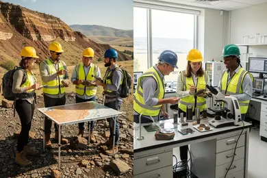
Online geoscience programs tend to fall short in delivering the hands-on experience employers demand by 2026, particularly when compared to campus-based geosciences training advantages. Critical skills like field mapping, rock and soil analysis, and direct geological surveying require physical immersion that online-only formats struggle to replicate. Employers in sectors such as environmental consulting and natural resource management prioritize candidates with proven fieldwork capabilities, which are often absent from purely remote curricula.
Graduate students targeting roles with site assessment or lab work responsibilities may find exclusive online training insufficient. For example, an environmental analyst in water resource management must master field data collection and interpretation-skills traditionally acquired through supervised, in-person experiences that campus programs emphasize. These programs integrate extensive field sessions and access to specialized instruments to ensure workforce readiness.
That said, online geoscience programs have advantages in teaching GIS software and spatial analytics, capitalizing on a GIS market projected to grow from $9.6 billion in 2023 to over $25 billion by 2032 with a CAGR exceeding 11%. This focus supports competencies transferable across mining, urban planning, and environmental assessment, areas less dependent on physical techniques but demanding software proficiency. Prospective students balancing full-time work or remote locations may find these programs strategically valuable, especially when combined with hybrid formats offering mandatory field components.
Students exploring options might also consider the cheapest online master's mechanical engineering pathways as a comparative reference for cost-effective STEM training.
Which core courses and labs develop the strongest quantitative and field skills in geosciences?
Proficiency in applied quantitative methods coupled with intensive field labs directly correlates with employability in geosciences, particularly for roles requiring precise subsurface analysis. For example, mastering geostatistics is indispensable for evaluating spatial variability in carbon capture and storage (CCS) projects, where monitoring subsurface heterogeneity impacts both feasibility and regulatory compliance. The Global CCS Institute's Global Status of CCS 2024 report notes a 50%+ growth in CCS capacity since 2021, signaling increased demand for quantitative expertise in this niche.
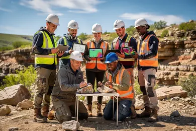
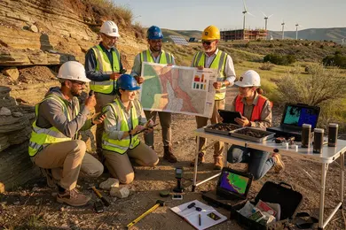
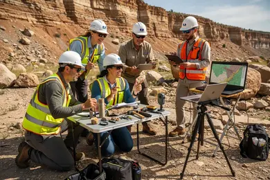
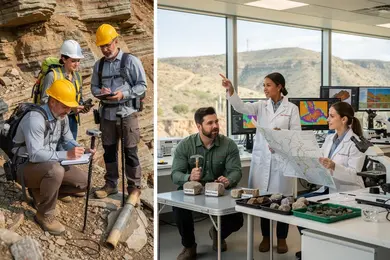
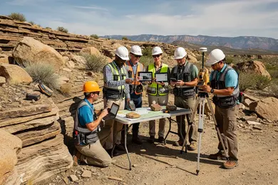
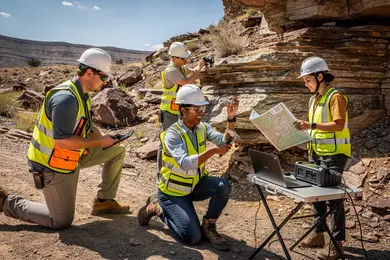
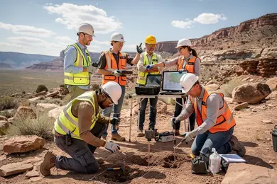
Fieldwork labs that focus on stratigraphic mapping, structural geology, and sedimentology teach essential observational skills and adaptability to real-world constraints like difficult terrain or erratic weather. Employers prioritize these practical problem-solving abilities over theoretical knowledge alone, especially in environmental impact assessments and resource exploration.
Integration of Geographic Information Systems (GIS) and programming languages such as Python or R into the curriculum is now standard, reflecting the growing need for automation and advanced data visualization in land management and hazard mitigation careers. However, students should weigh the challenge of balancing rigorous quantitative coursework with field-based demands, as both are critical but resource-intensive.
The most strategically sound programs blend these elements, equipping students for diverse professional contexts ranging from sustainable energy initiatives to environmental consulting by fostering versatile, cross-disciplinary capabilities.
How can you tell if a geoscience program is properly accredited and industry-aligned?
Accreditation status heavily influences a geoscience program's credibility and graduate marketability. Programs lacking recognized regional or national accreditation risk delivering outdated content that employers may overlook. Beyond formal approval from agencies like the Higher Learning Commission or Middle States Commission on Higher Education, alignment with current industry practices is essential. Employers prioritize familiarity with software tools such as GIS, remote sensing, and data analytics, making curriculum relevance a deciding factor in hiring.
Practical exposure through partnerships with organizations like the American Geosciences Institute can differentiate candidates by providing internships and access to proprietary research. This directly impacts employability, especially given the U.S. Bureau of Labor Statistics projects 6% job growth through 2032 for environmental scientists and specialists, signaling steady demand but also competition.
Key evaluation metrics include graduate placement rates and the extent to which programs incorporate industry-recognized certifications or real-world research engagement. Programs without transparent ties to active professional development risk graduates facing mismatches in skillsets. For example, a graduate trained on obsolete modeling software often struggles in consulting roles reliant on cutting-edge data platforms, affecting both job acquisition and career progression.
- Confirm accreditation by recognized bodies (HLC, MSCHE).
- Verify curriculum integration of current geoscience tools and methods.
- Prioritize programs with professional body partnerships offering internships.
- Assess graduate outcomes for job placement and further accreditation.
What are the typical program length and total costs for geoscience degrees and certificates?
Choosing a geoscience degree involves weighing program length, cost, and career objectives against employer expectations that emphasize practical skills in data collection (48%), interpretation (34%), and processing (33%). Bachelor's degrees typically require four years and cost between $30,000 to $40,000 in public in-state settings, with private or out-of-state options frequently exceeding $80,000. In contrast, associate degrees or certificates-often under two years and usually costing less than $10,000 at community colleges-offer expedited entry into technical roles but limit long-term advancement without further credentials.
The skill demands mean students must engage with geospatial analytics software and field methods, potentially extending study time via supplemental workshops. For those targeting federal agencies or environmental consulting, the path often includes interdisciplinary coursework and internships that may postpone workforce entry and increase living expenses. Conversely, certificate holders can rapidly access sectors like oil and gas or urban planning but face salary ceilings that encourage further education.
Decision-makers should consider these tradeoffs: shorter, affordable certificates provide immediate employability, while comprehensive degrees support broader career mobility but at higher financial and time investments.
What admission requirements do U.S. colleges set for competitive geoscience majors?
Strong proficiency in foundational STEM subjects-particularly calculus, chemistry, and physics-is indispensable for competitive applicants to U.S. geoscience programs. These disciplines underpin the quantitative reasoning and analytical rigor demanded by complex geoscience challenges, from data interpretation to problem-solving. Admissions committees typically prioritize candidates with sustained success in these areas, evidenced by high school coursework or college credits, as well as exposure to laboratory and earth or environmental science courses.
Practical experience remains a decisive factor. Internships with environmental agencies, science competitions, or fieldwork conducted during secondary education provide crucial validation of hands-on skills and genuine commitment. Without a strong STEM background, students face added burdens through foundational bridge courses that extend time to degree and increase overall cost-tradeoffs that particularly affect mid-career pivots seeking accelerated progression.
The geoscience job market grows steadily, with roles like geological and hydrologic technicians expanding at 4% over the decade and median wages around $56,600 as reported by the U.S. Bureau of Labor Statistics Occupational Outlook Handbook. This workforce demand requires graduates to be immediately operational in quantitative analysis, spatial reasoning, and computer modeling-skills often assessed in admissions interviews or prerequisite testing.
Key considerations for applicants include:
- Demonstrated strength in calculus, chemistry, and physics plus lab sciences
- Evidence of applied field experience enhancing employability
- Awareness of time and cost implications from remedial coursework
- Preparation for spatial reasoning and computer modeling proficiency testing
What jobs, sectors, and advancement paths are common for geoscience graduates with transferable skills?
Success in geosciences increasingly hinges on combining technical expertise with adaptable, cross-sector skills. Graduates frequently move between roles like environmental geologist, hydrogeologist, and petroleum geoscientist by leveraging competencies in GIS, remote sensing, and data analysis. These skills facilitate transitions from traditional mineral exploration to emergent fields such as renewable energy and climate impact assessment. However, navigating public versus private sector employment involves clear tradeoffs: government roles emphasize regulatory knowledge and communication duties, often with more stability, while private industry offers higher starting salaries but demands swift application of geological data for cost and risk control.
A practical example: marine geoscientists supporting offshore wind farms synthesize bathymetric and sediment data to optimize turbine placement, collaborating closely with engineers and policymakers. This multidisciplinary interaction underscores that success is not solely technical but requires fluency in stakeholder engagement.
Future-proofing involves dual skill development. On the technical side, machine learning for geological modeling is becoming indispensable. Simultaneously, sharpening soft skills-negotiation, technical writing-is vital to avoid career stagnation and expand advancement opportunities into project management or regulatory compliance.
The global ocean economy, projected by the OECD to surpass $3 trillion annually by 2030, expands demand for such versatile expertise in marine and coastal geosciences. Graduates who strategically balance these capabilities position themselves to capitalize on this evolving landscape.
What salary ranges and job outlook can you expect in versatile geoscience career tracks?
Salary ranges in geosciences vary substantially by specialization and sector, typically spanning from $60,000 to $110,000 annually, with entry-level roles near $55,000 and senior positions exceeding $120,000. It's important to recognize that these averages mask significant differences driven by industry demands and location. For example, planetary geoscientists and remote-sensing specialists benefit directly from a federally backed 17% budget increase in planetary science missions through 2028, fueling growth in aerospace and government research segments.
Within applied earth sciences such as environmental consulting or resource management, employer expectations extend beyond theoretical knowledge. Proficiency in geospatial analysis, GIS software, and remote sensing tools strongly influences compensation and career resilience. Additionally, these roles entail navigating multi-agency regulatory frameworks, which increases operational complexity and requires adaptable skill sets.
A common challenge arises when transitioning from academic settings to industry roles like oil and gas exploration, where market volatility and evolving environmental policies affect job stability and earnings. Thus, internships and cooperative experiences that emphasize sector-specific technical skills prove critical for better salary outcomes and enduring career paths.
- Salary for entry-level geoscientists typically starts around $55,000.
- Senior roles often exceed $120,000, varying by specialization.
- Government investment boosts demand in planetary and remote sensing fields.
- Applied sectors value expertise in GIS and regulatory compliance.
- Industry transitions require targeted work experience for salary growth.
Other Things You Should Know About Geosciences
Early specialization can limit exposure to diverse technical methods and reduce adaptability across sectors, especially in emerging interdisciplinary fields. Broad study ensures stronger foundational skills like data analysis, field techniques, and geospatial technologies that employers value for flexibility. Prioritize breadth in the first two years, then select a specialization aligned with your target industry or role to maximize transferability and career options.
Most geoscience specializations require a field camp, mapping exercise, or supervised field methods course. Common requirements include 2 to 6 credit hours of geology fieldwork, GPS/GIS use, sample collection, and safety training. These components build transferable skills in observation, data recording, and teamwork.
Internships offer hands-on experience that cannot be fully replicated in classrooms, exposing students to workplace tools, collaboration, and project cycles. Programs lacking structured or credit-bearing internships often deliver weaker practical skill development, impacting employability. Prioritize programs with formalized internship or co-op components, as these placements strongly influence the ability to transfer skills across sectors and improve job market outcomes.
Technology-focused specializations build skills in remote sensing, GIS, and modeling, which are in high demand in urban planning and environmental consulting but may limit fieldwork experience. Conversely, traditional fieldwork specializations develop observational and manual sampling skills crucial for mining, oil, and government survey jobs but can be less versatile for office-based roles. Students should align specialization choice with their intended sector, prioritizing tech skills for broader career flexibility and fieldwork skills for roles requiring physical site expertise.
References
- 500+ Water Jobs (Updated Today) â Free to Apply https://jobs.watertechintel.com/blog/geology-major-jobs
- Geology Degree | Requirements, Careers and more | Uni Compare https://universitycompare.com/guides/subject/geology-degree
- 8. Recruiting, Retaining, and Promoting Success of Undergraduate Students with Emphasis on Students Underrepresented in the Geosciences https://www.americangeosciences.org/change/sections/recruitment/
- Explore where VIU is going https://socialsciences.viu.ca/geography/professional-accreditation
- Supporting Geoscience Students https://www.grow-geocareers.com/forgeodepartments
- The Geological Society - Degree Accreditation https://www.geolsoc.org.uk/education-and-resources/universities/university-degree-accreditation/
- Section 4. Skills Framework https://graduate.americangeosciences.org/report/section-4/
- What Does the Future Demand Look Like for Applied Geoscientists? https://www.aegweb.org/index.php
- ThisIsGeoscience - Geoscience Skills https://www.thisisgeoscience.com/the-resources/geoscience-skills
- Online Geoscience Degrees: Top Schools and All Programs in 2026 https://www.gisdegree.org/online/geoscience-degrees/