2027 Online Geosciences Degrees With GIS Coursework

Co-Founder and Chief Data Scientist
Professionals in geosciences often encounter a pressing dilemma: how to upskill in GIS without interrupting demanding work schedules or relocating for campus-only programs. A 2024 National Center for Education Statistics report shows that over 40% of STEM graduate enrollees now prefer online courses, revealing a decisive shift toward flexible education that accommodates career advancement amid ongoing employment.
This trend reflects real constraints many face, including limited time and geographic barriers, which shape the feasibility of reskilling through traditional formats. This article evaluates current online geosciences degrees featuring GIS coursework, guiding readers through options that align with varied career timelines and mobility needs for strategic professional growth.
Key Things You Should Know
- Employers emphasize GIS proficiency combined with fieldwork experience, yet 60% of 2024 online geosciences degrees with GIS coursework underdeliver on practical labs, limiting graduate competitiveness in applied roles.
- Programs awarding degrees fully online reduce costs by 25% versus hybrid models but extend average completion time by 20%, exposing students to evolving geosciences software landscapes mid-study, potentially requiring supplementary certification.
- Regional workforce demand shifts show a 15% increase in geospatial data analysts with GIS expertise in energy and environmental sectors, pressing students to prioritize curricula aligned with sector-specific GIS tools to avoid career bottlenecks.
What is an online geosciences degree with GIS coursework, and who is it best for?
Online geosciences degree programs with GIS coursework offer a distinct advantage for professionals requiring spatial data skills integrated with geological expertise. Employers increasingly demand graduates who can translate geoscientific knowledge into actionable spatial analyses, as seen in roles like environmental consulting, where GIS maps contamination patterns grounded in geological context. This specialized competency is driving faster job growth in GIS-related positions such as surveyors and cartographers, projected by the U.S. Bureau of Labor Statistics at 11% through 2032, surpassing general geoscientist roles.
However, pursuing the best online geosciences degrees for GIS careers requires careful consideration of the commitment needed. Successful candidates must navigate self-driven study, handle complex spatial datasets, and access reliable technology including GIS software. Those without coding or spatial analysis experience might face steep learning curves without preparatory coursework. The online format suits individuals balancing full-time employment or limited geographic mobility, but the rigor demands consistent discipline and technological readiness.
In practical application, such degrees open doors in sectors like energy, urban planning, and environmental regulation, where geo-spatial decision-making influences operational strategies. Evaluating these programs should include an analysis of curriculum depth and real-world GIS integration to ensure graduates can meet employer expectations in increasingly technical geoscience roles. For a comprehensive view of available options, prospective students can consult geology online degree resources to identify programs balancing flexibility with substantive GIS training.
How do online geosciences programs with GIS compare to on-campus options?
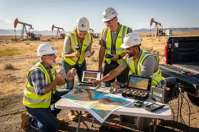
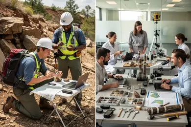
Online geosciences programs with GIS coursework closely align with traditional on-campus degrees in delivering essential GIS skills, yet diverge significantly in hands-on fieldwork and access to specialized lab facilities. Employers expect graduates to possess not only theoretical GIS competence but also practical experience with field data collection, rugged GPS equipment, and advanced remote sensing-elements often limited in purely online formats. This distinction is pivotal when comparing career outcomes for online and on-campus geosciences GIS programs, particularly for roles requiring terrain analysis or geological surveying.
Field-based proficiency remains critical; for instance, environmental consultants conducting site-specific assessments rely on skills that online programs cannot fully replicate. Conversely, working professionals benefit from online options by avoiding relocation and career interruptions while acquiring foundational spatial analysis expertise needed for many geoscience positions.
Logistical constraints of online study, such as limited real-time instructor guidance on complex GIS modeling, impact skill mastery. Prospective students must weigh these trade-offs against personal circumstances and employer expectations. For practical insights on related fields, see online animal science programs.
What types of online geosciences degrees with GIS are available at U.S. colleges?
Programs offering online geosciences degree programs with GIS specialization in the United States reveal a practical divide between foundational and advanced training. Bachelor's degrees typically cover core geology and environmental science principles with introductory GIS applications, equipping graduates for technical support roles or entry-level consulting positions. In contrast, master's degrees emphasize quantitative spatial modeling, remote sensing, and programming-skills directly aligned with specialized roles such as hydrogeologists or GIS analysts in resource management agencies.
Certificate programs provide a streamlined option for working professionals seeking targeted GIS competency without committing to longer degree paths. This path suits career pivots or rapid skill enhancements but may offer less employer recognition compared to degree credentials with integrated projects or internships.
Employers prioritize candidates demonstrating hands-on GIS software experience and applied analytical skills. For example, graduates of master's programs focused on spatial analysis can access higher-wage opportunities in sectors like oil, gas, and environmental remediation. Programs affiliated with state geological surveys or federal agencies often improve networking and job placement, a critical advantage given the competitive post-pandemic geoscience job market.
Tradeoffs between program length, cost, and applied training affect return on investment and career trajectories. Specialized master's degrees incorporating advanced data science and geospatial statistics typically command higher median salaries than bachelor's GIS minors embedded in environmental science. The 2024 median wage data from the U.S. Bureau of Labor Statistics show $92,580 for geoscientists compared to $74,420 for cartographers and photogrammetrists, both surpassing the $48,060 median for all occupations.
Prospective students should also consider programs emphasizing an internship or capstone component, as this practical exposure remains a decisive factor for employability in geosciences. Those exploring options beyond geosciences degrees might also find value in library science degrees online, further diversifying their skill sets and career pathways.
What GIS and geoscience courses can you expect in these online programs?
Online geosciences degrees with GIS coursework often require students to navigate a tradeoff between cost savings and practical skill acquisition. These programs integrate essential courses-mineralogy, hydrogeology, spatial data analysis, remote sensing, and geographic information systems programming-reflecting the combined technical and domain expertise expected by employers in sectors like natural resource management or urban infrastructure development.
GIS applications in geosciences online programs emphasize applied software proficiency, including ArcGIS and QGIS labs, preparing students for data-heavy roles in government agencies such as the USGS or private environmental consulting firms. The curriculum typically integrates project-based exercises analyzing satellite imagery and terrain, which are critical competencies in spatial data manipulation and interpretation.
Cost differences are substantial. In-state tuition for online programs averages $12,000 per year, a significant saving compared to $32,000 or more for private on-campus equivalents. However, remote learners must dedicate considerable time to self-directed software practice and simulated fieldwork, as in-person labs and direct mentorship are limited.
Advanced coursework in scripting with Python and spatial database management addresses workforce demands for workflow automation and efficient handling of large geospatial datasets. This practical combination enables career transitions into environmental hazard analysis, geographic information systems programming, or urban planning roles. For students balancing cost, flexibility, and market readiness, evaluating related options such as an online mechanical engineering degree may also provide pathways to labor markets valuing spatial analysis and technical software skills.
How do you verify accreditation and program quality for online geosciences degrees?
Accreditation directly impacts employment viability in geosciences with GIS specialization. Choosing a program accredited by a recognized U.S. Department of Education or CHEA agency ensures your credentials hold value across employers and academic institutions. For technical rigor in GIS, accreditation or approval by ABET or the GIS Certification Institute signals deeper industry alignment, which can influence job prospects in fields like environmental consulting or resource management.
Evaluate programs by faculty expertise and curriculum design rather than promotional claims. Faculty with applied GIS experience in government or industry tend to deliver course sequences that mirror real workplace demands more accurately. Programs that provide synchronous labs or field opportunities offer a practical advantage over purely asynchronous formats, reflecting the hands-on nature of many geosciences roles.
Alumni employment data is a critical metric: programs with at least 75% of graduates employed in GIS-related positions within six months demonstrate alignment with market needs. This differentiates programs that prepare students for immediate workforce entry from those that may fall short in practical outcomes.
The expansion of online GIS degrees noted by GISDegree.org's 2026 survey-now featuring dozens of programs-creates a wider selection but also increases variability in quality. Prospective students must weigh accessibility against accreditation status and transparent outcome reporting to avoid programs with weak labor market relevance.
What are the admission requirements and application materials for these online programs?
Admission into online geosciences degree programs with GIS coursework often demands more than formal credentials; it requires evidence of both academic foundation and practical readiness. Most programs expect a bachelor's or associate degree in STEM fields, though some defer to professional experience paired with detailed resumes and recommendations. Official transcripts reflecting proficiency in math, earth sciences, or computer science critically determine course placement and progression, underscoring the technical rigor applicants must meet.
Because geospatial applications are dynamic, programs typically require a personal statement illustrating applicants' technical focus and career intent. Graduate-level tracks may still request standardized test scores like the GRE, but these are frequently waived for candidates demonstrating relevant work experience or strong academic records.
Reliable technology access is a non-trivial barrier-students must have capable computers and stable internet to use GIS software, which may also incur extra licensing fees. Those unable to secure these resources face practical hurdles that affect their learning trajectory and eventual employability.
Esri's 2024 report shows geospatial analytics spending growing over 15% annually, surpassing $200 billion by 2025, confirming why employers prioritize candidates who can immediately apply GIS within geosciences tasks. Demonstrable GIS proficiency through portfolios or exams often influences hiring in sectors like environmental monitoring, energy, and infrastructure, where analytical precision and responsiveness are essential. Prospective students should weigh the tradeoff between meeting stringent academic prerequisites and gaining verifiable GIS skills that align tightly with employer expectations and evolving industry demands.
How long do online geosciences degrees take, and what do they cost?
Choosing an online geosciences degree with GIS coursework involves weighing time investment against career impact. Bachelor's programs span four years full-time but may stretch to six years part-time, affecting both total cost and career trajectory. Master's degrees generally require 18 to 24 months full-time, though part-time study can extend beyond three years, influencing when graduates enter or progress in the workforce.
Cost varies significantly with residency status and institution type. Public universities charge $300 to $600 per credit for in-state students, totaling roughly $30,000 to $60,000 for a bachelor's. Private or out-of-state options can exceed $80,000. Master's programs focusing on GIS range from $25,000 to $50,000, with additional technology fees of $1,000 to $3,000 annually. These financial commitments directly affect return on investment and should be balanced against likely employment outcomes.
Data from a 2024 Pennsylvania State University World Campus GIS alumni survey indicates over 90% of master's graduates secure relevant employment within six months, and more than half receive promotions or raises within two years. Decision-makers must therefore assess not just tuition but realistic timelines and employer expectations to avoid unintended delays and optimize career outcomes.
What careers use geosciences and GIS skills, and what jobs can graduates pursue?
Demand for professionals combining geosciences and GIS reflects sector-specific priorities and skill requirements. Urban and regional planners, with a projected 7% employment growth by the U.S. Department of Labor from 2022 to 2032, exemplify high-demand roles driven by climate resilience and land-use planning needs that rely heavily on GIS spatial analysis. Public agencies apply these skills in infrastructure management and disaster preparedness, such as coastal planners modeling flood risks to design mitigation strategies. In the private sector, industries like mining, oil and gas, and agriculture emphasize geosciences knowledge integrated with spatial data management.
Job seekers should weigh the tradeoff between programs focused on GIS software proficiency and those emphasizing geosciences theory. Overemphasis on technical GIS skills may hinder opportunities in regulatory or research-heavy roles, while insufficient applied GIS training can reduce immediate job readiness. Employers expect candidates to be proficient in multiple GIS platforms and capable of quantitative analysis, supported by hands-on project experience.
Decision-makers must prioritize curricula that integrate real-world case studies and internships. This approach strengthens graduates' adaptability across diverse environments, from environmental consulting tracking contamination to geospatial analysis in emergency response. Success navigating this educational path depends on balancing technical GIS capabilities with geosciences fundamentals relevant to the desired career trajectory.
What salary ranges and job outlook can you expect with geosciences and GIS training?
Salary ranges for professionals trained in geosciences and GIS typically span from $55,000 to $110,000 annually, with median wages for GIS specialists near $70,000. Higher earnings often correlate with specialization in areas like hydrogeology, petroleum geology, or advanced geospatial modeling-especially in markets such as Texas, California, and Washington. A GIS credential can yield a 10-20% salary premium over general environmental science roles, reflecting employer demand for integrated technical expertise.
Projected employment growth for geoscientists is about 5% through 2032, driven by sectors including environmental consulting, energy exploration, and urban planning. Job stability depends heavily on staying current with in-demand skills like cloud GIS platforms and programming languages such as Python and R. Without these proficiencies, professionals risk slower salary growth and less secure contract-based work rather than permanent positions.
Tuition costs for online geoscience/GIS master's degrees vary widely, from around $11,610 to $45,117 for non-residents, demanding careful evaluation of return on investment. Choosing a program with strong employer networks and specialized coursework aligned with emerging geospatial technologies is often more impactful than paying for brand recognition alone. Federal agencies like USGS and state environmental offices remain steady employers, but career progress hinges on balancing targeted education costs with timely acquisition of market-relevant skills.
How can you choose the best online geosciences program with GIS for your goals?
Choosing an online geosciences program with GIS coursework requires aligning curricula with specific job roles and sector demands, as the skill sets vary significantly across fields like environmental consulting, urban planning, and military intelligence. Practical GIS proficiency-especially when paired with real-world applications such as live labs or project-based assessments-distinguishes candidates in competitive markets.
Programs tied to active faculty research or partnerships with agencies like the U.S. Geological Survey can provide training on up-to-date standards critical for federal GIS analyst roles. Conversely, those aiming for climate adaptation positions should seek integrated coursework combining climate modeling and GIS techniques. Regional accreditation and recognized program endorsements remain non-negotiable for employer acceptance and credential portability.
Students must assess tuition and program duration relative to local salary norms, which can exceed $80,000 in metropolitan hubs. Programs with capstone projects or cooperative education components often yield superior practical experience valued by employers.
Other Things You Should Know About Geosciences
Online geosciences degrees with GIS coursework in 2027 are increasingly valued in the industry. Technological advancements have enabled the creation of interactive virtual labs and simulations, allowing students to gain comparable skills to traditional degrees, making graduates appealing to employers.
Geosciences with GIS coursework typically involve rigorous technical and spatial analysis assignments that require sustained software proficiency and data interpretation skills. The workload balances theory, computational tasks, and independent research, often demanding 15-20 hours weekly beyond lectures, which is comparable to other STEM degrees but with specialized GIS software learning curves. Prospective students should prepare for disciplined time management and allocate extra effort to master GIS tools, especially if they lack prior experience.
Acceptance of online degrees varies, with large firms and government agencies showing cautious openness if the program is accredited and includes substantial GIS coursework. Employers emphasize demonstrated GIS competency and applied problem-solving over delivery method but may prefer candidates with supplemental certifications or practical experience. Graduates should proactively validate their skills through portfolios, internships, or trusted GIS certifications to bridge potential trust gaps related to online credentials.
Most programs teach ArcGIS Pro, QGIS, and remote sensing tools such as ENVI or ERDAS IMAGINE. Students usually also use GPS, spatial analysis, and digital mapping labs. Many courses require file-based projects and geospatial data management assignments using shapefiles, rasters, and geodatabases.
References
- Gisdegree https://GISDegree.org
- GIS for Geologists – Online GIS Training Courses https://www.gisforgeologists.com/
- The Geological Society - Degree Accreditation https://www.geolsoc.org.uk/education-and-resources/universities/university-degree-accreditation/
- Best Online GIS Certificate Programs: Graduate-level Paths in Geographic Information Systems https://www.directionsmag.com/articles/best-online-gis-certificate-programs-graduate-level-paths-in-geographic-information-systems
- Geology - ABET https://www.abet.org/accreditation/new-and-developing-program-areas/geology/
- GIS Salary Germany: Complete Guide Geoinformatician https://www.gogeogo.com/en/blog/gis-salary-germany-2025
- 2025 Best Online GIS Degrees https://www.onlineu.com/degrees/geographic-information-systems
- Is Your Online Degree Legitimate? How to Verify Private University Approval https://matchtocollege.com/blog/verify-private-university-online-degree-approval
- Activity: Job adverts and salary bands | RGS https://www.rgs.org/schools/resources-for-schools/careers-with-geographical-information-systems/activity-job-adverts-and-salary-bands
- GIS Jobs: Explore Careers in Geographic Information Systems https://www.gisdegree.org/careers/