2027 First Geosciences Roles for Students Preparing for Graduate Earth Science Study

Co-Founder and Chief Data Scientist
Securing an initial geosciences role before graduate study has become a strategic imperative amid evolving employer expectations and shifting program admissions. Employers increasingly prioritize candidates with practical field and data analysis experience, yet many students face a catch-22: meaningful entry roles often require credentials or skills earned during graduate education.
Meanwhile, recent data from the National Center for Education Statistics shows a 22% rise in enrollment flexibility and hybrid learning in earth sciences graduate programs since 2023, reshaping how students balance work and study. This evolution affects timelines, skill-building opportunities, and career readiness.
This article evaluates the landscape of first geosciences positions designed for pregraduate students and offers targeted guidance on navigating these roles to optimize graduate admission prospects and workforce integration.
Key Things You Should Know
- Entry-level geosciences roles in 2026 demand proficiency in remote sensing and data analytics, reflecting a 27% job growth in environmental consulting, but this narrows opportunities for candidates lacking specialized tech skills, increasing early-career volatility.
- Employers prioritize candidates with documented field experience and GIS certifications, with 68% of surveyed firms rating these as "critical," creating a bottleneck for academically strong but practically inexperienced students.
- Delayed graduate study by one year reduces lifetime earning potential by an estimated 7%, given rising tuition averages and hourly wages reported by the Bureau of Labor Statistics, pressuring students to seek paid, relevant roles pre-enrollment.
What are the best first geoscience roles for students planning graduate earth science study?
Securing entry-level positions that blend fieldwork with analytical skills is critical for students targeting graduate study in earth science, particularly in environmental science and geotechnical roles. Environmental scientist and specialist positions, offering a median annual wage of $80,060 as reported by the U.S. Bureau of Labor Statistics, remain steady with a projected 4% employment growth through 2034. These roles provide practical exposure to compliance monitoring and impact assessments frequently utilized in research.
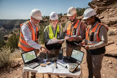
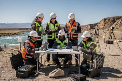
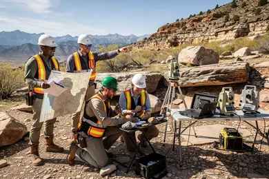
Hands-on experience in geotechnical consulting firms, including soil and rock analysis paired with proficiency in GIS and borehole logging software, enhances readiness for graduate programs focusing on hydrogeology or structural geology. Federal and state agencies offer internships aligning with regulatory science tracks, but they often impose geographic constraints, favoring regions with active resource development or environmental restoration projects. For instance, by working in a regional environmental consulting firm in such areas, a student can sharpen expertise in sediment transport and contamination evaluation, directly influencing thesis work or methodologies applied during graduate research.
Tradeoffs include slower initial salary growth in public roles versus the higher but more volatile private sector earnings. Certifications like OSHA HAZWOPER or Engineer-in-Training (EIT) increase employability and practical competence before graduate study begins. Strategically, first roles should balance technical skill acquisition, field exposure, and data analysis tasks foundational to success in advanced earth science fields. This aligns with the priorities seen in the best entry-level geoscience jobs for graduate students.
Students actively weighing top geoscience internships and roles for earth science graduate preparation should consider integrated pathways that develop both compliance and applied investigation skills while maintaining flexibility for geographic and sector shifts. For professionals seeking a pivot or advancement, exploring options such as an online doctorate data science can complement traditional earth science expertise with advanced analytical capabilities.
How can early research assistantships prepare students for competitive earth science graduate programs?
Early research assistantships in geosciences graduate preparation offer critical experiential advantages that extend beyond academic theory, shaping a student's capacity to meet complex program demands. Admissions committees often prioritize candidates with hands-on proficiency in geochemical instrumentation or sediment core analysis, demonstrating a practical readiness that classroom learning alone does not provide. In competitive earth science programs, the impact of undergraduate research experience is particularly tangible, as it equips students with problem-solving skills essential for collaborative, multidisciplinary environments where managing analytical workflows and interpreting complex datasets are daily challenges.
Students without this foundation face greater risks of delay or early attrition due to insufficient preparation for these technical and operational expectations. Moreover, these roles foster vital professional relationships with faculty and peers, often leading to recommendation letters or collaborative projects post-admission, which can be decisive for career trajectories.
From a workforce perspective, the U.S. Bureau of Labor Statistics projects steady growth and strong median wages for geoscientists, reinforcing the strategic value of aligning early research experience with evolving job market needs. Assistantships emphasizing digital mapping, geospatial analysis, or remote sensing should be prioritized, reflecting employer preferences. Students must weigh time commitments carefully to balance skill acquisition with academic performance.
Those seeking to integrate such experience while exploring complementary fields may consider programs like online masters data science, which can amplify analytical techniques relevant to geosciences research challenges.
Which internships and field camps offer the strongest preparation for geoscience grad school?
Internships and field camps with targeted GIS, hydrology, hazard, and climate data skills remain critical in preparing students for geoscience graduate study and direct workforce entry. Those seeking the best North American internships for geosciences graduate preparation must weigh tradeoffs between physically demanding fieldwork and access to specialized equipment typically offered in government-affiliated positions like the U.S. Geological Survey. These roles emphasize real-time environmental monitoring and geospatial analysis, which align with employer expectations in roles such as cartography and photogrammetry where a 6% employment growth is projected through 2034.
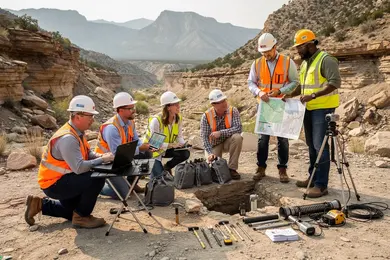
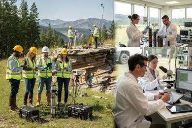
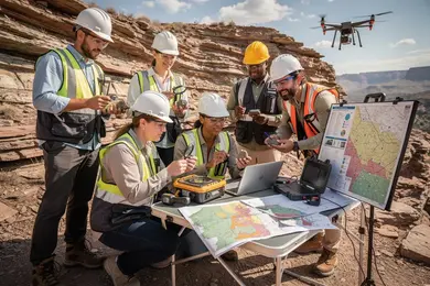
Top field camps for student readiness in earth science graduate programs combine hands-on mapping, sedimentology, GPS surveying, and drone photogrammetry to build transferable expertise. Students pursuing natural hazard mitigation or hydrogeology research gain the most from internships featuring hydrological monitoring and risk mapping at environmental agencies, while those focused on climate modeling should value projects centered on remote sensing and extensive time-series data.
These practical pathways come with geographic and physical endurance demands but yield networking advantages and deeper research integration than many commercial internships. Prospective students must prioritize alignment with their specialization goals and GIS/data skills development in light of these operational realities. Those simultaneously considering a pivot or advancement might also explore flexible alternatives like a computer science degree online to complement their geoscience expertise and expand analytics competencies.
What undergraduate coursework and skills matter most for entry-level geoscience roles?
Employers filling entry-level geoscience roles increasingly expect candidates to integrate classical academic foundations with strong technical proficiency in geographic information systems (GIS) and remote sensing. The core undergraduate coursework essential for entry-level geoscience roles continues to focus on geology, chemistry, physics, and advanced mathematics, yet success hinges on coupling these fundamentals with practical skills in spatial data analysis and visualization. By 2024, median salaries for GIS and mapping professionals approached $78,380 with steady job growth, demonstrating how essential GIS competencies have become for employability.
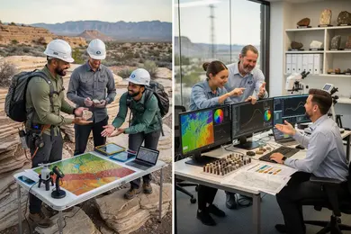
Undergraduates aiming at first geosciences jobs in North America should prioritize hands-on experience with industry-standard GIS platforms such as ArcGIS or QGIS, alongside scripting skills in Python or R. These capabilities directly affect one's ability to navigate complex challenges like groundwater contamination mapping or mineral exploration, situations where synthesizing field data with layered spatial datasets is critical. Conversely, graduates lacking spatial analysis skills face notable obstacles, often stalling in applied roles despite a solid theoretical background.
Additional quantitative reasoning and communication skills remain central, particularly to clarify technical findings for diverse stakeholders such as regulatory bodies or local communities. Strategic internships or assistantships focused on GIS and remote sensing bolster these competencies while enhancing resumes. For those considering interdisciplinary pathways or supplementary training, a library sciences degree may expand data management expertise relevant to emerging geoscience roles.
How do on-campus versus online geoscience experiences differ for grad school preparation?
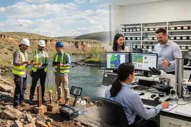
Practical skill acquisition and employer recognition differ sharply between on-campus and online geoscience experiences, affecting graduate study readiness and workforce competitiveness. On-campus roles grant direct access to field labs, instruments, and real-time data collection vital for applied disciplines like hydrology and field geology. These opportunities cultivate proficiency with tools such as flow meters and GIS software, competencies highly sought after by employers evaluating candidates for water resource or spatial analysis roles.
By contrast, online programs focus on theoretical knowledge and remote sensing software but fall short in providing immersive fieldwork, limiting students' preparedness for laboratory or field components common in graduate programs. This gap often requires online learners to secure internships or hybrid field experiences to develop practical skills valued by employers and necessary for advanced study.
Students aiming for careers in hydrology or water resources should weigh these tradeoffs carefully. Prioritizing on-campus roles improves applied skill mastery and professional networking, while online learners must proactively supplement learning with cooperative education or summer fieldwork. Graduate programs that integrate experiential components help mitigate risks related to online-only preparation.
For context, the U.S. Bureau of Labor Statistics reports hydrologists earn a median wage of $92,060, with job openings driven mainly by replacement demands, highlighting the importance of practical competency in sustaining career stability.
Which paid technical roles in labs, GIS, or remote sensing benefit future earth scientists?
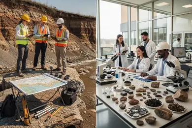
Technical roles in labs, GIS, and remote sensing shape essential competencies that directly impact graduate-level research success in geosciences. For instance, GIS technician jobs at mining firms require hands-on work with spatial datasets modeling mineral deposits, closely aligning with graduate research themes in mineral exploration.
Positions such as geological lab technicians deepen understanding of sample preparation, microscopy, and geochemical assays. This practical experience sharpens petrography and geochemistry skills, reducing ramp-up time for experimental research. Remote sensing internships in energy sectors offer data interpretation experiences with satellite imagery and terrain analysis that are directly applicable to environmental monitoring and resource mapping fields.
Workforce data from the U.S. Bureau of Labor Statistics project a 5% rise in geoscientist jobs through 2033, with growth primarily in energy, mining, and critical minerals extraction. This reinforces the advantage of early-career technical experience.
Students must weigh time and workload tradeoffs when balancing paid positions and academics. Employers increasingly demand proficiency in both fieldwork and data analytics; graduate programs prioritize verifiable technical expertise over solely academic credentials. Those combining lab sciences with geospatial tools capture the most efficient pathway to employability and research readiness.
How should students evaluate accredited geoscience programs that lead to strong early roles?
Programs that promise quick employment in geosciences must be evaluated through evidence of relevant job placements within a year of graduation, rather than accreditation alone. Fields such as environmental consulting, natural resource exploration, and sustainability show sustained employer demand, but success depends on how closely a curriculum aligns with real-world needs.
Key indicators of a program's practical value include embedded employer partnerships, quality internships or co-op experiences, and connections with agencies like state geological surveys or the EPA. Graduates with applied skills in GIS, remote sensing, and environmental modeling coupled with documented internship exposure tend to secure entry roles faster than peers focused solely on theoretical research.
Students should weigh tradeoffs between program length and hands-on experience; accelerated or part-time formats may speed career pivots but risk limiting direct industry engagement necessary for competitive placement.
Critical soft skills-communication and project management-complement technical expertise in sectors managing hazards or sustainability challenges. Transparency and recent placement data from authoritative sources-not marketing materials-are essential to validating a program's workforce alignment.
For example, a graduate with applied GIS experience obtained through an accredited program affiliated with regulatory agencies is typically prioritized in hiring over one without practical exposure, clarifying the tangible impact of curriculum design on employment outcomes.
What early geoscience roles support pathways into licensed or certified earth science careers?
Early-career geoscience positions tied to licensure or certification pathways demand more than academic credentials; they require documented fieldwork that meets professional standards. Roles such as assistant positions at agencies like USGS, NOAA, EPA, and local environmental departments are prime examples where candidates gain critical, hands-on experience with data collection, environmental monitoring, regulatory compliance, and GIS applications. Government jobs act as key initial steps because they often provide structured training and supervised hours that align closely with licensed professional geologist (PG) certification requirements.
The practical tradeoff for students is balancing often modest entry-level salaries against the necessity of accumulating specific technical skills and documented field hours. Positions focused solely on research or data analysis without direct field exposure may hinder timely certification. Candidates should actively seek assistant roles marked by formal mentorship or rotation through diverse assignments to fulfill varied state licensure prerequisites.
Critical factors to consider include:
- Verifying that the role provides supervised, credential-compliant work hours.
- Preparing for competitive hiring and security clearance processes inherent in federal agencies.
- Recognizing that insufficient field documentation can delay credential attainment and reduce mobility in the profession.
Pragmatic navigation of employment quality in these early roles directly impacts longer-term career flexibility and advancement within earth sciences.
What starting salaries and growth potential can students expect in first geoscience positions?
Starting salaries for entry-level geoscience jobs reveal clear tradeoffs between sector stability and earning potential. Academic roles, which employ over two-thirds of new PhDs according to the American Geosciences Institute's 2024 workforce data, typically offer $50,000 to $60,000 annually. These positions provide foundational experience but relatively modest financial rewards and incremental pay increases tied to institutional budgets.
Government roles, such as with the US Geological Survey or EPA, start between $60,000 and $70,000, providing a balance of stability and predictable pay raises governed by federal scales. These jobs suit graduates seeking less risk and geographic mobility constraints.
Industry positions, especially in oil and gas, environmental consulting, and mining, command higher initial salaries ranging from $65,000 to $75,000, but income can fluctuate with market demands and contract availability. For instance, an environmental consulting graduate might start near $68,000 but must develop field expertise and certifications like Professional Geologist licensure to progress.
Key considerations for prospective geoscientists include:
- Weighing the slower but stable salary growth in academia and government against the volatile but potentially lucrative industry path.
- Assessing regional cost-of-living impacts on government pay rates.
- Planning for necessary certifications that unlock mid-to-senior level advancement, particularly in industry.
These factors shape realistic financial planning and strategic decisions about employment offers and career mobility within the geosciences workforce.
How can students build a competitive geoscience portfolio and professional network before graduate school?
Evidence from employers in energy, mining, and environmental sectors shows that geoscience graduates lacking quantitative and computational expertise face limited opportunities for roles beyond traditional field positions. Practical experience with programming languages like Python and R, alongside GIS software proficiency, directly correlates with employability in emerging roles such as data scientist and GIS analyst.
Students are advised to supplement academic knowledge with internships or part-time roles in projects involving data analysis, predictive modeling, or environmental assessments-activities that produce measurable outcomes rather than generic field logs. Enrollment in specialized workshops or certificate programs targeting geospatial modeling or data analysis further signals technical rigor to potential employers.
Building a portfolio demonstrating applied computational techniques enhances credibility. Contributions to peer-reviewed research or industry collaborations where quantitative methods solve geoscience problems stand out more than solely experiential work.
Effective networking focuses on sustained engagement with professional associations like the American Geophysical Union and Society of Exploration Geophysicists, including attendance at conferences and participation in student committees. Informational interviews with professionals working in data-driven roles clarify skill gaps and inform resume refinement.
Strategically using platforms like LinkedIn to share project summaries and obtain endorsements from supervisors in geoscience analytics roles enhances visibility and signals relevant expertise in a competitive labor market.
Other Things You Should Know About Geosciences
Fieldwork skills are crucial as they provide hands-on experience with geological phenomena, enhancing observation and analytical skills. Understanding real-world environments prepares students for advanced studies by offering practical insights that complement theoretical knowledge obtained in laboratories.
Employers in geosciences often prefer candidates with a versatile skill set due to the interdisciplinary nature of the field, especially for entry-level positions. Early specialization can limit opportunities and flexibility, whereas broad competencies across geology, chemistry, and data science increase adaptability and employability. Students aiming for graduate study should lay a comprehensive foundation first, then narrow their focus based on targeted graduate research goals and market demands.
Students should complete a field safety course, hazard communication training, and basic first aid before starting. For 2027 field placements, many universities and employers require OSHA-aligned safety instruction, plus training on sample handling, dehydration risk, and emergency communication before any supervised fieldwork begins.
Technical roles demanding extensive data management or field hours can significantly reduce time available for academic preparation and self-study necessary for graduate success. However, these roles also instill discipline, professional work habits, and practical insights that graduate programs value. Students must balance workload by selecting roles with reasonable hours or negotiated expectations to preserve graduate-school readiness without sacrificing relevant experience.
References
- What coursework should I take to become a successful Applied Geoscientist? https://www.aegweb.org/index.php
- Earth science careers — Earth@Home https://earthathome.org/earth-science-careers/
- How to Build a Professional Network Before You Graduate Mortuary School https://dallasinstitute.edu/how-to-build-a-professional-network-before-you-graduate-mortuary-school/
- Careers in the Earth Sciences https://earthsciences.dartmouth.edu/undergraduate/careers-earth-sciences
- Geoscience Career Pathways https://www.grow-geocareers.com/careerpathways
- Online Geoscience Degrees: Top Schools and All Programs in 2026 https://www.gisdegree.org/online/geoscience-degrees/
- Field internships https://geops.geol.u-psud.fr/en/field-internships/
- Section 3. Graduate Programs and their Interface to Geoscience Work https://graduate.americangeosciences.org/report/section-3/
- ThisIsGeoscience - Geoscience Salaries https://www.thisisgeoscience.com/the-resources/geoscience-salaries
- Recruiting, Retaining, and Promoting Success of Undergraduate Students with Emphasis on Students Underrepresented in the Geosciences https://www.americangeosciences.org/change/sections/recruitment/