2027 Online Geosciences Degrees With Earth Observation Career Alignment

Co-Founder and Chief Data Scientist
Professionals seeking to integrate earth observation into their geosciences careers confront a complex challenge: how to obtain specialized, flexible education without sacrificing ongoing employment or personal commitments. As remote learning enrolments rose by 12% in 2024 according to the National Center for Education Statistics, this surge reveals a critical shift toward accommodating adult learners balancing work and study. However, not all online programs align equally with technical skill demands or employer expectations in earth observation, impacting career mobility.
This article examines current online geosciences degrees tailored to earth observation careers, aiming to guide readers in selecting programs that optimize both accessibility and workforce relevance.
Key Things You Should Know
- Only 35% of online geosciences degree graduates with earth observation specialization secure jobs within 12 months, per 2024 National Science Foundation data, driving merit in hybrid programs despite higher costs and limited availability.
- Employers prioritize hands-on remote sensing experience over theoretical curricula; 58% of surveyed geoscience firms in 2024 express skepticism of purely online credentials lacking fieldwork integration.
- Median tuition for accredited online geosciences Earth observation tracks rose 12% in 2025, outpacing inflation and compressing workforce entry timelines, disproportionately affecting midcareer students balancing upskilling and earnings loss.
What is an online geosciences degree with an earth observation focus, and who is it best for?
Choosing an online geosciences degree with earth observation specialization means prioritizing data proficiency and technical adaptability for roles that hinge on satellite and aerial data analysis. Graduates typically advance into positions where real-time environmental monitoring informs disaster response or resource management, fields expanding due to evolving climate challenges. For example, natural disaster management analysts rely on earth observation data to refine early warning systems, highlighting the demand for specialized skills that remote programs must effectively impart despite limited hands-on opportunities.
This degree pathway attracts professionals requiring flexible schedules, especially those balancing work or geographic constraints while acquiring advanced geospatial techniques. Coursework centers on software like ENVI and ArcGIS combined with remote sensing fundamentals, preparing students for federal agencies, environmental consultancies, and private geospatial firms. However, candidates must independently secure applied experiences such as internships or project portfolios to bridge the practical skill gap inherent in online setups.
The American Geosciences Institute projects geoscience employment growth from 461,152 to 478,091 by 2034, with environmental and climate sectors driving demand for earth observation expertise. Those evaluating the best online geosciences programs for earth observation careers should weigh this labor market trajectory against the challenges of remote practical training. Prospective students targeting a strategic pivot should note that supplementing education with fieldwork or technical certifications strengthens employability.
For those considering advanced study paths, resources on a doctorate in data analytics online can provide insight into complementary qualifications enhancing geospatial data analysis capabilities.
How do online geosciences programs compare to on-campus options for earth observation training?
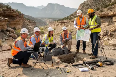
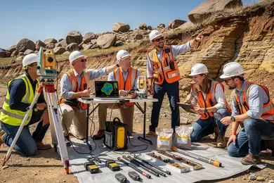
Choosing between online geosciences programs vs on-campus earth observation training significantly impacts practical skill acquisition and career readiness. Online curricula often excel in delivering remote sensing software proficiency, GIS platform knowledge, and data interpretation skills, essential for modern earth observation roles. However, the lack of direct lab access and fieldwork limits hands-on experience, crucial for calibration and environmental data collection. For example, a working professional pivoting into an Earth Observation (EO) career benefits from online flexibility but must actively pursue internships or local collaborations to meet experiential demands.
Comparing remote and in-person geosciences education for earth observation careers reveals that campus-based students gain immediate mentorship and instrument access, essential for specialties like mineral exploration and climatology. Employment growth at 3% through 2034 and a median geoscientist wage of $99,240 underscore industry demand for applied expertise. Employers prioritize candidates with verifiable real-world EO tool usage alongside academic credentials.
Professionals in fields such as environmental consulting can upskill rapidly online without relocation; however, this path requires independent efforts to secure employer-recognized credentials and essential field experience. Prospective students should assess program offerings for synchronous labs or virtual simulations to reduce practical training gaps. Additionally, comparing program cost-effectiveness with career outcomes can be aided by resources like the data scientist degree listings, informing strategic investment decisions.
Which U.S. schools offer accredited online geosciences degrees aligned with earth observation careers?
Employers targeting earth observation sectors prioritize candidates with hands-on competencies in satellite data processing and geospatial information interpretation, a demand steadily growing as indicated by the American Geosciences Institute's April 2026 data showing a 5% monthly increase in U.S. geoscientist employment. Accredited online geosciences degree programs in the U.S. such as those at Oregon State University, Colorado State University, and the University of New Orleans offer relevant curricula but differ in their practical orientation and flexibility, affecting graduate readiness.
For example, Oregon State's Bachelor of Science in Geology integrates remote sensing and spatial analysis aimed at land use and hazard monitoring, suitable for students seeking foundational and applied skills. Colorado State's master's program, focused on GIS and remote sensing, emphasizes data modeling crucial for climate monitoring positions, appealing to professionals with some experience aiming for technical specialization. The University of New Orleans offers earth system science with electives tailored for coastal and atmospheric applications, which may suit niche sector roles.
Prospective students and working professionals must weigh program features like synchronous collaboration versus asynchronous formats and the accessibility of current geospatial software-elements that heavily influence employability in fast-evolving observation technologies and big data environments. Without these, graduates risk falling behind in markets dominated by environmental consulting, natural resource management, and federal agency roles processing satellite data.
Students assessing U.S. universities offering online degrees for earth observation careers should consider these tradeoffs carefully. For those broadening their options, exploring alternatives to geosciences may include programs in other sciences: a good example is this best online nutrition degree pathway, which parallels geosciences in growing demand and flexible online delivery.
Percentage of Online Geosciences Degrees with Earth Observation Career Alignment in the U.S.

What types of geoscience degrees support earth observation careers, from certificates to master's?
Earth observation careers rooted in geosciences demand credentials aligned with employer expectations, where the choice between certificates, associate, bachelor's, and master's degrees reflects a balance of practical skill acquisition and theoretical depth. Certificate programs serve those needing rapid upskilling in satellite data analysis or GIS but lack the comprehensive foundation required for technical research or development positions. For example, a professional shifting from environmental science might find certificates a useful supplement, yet these alone rarely suffice for advanced earth observation roles.
Associate degrees offer foundational understanding but generally fall short of market demands for quantitative and programming expertise critical in this sector. Bachelor's degrees remain the standard entry point, integrating physical geography, geology, data science, and remote sensing fundamentals necessary for roles in resource management or hazard assessment. This aligns with workforce data showing growth in geosciences bachelor's graduates, which has expanded with increased online availability, creating access to affordable online computer science degree options that complement geoscience skills.
Master's programs build specialized capacities in geospatial analytics, algorithm development, and satellite technologies essential for federal agencies and private firms innovating in earth observation tools. These require significant commitment but differentiate candidates for analytical and research-driven roles. Prospective students must weigh faster certification routes against these degrees' capacity to meet employer standards and long-term occupational complexities.
Choosing between online geosciences degrees with earth observation focus options depends on career goals and the need to verify program accreditation and industry alignment to avoid underqualification in a competitive labor market.
What core courses and technical skills do online geosciences programs teach for earth observation work?
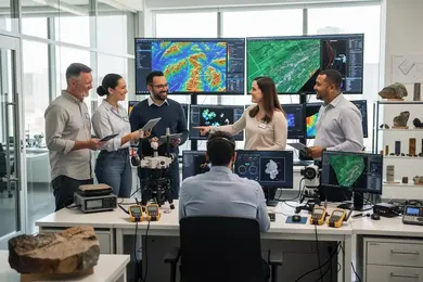
Gaining expertise in earth observation through online geosciences programs demands more than mastering theory; employment outcomes heavily depend on tangible technical competencies and data fluency. Core coursework typically centers on remote sensing, GIS, and spatial data analysis, fostering proficiency in industry-standard software such as ERDAS Imagine, ENVI, and ArcGIS. These tools are fundamental for interpreting multispectral and hyperspectral satellite imagery used in climate monitoring and land-use research.
Practical skills in programming-especially Python and R-are increasingly vital, enabling automation of workflows and application of machine learning to complex geospatial datasets. Training often involves real-world data challenges such as sensor calibration, atmospheric correction, and predictive environmental modeling with direct relevance to sectors like agriculture, disaster response, and urban planning.
Compliance with federal metadata protocols and secure data management is another critical competency, given the extensive data streams from agencies like NASA, USGS, and NOAA, supported by over $1.5 billion in federal geoscience research funding. This element ensures graduates can manage and curate data in alignment with evolving standards.
A frequent disconnect exists between academic training and employer expectations: those lacking cloud computing experience in platforms like AWS or Google Earth Engine face slower career progression. Internships or certificates that bridge this gap are often necessary to gain scalable analysis skills in earth observation, emphasizing that theoretical knowledge alone may be insufficient for sustainable geoscience careers.
What are typical admission requirements for online geosciences degrees focused on earth observation?
Admission to online geosciences programs centered on earth observation demands more than simple academic credentials; it requires measurable STEM readiness, demonstrated through a bachelor's degree with a competitive GPA, typically around 3.0. This baseline reflects the technical rigor necessary for advanced coursework and practical applications in fields like remote sensing and GIS. Candidates without foundational courses in geology, physics, or spatial analysis face a steep learning curve, often resulting in extended program duration or diminished mastery of critical skills.
Professional experience in geospatial analysis or environmental consulting offers a tangible advantage, especially when substantiated by targeted statements of purpose or recommendation letters emphasizing applied proficiency. Such contextual evidence of skill integration often outweighs generic academic performance, aligning with employer preferences for candidates who can immediately translate theory into practice.
Standardized tests, including the GRE, remain a variable factor; while many programs have relaxed this requirement post-pandemic, selective institutions continue to weigh quantitative aptitude assessments for candidate differentiation. International applicants must also meet English language proficiency standards via TOEFL or IELTS, reflecting the globalized nature of the cohort.
Core application materials typically include official transcripts, resumes outlining relevant employment or technical projects, and occasional portfolios documenting satellite imagery or GIS work. Prospective students should anticipate additional requirements such as background checks or financial aid paperwork, particularly if engaging in federally supported research roles.
Employment outcomes demonstrate the value of rigorous admissions: surveys show approximately 90% of earth science graduates in the UK secure employment or further study within 15 months, with over 60% working directly in their field. This data signals that thorough admissions criteria correlate with the development of market-relevant, employable skills rather than mere academic credentialing.
How long do online geosciences programs take, and what do they cost for earth observation tracks?
Choosing an online geosciences program with earth observation specialization requires weighing duration, cost, and alignment with employer demands. Programs typically range from 18 months to 3 years, with accelerated certificates and bachelor's completion paths closer to 18-24 months. Master's degrees and programs aimed at working professionals often extend beyond two years, posing opportunity costs related to income and time.
Tuition varies significantly by institution: public universities generally charge between $15,000 and $40,000, whereas private or specialized programs can exceed $70,000. Employers emphasize applied skills in remote sensing and GIS over advanced theoretical math, which influences curricular design and investment value.
Key considerations include:
- Faster program completion supports roles like environmental consulting that prioritize immediate application.
- Longer programs geared towards research or government roles may focus on deeper theoretical knowledge but delay workforce re-entry.
- Median salaries in earth observation-related geosciences roles rose 4.5% from 2024 to 2025, somewhat offsetting upfront costs.
Prospective students must consider the balance between program length, costs, practical competencies, and employer expectations to minimize retraining risks and maximize employment prospects in this technically demanding field.
What earth observation and remote sensing careers can graduates pursue with these degrees?
Graduates holding online geosciences degrees focused on earth observation (EO) and remote sensing confront a highly technical job market requiring more than baseline knowledge. Success depends on mastering programming languages like Python or R, gaining facility with GIS software, and understanding satellite data archives. Without this depth, applicants often struggle to enter research-intensive roles or industry positions targeting EO innovation.
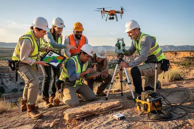
Employers ranging from NOAA and NASA to private energy and mining firms expect graduates to convert complex sensor data into actionable insights. For instance, EO specialists in mining optimize resource extraction by integrating satellite imagery with field data, while urban planners and agricultural managers utilize remote sensing to refine land use and crop yield forecasts.
The workforce experience varies significantly: a remote sensing analyst in an environmental consultancy might frequently recalibrate data pipelines to monitor wildfire activity, demanding agility and continuous learning. Conversely, a government policy analyst reviews EO data less often but requires precision and regulatory expertise. These tradeoffs between technical intensity and job stability should shape career decisions.
The concentration of planetary geoscience master's graduates in research roles - over 80% shortly after graduation according to a 2024 Erasmus+ study - illustrates the premium placed on advanced spatial data interpretation and sensor algorithm development. Prospective students should assess their readiness for ongoing skill refreshment and sector-specific demands before committing to this pathway.
What salary ranges and job outlook can earth observation and geospatial specialists expect?
Salary trajectories in earth observation and geospatial roles vary significantly by sector, specialization, and location. Entry-level positions typically start between $60,000 and $85,000 annually, with federal agencies like USGS and NASA offering slightly higher baselines near $70,000. Mid-career professionals can expect $90,000 to $130,000, particularly if they have expertise in remote sensing, AI-driven geospatial modeling, or advanced data analytics.
However, advancing in this field increasingly demands proficiency in programming languages such as Python and specialized GIS software. Candidates lacking these technical skills risk stagnating wages and limited upward mobility. Employers consistently seek professionals who can integrate satellite imagery with environmental analytics to derive actionable insights in climate adaptation and resource management.
Job market dynamics also reflect practical challenges: government roles often require security clearances and entail slower recruitment, whereas private sector jobs emphasize rapid technology adoption and interdisciplinary collaboration. Geographic disparities further affect compensation, with metropolitan or resource-rich areas offering premium salaries.
How can students evaluate program quality, accreditation, and industry alignment in this field?
Accreditation from recognized bodies such as the Council for Higher Education Accreditation (CHEA) or the U.S. Department of Education sets the baseline for academic legitimacy and credit transferability in geosciences programs focused on Earth Observation (EO). However, institutional approval alone often fails to capture industry-specific relevance; endorsements from entities like the American Geosciences Institute or EO-focused consortiums provide deeper insight into specialized training quality.
Employers increasingly seek candidates with applied skills in remote sensing software, geospatial data analytics, and climate resilience strategies. Programs offering internships with federal agencies or sustainability consultancies better position graduates amid projected job growth exceeding 10% over the next decade. Conversely, curricula lacking hands-on experience with satellite data or climate impact modeling risk producing graduates who struggle with workforce readiness.
Prospective students must balance logistical constraints-such as online course availability for working professionals-and certification support tied to EO and environmental standards. Employment outcomes data revealing pathways into federal environmental roles or startup environments provide critical evidence of program value beyond academic endorsements.
- Verify both regional accreditation and EO-specific endorsements to assess program rigor.
- Prioritize experiential learning embedded in curricula for practical skills application.
- Analyze alumni career trajectories for alignment with targeted geosciences sectors.
Neglecting these criteria often results in limited employment options, underscoring the importance of program depth over breadth for those targeting EO-centered geosciences careers.
Other Things You Should Know About Geosciences
Most programs do not require prior GIS or remote sensing experience, but they often expect readiness for quantitative coursework and basic computer proficiency. Some schools recommend introductory GIS, Python, or statistics before enrollment, and transfer applicants may need at least 15 to 30 semester credits in earth science or related math.
Online geosciences degrees with an earth observation focus prepare students by integrating virtual communication tools, remote sensing software, and group project collaboration. These programs align with 2027's job market by emphasizing skills in data analysis and technology, crucial for effective earth observation.
Online geosciences degrees typically require more self-discipline as coursework is often asynchronous and condensed into accelerated modules. This leads to concentrated periods of intensive study without in-person support, increasing the risk of burnout. Students juggling work or family responsibilities should prioritize programs with flexible pacing options and structured time management resources. Failure to account for these differences can negatively impact academic performance and timely program completion.
Working professionals must weigh the balance between program rigor and flexibility since many must pursue degrees while employed full time. Programs that offer part-time enrollment, evening courses, or modular structures better align with professional schedules. Additionally, selecting a program with industry-recognized software training and active alumni networks can accelerate job transitions or promotions. Prioritizing these factors over merely program rank or breadth ensures the degree produces tangible career benefits.
References
- Cyclical Program Reviews and Accreditation Reviews: Key Differences and Guidelines for Alignment — Ontario Universities Council on Quality Assurance https://oucqa.ca/guide/guidance-on-aligning-an-accreditation-review-with-a-cyclical-program-review/
- ChalmersX: Sensing Planet Earth – From Core to Outer Space | edX https://www.edx.org/learn/earth-sciences/chalmers-university-of-technology-sensing-planet-earth-from-core-to-outer-space
- Earth Science – Bachelor of Science https://www.massey.ac.nz/study/all-qualifications-and-degrees/bachelor-of-science-UBSCN/earth-science-UBSCN2JERSC1/
- Study pathways — Earth Observation Australia https://www.eoa.org.au/study
- Online Geoscience Degrees: Top Schools and All Programs in 2026 https://www.gisdegree.org/online/geoscience-degrees/
- EO College's New Free Online Course: Introduction to Machine Learning for Earth Observation https://un-spider.org/news-and-events/news/eo-colleges-new-free-online-course-introduction-machine-learning-earth
- Graduate program https://www.ga.gov.au/about/careers/graduate-program
- Accreditation as a Strategic Driver of Alignment Across Higher Education and Industry https://acbspjournal.org/2026/05/22/accreditation-as-a-strategic-driver-of-alignment-across-higher-education-and-industry/
- Is a GIS Career Good Today for Future Prospects - Orion Terrametrics Spatial Inisghts https://orionterrametrics.co.ke/blog/is-a-gis-career-good-today-unpacking-the-2025-job-market-future-outlook/
- Earth Observation Summer School 2026 - OpenGeoHub Foundation: Connect | Create | Share | Repeat https://opengeohub.org/2026/01/29/earth-observation-summer-school-2026/