2027 Geosciences Specializations for Environmental Monitoring Careers

Co-Founder and Chief Data Scientist
Facing a sudden spike in environmental contamination reports, professionals in geosciences must quickly identify specialization paths that align with urgent monitoring needs like groundwater quality or atmospheric pollutants. The U. S. Bureau of Labor Statistics projects a 9% growth in environmental science-related jobs over the next decade, reflecting a robust demand for specialized skills that can translate complex data into actionable policy.
Yet, many prospective students juggle work and family, making flexible enrollment crucial; a 2024 National Center for Education Statistics report highlights a 17% rise in part-time and online enrollments among adult learners in applied sciences programs. This article maps current geosciences specializations tailored to environmental monitoring careers, offering insights that clarify how these options can strategically address workforce demands and individual constraints.
Key Things You Should Know
- Environmental geochemistry specialization commands a 15% higher average starting salary in U.S. EPA jobs, yet demands extensive lab experience, delaying workforce entry by 6-12 months per OPM hiring data.
- Remote sensing proficiency correlates with 22% faster job placement in private environmental consulting firms due to accelerating demand for geospatial analytics, highlighting a tradeoff between technical breadth and fieldwork opportunities.
- Soil and groundwater hydrology programs show 18% stronger employment growth through 2030 per BLS, but require costly field equipment access often unavailable in community colleges, affecting cost-efficiency for career changers.
What are the main geosciences specializations for environmental monitoring careers?
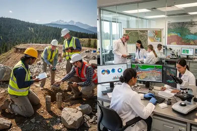
Choosing a geosciences specialization directly shapes employability and job function in environmental monitoring sectors. The leading specializations in 2026-atmospheric science, hydrology, geochemistry, and remote sensing-each respond to distinct operational needs and data demands within environmental risk management and regulatory frameworks. For example, atmospheric science specialists apply quantitative modeling and climate data analysis to address a documented 83% increase in disaster events related to weather, a scenario that agencies tasked with disaster response cannot adequately manage without these skills.
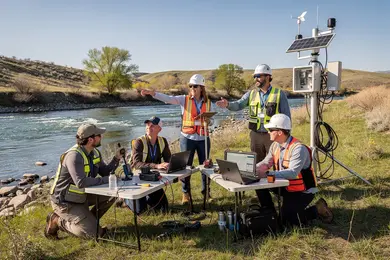
Hydrology professionals focus on water resource assessments crucial to urban planning and agriculture; failure to accurately interpret hydrological data can lead to costly infrastructure damage or ineffective resource allocation. Geochemistry careers center on pollutant analysis and regulatory compliance, requiring integration of laboratory precision and environmental law knowledge. Remote sensing expertise offers rapid environmental assessment capabilities through GIS and programming skills, increasingly vital for emergency managers dealing with large-scale impact mapping.
Students targeting environmental monitoring career paths in geosciences should weigh specialization against workforce demand and role requirements. Cross-disciplinary competencies and certifications-such as EPA sampling licenses or GIS technical certificates-improve marketability and practical readiness. Internships with a strong emphasis on field data collection remain a significant differentiator for hiring managers. Prospective students contemplating specialized pathways might also consider how their current skills could transfer, much like a teacher to speech language pathologist transition illustrates, underscoring the value of strategic upskilling and certification in career pivots.
How do different geoscience specializations align with specific environmental monitoring jobs?
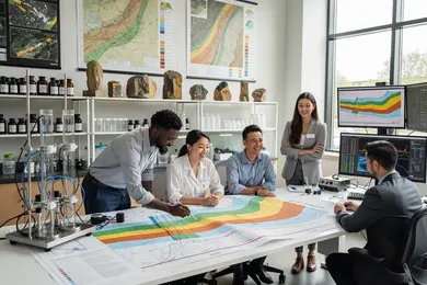
Specializing within geoscience shapes distinct trajectories for environmental monitoring careers in geoscience specializations, with each path demanding a tailored skill set and offering varying job market realities. Remote sensing experts, for instance, navigate large-scale satellite data-the European Space Agency reported over 5,500 Copernicus Sentinel satellite products downloaded each minute-making proficiency in data interpretation vital for roles in climate tracking and disaster assessment. Conversely, hydrogeology demands a focus on subsurface water behavior, aligning with groundwater quality monitoring and regulatory compliance jobs.
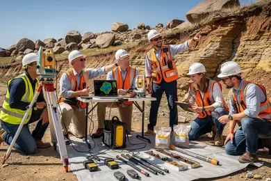
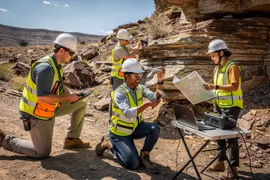
Other specializations like geochemistry concentrate on soil and water chemical analysis to support contamination assessments, while geophysics applies seismic and electromagnetic methods critical for earthquake and volcano hazard monitoring. Soil science integrates into agricultural environmental monitoring by linking soil health to sustainable land use. Those pursuing fieldwork-heavy environmental geology roles must balance direct sampling and mapping skills against more computationally intense specialties like remote sensing and geophysical modeling.
Geoscience specializations for targeted environmental job roles require integrating diverse datasets while navigating workforce expectations, including mastery of GIS software and an understanding of environmental regulations. Prospective students should weigh stress levels, location constraints, and equipment familiarity inherent to each specialization. Assessing these tradeoffs is essential for aligning career goals with real-world demands. Those considering an environmental engineering bachelor's degree online may find crossover skills advantageous in multidisciplinary roles.
What degrees do you need for geoscience-based environmental monitoring careers?
Environmental monitoring roles in the United States demand more than foundational knowledge; they require practical expertise in earth system processes paired with digital spatial analysis skills. A bachelor's degree in geosciences, environmental science, geology, or hydrogeology remains the baseline credential across water resource management, consulting, and government sectors. Programs that combine coursework with Geographic Information Systems (GIS) and remote sensing technologies enhance employability by equipping students with market-relevant technical skills.
Entry-level technical positions might be accessible for professionals with substantial field experience or certifications even without formal degrees. However, such roles often cap advancement potential, particularly in specialized fields like groundwater assessment, where master's degrees in hydrogeology or environmental geosciences are increasingly expected. For example, UN-Water's 2024 Global Status of Groundwater report identifies critical aquifer depletion issues, reinforcing demand for advanced hydrogeologic expertise capable of modeling aquifer systems and managing contamination risks.
Students weighing graduate education must consider the balance between the extended investment of time and resources versus employer preference for candidates skilled in quantitative modeling and regulatory compliance. In sectors like oil, gas, and mining, a geology degree integrated with environmental monitoring coursework opens targeted pathways in impact assessment and site reclamation. Evaluating the best academic programs for environmental monitoring and geosciences specialization can reveal which curricula offer these practical competencies alongside internships or field experience.
For those exploring interdisciplinary options, an online exercise physiology degree serves as an example of a non-traditional pathway where specialized scientific knowledge aligns with applied health fields, but may not intersect directly with geosciences requirements.
How do online geoscience programs for environmental monitoring compare with campus options?
Online geosciences programs for environmental monitoring offer flexibility in theory and data analysis but fall short in delivering the hands-on training essential for entry-level positions requiring mercury emission monitoring. The UN Environment Programme's 2024 Global Mercury Assessment notes artisanal and small-scale gold mining contributes 37% of global anthropogenic mercury emissions, heightening demand for practitioners skilled in field sampling and instrument calibration. Such training is practically exclusive to campus programs, which provide direct access to lab facilities, core equipment, and supervised site visits-prerequisites frequently mandated by government agencies and environmental consultancies tackling geochemical pollution.
Online programs excel at theoretical foundations, GIS simulation, and remote sensing skills but do not adequately prepare students for regulatory compliance or real-time biosample handling. Without local internships or agency partnerships to supplement online coursework, employability in monitoring-intensive roles significantly diminishes.
For prospective students weighing campus vs online geosciences education for environmental careers, the decision hinges on immediate job market priorities versus program accessibility. Campus education remains indispensable for entry-level field technicians, while online degrees benefit mid-career professionals with existing field experience targeting data-focused roles.
Students exploring allied disciplines might consider a library sciences degree as an alternative pathway to environmental data management within broader environmental monitoring frameworks.
What courses and technical skills are taught in environmental monitoring-focused geoscience programs?
Environmental monitoring programs within geosciences demand a tactical blend of specialized coursework and applied technical skills tailored to meet stringent regulatory and industry requirements. Graduates must navigate tradeoffs such as optimizing data precision against operational costs while anticipating contaminant behaviors under shifting climate conditions. For instance, a consultant monitoring wetland degradation will routinely integrate multispectral and LiDAR data with in-field measurements to produce regulatory-compliant impact assessments.
Core training typically covers geospatial data analysis, remote sensing, hydrology, environmental chemistry, soil science, and GIS proficiency, alongside programming in Python and R to automate data workflows. Advanced modules focus on sensor technology operation and environmental modeling, equipping students to manage diverse datasets effectively.
Employment outlook reflects a 6% growth projection for GIS and mapping scientists from 2024 to 2034, underscoring the value of competence in database management and cloud computing platforms amid expanding geospatial data volumes. Employers prioritize candidates who can synthesize disparate data streams into verifiable reports aligned with EPA and state standards across sectors ranging from urban planning to energy.
Key competencies include:
- Data accuracy vs. monitoring budget optimization
- Proficiency with LiDAR, remote sensing, and GIS tools
- Programming for spatial data manipulation and automation
- Cloud-based geospatial database management
- Environmental modeling under uncertain climate scenarios
Graduates who develop these applied technical skills respond to increasing market demands for actionable environmental intelligence, positioning themselves beyond entry roles to specialized consulting and regulatory analysis.
How can students verify accreditation and program quality for geoscience environmental monitoring degrees?
Choosing a geoscience environmental monitoring degree without verifying accreditation and program relevance risks professional setbacks, including barriers to GIS certification and complications in compliance monitoring roles. Regional institutional accreditation is a minimum requirement, but students must seek program-specific validations such as ABET or Geological Society of America approval to ensure curricula meet employer expectations for technical rigor.
Students should evaluate courses for alignment with industry demand, prioritizing training in GIS, remote sensing, and climate data analysis. For example, the World Meteorological Organization reported a glacier ice loss averaging one meter per year from 2010 to 2019, signaling urgent employer demand for precise cryospheric data skills. Without updated coursework reflecting such rapid environmental dynamics, graduates may face reduced job readiness.
Assessing program outcomes-including federal agency placements and environmental consultancy employment-provides pragmatic insight into a degree's market value. Alumni feedback and graduation metrics reveal how well programs adapt to evolving regulations and emerging data technologies, beyond basic accreditation claims.
Equally important is faculty expertise and access to applied research and fieldwork, which shape essential hands-on experience in specialized monitoring fields like glacier dynamics or atmospheric pollution. Lower-tier or unaccredited degrees often lack these opportunities, limiting graduate employability and career progression.
- Confirm program accreditation with the U.S. Department of Education or Council for Higher Education Accreditation databases.
- Prioritize curricula integrating current environmental monitoring technologies and regulatory frameworks.
- Request detailed graduate outcome data and employer engagement evidence.
What are the typical admission requirements and time to completion for these programs?
Securing a role in environmental monitoring through geosciences specializations hinges on more than completing a degree; employers weigh quantitative aptitude and applied technical skills heavily. Admission prerequisites generally include a bachelor's degree in geology, earth sciences, or related STEM areas with a minimum 3.0 GPA, alongside foundational coursework in calculus, physics, chemistry, and computer science. Work experience or internships in GIS, hazard assessment, or environmental monitoring substantially improve prospects, especially for master's or certificate programs targeting data-intensive roles.
Program duration varies widely and carries practical implications for career transitions. Bachelor's degrees typically require four years, while specialized master's and graduate certificates concentrate in 1.5 to 2 years full-time. For working professionals, part-time or online options extend to 3-4 years but allow continuation of income streams. Shorter certificates-often under a year-offer rapid skill acquisition for urgent labor market needs, particularly where employers prioritize hazard modeling and data interpretation expertise over academic pedigree.
Deciding between these pathways necessitates balancing speed of entry against technical depth and future advancement potential. Employers in government and disaster mitigation sectors favor candidates with practicum experience or affiliations with local monitoring centers, which can sharply reduce job search durations. Prospective students must also measure costs and time away from income against workforce demand, which remains acute given the escalating financial toll of disasters globally.
What entry-level and advanced roles can geoscience graduates hold in environmental monitoring?
Environmental monitoring roles accessible to geoscience graduates generally fall into two broad tiers, reflecting a clear divide in responsibility, expertise, and long-term career implications. Entry-level positions-such as field technicians, data analysts, and environmental compliance assistants-focus on data collection, processing, and reporting under supervision. These roles demand hands-on skills in deploying sensor networks, performing real-time assessments of soil, water, and air quality, and using GIS tools for mapping environmental changes. For example, technicians involved in coastal monitoring must be adept at tracking sea level rise, a phenomenon confirmed by the Intergovernmental Panel on Climate Change's 2024 report, which indicates a 0.20-meter global mean increase since 1901 and an accelerating rise of 3.7 mm annually from 2006 to 2018.
Advanced positions like environmental modelers and geospatial data scientists require graduate-level expertise and emphasize quantitative modeling to interpret complex datasets. These professionals often develop policy-oriented tools, such as translating sea level rise projections into zoning recommendations that mitigate flood risks. The tradeoff is clear: technician roles enable earlier entry into the workforce but limit influence over decision-making and long-term strategic planning, while advanced roles require significant investment in education and offer leadership opportunities centered on interdisciplinary collaboration and program design.
Employers across government agencies and environmental consultancies consistently expect a baseline proficiency in data management software and regulatory compliance standards. Prospective students must weigh immediate employment and skill acquisition against the time and cost of advanced degrees, aligning choices with specific career objectives in environmental monitoring.
What salary ranges and earning potential exist in environmental monitoring geoscience careers?
Environmental monitoring careers in geoscience exhibit wide salary variability shaped by employer type, specialization, and geographic location. Entry-level roles in smaller consulting firms or local government typically start between $55,000 and $70,000, emphasizing foundational skills in baseline environmental assessments. Mid-career specialists focused on urban infrastructure resilience-an area gaining urgency since urban centers produce nearly 70% of global greenhouse gas emissions according to the UN-Habitat World Cities Report 2024-earn roughly $80,000 to $100,000 annually.
Positions within federal agencies like the U.S. Geological Survey offer the upper salary range combined with greater job security but may require navigating bureaucratic complexities. Specializations in remote sensing and GIS for urban environmental monitoring offer a pathway to senior roles with compensation reaching $120,000, especially when professionals lead data-driven climate adaptation efforts.
A practical example: a consulting geoscientist managing greenhouse gas emissions mapping for a major city infrastructure project can negotiate salaries near $115,000 by leveraging technical expertise tied to regulatory compliance. Conversely, public sector roles engaged in similar projects may yield closer to $90,000 with more predictable career progression.
Tradeoffs between sectors include the private industry's higher immediate pay versus government roles' stability and long-term funding. Geographic context also matters-urban areas with critical climate challenges pay more but come with increased living costs and market competition.
What is the job outlook and industry demand for geoscientists in environmental monitoring?
Growing demand for technically skilled geoscientists in environmental monitoring is reshaping workforce requirements. The American Geosciences Institute projects a 3.7% rise in U.S. geoscience jobs by 2034, with growth centered on data-driven roles involving GIS, remote sensing, and predictive simulation. Employers increasingly expect professionals who can integrate complex environmental data for regulatory compliance and resource management decisions.
Environmental consulting scenarios illustrate this shift: firms working with government or industry clients prioritize real-time monitoring of soil, groundwater, and air quality, valuing proficiency in advanced analytics alongside fieldwork. Lack of quantitative modeling skills is a significant barrier, as actionable insights outweigh simple data collection.
For students and career changers, this means balancing geoscience fundamentals with targeted upskilling in programming languages such as Python or R and statistical methods. While a bachelor's degree can open entry doors, hiring managers prefer candidates holding master's degrees or specialized certifications in environmental informatics or spatial data science.
Occupational advancement demands adaptability to evolving regulations and technology. Entry-level roles focus on data acquisition and quality assurance, but mid-career professionals often lead interdisciplinary teams translating environmental data into compliance strategies. Aligning technical skill development with federal or state environmental projects enhances long-term employability.
Other Things You Should Know About Geosciences
Employers often expect GIS, remote sensing, and statistical analysis skills, plus working knowledge of Python, R, and Excel. Many environmental monitoring roles also require handling field data in ArcGIS or QGIS and interpreting satellite or sensor datasets for compliance and trend reporting.
Programs emphasizing technical training develop specialized skills in GIS, remote sensing, and environmental sampling that are prerequisites for many scientific roles. Conversely, policy-focused curricula prepare students for roles that interface with government agencies and regulatory compliance, which typically offer less direct fieldwork but more stakeholder engagement. Selecting a program should depend on whether you intend to engage primarily in technical data work or environmental decision-making and advocacy.
Internships and co-op placements provide crucial hands-on experience that employers prioritize, often outweighing academic performance in hiring decisions. They offer exposure to real-world project constraints, regulatory frameworks, and networking opportunities vital for career advancement. Prioritize programs offering structured industry partnerships or mandatory internship components to ensure market-readiness.
References
- Explore UM | University of Manitoba - Undergraduate admission requirements https://umanitoba.ca/explore/undergraduate-admissions/requirements
- Online Geoscience Degrees: Top Schools and All Programs in 2026 https://www.gisdegree.org/online/geoscience-degrees/
- Environmental Geoscience https://www.durham.ac.uk/study/courses/environmental-geoscience-f630/
- First-year requirements https://admission.universityofcalifornia.edu/admission-requirements/first-year-requirements/
- Career Services | University of Manitoba - Career Compass: Earth Sciences https://www.umanitoba.ca/career-services/career-planning/career-compass-earth-sciences
- Environmental Geosciences Diploma (CIP 30.4101) https://catalogue.coastmountaincollege.ca/programs/environmental-geosciences-diploma/
- Environmental Career Profiles Australia https://environmentaljobs.com.au/resources/environmental-sustainability-careers
- Salary Information https://www.geolsoc.org.uk/Geology-Career-Pathways/Careers/Salary-Information.html
- Environmental Geoscience degrees & courses https://universitycompare.com/courses/degrees/environmental-geoscience
- What Does the Future Demand Look Like for Applied Geoscientists? https://www.aegweb.org/index.php