20 Best Public Works Software Solutions for 2026
Co-Founder and Chief Data Scientist
20 Best Public Works Software Solutions for 2026 Table of Contents
List of Public Works Software
Key Public Works Statistics
With so much complexity inherent in managing public works, doing it efficiently has become the mandate of digital technology—from issuing permits and work orders to planning budgets and avoiding cost escalation. In fact, under a new popular public digital transformation paradigm, digital tools are no longer just only intertwined but are also considered pillars of the redesigning and reengineering of “government services from the ground up to fulfill changing user needs (Mergel et. al, 2018)."
In terms of planning, implementing, and maintaining public works projects, a good deal of useful software solutions are available to provide the backbone of operations. In this article, you will know the best asset management software in no particular order—from highly-specialized platforms to general public works management products, all the way to handy business software applications. In this way, you will have a better idea of which ones can help your specific organization be more effective and fit your current selection of the best public sector software stack.
Public works in the United States are far from being the best models of efficiency. They are deemed underfunded (American Society of Civil Engineers, 2022), while experts have pointed out their inaccuracies in demand forecasting and cost estimations. The underlying causes are plenty, among which is the evolving political causes (see Flyvbjerg, Skamris Holm, & Buhl, 2005). But for the most part, they all boil down to the quality of planning and implementation—as it is for the management profession in all industries.
In transportation, a main public works area, the problems are quite pronounced. Cost escalations have been found to be rampant. Firstly, they have been found to be strongly dependent on the length of implementation (Flyvberg et al., 2011). Secondly, cost escalations have been seen to be present in projects that become larger over time. These are planning and projection issues that involve a variety of management areas—from HR and project management to budgeting and maintenance planning. Without a way to manage them effectively, expensive projects could be riddled with inaccuracies at the onset.
In fact, this is the case for demand forecasts. One study by Flyvbjerg, Skamris Holm, and Buhl (2005) found that in 210 public works projects across 14 nations worth $59 billion, 90% of rail projects and passenger forecasts were overestimated—with the average overestimation at 106%. For about 50% of road projects, the difference between forecast and actual traffic is more than 20%. These findings, of course, have serious repercussions that involve tax dollars. And with the added tax complexity comes the need for tech solutions like tax management software.
Even though public construction in 2021 only accounted for 21.75% of average monthly construction spending in the United States, the figure still reached $346.3 billion (Statista, 2022). In fact, this is the second-highest average monthly public works expenditure since 2015, only trailing 2020’s average of $361.12 per month. This shows that public infrastructure projects in the country are not slowing down. This is to be expected as new infrastructures are constructed and existing ones demand maintenance and repairs. This is especially so for public roads. In fact, recent estimates show that over 62% of roadway spending was for system preservation (ASCE, 2022).
Spending this much, however, is still not enough. In 2021, it was found that 43% of the system was in poor or mediocre condition (American Society of Civil Engineers, 2022). Also, the share of vehicle miles traveled on roads in “poor" condition has risen to more than 17% from 15% over the last decade. One factor singled out for this, according to the ASCE (2022), is that roadway maintenance has been underfunded for years. This is also compounded by other inefficiencies in planning and implementation across different levels of government.

This would be very apparent when you take cost escalation statistics around the world into consideration. In 15 fixed links projects, it was found that average cost escalations for traditional public-owned and state-owned enterprise projects were 23.1% and 110%, respectively (Flyvberg et al., 2011). In 25 rail projects, state-owned enterprise high-speed rail projects had an average of 88% cost escalation. Conventional publicly-owned urban rail projects have an average of 53.5% cost escalation. Also, as mentioned in the previous section, demand forecasting is not any better.
Hence, besides increasing funding, the ASCE (2022) suggests the development of “state and local level comprehensive transportation asset management plans that link asset management efforts to long-term transportation planning and incorporate the use of life-cycle cost analysis." Agencies, however, do not have to build this framework from scratch. Tools for planning and implementation with these in tow, along with some of the features carried by the best online backup software, are readily available in public works software solutions.
Why Public Works Software Is Important
As mentioned, a platform that integrates different areas of planning and implementation together is required to effectively manage public works projects. These include demand forecasting, costing, labor management, predictive maintenance, geographical mapping, and financial management, among others. If data from these seemingly disparate management areas are not put to bear on each other, accurate and more meaningful analysis would not be available for planning. It would make up-to-date executive visibility impossible.
Like with the best project management software, public works asset management software solutions make these happen. In the most basic sense, planning capability and real-time visibility for management are what make public works software tools very important. These tools allow government agencies to deal with backlogs better and plan contingencies more efficiently.
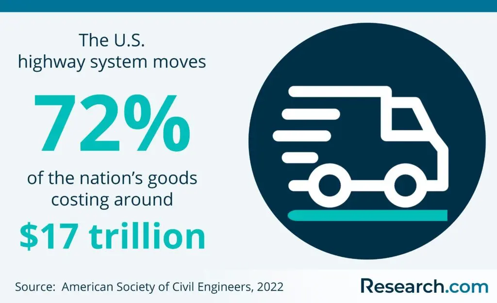
This is very important in the United States where there is a $786 billion backlog of capital needs for bridges and roads (ASCE, 2022). Also, long-term contingency planning for unforeseen environmental or force majeure causes is also needed. Experts estimate that pavement costs each year by 2040 will increase by $19 billion because of rising temperatures. Should public works agencies fail to deal with backlogs and contingency planning, great economic repercussions are to be expected. This is because the nation’s road and highway system moves 72% or around $17 trillion of U.S. goods.
Of course, just having public works software solutions is not the only answer. As Flyvberg and colleagues (2005) noted, the “cure is transparency, accountability, and new forecasting methods." The challenge, they added, is “to change the governance structures for forecasting and project development (Flyvberg et al., 2005).
But, as we noted, digital platforms are involved in this change. They undergird the shift and allow, limit, or expand what can be thought of and done with public works projects. Moreover, these asset management software for public works integrate with other public administration solutions like some of the best construction management software. Thus, siloes could be eliminated and an integrated view of governance can be achieved.
List of Best Public Works Software for 2026
These said, below are the best public works software solutions available today. Note that they are not arranged in any order. This is because they come in different kinds and flavors—from specialized technical solutions to more general management platforms like real estate management software. Thus, it would be possible to build a good software stack with multiple solutions on this list.
1. Cityworks: The GIS-Centric Infrastructure Management Platform for Local Governments and Utility Agencies
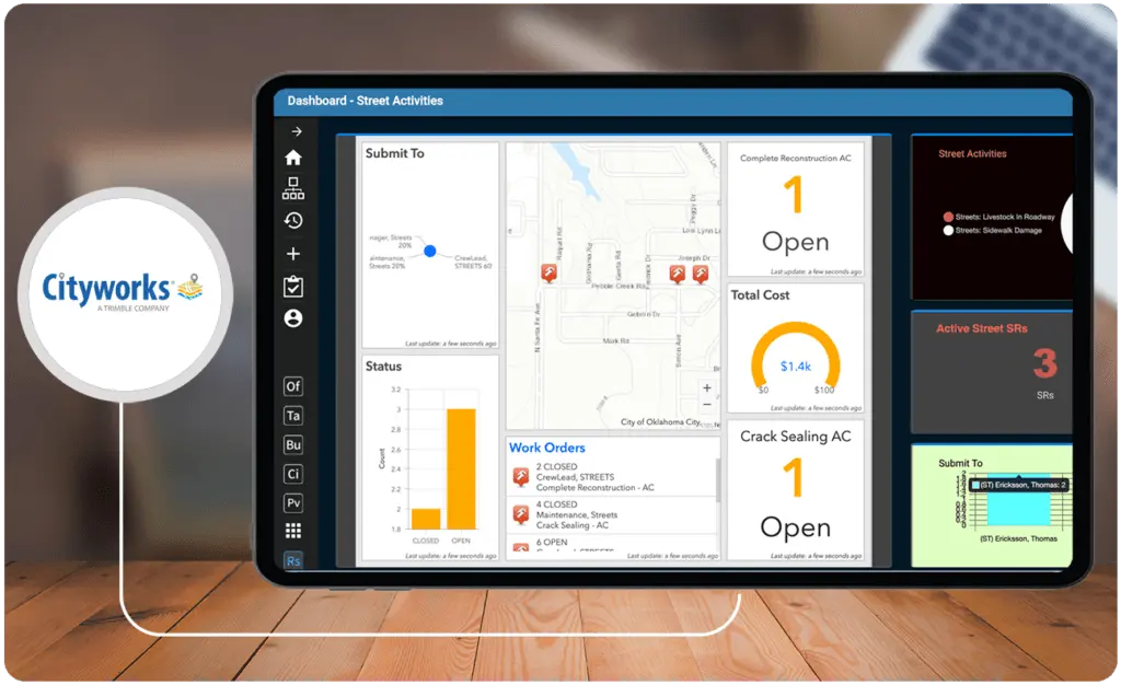
Cityworks is a go-to GIS-centric public works asset management tool used for local governments and utility agencies to streamline operations. In fact, it is one of the best public works software solutions available in terms of well-roundedness. It provides them with comprehensive tools for permitting and public asset management that support the infrastructure lifecycle. These have end-to-end functionalities, from permits and construction to maintenance and replacement. In essence, Cityworks is two software products rolled into one with Cityworks AMS for asset management and Cityworks PLL for permitting, licensing, and land management.
The platform is built exclusively on ArcGIS. Hence, it is designed to leverage GIS data to help optimize the operations of agency users. Cityworks also integrates with other software solutions and frameworks. These include Woolpert for hydrant flow testing and an e-Builder for construction project visibility. The solution also has mobile versions for both iOS and Android devices.
Key Features
- Asset management software module
- Permitting, licensing, and land management module
- Uses geographic information system data from ArcGIS for a single source of truth
- Streamline asset inspections and scoring processes
- Identify and evaluate risks
- Make cases for maintenance or asset replacement
- Optimize permitting processes
- Improve communication with customers and stakeholders for better community development
- Manage tasks, budgets, and work activity in a project management framework
- Provides intuitive data visualizations
- Mobile solutions
- Integrations with other products and workflows
Price
- Custom Pricing
2. STAR Road: End-to-End Road Management and Maintenance Software
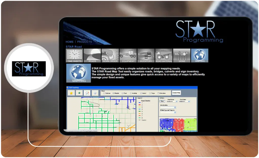
STAR Road is a public works work order software that offers end-to-end road management solutions ranging from work order and equipment management to road materials and inventory management. The platform also has modules for easy mapping and road sign management. Moreover, STAR Road has a Time Sheet module that tracks costs based on employee time cards.
All of these work together to provide users not only with a 360-degree view of their fixed assets but also drill-down capabilities. STAR Road makes useful information from repair costs and material options to even know what day a high reflective tape was added to a stop sign.
Key Features
- Provides a timesheet to easily track and project labor costs
- Organizes fixed assets into a single form and sort them by material type, location, township, or district
- Breaks down labor, material, and equipment cost with date sensitivity
- Work order management with forms generator
- Equipment maintenance module to manage fleet and repairs
- Incorporates depreciation and lease payments for analysis
- Cost breakdown per hour or per mile
- Track routine maintenance
- Monitor fuel logs
- Inventory management and road material breakdown
- Road signs and culvert management
- Mapping tools
Price
- Custom pricing
3. EnerGov: The Public Sector Software Suite
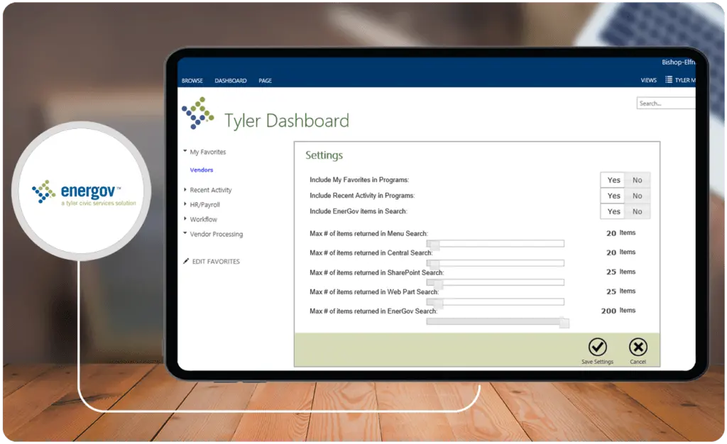
EnerGov is a web based work order system. It is a product by Tyler Technologies, a market leader in public sector software solutions. The company has management software tools for civic services, corrections, and even disability and benefits included in the suite. Public works solutions can be found in its Public Administration module. These include ERP, Property and Recording, and Land and Official Records.
These include tools for record management, regulatory compliance, property data management, and self-service portals for constituents. Moreover, it has a Civic Service module that allows users to streamline community development, permitting and licensing processes, and enterprise asset management. Moreover, it even has a module for Parks and Recreation management. Overall, EnerGov is one of the most comprehensive public sector software solutions with robust public works management features.
Key Features
- Streamlines record keeping
- Integrates records from all public administration functions
- Permitting, reviews and approvals, and enforcement activities
- Self-service portals for constituents
- Enterprise Asset Management
- Property and Recording module
- Land and Official Records module
- Electronic plan review
- Financial tools
- Comprehensive integrations with other Tyler Technology public sector software solutions
Price
- Custom pricing
4. MyGov: Simple Web-Based Solutions for Smart Cities
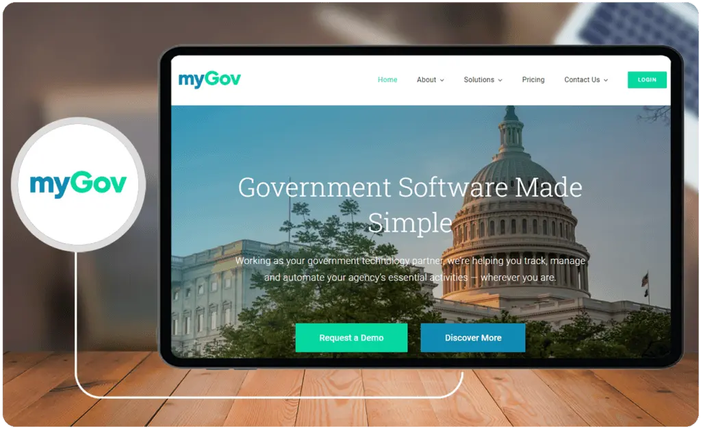
MyGov‘s infrastructure asset management software is a suite of web-based solutions for public services with tools ranging from asset management to geographic information system (GIS) mapping. Its asset management module and best scheduling software features allow users to manage schedules, budgets, inventory, and cycle counts. Moreover, its work order management module has features for job tracking, personnel management, public infrastructure maintenance, and agency equipment maintenance.
MyGov also increases visibility. Locations for public works projects such as those for centerlines, landmarks, wastewater, parcel, and historic assets can be tracked using its GIS mapping feature. Furthermore, the feature allows users to customize attributes and even create layers. Hence, it can be customized to reflect real-time public works activities.
Key Features
- A complete public governance suite
- GIS mapping integrates with all solutions
- Work order management
- Permitting and electronic plan reviews
- Code enforcement solution
- Asset management
- Maintenance schedule management
- Inventory management and cycle counts
- Supports online payments
- Provides citizen and collaboration portals
- Has a lien and collection solution
Price
- Custom pricing
5. Elements XS: Flexible GIS-Centric Software for Utilities and Local Government
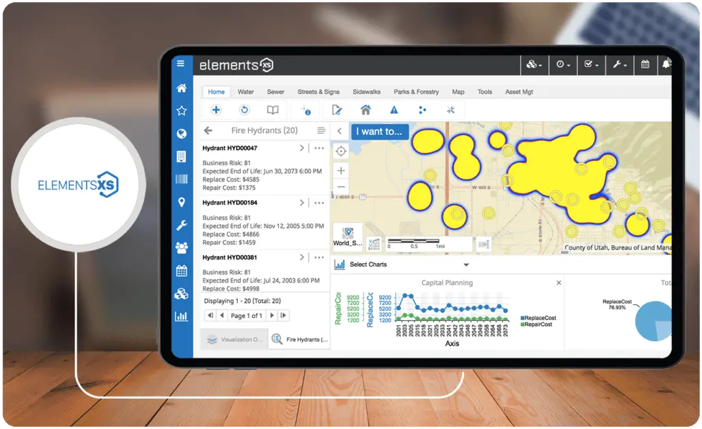
Elements XS is one of the most popular GIS software solutions used by utility companies and local governments. Its ability to document and organize inventory also makes it an effective tool for inventory management companies. It provides them with tools for managing public works, streets, traffic, and even park and recreation departments, among others. These include features such as inventory management, work order management, fleet management, routine maintenance management, and permitting.
The platform uses an intuitive highly-visual design, making it easily operable even by novices. Hence, it is highly usable right out of the box. The product also integrates with other platforms such as Esri ArcGIS for mapping and MuniBilling for cloud utility payments. As it is a web-based solution, it can be accessed by users via any device and browser.
Key Features
- GIS-centric assets management
- ArcGIS integration
- Mobile-ready
- Dynamic data management with custom data sets
- Custom workflows
- Utility billing integrations
- Reporting and analytics
- Permits and land management
- Track vertical and horizontal assets
- Offline access and automatic syncing
- Asset automation using GIS
- Automatically generates service orders
- Parks and recreational facilities management
- Ultra-flexible deployment
- Offers professional GIS services
Price
- Custom pricing
6. PubWorks: GIS-integrated Public Works Software Solution
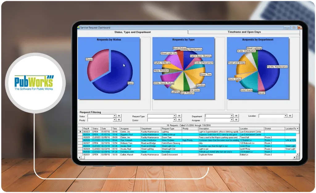
PubWorks is a mobile-ready municipal management software. It offers users easy-to-use tools for managing work orders, service requests, asset management, fleet maintenance, and job costing, among others. The platform is also known for its extensive list of ready-to-run reports that reach more than 700 in number.
The platform is also accessible via its mobile application. So, field personnel will always be in the loop and be able to make updates in real-time. Moreover, PubWorks integrates with third-party solutions, including software for fuel systems, work orders, HR, and financial management. The list includes Tree Plotter, Fuel Master, Cenex, and Spring Book.
Key Features
- Streamlines work orders
- Create preventive maintenance programs
- Process service requests smoother
- Accessible via mobile app
- Provides an asset management cornerstone
- Fleet maintenance solution
- Has a built-in GIS MapViewer
- More than 700 ready-to-run reports
- Fuel systems integrations
- Integrations with HR and financial management software
Price
- Custom pricing
7. BigChange: Comprehensive Field Service Management Solution
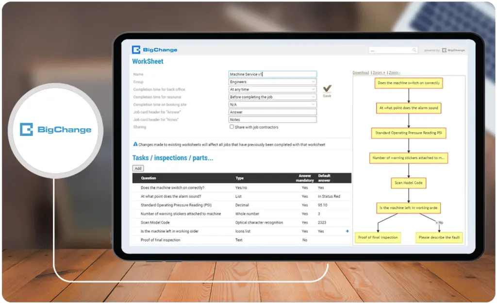
BigChange is a leading municipal asset management software that is flexible enough for public works use. In fact, the platform is not only widely-used among facilities management and utility businesses, it is also being used in the public sector and highway maintenance. Its public works solution is essentially a 5-in-1 product with job scheduling, network, back office and CRM, vehicle and asset tracking, and mobile workforce application modules rolled into one.
BigChange also has a GIS feature for intuitive location-based job and asset tracking and management. Moreover, the product integrates seamlessly with other solutions, including Sage, Xero, Power BI, Microsoft, Oracle, and Symology, among a long list of others.
Key Features
- Real-time fleet tracking using wired, plug-in OBD, or mobile phone
- Driver behavior monitoring
- Timesheets and expense management
- Provides communication tools such as messaging and file sharing
- Has driver checks and defect management features
- Jobs and process workflow
- Invoicing, quotes, and finance management
- Stock and equipment management
Price
- JourneyWatch vehicle tracking and driver mobile app at $19.00 per vehicle per month
- JobWatch all-in-one mobile workforce management at $139.00 per office or mobile license per month
- JobWatch Plus JobWatch with a fully-managed rugged Samsung tablet at $99.00 per mobile user per month
8. BluePrince: Digital Solutions for Community Development
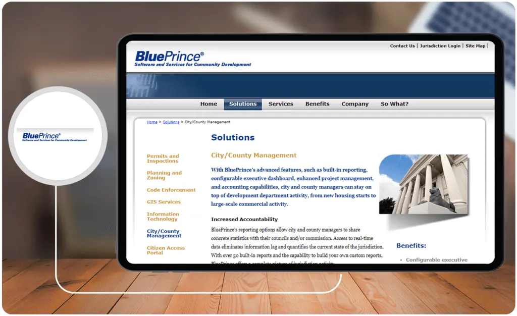
BluePrince is one of the best municipal software solutions because it offers users tools to effectively manage community development and public administration processes. It has on-premise solutions, ranging from city/county management to planning and zoning. The product also provides users with tools to customize GIS maps that can be used for assets and job management. Moreover, it has customizable executive dashboards for providing city managers with quick statistics and trends.
Other features include a code enforcement software module, permitting, and inspection management. Also, the product has a citizen access portal to make communication and collaboration easier for work requests and licensing. Also, the system can be customized to coordinate with a jurisdiction’s brand.
Key Features
- Permits and inspections management
- Customizable GIS with layers for assets and job management
- Provides a citizen access portal for self-service licensing
- City/county management solution
- Quick executive dashboards with real-time statistics and trends
- Offers a flexible open architecture for integrations
- Interactive voice response system
- Email and SMS notifications
Price
- Custom pricing
9. usDPW: Cloud-Based Public Works Records

usDPW by Docufree is among the best IT asset management software. It offers digital transformation tools for public works. usDPW is essentially a document scanning and records management service. The company offers a physical document scanning service for any document of any size. It is exclusively used by public works departments to create a new searchable digital database for their records. Search can be done using GIS data, addresses, or service numbers. With usDPW, users eliminate manual processes and make their operations paperless.
The platform also allows users to add or update information on the go. Using a secure password account, users can access the platform from the field using any device. Also, it has backup capability, allowing. users to download their data anytime.
Key Features
- On-location public works document scanning
- Easy-to-use public search interface
- Public works records storage
- Provides 24/7 cloud-based access
- Backup command
- Download data anytime
- Provides unlimited training and support
- Automatic software updates
- Secure log-in with user-level access
- Edit or add information on the go
- Search via address or service number
- GIS search
Price
- Custom pricing
10. ArcGIS Online: The Leading Geographic Information System (GIS) for Public Works Management
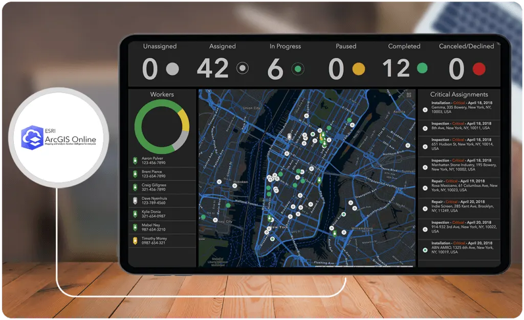
ArcGIS Online is a popular GIS municipal project management software used in many industries. And, it is particularly popular in the public sector, especially with public works and parks and recreation departments. In fact, there are many digital public works and field service solutions that build on the ArcGIS framework. Basically, the software is a web-based platform for creating and sharing interactive web maps.
These allow users to create informational layers on top of geographic information to help organizations visualize and track processes like road maintenance or construction projects.
Key Features
- Map creation and customization
- Shareable interactive maps
- Create maps from various sources, including geospatial files, spreadsheets, and imagery
- Connect to Internet of Things (IoT) devices, data sensors, and platforms
- High-resolution basemaps
- Visualization and exploration tools
- Collaboration tools
- Analysis tools such as route optimization and reveal relationships
- Integrates with third-party solutions, including other public works software
Price
ArcGIS for personal use and students costs $100 per year
Business accounts have custom subscription pricing
11. GovPilot: Digital Transformation for Governments
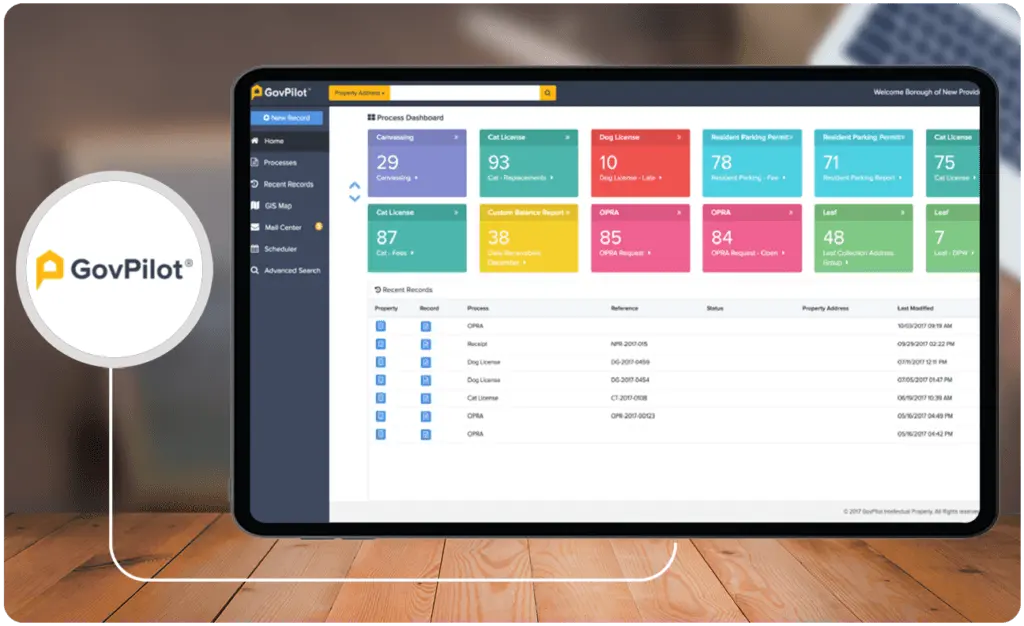
GovPilot offers comprehensive digital transformation solutions for local governments, including those for public works departments. The GovPilot cloud-based Department of Public Works solution is made up of eight modules. These include vehicle maintenance, fleet management, and asset management. It also has functionalities for instant reporting, online forms, payment support, GIS mapping, property profile, workflows, and communication. Also, these can integrate seamlessly with other GovPilot modules for court management, engineering, and parking, among many others.
Also, it works well with other third-party solutions. These include Google Maps for GIS, BRT Technologies for tax assessment, and Eagleview from Pictometry. Moreover, it connects with the ICC Code Connect API and the General Code eCode360 API for compliance. The product is also easy to use and very flexible to deploy. This is because it is made available through a templated module pricing scheme.
Key Features
- Work orders management
- Efficiently manage your fleet
- Plan and coordinate maintenance efforts
- Make financial workflows efficient
- Instantly generate reports
- Customize online forms
- Make and receive online payment
- GIS mapping with property profiles
- Communication tools with transparency
- Customizable workflows
- Tonnage grant reporting
- General service work order process management
- Additional parks and recreation modules are also available
Price
There are basically four plans and pricing depends on your state, government type, country, and on your personalized consultation.
- Essentials (5 templated modules)
- Professional (10 templated modules)
- Enterprise (20 templated modules)
- Unlimited (125 templated modules)
12. Cartegraph: Strategic Asset Management Solution for Public Works
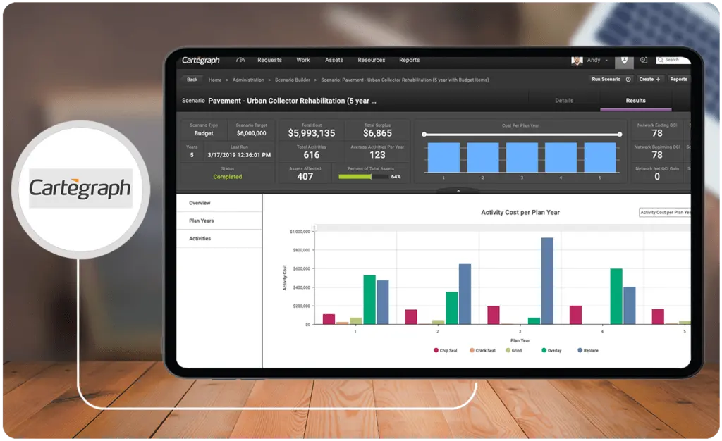
Cartegraph is a strategic asset management solution with a specialized deployment for public works. This cloud-based solution helps users maintain every asset and streamlines workflows across different aspects of asset management, including work orders and inventory management. Moreover, it offers tracking features for every task such as equipment, labor, and materials.
The platform also offers advanced tools such as a scenario builder, analytics, automations, proactive planning, and preventive maintenance. Moreover, thanks to its open systems model, it offers its API and provides users with integrations with third-party solutions. These include those with ArcGIS, AWS IoT, Workday, and CRM software for citizen engagement such as Salesforce, among others. Also, it has mobile applications for Android and iOS users.
Key Features
- Preventive maintenance
- Proactive planning from dailies to five-year capital improvement projects
- Save time and money with Cartegraph automation
- Online and offline access with photo documentation capabilities
- Analytics dashboard
- Budgeting and planning features
- An easy-to-use scenario builder
- Advanced reporting from MS4 reports to FEMA reimbursement requests
- Inventory management
- Work order management
- Resource tracking
- GIS mapping with ArcGIS integration
Price
- Custom pricing
13. ECAT: Cloud-Based Service Delivery Management Tool
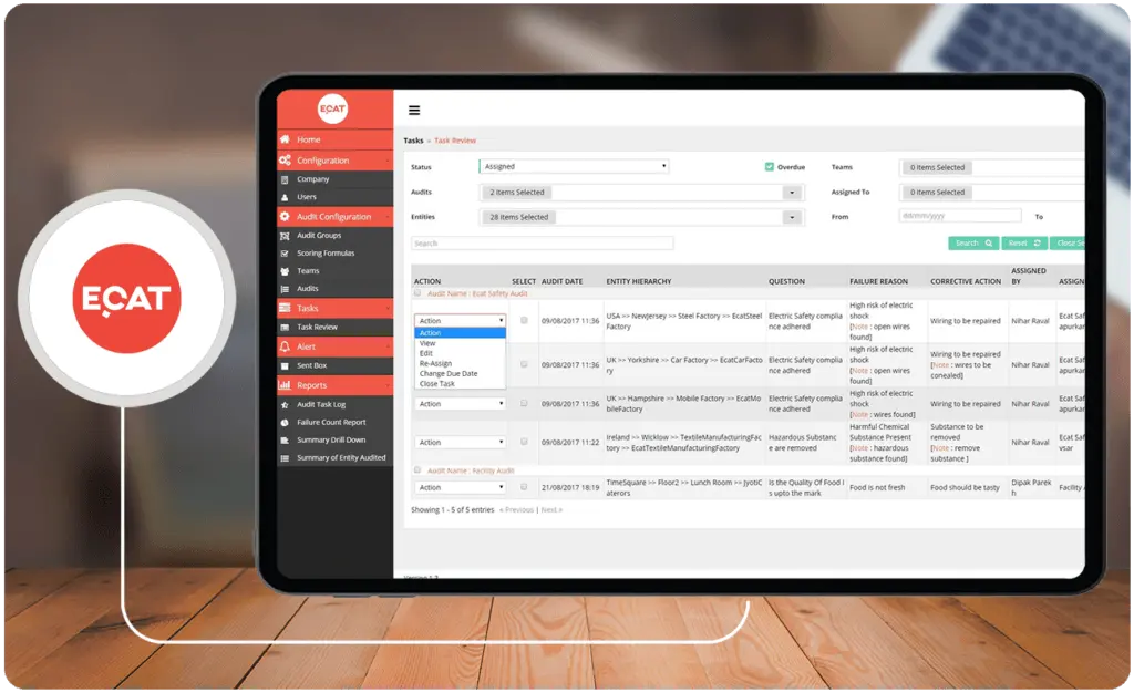
ECAT, which stands for Electronic Compliance Audit Tool allows users to digitize their inspection checklists, reports, and analytics. The platform is used by government agencies among other organizations to help in maintenance management and audits. The solution helps expedite inspections and collect data in real-time from as many locations and engineers as required.
The platform also connects to other solutions such as business information systems. Moreover, the product can be accessed using mobile devices, thanks to its native apps for both iOS and Android devices.
Key Features
- Go paperless with inspection checklists and audits
- Shareable drillable reports
- Automation tools for collating data and workflow management
- Task scheduling for corrective actions such as maintenance orders
- Supports multiple locations and sites
- Add pictures and attachments
- Live dashboard for inspections and audits
Price
- Custom pricing
14. eMaint CMMS: Web-Based Maintenance Management System
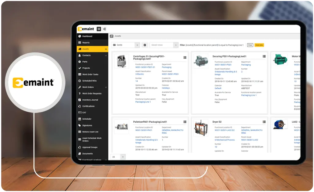
eMaint CMMS is a cloud-based maintenance management system by Fluke, a leader in maintenance and construction hardware and software products. The platform is used by organizations of different sizes in a wide range of industries, including the public sector. eMaint CMMS offers users key maintenance management features in its modules for asset management, work orders management, and PM tasks and schedules.
Comprehensive CMMS solutions like eMaint also provide users with instantly generated reports and dashboards to increase operational visibility. Moreover, it can be accessed through mobile devices via its native applications for iOS and Android users.
Key Features
- Work order management solution
- Provides users with inventory management capabilities
- Track, make notes, and manage assets across multiple locations and sites
- Use mobile phones for mobile maintenance checks and reporting
- Schedule maintenance operations
- Create interactive plans, maps, and storage to visualize assets and geographical location
- Includes the eMaint Sanitation module
- Predictive maintenance for planning
- Preventive maintenance for contingencies
- Generate real-time reports
Price
- Team $69 per user, minimum of three users per month
- Professional $85 per user, minimum of three users per month
- Company $120 per user, minimum of five users per month
15. iMS Suite: Intuitive Municipal Management Solutions
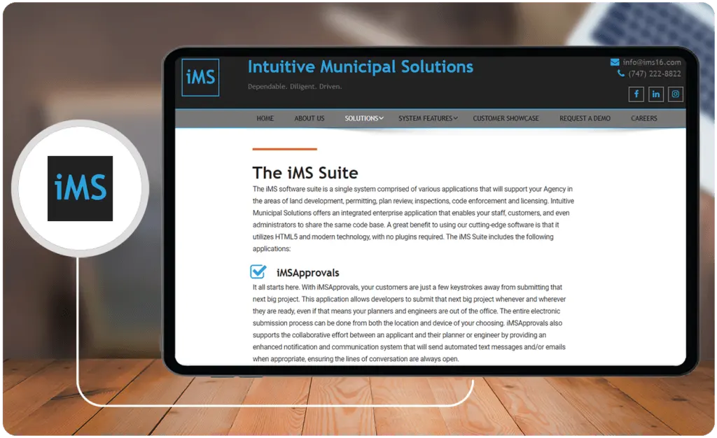
iMS Suite is a collection of various applications for community development departments. It has features for managing land development, plan review, permitting, code enforcement, licensing, and inspections. The platform is cloud-based busting HTML 5 and modern technology. Hence, no plug-ins are required to run it.
The suite includes iMSApprovals for applications management, iMSPermits for permitting management, iMSEnforce for easy citizen reporting, and iMSLicenses for cloud-based business license or home occupation permit services. Moreover, the company is known for its proactive hands-on customer service. They also provide customization options for cities and municipalities.
Key Features
- Easy cloud-based project submissions and approvals
- Enhanced communication and notification system for collaboration
- Streamlined permitting workflows
- Real-time reports on the status of inspections and reviews
- Online payment support
- Capture and document violations on the spot
- Streamline business licensing and home occupation permit workflows
- Citizen-facing web-based tools for collaboration, application, and reporting
Price
- Custom pricing
16. MuniLogic: Cloud-Based Digital Solutions for Municipalities, Counties, and Cities
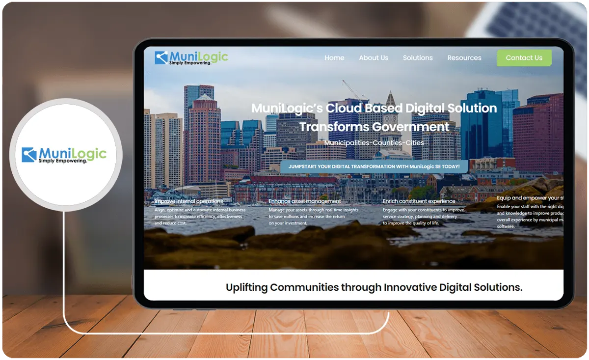
MuniLogic offers users a suite of solutions for digital transformation. This municipality management software solution includes robust features for public works management. These include features for managing properties, tax, GIS mapping, licensing, permitting, and zoning, among others. It is also known for its comprehensive roadway asset management module, complete with maintenance management and reporting. In addition, it carries some of the features of the best workforce management software.
The company also offers additional services, including GIS consulting, digital transformation consulting, digital risk management service, and setting up MyGovLinks, among many others.
Key Features
- Code compliance and violation history
- Manage permit and inspection
- Field staff scheduling
- Issue and manage all types of licenses from plumbing to amusement
- Roadway module for public works management
- Create relationships using GIS mapping data
- Document management
- Maintain the value of assets using different methods for GASB34 reporting
- Work order management
- Asset management linked to mapping, reporting, and documents modules
- Create and modify routes for collections
Price
- Custom pricing
17. CityReporter: Cloud-Based Inspection, Management, and Tracking Software

CityReporter is a popular inspection, management, and tracking software used in managing public works operations. It helps users meet national and local regulatory requirements. Its features include those for managing work orders, inspections, and maintenance activities, among others. Moreover, it also allows users to track staff, devices, equipment, vehicles, and stationary assets.
It also sports communication tools such as comments and notes along with instant access to comprehensive full record history. The product is being used to streamline inspections needed for roads, sidewalks, landfills, water and sewage systems, pools, parking lots, and trails, among others.
Key Features
- Streamline work order management processes
- Full visibility of history
- Inspection management
- Comprehensive stationary asset tracking
- Track staff and devices
- Manage ongoing maintenance of equipment and vehicles
- Customer-facing solutions to help manage customer concerns
- Task management
- Communication tools such as notes and comments
- GIS mapping layers
- Push notifications for work orders
Price
- Custom pricing
18. LAMA Suite: GIS-Based Integrated Local Government Software Solution
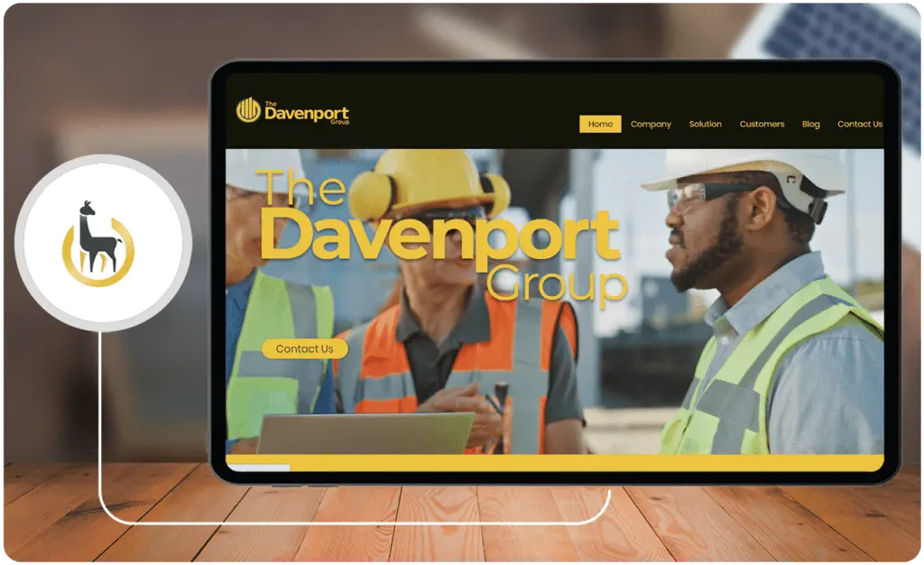
LAMA Suite by The Davenport Group is a GIS-based integrated local government software solution for managing work orders, code enforcement, licensing, permitting, and project planning. LAMA Suite can be cloud-hosted or users can choose to have an on-premise client. It has features for managing assets, inventory, work orders, inspections, and maintenance. The platform is also accessible via its mobile applications. Hence, field personnel can be kept in the loop and send updates in real-time.
Key Features
- GIS-based local government management software suite
- Streamline permitting and planning processes
- Helps local governments enforce codes and regulations
- Improve licensing processes
- Perform mobile inspections with photo documentation
- Electronic plan review capabilities
- Work orders management
- Public assets and infrastructure management
- Track real and movable property
- Maintenance scheduling and history
- Online application and tracking
- Find work orders using GIS mapping
Price
- Custom pricing
19. BOSS811: Cloud-Based One Call Ticket Management Solution for Public Utilities
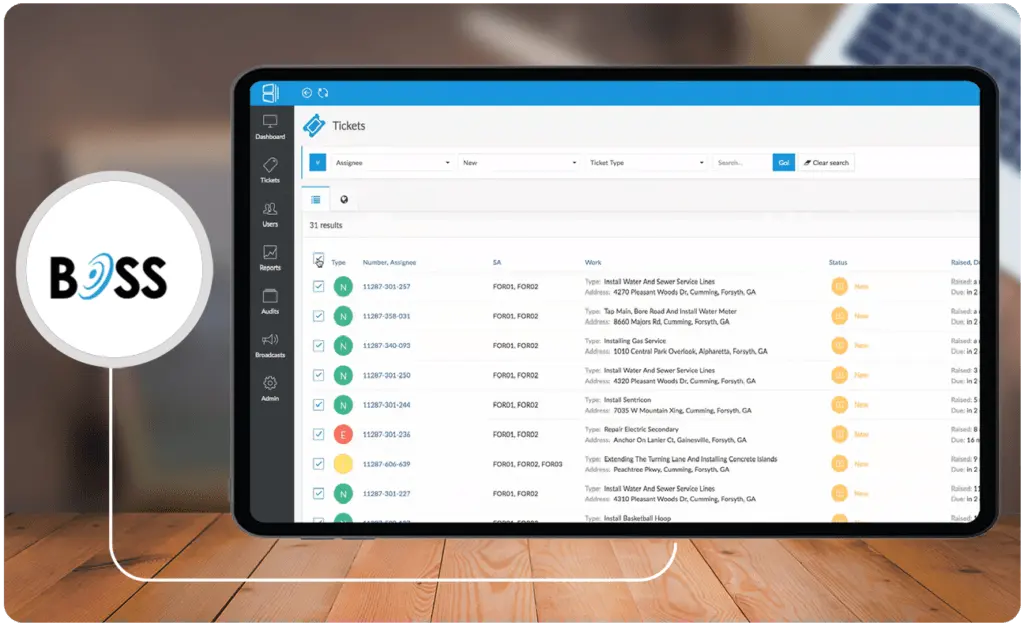
BOSS811 is a cloud-based ticket management solution useful in public works scenarios, from maintenance to inspections. The platform is also billed as a damage prevention solution used primarily in public utilities. It uses GIS mapping as well to locate tasks and even create workflows. Also, it provides driving directions using the most efficient route to make it to their tickets.
The platform also has advanced screening capabilities for routing tasks and workflows. Also, automations for ticket preprocessing are available. For mapping, the platform integrates with Google Maps and ESRI products such as ArcGIS. Lastly, it has mobile applications for both Android and iOS devices.
Key Features
- Cloud-based ticket management
- Maintenance work order management
- Map-based workflows and automation
- Advanced screening to preprocess tickets
- Manifest generation for creating sketches of site that are useful to excavators
- Auto-clear tickets based on set parameters
- Dashboards and reports
- Analytics for compliance
- Mobile applications
Price
- BOSS811 has two plans—Professional and Enterprise—offered at custom subscription prices.
20. WaterSmart: Customer Engagement Suite for Public Water Utilities
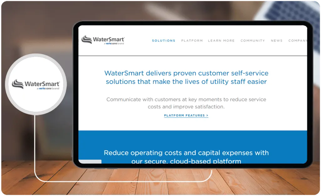
WaterSmart is a comprehensive customer engagement suite for water utility organizations. It is basically a CRM solution designed to meet the needs of water utility customers—from customer service to online payments. Features include an analytics dashboard, quick bill explainer, and communication tools. Moreover, the platform has a unique interactive money- and water-saving recommendations library.
Aside from the usual alerts, utility end-users also receive My Use Notifications if their water use is higher than normal. Also, the platform is mobile-ready and can be accessed using any mobile device. Lastly, the platform provides users with real-time benchmarks using data from WaterSmart systems with 4 million meters under the company’s management across 120 water utility partners.
Key Features
- CRM capability
- Advanced leak alert algorithm
- Anomalous water usage notifications and bill forecast
- Customer portal and bill explainer
- Interactive money- and water-saving recommendations library
- Form creator for gathering customer information
- Custom lists and group messenger for mass customized outreach
- Customer segmentation and geospatial analytics
- Rebate program participation metrics
- Online payment support
- Performance benchmarks
- Notifications and alerts
Price
- Custom pricing
What are the best practices For implementing public works Software?
To ensure a successful rollout and operation of public works software, agencies should establish clear objectives and benchmarks from the outset. Start with a comprehensive needs assessment that includes input from all stakeholders, ensuring that the software aligns with existing processes and long-term infrastructure goals. It is essential to plan phased implementations, allowing teams to adapt gradually and provide feedback for iterative improvements. In addition, securing full executive buy-in and investing in targeted training programs can significantly boost user adoption and efficiency. Agencies should also focus on seamless integration with complementary digital solutions, such as marketing platforms, to enhance communication and data analytics across departments. Finally, continuously monitoring performance against established KPIs and adjusting strategies based on real-time insights will help maintain operational excellence and drive sustainable outcomes.
How can public works software improve sustainability efforts?
- Promote environmentally-friendly practices: By utilizing data analytics and predictive maintenance tools, public works software can identify energy-saving opportunities, reduce resource consumption, and help in selecting eco-friendly materials. This supports sustainable practices and aligns with green initiatives.
- Reduce carbon footprint through optimized operations: With route optimization, asset tracking, and fleet management modules, public works software can minimize fuel consumption and emissions by planning efficient routes for transportation and maintenance vehicles.
- Support water conservation efforts: Public works software with water management modules, such as leak detection and usage monitoring, can help reduce water waste. It allows agencies to proactively address issues in water utilities, enhancing conservation efforts.
- Facilitate smart infrastructure planning: Using GIS data and lifecycle cost analysis, public works software enables better planning for long-lasting infrastructure. It helps choose locations and designs that minimize environmental impact, supporting sustainable urban development.
Emerging Trends in Public Works Software
Public works software is continuously evolving, adapting to new technological advancements and the changing needs of infrastructure management. Here are some of the most significant trends shaping the future of these tools:
1. AI-Driven Predictive Analytics
Artificial intelligence (AI) is revolutionizing forecasting and decision-making processes. By analyzing vast datasets, AI can identify patterns and predict potential issues, such as maintenance needs or cost escalations, long before they occur. This not only improves efficiency but also reduces costs by enabling proactive interventions.
2. Integration with IoT Devices
The Internet of Things (IoT) is becoming increasingly important in public works. IoT-enabled sensors can monitor infrastructure in real-time, providing critical data about asset performance and environmental conditions. When paired with robust software, these insights can guide maintenance schedules and enhance operational visibility.
3. Sustainability and Green Infrastructure
As environmental concerns grow, public works software is incorporating features to support sustainability initiatives. From lifecycle cost analysis for eco-friendly materials to carbon footprint tracking, these tools help agencies align with green infrastructure goals.
4. Enhanced Collaboration Through Cloud Solutions
Cloud-based platforms are enabling better collaboration among teams, stakeholders, and contractors. By centralizing data and providing real-time access, these solutions ensure everyone stays aligned throughout a project's lifecycle. Additionally, integrated support systems, often paired with help desk tools like those listed in our help desk tools list, streamline communication and issue resolution.
5. Advanced GIS Capabilities
Geospatial Information Systems (GIS) continue to evolve, offering more sophisticated mapping and visualization tools. These advancements help agencies better plan and implement projects by providing accurate spatial data and insights.
6. Cybersecurity Enhancements
As public works software becomes more interconnected, protecting sensitive data is a growing priority. Modern platforms are adopting advanced security measures, such as encryption and multi-factor authentication, to safeguard information and ensure compliance with regulations.
By staying abreast of these trends, public works agencies can leverage technology to improve efficiency, transparency, and sustainability. The continued evolution of these tools promises a brighter future for infrastructure management, benefiting both governments and the communities they serve.
What is the best public works software for you?
The answer to this question really depends on what you need. Also, as mentioned, public works software solutions vary. Some are quite general and some are very specific. Some like GIS mapping tools just focus on that area but they do it very well. You would need other tools on top of them to track assets, conduct analytics, create reports, and many more. Not one solution can really solve everything all at once.
Moreover, the answer also depends on what issues you need solutions for. You could assess weak points. For instance, this could be your CRM, analytics, field service management, GIS mapping, or online digital services. If this is the case, maybe you can do all right with just adopting a standalone solution for a single aspect.
But if you are looking to find a platform that has the basic framework or system of public works, you would do well with solutions like Cityworks. Solutions like this provide users with a GIS-based framework to locate all assets and manage public works tasks, from construction and repair to sanitation and inspections. Also, these tools also come with analytics features such as quick dashboards and drillable reports. So, they provide users with valuable real-time visibility and the chance to make data-driven decisions.
With such a platform, users will come closer to mitigating inefficiencies, inaccuracies, and misinformation. Moreover, they can streamline processes and align them together with other government processes to optimize spending and offer the best public works services possible. This, of course, can be done through integrations with other government software solutions. So, it is important to choose products that can work well with other solutions.
Key Insights
- Digital Transformation in Public Works: The shift to digital technology is pivotal for managing public works efficiently, including issuing permits, work orders, planning budgets, and preventing cost escalation.
- Market Growth: The global market for legal case management software was valued at $0.776 billion in 2020 and is projected to reach $1.91 billion by 2028, growing at a CAGR of 12.4%.
- Challenges in Public Works: Inaccuracies in demand forecasting and cost estimations are prevalent, leading to inefficiencies and underfunding, particularly in the transportation sector.
- Importance of Software Solutions: Effective management of public works requires integrated software solutions that handle demand forecasting, costing, labor management, predictive maintenance, geographical mapping, and financial management.
- Top Software Solutions: Key public works software includes Cityworks, STAR Road, EnerGov, MyGov, Elements XS, PubWorks, BigChange, and BluePrince, among others.
References:
- American Society of Civil Engineers. (2021, April 16). ASCE’s 2021 Infrastructure Report Card. ASCE.
- Flyvberg, B., Skamris Holm, M. K., & Buhl, S. L. (2004). What causes cost overrun in transport infrastructure projects? Transport Reviews, 24(1), 3-18. Taylor & Francis.
- Flyvbjerg, B., Skamris Holm, M. K., & Buhl, S. L. (2005). How (In)accurate are demand forecasts in public works projects?: The case of transportation. Journal of the American Planning Association, 71(2), 131-146. Taylor & Francis.
- Statista. (2022, May 2). U.S. private and public construction 1993-2021. Statista.
Other Things You Should Know About Public Works Software Solutions
Public works software integrates various management areas such as demand forecasting, costing, labor management, predictive maintenance, geographical mapping, and financial management to streamline operations and improve efficiency in public works projects.
Digital transformation enables public works agencies to streamline workflows, improve accuracy in case and evidence analysis, enhance productivity, and provide real-time visibility into project progress and costs, thereby preventing inefficiencies and cost escalations.
Essential features include work order management, asset management, GIS mapping, mobile accessibility, integration with other systems, real-time analytics, and reporting tools.
Some leading solutions include Cityworks, STAR Road, EnerGov, MyGov, Elements XS, PubWorks, BigChange, and BluePrince. Each offers unique features tailored to different aspects of public works management.
GIS integration provides a visual representation of assets and project locations, facilitating better planning, tracking, and management of public works activities. It also helps in identifying potential issues and optimizing routes for maintenance and service delivery.
Without proper software solutions, public works agencies may face inefficiencies in planning and implementation, inaccurate demand forecasting, cost escalations, poor asset management, and a lack of real-time visibility, leading to increased costs and delays.
In 2026, top public works software solutions include Cityworks, Cartegraph, and AssetWorks. These solutions offer comprehensive asset management, work order management, and integration capabilities. They enhance efficiency and productivity, helping public works departments in planning, implementation, and maintenance tasks essential for effective community infrastructure management.
Yes, many public works software solutions offer customizable features and modules that can be tailored to meet the specific needs of different public works departments and projects.
Predictive maintenance helps in identifying potential issues before they become critical, thereby reducing downtime, extending the life of assets, and saving costs associated with emergency repairs.
Many public works software solutions offer APIs and integrations with other government systems, such as ERP, financial management, and CRM systems, enabling a seamless flow of information and improved coordination across different departments.


