2027 Geosciences Roles at the Center of AI-Enabled Earth Monitoring

Co-Founder and Chief Data Scientist
Facing a surge in satellite data volume, geoscientists struggle to integrate AI-driven analytics into real-time earth monitoring workflows without inflating project timelines or budget overruns. The U. S. Bureau of Labor Statistics projects a 7% growth in geoscience-related jobs by 2032, reflecting increasing demand for professionals adept at combining domain expertise with AI tools. Yet many candidates hesitate due to limited access to flexible, industry-aligned programs that accommodate working professionals or non-traditional students balancing upskilling with existing commitments. Recognizing this gap is essential for strategizing educational choices. This article examines emerging geosciences roles shaped by AI and identifies practical education pathways enabling timely, effective workforce integration.
Key Things You Should Know
- AI integration demands geosciences professionals adept in advanced data analytics; 62% of employers in a 2024 US Geological Survey report prioritize hybrid domain and AI skills, forcing curricula tightening and delayed workforce entry.
- Rising AI reliance reallocates geosciences roles from fieldwork to remote data interpretation, with 48% workforce shift reported by the National Science Foundation, driving demand for redeployment reskilling that lags available training programs.
- Certification costs for AI-augmented geosciences roles have surged 27% since 2023, per the Department of Labor, creating financial barriers that extend time-to-hire and disproportionately affect mid-career pivots.
How are AI-enabled Earth monitoring technologies transforming careers and roles in the geosciences?
The shift toward AI-driven Earth monitoring career opportunities in geosciences requires professionals to move beyond traditional data collection to advanced modeling and interpretation. Over 70% of new Earth observation research incorporates machine learning or deep learning, signaling a clear demand for candidates with integrated expertise in AI methodologies and domain knowledge. Employers now expect proficiency in programming languages such as Python or R, experience with cloud platforms, and familiarity with AI frameworks like TensorFlow combined with geospatial information system (GIS) skills.
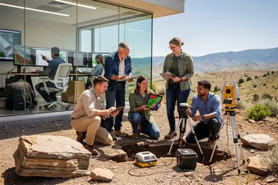
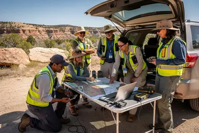
In practical terms, geoscientists in natural disaster management illustrate this transformation by designing predictive deep learning models for flood or wildfire risks using multispectral satellite data. These hybrid roles demand balancing automated AI outputs with ground-level validation to ensure reliability under varied conditions. This operational shift increases the complexity of typical geosciences job roles and skills, as professionals must address issues like data bias, algorithm transparency, and uncertainty quantification.
Career pathways increasingly necessitate formal qualifications or certifications in AI and data science, pressuring those without such skills to pursue additional training. Entry-level positions often involve curating datasets to train AI models, whereas senior roles focus on algorithm development and cross-disciplinary collaboration involving climatology and remote sensing. The transition requires a steep learning curve and commitment to ongoing skill enhancement.
For those evaluating options, understanding what can you do with an environmental science major is critical to strategically align educational choices with evolving workforce demands.
What geoscience degrees best prepare students for AI-focused Earth observation and monitoring work?
Employers in AI-driven environmental monitoring prioritize candidates with geosciences degrees that marry Earth system science fundamentals and advanced computational skills. Graduates focused solely on traditional geology or meteorology often face significant obstacles adapting to AI-enabled tasks, whereas programs emphasizing machine learning, remote sensing, GIS, and coding languages like Python or R address this gap. Practical expertise with large Earth observation datasets and real-world applications such as disaster response or climate trend forecasting is essential for immediate job impact.
The best geosciences programs for AI-enabled environmental monitoring embed AI course components or offer joint degrees involving computer science, which materially improve employability by reducing the typical AI skills gap. This integration responds directly to workforce realities where training state-of-the-art geoscience foundation models can cut data needs by up to 90% and boost predictive accuracy by 10-30%, streamlining environmental decision-making processes.
Students pursuing geosciences degrees for AI-driven Earth observation should consider tradeoffs between domain depth and computational breadth. For example, dataset scarcity in certain regions demands proficiency in transfer learning and augmentation techniques, often covered in specialized graduate programs or industry certifications.
Those evaluating options might compare interdisciplinary curricula balancing physical geosciences with applied data science, while also noting affordability as a factor; resources listing environmental engineering degree online options can inform decisions when cost constraints intersect with educational goals.
Which geoscience job roles work most directly with AI, remote sensing, and Earth data?
Geoscience roles that interface with AI and remote sensing technologies require a nuanced skill set blending domain expertise and technical fluency. For instance, atmospheric modelers employing AI models like the European Centre for Medium-Range Weather Forecasts' "AIFS" demonstrate significant tradeoffs by achieving near-real-time, 10-day forecasts at a fraction of traditional computational costs without sacrificing accuracy. This balance is crucial given operational demands for timely, reliable environmental data.
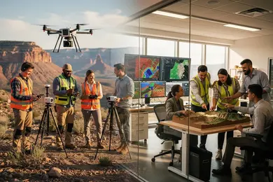
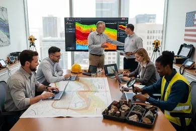
Remote sensing analysts must process massive satellite and drone data streams, deploying machine learning to automate tasks such as land cover classification and hyperspectral imaging. These positions demand proficiency in programming languages like Python or R and a thorough understanding of AI pipelines, underscoring the complexity behind Earth data analysis and interpretation jobs in geosciences using AI tools.
Data scientists within geosciences are often challenged by limited labeled datasets and the interpretability of their models, requiring active collaboration with field experts to ensure relevant, actionable outputs. Employers now prioritize candidates who combine foundational geoscience knowledge with experience in AI frameworks and scalable cloud infrastructure, as deployed models must maintain operational integrity at scale.
Real-world scenarios like wildfire monitoring emphasize that seamless integration of these specialized roles determines the effectiveness of AI-powered environmental monitoring. Upskilling through targeted graduate study or certificate programs can ease transition hurdles but must be carefully evaluated against workforce demand and practical constraints. Prospective students evaluating library science degrees online may find parallel lessons in balancing domain expertise with technical specialization to address evolving job markets.
How do online geoscience programs in Earth monitoring compare with campus-based options?
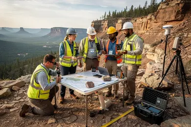
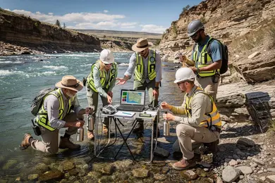
Choosing between campus-based geosciences degrees and online earth monitoring courses requires understanding critical tradeoffs in workforce readiness. While online geosciences programs for Earth monitoring in the United States offer theoretical instruction and AI-driven data tools comparable to campus options, they generally lack immersive field experiences vital for sensor calibration and spatial data validation. Professionals in flood management, for example, must interpret near-real-time AI flood detection outputs-a skill sharpened by direct involvement in field data confirmation. A 2024 global flood-mapping experiment by NASA illustrated how advanced AI systems detected 4-8 times more flood events with latency reduced to under 12 hours, emphasizing the importance of hands-on validation alongside digital analysis.
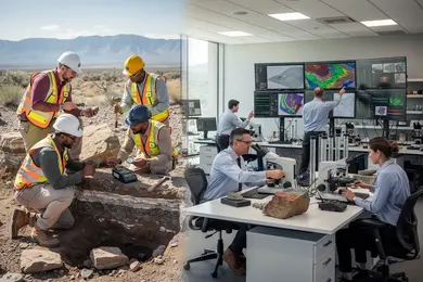
Online programs enable flexible, accelerated entry into roles primarily focused on data analysis, modeling, or AI application within government or private sectors. However, employers consistently seek proven physical site assessment capabilities and ground-truthing experience, often acquired through campus programs delivering specialized equipment access and face-to-face mentorship. This practical exposure remains indispensable for positions in environmental consulting and disaster response agencies.
Decision-makers should consider career goals carefully, as online credentials vary widely in employer recognition and quality. Supplementing asynchronous coursework with internships or collaborations is crucial to bridge practical skill gaps. Prospective students evaluating pathways, including those weighing a mechanical engineering online degree or related fields, must prioritize accreditation and faculty expertise to ensure multidisciplinary readiness in AI-enabled Earth monitoring roles.
What courses and technical skills are essential for geoscience students entering AI-driven roles?
Securing AI-focused roles within geosciences demands more than memorizing standard coursework; it requires integrating domain knowledge with coding, statistical rigor, and practical AI tool usage. Proficiency in languages like Python and R enables data wrangling and algorithm creation, while experience with machine learning frameworks such as TensorFlow or PyTorch is essential when addressing challenges like satellite image interpretation or complex climate data pattern recognition.
A strong grounding in spatial statistics and multivariate analysis complements hands-on geographic information systems (GIS) skills-indispensable when combining classical geoscience data with AI outputs for actionable insights in environmental monitoring and resource management.
Consider recent research on AI-based sea-ice mapping showing a 40% reduction in boundary detection errors compared to traditional passive microwave approaches, delivering daily, 1-km Arctic-wide data. Such improvements highlight the value of expertise in remote sensing, high-resolution modeling, and uncertainty quantification, which employers in government and research sectors prioritize.
Practical knowledge in cloud computing platforms and version control (e.g., Git) supports collaborative workflows expected in professional settings. Equally important are skills in model validation and bias correction to ensure dependable AI systems under operational constraints.
- Strong statistical and mathematical foundations applied to geospatial datasets
- Competency in AI frameworks tailored for Earth observation
- Hands-on GIS and remote sensing data processing experience
- Collaboration skills using cloud and version control tools
This combination delineates a divide between graduates limited to legacy roles and those equipped for projects like predictive hazard modeling or resource exploration using AI-driven geoscience data. Balancing intense technical coursework with internships involving real-world datasets remains a practical necessity for those seeking this career transition.
How can prospective students evaluate accreditation and program quality for geoscience and Earth data degrees?
Institutional accreditation and program-specific recognition significantly shape employability in geosciences roles that integrate AI-driven Earth monitoring. Regional accreditation from established U.S. agencies confirms baseline academic quality, but alignment with specialized bodies such as the Geological Society of America or American Geophysical Union better signals curriculum relevance to employers seeking applied expertise.
Programs demonstrating practical engagement with current datasets-illustrated by the 2024 AI for Ecosystems, Agriculture, and Urbanization study where transformer models enhanced global land-cover classification accuracy to 82-85%, outpacing earlier approaches by 5-10 percentage points-better prepare graduates for workforce demands. Employers prioritize candidates with hands-on experience applying advanced AI to real-time or frequently updated satellite data rather than outdated or static repositories.
Key considerations beyond accreditation include faculty research impact in top-tier Earth science journals and integration of contemporary AI tools within coursework. Graduates linked to environmental consulting firms, government agencies, or AI-driven resource management consistently emerge from programs with robust industry partnerships and regular data updates.
For working professionals, program flexibility-such as part-time, hybrid formats, and virtual labs-is essential but should not come at the expense of access to computational skill-building or internship opportunities that enhance job readiness. Employment placement rates and alumni career trajectories offer practical benchmarks to assess educational value in this dynamic field.
What are the typical admission requirements and prior preparation for AI-oriented geoscience programs?
Successful admission to AI-focused geoscience programs demands more than foundational knowledge; it requires demonstrated prowess in quantitative subjects like calculus, linear algebra, and probability, combined with proficiency in programming languages such as Python, R, or MATLAB. Candidates must also possess substantive earth science expertise, often proven through prior work with geospatial data analysis, remote sensing, or environmental modeling. Graduate-level applicants typically need a bachelor's degree in geosciences, computer science, engineering, or related STEM fields, reinforced by coursework in data science and machine learning. Practical experience, such as internships or research involving satellite data or sensor fusion, critically enhances competitiveness given employers' emphasis on applied AI skills.
A practical scenario to consider: AI models analyzing multi-sensor satellite data recently improved marine debris detection, identifying floating plastics with 80%-90% success, surpassing traditional threshold algorithms under 50%. This operational edge reflects workplace demand for candidates skilled in handling heterogenous environmental datasets, validating models rigorously, and extracting domain-tailored features.
Prospective students face a tradeoff between programs emphasizing theoretical AI and those focused on applied environmental challenges. The latter typically leads to stronger immediate job prospects in sectors like marine monitoring, fisheries, or coastal risk management. Employers prioritize professionals who can translate AI outputs into actionable environmental risk assessments rather than solely developing novel AI algorithms.
How long do geoscience programs focused on Earth monitoring typically take, and what do they cost?
Choosing an educational path in geosciences demands a nuanced appraisal of time, cost, and practical outcomes. Certificate programs, typically lasting 6 to 12 months and priced between $5,000 and $15,000, offer rapid workforce entry but may restrict growth without advanced study. Bachelor's degrees require 3 to 4 years and can total $40,000 to $120,000 for tuition alone, providing comprehensive training but at a notable financial and time commitment.
Master's programs, lasting 1 to 2 years with tuition ranging from $20,000 to over $60,000, often add specialized skills that align with evolving employer demands, while doctoral programs extend 4 to 6 years but frequently offset costs through funding or assistantships. Prospective students should factor in logistical elements like fieldwork, software licensing, and computing resources, which are often excluded from tuition.
Employers explicitly prioritize proficiency in remote sensing, GIS, data analytics, and machine learning-skills that directly improve efficiency and discovery rates. For instance, machine-learning-assisted methods in mineral exploration have boosted successful targeting by 20-30% while reducing costs by up to 20%, illustrating the tangible value of integrating GeoAI competencies.
Individuals must weigh accelerated credentialing's immediacy against the broader theoretical and applied expertise afforded by longer programs, recognizing that mid-career pivots may be constrained by either time or financial resources.
What is the salary potential and job outlook for geoscientists specializing in AI-enabled Earth monitoring?
Geoscientists integrating AI into Earth monitoring roles face a clear division between those who adapt and those who risk obsolescence. Starting salaries in this niche range from $75,000 to $95,000, with mid-career professionals earning up to $140,000. This variation hinges on demonstrated expertise in AI model development, satellite data workflows, and real-time processing-skills that increasingly shape employability.
The stark workforce implication: practical proficiency in AI-enabled data compression can reduce satellite data downlink volume by up to 95%, enabling more frequent and higher-resolution observation missions without bandwidth expansion. Those unable to develop or manage such workflows will find opportunities narrowing, as automated systems supplant manual data handling.
- Master AI models tailored for satellite data prioritization to meet evolving mission needs
- Gain fluency with cloud platforms managing large geospatial datasets for timely analysis
- Develop adaptability to collaborate across AI engineering, data science, and mission operations teams
- Understand how balancing data fidelity against AI compression impacts outcomes and funding pathways
For mid-career professionals shifting into this domain, targeted upskilling in deep learning and edge computing aboard satellites offers meaningful premiums and near-term job security. However, those relying on traditional remote sensing techniques face plateauing roles as automation becomes intrinsic to Earth observation missions.
How can professionals upskill or transition into AI-enabled Earth monitoring careers from related fields?
Success in transitioning into AI-focused Earth monitoring roles hinges on developing applied computational skills specific to geoscience challenges. For example, a hydrologist focused on flood prediction gains more immediate workforce traction by mastering remote sensing integration with neural networks than by studying abstract AI theory. This applied expertise mirrors hiring trends shown by tripled AI-related Earth science publications co-authored with computer scientists over the past decade, indicating rising employer demand for domain-specific tech fluency.
Professionals should seek certifications or short courses emphasizing projects with satellite imagery, time-series data, and climate models that showcase relevant AI applications. Those shifting from geology or meteorology benefit substantially from workshops fusing their domain knowledge with algorithm development for anomaly detection or forecasting. A notable barrier remains the steep learning curve combining geoscience numeracy with AI algorithm tuning, which part-time graduate certificates address by balancing flexible online formats and industry partnerships.
Employers in environmental consulting and government sectors prioritize portfolios demonstrating AI's practical deployment in Earth monitoring over generic coding ability or broad AI credentials. Advanced geoscience degrees supplemented with targeted AI upskilling may command higher salaries but require multi-year commitment. In practice, effective interoperability between AI tools and Earth data platforms outweighs credentials alone in determining employability and career sustainability.
Other Things You Should Know About Geosciences
Applicants typically must pass a government-style identity verification and a criminal-record screening before onboarding. Roles handling satellite, climate, or hazard data may also require data-access clearance, a signed confidentiality agreement, and completion of ethics and cybersecurity training within the first 30 days.
AI-enabled roles often require significant ongoing learning to keep pace with rapid tool evolution, adding to workload beyond standard tasks. While AI automates certain data processing, it introduces responsibilities for model validation, data quality control, and algorithm tuning. This shifts time from manual fieldwork to continuous technical skill upgrades, often increasing work intensity for professionals without strong computational backgrounds. Employers expect adaptability and command of AI workflows alongside domain expertise.
Solely concentrating on AI skills risks narrowing career flexibility if demand shifts or if employers prioritize holistic Earth science understanding. Deep domain expertise remains essential to interpret AI outputs correctly and bridge data analytics with geoscience phenomena. Graduates who neglect foundational geoscience knowledge may face challenges in validation, regulatory compliance, or interdisciplinary collaboration. A balanced skill set ensures resilience against shifting technology trends and employer needs.
Certification in specific AI software can accelerate entry into roles requiring those exact tools but often has limited shelf life due to rapid software turnover. Broad geoscience credentials with AI coursework provide a more stable foundation adaptable to multiple platforms and evolving technologies. Prioritize certifications when targeting niche employers or roles demanding immediate software competence, but ensure they complement comprehensive geoscience training to sustain long-term career growth.
References
- Intelligence from above: how Earth observation and AI are transforming climate and biodiversity action | SDG Action https://sdg-action.org/intelligence-from-above-how-earth-observation-and-ai-are-transforming-climate-and-biodiversity-action/
- Artificial Intelligence Resources - eage.org https://eage.org/communities/artificial-intelligence-resources/
- What Does the Future Demand Look Like for Applied Geoscientists? https://www.aegweb.org/index.php
- Section 4. Skills Framework https://graduate.americangeosciences.org/report/section-4/
- Bachelor in Management and Artificial Intelligence https://www.kozminski.edu.pl/en/programs/undergraduate-programs-bachelor/bachelor-management-and-artificial-intelligence
- A Globally Recognized Degree - EARTH https://www.earth.ac.cr/a-globally-recognized-degree/
- The AI Career Revolution: Why Skills Now Outshine Degrees http://www.sundeepteki.org/advice/the-ai-career-revolution-why-skills-now-outshine-degrees
- Geologists: Salary, career path, job outlook, education and more - RaiseMe https://www.raise.me/careers/life-physical-and-social-science/geoscientists/geologists/
- Geoscientific AI Solution | Mineral Forecast https://www.mineralforecast.com/geoscientific-ai/
- When Geoscience Meets Foundation Models: Towards General Geoscience Artificial Intelligence System https://arxiv.org/html/2309.06799v3