2027 GIS Analyst Roles You Can Target With an Environmental Science Degree

Co-Founder and Chief Data Scientist
Facing the urgent need to assess and manage climate risks, many environmental science graduates confront a critical bottleneck: how to translate interdisciplinary knowledge into specific GIS analyst roles that drive actionable insights. The U.S. Bureau of Labor Statistics projects a 10% growth in environmental technician positions, emphasizing data-driven spatial analysis skills, yet many programs lack flexible, career-aligned pathways.
Meanwhile, over 55% of adult learners prefer part-time or online studies according to the National Center for Education Statistics, reflecting a growing demand for adaptable education that doesn't stall career momentum. This article identifies targeted GIS analyst roles attainable with an environmental science degree and clarifies which options best align with diverse professional goals and realities.
Key Things You Should Know
- Demand for GIS analysts with environmental science degrees grew 12% since 2023, driven by EPA and USGS projects favoring advanced spatial modeling skills, pressuring candidates without specialized geospatial training.
- Employers now prioritize proficiency in Python and R scripting alongside GIS software, forcing a costly tradeoff between investing in multidisciplinary coding skills versus pure domain knowledge, which alters hiring dynamics in public and private sectors.
- Median time-to-hire for environmental GIS roles stretched by 25% due to skill mismatches reported by the Bureau of Labor Statistics, compelling candidates to weigh additional certification costs against immediate workforce entry.
What does a GIS analyst do, and how does this role connect to environmental science?
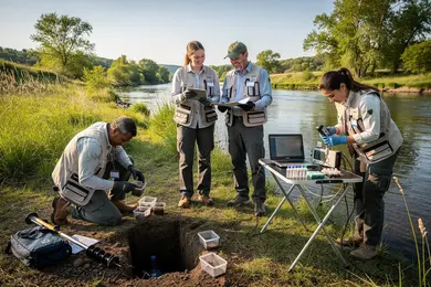
A GIS analyst's role extends beyond basic map-making to directly supporting environmental decision-making through the integration of spatial technology with ecological data. This link between GIS analysis and environmental science applications requires interpreting complex geospatial data on natural resources, pollution, and ecosystem dynamics, often with immediate regulatory implications. For example, a GIS analyst at a state environmental agency may map wetland distributions to evaluate flood risks or track habitat fragmentation, delivering insights that shape policy enforcement and resource management.
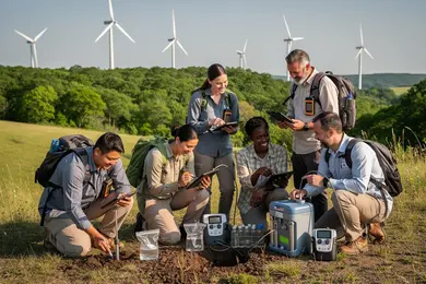
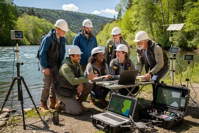
Employers prioritize candidates who combine hands-on GIS software proficiency-such as ArcGIS or QGIS-with a meaningful grasp of environmental science principles. This dual expertise supports nuanced spatial statistics, remote sensing, and visualization crucial for interpreting ecosystem trends. Given GIS analyst responsibilities in environmental science careers, professionals must also manage field data collection and resolve dataset inconsistencies that can affect project accuracy and funding continuity.
Employment prospects for this sector, representing environmental scientists and specialists, are expected to grow steadily at about 6% through 2032, presenting near 6,900 annual job openings nationwide. However, the competitive landscape favors those who obtain real-world experience with environmental datasets and can adapt rapidly to shifting regulatory priorities. Prospective students evaluating options should consider practical credentials and inquire about immersive environmental data projects, notably through an online geoscience degree, to strategically position themselves in the field.
Which GIS analyst positions can you pursue with an environmental science degree?
Targeting GIS analyst roles with an environmental science degree requires balancing foundational ecological expertise with technical GIS skills demanded by employers. Positions like environmental GIS specialists, natural resource mappers, and ecological data analysts emphasize applied spatial data interpretation to inform decisions about pollution monitoring or wildlife habitat management. These roles integrate core environmental principles with geospatial technology, a critical aspect of environmental science degree GIS career opportunities.
Beyond specialized GIS roles, options extend to urban environmental planners and climate data analysts, who apply GIS toward sustainable development and risk modeling. However, many roles require additional competencies in programming languages such as Python or R and experience with remote sensing. This technical proficiency is often a decisive factor in hiring, reflecting practical tradeoffs for graduates seeking more advanced positions in government or the private sector.
Wage data from the Bureau of Labor Statistics shows environmental scientists and specialists, including many geospatial analysts, earn a median annual income around $80,060, with experienced technical experts reaching $103,730-$134,830 depending on specialization and location. Gaining hands-on GIS experience and relevant certifications is a pragmatic strategy to access higher earning potential.
Focus on applied internships and projects within environmental consulting or regulatory agencies to align with realistic GIS analyst roles for environmental science graduates. Avoid entry-level positions with limited scope such as basic map production, which usually offer lower pay and restricted upward mobility. For prospective students weighing study options, consulting resources on the cheapest master in data science may provide strategic insights for supplementing GIS expertise through data science education.
What education, skills, and software competencies are required for entry-level GIS analyst jobs?
Bachelor's degrees in environmental science, geography, or related quantitative fields remain the baseline educational requirements for entry-level GIS analyst positions, yet job candidates must demonstrate more than academic credentials to secure employment. Employers prioritize applied proficiency in spatial data management and environmental dataset interpretation alongside core technical skills such as SQL and Python automation, which are increasingly decisive in distinguishing applicants. This reflects a shift toward analytical rigor beyond basic map creation.
Key software skills for GIS analysts with an environmental science background center on mastery of both industry-standard and emerging platforms. ArcGIS Pro and ArcMap are widely expected, while QGIS offers a viable open-source alternative. Proficiency with remote sensing tools like ERDAS Imagine or ENVI and familiarity with cloud GIS services such as Esri's ArcGIS Online or Google Earth Engine cater to the demands of collaborative environmental projects involving complex, large-scale data.
Practical workforce realities demand continuous technical skill upgrades to keep pace with evolving software and environmental regulations. For example, an analyst at a water quality nonprofit might leverage advanced scripting to automate data validation and generate dynamic reports, which can shape competitive differentiation in a typically crowded job market.
A recent Environmental Integrity Project GIS Analyst posting lists a salary range of $62,000-$82,000 per year for roles focusing on environmental enforcement and policy, underscoring how solid interdisciplinary preparation combined with real-world GIS fluency translates into competitive pay even within nonprofit sectors.
Those evaluating educational pathways should weigh these technical requirements and market demands carefully and consider complementary options like a sports science degree online for broader analytical skill development that can intersect with environmental monitoring roles.
How can an environmental science major specialize in GIS during their degree program?
GIS specialization within an environmental science degree demands balancing domain knowledge with technical proficiency in spatial analysis. Prioritizing coursework in GIS software such as ArcGIS or QGIS alongside remote sensing and spatial data management is essential to meet employer expectations for data accuracy and actionable insights. For example, a capstone project analyzing watershed dynamics using GIS layers not only develops applied spatial modeling skills but also aligns with real-world environmental consulting tasks.
Successful GIS career pathways for environmental science students depend heavily on securing internships or cooperative education placements with agencies or consulting firms. These experiences expose students to regulatory data standards and the impact assessment processes critical in resource management roles. Electives in environmental policy, statistics, and coding languages like Python or R further strengthen the capacity to automate GIS workflows and handle large datasets.
The tradeoff between deep environmental science knowledge and GIS technical expertise must be carefully considered. Dual degrees or certificates in GIS enhance employability but may extend time and cost to degree completion. Reports indicate GIS analyst roles in California offer salary ranges of approximately $74,000-$92,000, reflecting the market value of this combined skill set.
For working professionals, flexible online GIS courses with project-based learning can upskill without committing to full programs. Those evaluating a strategic shift should also consider computer science online degree options to complement GIS technical skills for broader analytical roles.
What GIS and spatial analysis courses should environmental science students prioritize?
GIS analyst roles within environmental science demand technical proficiency that extends beyond basic mapping skills. Employers expect candidates to master spatial data management, advanced geostatistics, and GIS applications like ArcGIS or QGIS, backed by hands-on experience in spatial modeling and remote sensing. For example, conservation groups require analysts who can manipulate large ecological datasets and apply predictive habitat models, leveraging both raster and vector data formats. Missing these competencies significantly reduces chances of accessing positions offering $82,000-$115,000 annually, according to 2026 Conservation Job Board insights.
Students who integrate programming languages such as Python or R into their curriculum gain essential automation and spatial data processing skills. This capability is often decisive for senior technical GIS roles, where salaries can reach $130,000. Employers increasingly prefer analysts adept at scripting workflows for tasks like landscape change detection and species distribution modeling, rather than those dependent on GUI-only tools.
Database design-particularly spatial SQL or PostGIS-and statistical analysis focused on spatial data are key to supporting complex environmental impact assessments, especially in projects commissioned by federal agencies or research institutions. For instance, environmental consultants managing watershed assessments must combine GIS and hydrological modeling skills, requiring coursework across spatial analysis and environmental data integration. Omitting these leads to narrower job prospects and hindered progression.
How do online environmental science programs compare with campus-based options for GIS training?
Practical GIS proficiency drives employer preference in environmental science roles, with campus-based programs better equipping students through hands-on labs, direct software access, and structured internships. In sectors like mining, where environmental data management is complex and compliance-driven, candidates demonstrating applied GIS skills through projects and certifications command higher salaries and improved job prospects. For example, a 2026 Intermediate Environmental Data Analyst role offered $84,000-$106,000 annually, reflecting tangible rewards for technical expertise.
Online programs provide greater scheduling flexibility, a key consideration for working professionals, but often lack consistent access to immersive software environments and real-world datasets. This gap can slow skill acquisition and reduce immediate workforce readiness unless complemented by self-directed practice or hybrid program formats that blend remote coursework with on-campus labs or virtual simulations.
Decision factors include:
- Availability of proprietary GIS databases and fieldwork opportunities, usually exclusive to campus settings
- The necessity of a robust portfolio presenting demonstrable GIS projects, especially for online learners
- Employer emphasis on verified software certifications alongside academic credentials
- Balancing flexibility against immediate technical immersion and networking access
Choosing between remote and on-site training requires assessing how each pathway aligns with one's current professional demands and the technical rigor expected within the environmental science labor market.
What is the typical career path from environmental science graduate to senior GIS analyst?
Early career roles for environmental science graduates aiming at senior GIS analyst positions hinge on securing paid, practical experience through internships or entry-level jobs where managing spatial data and proficiency with GIS software like ArcGIS and QGIS are vital. USDA-supported internships in 2026 anticipate stipends of $30,000-$70,000 annually, offering foundational exposure to geospatial analysis, data collection, and map production. These roles require solid skills in remote sensing and database management, bridging academic learning and workplace demands.
Advancement depends on demonstrating project leadership, handling complex datasets, and integrating GIS outputs with environmental modeling tools. Real-world application of environmental science principles within sectors such as natural resource management or urban planning shapes the progression beyond technician roles. Candidates face a tradeoff between deep technical specialization and maintaining broad environmental knowledge relevant to their domain, for example:
- Environmental compliance analysts focus on regulatory spatial reporting and frameworks.
- Conservation specialists prioritize habitat modeling and change detection algorithms.
While certifications like GISP add distinction, employers prioritize tangible, hands-on experience and communication skills for multidisciplinary collaboration. Continuous learning aligned with evolving GIS technologies and sector needs remains essential to remaining competitive in a labor market where promotion depends equally on technical acumen and domain-specific situational awareness.
What salary ranges and benefits can GIS analysts with environmental science backgrounds expect?
GIS analysts with an environmental science foundation face a salary spectrum ranging from about $53,000 to $120,000 annually, depending heavily on sector and experience. Entry-level roles typically fall near the lower end, often tied to state agencies or nonprofits with constrained budgets and limited supervisory duties. Within five years, analysts advancing from GIS mapping toward environmental impact assessment can expect salary growth driven by technical skill development and regulatory fluency. Mid-career professionals working for environmental consulting firms or federal bodies generally earn between $70,000 and $90,000, reflecting their ability to manage projects independently and apply nuanced regulatory knowledge.
Senior GIS analysts, especially those specializing in areas like habitat restoration or climate risk, command salaries at or above $100,000. These roles require mastery of complex geospatial modeling, leadership in compliance programs, and cross-disciplinary collaboration. However, compensation is not purely monetary; benefits vary widely and influence total rewards. Public sector positions often include health insurance, retirement plans, and loan repayment options, while private firms may offer performance bonuses linked to certifications such as GISP or PMP.
Negotiations should highlight both GIS certifications and applied environmental science expertise to target upper salary quartiles. Candidates must also weigh regional cost-of-living differences and sector-specific perks, which significantly affect net compensation even when gross salary figures appear similar.
What professional certifications or credentials strengthen your qualifications as a GIS analyst?
Pursuing certifications like the GIS Professional (GISP) credential signals to employers a tested combination of education, professional experience, and documented contributions, which can drive higher salary offers and reduce onboarding time in environmental and municipal GIS roles. For example, municipal agencies in Monterey Park, California, often pay $6,515-$8,335 monthly for analysts proficient in GIS workflows supporting planning and environmental decisions. However, the decision to invest time and money into certification should be weighed against immediate job requirements and sector-specific value.
Technology-specific credentials, such as Esri's ArcGIS Desktop Professional and ArcGIS Enterprise certifications, target software proficiency that employers in government and environmental sectors prioritize for operational readiness. In contrast, certifications like the Certified Mapping Scientist recognize niche skills in remote sensing, which may not carry the same weight in local government roles focused on GIS software application.
Given these dynamics, a pragmatic approach for those pivoting into environmental science GIS roles involves combining a strong degree with select certifications aligned to employer expectations. Doing so balances the cost-benefit equation, enabling candidates to enter competitive metropolitan labor markets with credentials that demonstrate practical competence and relevance.
How can you evaluate and choose reputable U.S. environmental science programs with strong GIS offerings?
GIS competence remains a decisive factor for environmental science graduates entering workforce sectors tied to climate and resource management. Programs that embed advanced GIS courses with applied environmental analysis offer a distinct advantage, especially when combined with cross-disciplinary options like joint degrees or minors linking GIS technology to environmental science. Graduates lacking hands-on GIS experience often face narrower job prospects in specialized environmental roles.
Employment outcomes provide a practical benchmark: schools reporting robust GIS-related placement rates and competitive starting salaries give clearer insight into a program's market relevance. For instance, Canadian government labor data reveal weekly wages between $1,704.68 and $2,924.93 in environmental GIS positions, translating to annual salaries from $88,000 to $152,000-figures indicative of demand for spatial data skills in environmental sectors.
Key program attributes to prioritize include faculty engagement with active projects or partnerships involving agencies such as the EPA or USGS, practical access to GIS labs and current software like ArcGIS or QGIS, and structured internships offering tangible, regulatory or conservation-related experience. Emphasizing real-world projects over theoretical coursework improves graduate readiness and employer alignment.
Because workforce needs vary regionally, aligning curricula post-2024 with evolving priorities like data science and climate resilience strengthens career mobility. Finally, alumni networks and feedback loops with employers serve as vital feedback mechanisms to ensure sustained program relevance beyond initial hiring.
Other Things You Should Know About Environmental Science
Environmental science graduates aiming for GIS analyst roles in 2027 should master tools like ArcGIS, QGIS, and GPS technology. Proficiency in remote sensing tools, such as ERDAS IMAGINE, and Python programming for geospatial data analysis is also recommended to meet current industry standards.
Employers often prioritize practical GIS experience demonstrated through internships or project work embedded in environmental science programs over certifications alone. Certifications can validate skills but rarely replace hands-on application, especially in complex environmental contexts requiring data interpretation and problem-solving. Candidates should aim to combine verified project experience with relevant certifications to meet employer expectations and avoid overreliance on credentials without practical grounding.
SQL is the key database skill for GIS analyst roles in 2027, especially for querying spatial tables in PostgreSQL/PostGIS or Microsoft SQL Server. Employers also value basic data cleaning, joins, and attribute validation, because analysts often manage large environmental datasets before mapping and analysis.
References
- Top Jobs in Environmental Science | Build a Sustainable Career https://bootcampgis.com/jobs-in-environmental-science/
- What is a GIS Analyst? | Conservation Careers https://www.conservation-careers.com/what-is-a-gis-analyst/
- Geospatial & GIS Jobs Board | GEO CAREERS https://www.geo-careers.com/posts/break-into-gis-no-experience/
- Best place to study environmental science R1 or SLAC? And list all of best programs? https://talk.collegeconfidential.com/t/best-place-to-study-environmental-science-r1-or-slac-and-list-all-of-best-programs/3691333
- Exploring the Wonders of GIS in Environmental Applications | Terra Nexus https://terranexus.co/blogs/wonders-of-gis/
- How to Become A GIS Analyst - Unity Environmental University https://unity.edu/careers/gis-analyst/
- Online Environmental Science Degrees: Compare Schools https://www.degreesforgood.org/online-degrees/environmental-science/
- Geographic Information Systems Analyst Certifications: Best Credentials to Advance Your Career | Teal https://www.tealhq.com/career-paths/geographic-information-systems-analyst-certifications
- GIS Analyst | ECO Canada https://eco.ca/career-profiles/gis-analyst/
- Education Partner Directory https://thegpn.org/page/educationalpartners