2026 Remote Jobs You Can Get With a Geographic Information Systems Master's Degree
Co-Founder and Chief Data Scientist
Consider a professional with a master's degree in Geographic information systems weighing a remote job search to gain location flexibility without sacrificing career advancement. While nearly 29% of gis-related roles reported remote or hybrid options in 2024, many still demand specialized technical fluency, ongoing certification, or periodic on-site presence. Employers often prioritize candidates with demonstrated remote project management skills alongside advanced gis expertise, narrowing true location-independent opportunities.
This mismatch intensifies for those seeking fully remote roles without local licensure or substantial fieldwork. Understanding these nuances is crucial to avoid investing in qualifications that don't align with remote job market realities. This article details viable remote careers for gis master's holders and guides realistic expectations grounded in current labor trends.
Key Things to Know About Remote Jobs You Can Get With a Geographic Information Systems Master's Degree
- Many remote GIS roles focus on data analysis and cartographic modeling, requiring advanced software skills but limiting fieldwork opportunities; this tradeoff suits candidates prioritizing desktop research over onsite collection.
- Employer surveys from 2024 show 47% of GIS-related hires expect hybrid arrangements due to sensitive data handling, implying fully remote positions often demand stringent data security competencies.
- The average master's program duration and costs create timing and financial barriers, affecting accessibility for mid-career professionals considering a remote GIS transition without employer tuition support.
What Remote Jobs Can You Get With a Geographic Information Systems Master's Degree?
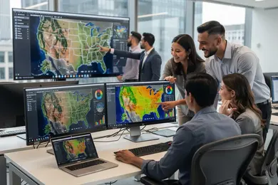
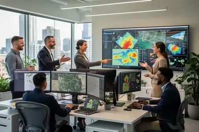
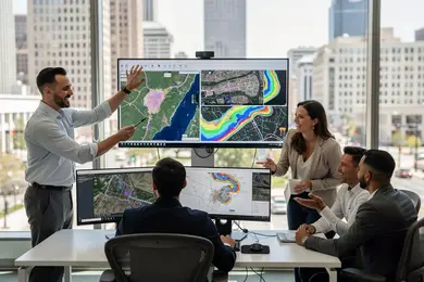
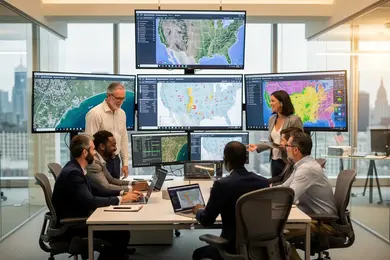
Remote roles accessible to graduates with a master's degree in geographic information systems often hinge on the nature of the employer's data infrastructure and the level of hands-on field requirements. For instance, GIS analysts typically perform spatial data management and analysis tasks that can be entirely remote, provided they have secure access to cloud-based platforms like ArcGIS Online or QGIS. However, positions such as remote sensing specialists or cartographers may demand occasional site visits or stakeholder interactions, making fully remote arrangements less common. Understanding these nuances is critical for those weighing remote job prospects because hybrid roles may offer flexibility but also require geographic proximity or travel, influencing work-life balance and location choices.
The labor market reflects increasing adoption of remote work models across environmental agencies, urban planning offices, and private consultancies, yet remote job availability can vary widely depending on the sector and project scope. A 2024 survey from the American Society for Photogrammetry and Remote Sensing reported that 42% of GIS professionals work fully remotely, with another 30% in hybrid roles, highlighting a significant shift but also indicating that nearly a third of positions still combine remote and on-site expectations. Employers often prioritize candidates with advanced technical skills in spatial statistics, database management, and cloud GIS platforms, as well as experience coordinating distributed teams, particularly in roles like GIS project manager or spatial data scientist. For career changers or working professionals, aligning job search strategies with these flexible career paths for geographic information systems graduates requires a clear-eyed view of which roles match their remote-work preferences and which demand more traditional in-person elements.
Decisions about pursuing remote job opportunities with a geographic information systems master's degree must also consider industry-specific demands and licensure or certification where applicable, especially for roles intertwined with public health tracking, disaster response, or autonomous vehicle mapping. Graduates prepared to navigate both technical complexity and communication challenges stand a better chance of securing remote positions that leverage their expertise without sacrificing operational effectiveness. Those exploring this field will benefit from targeted insights into evolving remote versus hybrid hiring patterns and should consider how their experience aligns with employer expectations in emerging GIS applications.
For example, professionals might examine hybrid openings for roles requiring periodic field data collection, balancing remote work flexibility with real-world engagement. Career strategists may also find value in exploring connections between GIS competencies and complementary credentials such as those detailed in BCBA masters programs, which can diversify their qualifications in spatial data analysis contexts.
Which Industries Hire Remote Professionals With a Geographic Information Systems Master's Degree?
Remote hiring for professionals with a master's degree in geographic information systems is uneven across sectors, largely shaped by how core job functions align with digital workflows and field requirements. Environmental consulting stands out as one of the most remote-accessible fields, since the work heavily revolves around data analysis and report generation that typically don't require onsite presence. In contrast, industries like natural resources and energy often demand hybrid roles due to site visits and regulatory compliance activities that necessitate physical presence. The U.S. Bureau of Labor Statistics notes an 8% growth in geospatial roles through 2034, with a significant portion of these opportunities emerging in tech firms focused on location analytics, which frequently support fully remote teams to leverage specialized skills globally.
Urban planning and public health sectors increasingly integrate GIS for modeling infrastructure and disease tracking, expanding remote opportunities as these fields adopt cloud-based collaboration tools. However, candidates should gauge that remote work expectations vary: tech and consulting firms may expect flexible, location-independent contributors, whereas government or resource management agencies might prioritize workers available for periodic onsite coordination. Career advancement in remote GIS roles often depends on domain expertise and the ability to translate spatial data into actionable insights without extensive in-person supervision, thus favoring applicants who demonstrate digital collaboration and independent project management capabilities.
A remote GIS professional, evaluating job offers across sectors, found that while tech companies readily hired fully remote data analysts with minimal field duties, positions in urban planning frequently required hybrid schedules to coordinate with municipal teams and attend local stakeholder meetings. This candidate adjusted applications to emphasize cloud GIS proficiency and virtual collaboration experience for tech roles, while tailoring resumes to highlight project coordination and regulatory knowledge for planning jobs. The balancing act underscored how geographic information systems credentials open diverse remote possibilities, but matching industry-specific expectations is crucial for securing and thriving in these roles.
What Are the Highest-Paying Remote Jobs for Geographic Information Systems Master's Degree Graduates?
Among remote roles accessible to Geographic Information Systems master's graduates, positions demanding advanced technical skills and independent project leadership generally yield the highest compensation. Employers in sectors such as environmental consulting, urban planning, and defense increasingly seek GIS software developers and spatial data scientists who combine programming proficiency-particularly in Python and R-with expertise in cloud platforms and big data integration. These roles typically offer greater remote flexibility and command a premium because they address complex organizational needs without requiring onsite presence or extensive fieldwork.
Leadership roles like GIS project managers often balance remote work with some hybrid responsibilities, reflecting the need for coordination across distributed teams and occasional client interaction. However, positions heavily reliant on field data collection or federal licensure tend to limit full-time remote opportunities despite competitive pay, thereby narrowing the scope for those prioritizing location independence. The U.S. Bureau of Labor Statistics noted in 2024 that remotely compatible GIS jobs with technical specialization and certification credentials report median salaries significantly above the general GIS workforce, highlighting how these factors shape earning potential and access to fully remote work.
Geographic location remains influential despite remote trends, with employers in metropolitan hubs adjusting salaries to local cost-of-living differences. Graduates without established professional certifications or advanced analytical skills may encounter more competition and fewer fully remote openings, underscoring the importance of continuous skills development for sustainable career advancement. Ultimately, graduates who align technical mastery with adaptable remote work practices stand the best chance of securing the top-paying remote GIS roles in today's evolving labor market.
Can You Get a Remote Job With a Geographic Information Systems Master's Degree and Little or No Experience?
Securing remote jobs for geographic information systems master's graduates with no experience is feasible but typically hinges on demonstrating practical capabilities beyond academic credentials. Employers often require evidence of applied skills, such as internships, technical project portfolios, or certifications in software like ArcGIS or QGIS. According to the U.S. Bureau of Labor Statistics' 2024 projections, GIS employment is growing at a rate faster than many fields, yet most entry-level geographic information systems remote positions still favor candidates who combine theoretical knowledge with verifiable hands-on experience, including effective communication and independent problem-solving abilities.
Recent graduates and career changers must recognize that many remote employers view initial GIS roles as both a test of technical mastery and a demonstration of managing spatial data projects independently. This dynamic means that relying solely on coursework limits competitiveness when competing against candidates with documented internships or contributions to open-source GIS initiatives. A strategic approach involves building a comprehensive portfolio and pursuing relevant certifications while acknowledging that some remote positions may initially require onsite experience or hybrid arrangements before fully remote opportunities become viable. Career seekers interested in flexible education options might explore programs like an affordable online masters in clinical psychology to diversify their qualifications alongside GIS expertise.
What Skills Do Employers Look for in Remote Candidates With a Geographic Information Systems Master's Degree?
Remote employers seeking candidates with a master's in geographic information systems expect more than academic credentials; they prioritize demonstrated capabilities in autonomous problem-solving, clear and concise written communication, and proficiency with digital collaboration tools. Candidates must show an ability to manage complex geospatial data projects independently, often across varied time zones, reflecting strong project ownership and accountability.
Familiarity with cloud platforms, version control, and virtual meeting software is critical for seamless teamwork, while portfolios or practicums that provide concrete evidence of applied GIS skills and remote workflow adaptability increase hiring appeal. According to the 2024 National Association of Colleges and Employers survey, 82% of employers rate communication skills as essential when assessing remote candidates, underscoring the weight placed on effective virtual interaction.
Relying solely on a master's degree to demonstrate remote work readiness carries inherent risks. Many graduates lack substantial hands-on experience using industry-standard GIS tools in fully asynchronous settings, which can hinder the development of routine virtual communication and project coordination habits. Employers also weigh the clarity of role alignment and industry context heavily; without relevant sector experience or certifications addressing licensing or compliance requirements, candidates may struggle to compete with those having direct remote employment backgrounds. Moreover, remote roles often demand nuanced professional judgment and adaptability that a degree alone does not guarantee, making practical experience a crucial differentiator in the hiring process.
One candidate, applying for a remote GIS analyst position at a regional environmental consultancy, recounted her interview experience centered on managing deliverables without direct oversight. She shared that the hiring manager probed deeply into how she organized data workflows and communicated progress across a dispersed team during her capstone project. Initially uncertain about demonstrating readiness beyond technical skills, she found that discussing moments requiring ethical decision-making and problem-solving during remote collaborations helped build the employer's confidence. This nuanced exchange highlighted how successful remote hiring hinges on illustrating integrated technical and interpersonal competencies cultivated through practical, project-based experiences rather than coursework alone.
How Can a Geographic Information Systems Master's Degree Help You Qualify for Remote Leadership and Management Roles?
Holding a master's degree in Geographic Information Systems can distinctly strengthen candidacies for remote leadership opportunities with a Geographic Information Systems master's degree by honing skills essential for managing distributed teams and complex spatial projects. Employers increasingly seek professionals who can navigate asynchronous communication, ensure measurable outcomes, and leverage digital collaboration tools to coordinate cross-functional initiatives without daily face-to-face interaction. For example, a GIS program manager overseeing multi-vendor digital mapping services must balance technical oversight with strategic decision-making remotely, relying heavily on clear progress metrics and stakeholder updates rather than traditional supervision.
This management focus differentiates remote leadership careers in geographic information systems for remote professionals from in-person roles, demanding advanced competencies in trust-building and accountability across locations. Graduate training emphasizes project ownership, compliance awareness, and analytical judgment, equipping leaders to align geospatial programs with broader organizational goals while addressing challenges such as maintaining team cohesion without physical presence. These skill sets address real employer expectations, notably the integration of technical GIS expertise with nuanced communication and vendor management in scenario-driven environments.
Given the growing demand highlighted by workforce data, graduates considering advancement into remote GIS leadership roles should carefully evaluate how their program's curriculum balances technical and soft skills. Those exploring remote or hybrid geospatial careers should also consider supplemental training, similar to what is available in online PsyD programs accredited by APA, which emphasize emotional intelligence critical for virtual team dynamics and leadership effectiveness.
Can You Work as a Freelance Consultant With a Geographic Information Systems Master's Degree?
Freelance consulting with a Geographic Information Systems master's degree can be viable but demands clear recognition of the tradeoffs involved. For example, a consultant tasked remotely by an environmental firm to develop custom spatial analytics must demonstrate not only technical mastery but also proven project delivery and client communication skills without the institutional credibility that employment provides. Establishing a robust portfolio backed by advanced coursework and certifications is essential, as is an understanding that roughly a quarter of the consultant's time may be devoted to business development activities rather than pure GIS work.
This independent model requires careful navigation of scope and liability, especially since GIS consulting often intersects with regulated domains like environmental science or civil engineering where licensed collaboration might be mandatory. Given that no formal regulatory barriers restrict GIS practice itself, positioning as a freelance consultant hinges on defining advisory limits and managing client expectations remotely. Individuals must weigh the unpredictable income and client acquisition effort against the flexibility of project-based work, recognizing that steady employment with specialized GIS employers typically offers clearer pathways for career development and income stability.
Ultimately, those considering freelance roles should assess whether their GIS expertise, combined with entrepreneurial skills and adaptive communication, can sustain ongoing client engagement and project complexity remotely. While freelance GIS consulting can suit professionals who prioritize autonomy and skill diversity, it also requires a disciplined approach to risk management and marketplace visibility. The U.S. Bureau of Labor Statistics projects a 10% growth in this sector over the next decade, underscoring continued demand, but success remains contingent on blending technical expertise with proactive client and business management strategies.
Where Can You Find Legitimate Remote Jobs for Geographic Information Systems Master's Degree Holders?
Legitimate remote roles for Geographic Information Systems master's graduates are concentrated within specialized sectors where employers recognize and rigorously verify advanced spatial analysis skills. Rather than relying solely on popular generalist job boards, candidates improve their odds by engaging with professional associations, alumni groups tied to accredited GIS programs, and sector-specific recruiters who understand the nuanced demands of geospatial technology positions. For example, a candidate targeting public sector GIS analyst roles may find the best remote opportunities through government or nonprofit organizations that maintain strict credential verification and require familiarity with regulatory compliance, which many generic listings overlook.
Remote GIS positions remain competitive, with employer surveys from 2024 indicating that about 37% of geospatial technology jobs offer fully remote work options. This data reflects a growing but still limited landscape where many roles incorporate hybrid or location-flexible arrangements instead of fully remote settings. Candidates should therefore weigh the tradeoff between geographic flexibility and job security, as some remote listings may impose unforeseen onsite obligations or restrict licenses to specific jurisdictions. Employing a deliberate approach-prioritizing curated career pages, verified certifications, and trusted network referrals-helps graduates navigate the proliferation of remote job postings and filter out misleading or low-quality offers that overpromise or demand unnecessary upfront fees.
What is the Salary Potential for Remote Professionals with a Geographic Information Systems Master's Degree?
Salary potential for remote professionals holding a master's degree in Geographic Information Systems depends heavily on variables such as specialization, experience, industry, and regional wage practices despite the remote nature of the work. According to 2024 data from the U.S. Bureau of Labor Statistics, the median annual wage for cartographers and photogrammetrists-roles closely linked to GIS expertise-is around $80,000, but advanced skills and certifications in GIS software or programming languages like Python can drive salaries well above this baseline. Entry-level remote positions often start near $60,000, while those with five or more years of relevant experience and a master's degree can surpass $90,000, reflecting employer demand for seasoned candidates with demonstrable technical proficiency and problem-solving abilities.
Regional differences remain impactful, with employers in technology hubs and government sectors on the East and West Coasts typically offering higher salaries compared to lower-cost areas, even for remote roles. This geographic variation reflects an ongoing tradeoff for candidates weighing location flexibility against compensation benchmarks tied to local labor markets. Furthermore, specialized roles such as GIS analysts or data scientists with Geographic Information Systems expertise may command salaries ranging from $70,000 to beyond $110,000, emphasizing the value of focused career pathways and industry alignment. Remote GIS job seekers should also consider that credentials and security clearances in defense or environmental consulting sectors can meaningfully expand earning potential. Exploring options through resources like cheap online colleges can be a practical step for those balancing cost and advanced education investments within this competitive labor space.
What is the Long-Term Career Outlook for Remote Jobs Requiring a Geographic Information Systems Master's Degree?
The long-term viability of remote jobs requiring a Geographic Information Systems master's degree hinges on the sector's response to technological advancement and shifting employer expectations. The U.S. Bureau of Labor Statistics (2024) projects a 10% growth rate for GIS-related occupations through 2032, reflecting robust demand but also signaling increased competition as remote roles open opportunities nationally and internationally. Professionals must therefore cultivate advanced technical skills such as programming and machine learning, which are critical for securing positions and addressing complex spatial data needs across fields like environmental management and public health. This trend underscores the importance of continuous adaptation to evolving technologies for those seeking sustainable remote careers in Geographic Information Systems.
Remote job growth and demand for Geographic Information Systems master's degree holders also intersect with hybrid work patterns and regulatory considerations. Despite the rise of remote analysis roles, many employers still prioritize in-person collaboration for fieldwork or integrative projects, imposing a tradeoff between geographic flexibility and workplace presence. Licensure and certifications often shape access to consulting and government positions, emphasizing specialization beyond core GIS expertise. For those planning long-term career trajectories, expanding into project management or interdisciplinary fields alongside Geographic Information Systems knowledge can improve employability and leadership prospects.
Understanding these dynamics helps career-minded adults assess their position amid the changing labor market for Geographic Information Systems professionals. Choosing a program requires balancing practical upskilling with realistic job market expectations, especially given the proliferation of degree options including what some regard as the easiest bachelors degree paths in related areas. Navigating this landscape effectively involves aligning educational investments with sector-specific demands and evolving remote work models to maintain long-term professional relevance.
What Do Graduates Say About Working Remotely With a Geographic Information Systems Master's Degree?
- Kaiden: "After completing my master's in geographic information systems, I quickly learned that employers often value a strong portfolio and hands-on internships more than formal licensure. Working remotely gave me the flexibility to take on diverse projects, but I had to actively seek out extra certifications to stay competitive for the roles I wanted. The job market is dynamic, so practical experience and adaptability were key in my career decisions."
- Hank: "I found the transition to a remote GIS role both promising and challenging. While remote work allowed me to balance personal commitments, I noticed that salary growth can plateau without licensure or specialized skills. I shifted focus toward certifications in remote sensing and database management to broaden my advancement opportunities, realizing that strategic pivots post-graduation are important to stay relevant."
- Colton: "Graduating with a geographic information systems master's was just the start; competing for certain positions required more than academic credentials. I concentrated on building a strong internship background during my studies, which helped me enter the workforce faster and secure remote roles. However, I remain cautious about the trade-offs, such as less direct mentorship and slower promotion paths compared to onsite jobs."
Other Things You Should Know About Geographic Information Systems Degrees
The structure of your graduate program can significantly affect your ability to thrive in remote roles. Programs with a strong emphasis on asynchronous learning, project management tools, and collaborative software better prepare students for the communication and self-discipline challenges posed by remote environments. Conversely, programs relying heavily on in-person lab work or synchronous sessions may limit exposure to the types of independent problem-solving and virtual teamwork critical for remote GIS roles. Prioritizing programs that integrate practical, remote-friendly workflows can improve both your learning experience and hiring appeal.
Remote GIS jobs often demand greater self-motivation and time management as there is less direct supervision. While you may avoid commutes and have flexible hours, employers frequently expect availability across multiple time zones and rapid responses via digital platforms. This can blur work-life boundaries and increase cognitive load, especially when juggling complex spatial analysis projects. Prospective remote workers should weigh the autonomy benefits against potential isolation and the pressure to always be "online," adjusting their routines and work environments accordingly.
In the remote GIS job market, hands-on, verifiable skills often carry more weight than solely holding advanced degrees. Employers value certifications in specific GIS software or programming languages that demonstrate immediate capability to handle technical tasks remotely. While a master's degree provides foundational theory and analytical methods, supplementing it with targeted certifications or portfolio projects can decisively enhance employability. Candidates should assess job listings carefully and prioritize skill credentials that align with employer expectations in remote work settings.
Remote GIS positions demand higher proficiency in digital communication tools and asynchronous teamwork than traditional office roles. Employers expect candidates who can clearly document workflows, share geospatial data effectively, and maintain consistent updates without face-to-face interaction. This places a premium on strong writing skills, responsiveness in virtual meetings, and familiarity with collaboration platforms like GitHub or GIS cloud services. Candidates who overlook these demands may face barriers despite technical GIS expertise, making communication skills a critical area to develop alongside spatial analysis capabilities.
References
- Best Online Master's in GIS Programs - GISDegree.org https://www.gisdegree.org/online/masters/
- Importance of taking a Master's degree degree in GIS and Remote Sensing | AGSRT Blogs https://www.agsrt.com/post/importance-of-taking-a-master-s-degree-in-gis-and-remote-sensing
- 10 ways a GIS master’s degree translates into real jobs https://technical.ly/sponsored-articles/geographic-information-systems-gis-degree-careers-temple-university/
- Is a Master's in GIS Degree Worth It? | Elmhurst University Blog https://www.elmhurst.edu/blog/masters-gis-worth-it/
- GIS Salaries: Skills for Higher Pay | Bootcamp GIS https://bootcampgis.com/gis-salaries-which-skills-get-you-higher-pay/
- 10 Remote GIS Jobs Hiring Now (Plus the Skills Employers Want Most) https://www.virtualvocations.com/blog/remote-jobs/10-remote-gis-jobs-hiring-now-plus-the-skills-employers-want-most/
- Best Careers in Geographic Information Systems https://potomac.edu/best-careers-in-geographic-information-systems/
- GIS Jobs - Search jobs in GIS https://www.mygisjobs.com/
- Guide to Geographic Information Systems (GIS) Degrees https://www.umassglobal.edu/blog-news/guide-geographic-information-systems-gis-degrees