2027 Conducting a Walkability Observation Without Recording Identifiable Residents

Co-Founder and Chief Data Scientist
A walkability assignment can reveal barriers to safe, accessible travel without turning residents into research subjects or leaving identifiable information in a student's notes. For public health students planning fieldwork, the key decision is what to observe, what not to record, and which approvals to check before going outside.
This guide offers a practical observation method, explains its privacy limits, and shows how to turn street-level findings into a defensible academic deliverable without claiming more than the observations support.
Key Things You Should Know
- Record features of street segments and crossings - not names, faces, conversations, or descriptions that could identify residents.
- Use a consistent route, checklist, observation window, and segment-level notes; report the number of segments assessed rather than treating passersby as your study population.
- A non-identifying class exercise may not require IRB review, but the instructor or institution must determine applicable review, site-permission, and data-handling requirements before fieldwork begins.
What is a walkability observation in public health research?
A walkability observation, or pedestrian-environment audit, is a structured assessment of conditions that may help or hinder walking. Its unit of observation can be a street segment, intersection, or defined route.
Students document conditions such as sidewalk continuity, crossing design, lighting infrastructure, and access to destinations. They do not need to document who lives there or who passes by.
The public health purpose is to identify environmental conditions relevant to physical activity, transportation access, and injury prevention.
An audit describes what was visible at a particular place and time; it does not establish that a feature caused a health outcome or represent every resident's experience. For example, noting a missing curb ramp is defensible. Concluding that all wheelchair users avoid the route requires different evidence.
For a class assignment, decide whether the deliverable is a descriptive route audit, a comparison of specified segments, or a proposal for changes to share with a partner. That choice controls the checklist and the claims you can make.
Students considering whether this work fits an MPH or a more research-intensive MS can explore choosing among public health master's degree formats; the observation itself does not require either degree.
How can you observe neighborhood walkability without recording identifiable residents?
Design the observation around places rather than people. Give each preselected street segment or intersection a code, then record only the environmental fields on your checklist.
A note such as "Segment B: sidewalk ends before the crossing" answers a walkability question; a description of the person who encountered that barrier usually does not.
Set these boundaries before collecting any data:
- Keep names, faces, voices, license plates, house numbers tied to individuals, and descriptions of specific people out of notes and images.
- Do not follow anyone, record conversations, enter private property, or infer a person's disability, housing status, or other personal characteristic.
- If photographs are necessary and permitted, frame infrastructure without people or identifying details; if that cannot be done, use a written description instead.
- Use segment codes in the working file, keep any route key separately if needed, and share only the location detail necessary for the project's purpose.
Incidentally seeing a passerby is different from creating a record about that person. Even a photograph later cropped or blurred may have stored an identifiable original, including location metadata.
A notes-only protocol is often simpler for an introductory assignment, including one undertaken through online public health bachelor's degrees and programs, where students may be observing near home rather than at a university-selected site.
What ethical and privacy rules apply to non-identifying walkability observations?
Public visibility is not a blanket permission to collect or publish information about residents. Follow the course protocol, applicable institutional policies, property and site-access rules, and any agreement with a community partner.
Ask before using photographs or sharing a detailed map of a sensitive location. If someone approaches, explain the assignment plainly; do not treat the exchange as an unapproved interview.
Under the federal Common Rule, questions about human-subjects research depend on the project's purpose and whether investigators obtain information through interaction or intervention, or obtain identifiable private information.
Observing public infrastructure without recording information about individuals is different from interviewing residents or linking observed behavior to identifiable people. HIPAA likewise does not automatically govern ordinary observations of public streets; it becomes relevant to certain uses or disclosures of protected health information by covered entities and their business associates.
Ethical reporting also means avoiding a deficit-only portrayal of a neighborhood. Describe specific conditions, observation limits, and any community interpretation obtained through an approved process rather than assigning blame to residents.
When comparing programs, CEPH accreditation for online MPH study may inform a broader education decision, but accreditation neither approves a particular field site nor substitutes for project-specific ethical review.
Select features that serve the assignment's decision: whether a route is continuous, whether crossings are usable, or which locations merit a closer accessibility review. A short checklist applied consistently is more useful than a long list completed unevenly.
Common categories include sidewalk presence and condition, curb ramps, crossing distance and signals, traffic separation, lighting infrastructure, shade, seating, transit connections, and access to everyday destinations.
Define each measure before the visit. "Sidewalk present on both sides" is easier to reproduce than "good sidewalk"; a "crossing with a marked crosswalk" is more specific than "safe crossing."
Record a feature as not observed when sightlines or access prevent assessment, rather than assuming it is absent. Built features and temporary conditions should also be separate: a broken sidewalk may persist, while construction or standing water may not.
If the goal is to compare access across areas, specify the audited segments and the basis for comparison before interpreting differences. Segment-level observations cannot establish how often residents walk, who uses a route, or whether a neighborhood has a particular health outcome.
Learners who want to move from descriptive audits into population-level comparisons may need additional methods training, including flexible routes to a biostatistics master's degree when that depth matches their research goal, not simply to complete a sidewalk checklist.
Use a structured pedestrian-environment audit tool when it matches the question, but inspect its definitions before adopting it. Tools such as the Pedestrian Environmental Data Scan (PEDS) and Microscale Audit of Pedestrian Streetscapes (MAPS) illustrate different levels of detail; neither eliminates the need to define the route, train observers, and document adaptations. A simple instructor-approved checklist may be more feasible for a small student project.
Reliability improves when observers use the same segment boundaries, response options, and rules for ambiguous cases. If more than one student is collecting data, they can independently assess a practice segment and resolve disagreements before the main audit.
Revisiting a segment at another time may help distinguish stable infrastructure from temporary conditions, but neither repeat visits nor agreement between observers makes a small, purposively chosen route representative of an entire city.
A paper form or offline form can reduce accidental collection of images and location data. If using a phone-based tool, check whether it automatically saves GPS coordinates, photo metadata, account identifiers, or cloud backups.
Advanced study of built-environment methods may arise within public health doctorates for research and practice, but a student audit is judged first on its fit to the question and the quality of its documentation.
Start with a question narrow enough to answer from visible conditions, such as whether selected crossings along a route have usable curb ramps. Confirm who may approve the location and deliverable, then prepare the checklist and privacy plan before the first visit. This sequence keeps the assignment feasible within its course timeline.
A workable field plan follows these steps:
- Define the route, segment boundaries, observation question, and intended audience for the findings.
- Choose observable features and write response rules, including how to mark obstructed views and temporary conditions.
- Confirm instructor, site, and any institutional requirements; plan a safe observation time and an accessible way to complete the assignment.
- Practice the form, then observe each selected segment without collecting information about residents.
- Review notes for identifying details, inconsistent entries, and missing observations before analysis.
- Report patterns by audited segment, note the observation dates or time windows as appropriate, and describe selection and visibility limitations.
For an applied course project, ask the academic coordinator what constitutes an acceptable deliverable and whether a partner must supervise or approve it. Travel, repeat visits, and unpaid fieldwork may affect feasibility; students comparing programs on that basis can consult online MPH affordability rankings while separately checking each program's actual fieldwork costs and scheduling rules.
Not automatically. A class exercise that documents only public infrastructure may fall outside human-subjects research oversight. But "no names recorded" is not itself an IRB determination: a project involving interviews, identifiable observations of people, private information, or a research purpose may require a different review pathway. Some institutions also require review or registration for projects they determine are not human-subjects research.
Before collecting data, give the instructor or institutional review office a concise description of the purpose, locations, observation fields, any images, recruitment or interaction plans, storage, and intended use or publication.
Let the authorized office decide whether an IRB submission, other institutional review, or no formal review is required. A community organization's permission to visit a site and a university's review decision answer different questions; obtain both when applicable.
Do not broaden an approved infrastructure audit into resident interviews or identifiable photography mid-project. Doctoral students should account for review and access timelines when planning a dissertation budget; public health PhD program cost comparisons are only a starting point because extended enrollment or fieldwork expenses depend on the specific program and project.
Walkability assessment can appear in undergraduate public health, MPH, or research-oriented MS coursework involving environmental health, community assessment, physical activity, urban health, or GIS. The course title alone is not proof of hands-on auditing.
Look for a syllabus or assignment that includes field observation, operational definitions, data quality, ethical practice, and interpretation of limitations.
For a student who only needs to complete a sound observation, a relevant course, supervised project, or targeted audit training may be sufficient. An MPH may suit someone who wants to apply findings in community programs or policy work; a method-intensive MS may better fit a goal involving advanced spatial or population research.
Verify each program's actual courses, prerequisites, fieldwork access, and degree requirements rather than assuming a named concentration teaches a particular tool.
Applicants concerned about academic eligibility should check published requirements and speak with admissions staff, not treat one methods assignment as a substitute for prerequisites. Guidance on low-GPA eligibility for public health graduate programs can help frame that separate admissions question without changing what a walkability audit requires.
Either format can teach observation design through readings, demonstrations, practice scoring, and feedback. The consequential difference is often who arranges and supervises local fieldwork.
A campus course may organize a shared route and in-person calibration; an online course may ask students to identify an accessible local route and submit forms or deidentified notes for remote feedback. Neither model is inherently more rigorous.
Before enrolling or selecting a project, ask whether field visits are required, whether a local partner is needed, how observation sites are approved, what happens if a student cannot safely reach a site, and how group work or live sessions are scheduled.
Online delivery does not make an assignment asynchronous, and a campus location does not guarantee an approved community placement.
For students balancing work or caregiving, the practical comparison includes travel, daylight availability, supervision, and possible repeat visits, not tuition alone. University awards for online public health graduate education may inform the financing decision, but students must confirm award eligibility and any fieldwork expenses with the institution.
What careers use walkability observation and built-environment data?
Walkability observations can support work in local public health, transportation planning, community development, injury prevention, and research.
An entry-level program assistant might organize audits and check forms; a community health practitioner might use findings in a partner discussion; an analyst might combine audited features with other appropriately governed data. Transportation design decisions may require planning or engineering expertise beyond a public health degree.
For early-career applicants, a useful portfolio sample is a redacted checklist, a clearly labeled route summary, and a short explanation of sampling, privacy protections, and limitations.
Do not present a class exercise as an agency-approved study or claim that observed conditions caused health outcomes. Supervised projects and collaboration with residents or transportation staff provide stronger evidence of readiness than the degree title alone.
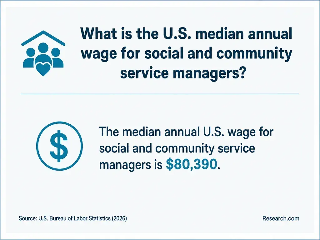
Job titles and pay vary substantially across these functions. Public health graduate salaries by career can provide occupational context, but a broad salary figure is neither the wage for a walkability-audit role nor an expected outcome of completing an MPH.
Compare actual job postings for the methods, community-engagement experience, credentials, and software skills a target position requests.
Other Things You Should Know About Public Health
They can support a desk-based assessment if the assignment permits it, but image dates, coverage, and viewing angles may be inadequate for current sidewalk conditions. Label image-based findings separately from field observations.
Explain your course or project purpose, say that you are documenting street features rather than people, and provide the instructor's or project contact if authorized. Do not turn the conversation into an interview without approval.
Usually, if course and partner rules allow it. Remove identifying details and restricted materials, describe your own contribution, and label the work as a student project rather than an official community assessment.
Name the observable condition and location needed for the decision - for example, a sidewalk gap on an audited segment. Avoid labeling residents or the whole neighborhood based on a limited visit.
- Development of a pedestrian audit tool to assess rural neighborhood walkability - PubMed https://pubmed.ncbi.nlm.nih.gov/23962803/
- A Guide to Conducting Field Observations | Illinois Criminal Justice Information Authority https://icjia.illinois.gov/researchhub/articles/a-guide-to-conducting-field-observations/
- Tools for Identifying Pedestrian Safety and Access Issues | dot.gov https://highways.dot.gov/safety/pedestrian-bicyclist/pedestrian-safety-guide-transit-agencies/chapter-1-tools-identifying
- § 1190.1 Accessibility Guidelines | access-board.gov https://www.access-board.gov/prowag/complete.html
- Federal Register:: Accessibility Guidelines for Pedestrian Facilities in the Public Right-of-Way https://www.federalregister.gov/documents/2023/08/08/2023-16149/accessibility-guidelines-for-pedestrian-facilities-in-the-public-right-of-way
- Ten quick tips for protecting health data using de-identification and perturbation of structured datasets - PMC https://pmc.ncbi.nlm.nih.gov/articles/PMC12456793/
- De-identification and Confidentiality of Research Data | ucsf.edu https://irb.ucsf.edu/content/de-identification-and-confidentiality-of-research-data
- De-identification - Research Data https://researchdata.unl.edu/collecting/deidentification/
- Interrater Reliability - an overview https://www.sciencedirect.com/topics/nursing-and-health-professions/interrater-reliability
- Audit Tools | pedbikeinfo.org https://www.pedbikeinfo.org/resources/resources_details.php