2027 Fastest Accredited Online Geographic Information Systems Degree Programs That Accept Transfer Credits

Co-Founder and Chief Data Scientist
Transfer students often lose time when credits do not apply to a new degree. In Geographic Information Systems, the right accredited online program can turn prior college work into a shorter path to graduation. NCES distance education data released in 2024 shows that more than half of U.S. college students took at least one online course in fall 2022, making online degree completion a mainstream option.
This guide is for transfer students, adult learners, military students, and degree completers who want the fastest legitimate route while checking accreditation, transfer rules, realistic timelines, and career value.
Key Things You Should Know
- The fastest realistic path is usually a 120-credit online bachelor's in GIS, geospatial science, geography, or geosciences that accepts up to 90 transfer credits and requires about 30 credits in residence; highly prepared transfer students may finish in roughly 12 to 18 months.
- Transfer-friendly accredited options to compare include SNHU, Fort Hays State University, Arizona State University Online, University of Arizona Online, Oregon State Ecampus, and Unity Environmental University, but the fastest choice depends on which credits apply to the GIS major, not just the school's maximum transfer limit.
- Regional accreditation is the baseline; before enrolling, confirm the school's institutional accreditation, online course availability, residency requirement, upper-division GIS requirement, portfolio or prior-learning policy, and whether accelerated 7- or 8-week terms are offered year-round.
What Are the Fastest Accredited Online Geographic Information Systems Degree Programs That Accept Transfer Credits?
The fastest accredited online Geographic Information Systems degree programs are not always labeled exactly "GIS." Many are bachelor's degrees in geographic information science, geospatial technology, geography, geosciences, environmental science, or spatial data science with a GIS-heavy curriculum. For transfer students, the best programs combine institutional accreditation, online completion, accelerated terms, a generous transfer-credit ceiling, and enough course availability to avoid bottlenecks.
The table below summarizes transfer-friendly online options that commonly fit GIS degree seekers. Catalogs and transfer policies can change, so treat this as a shortlist to verify with each school's registrar and GIS department before applying.
| Program type to compare | Accredited online option | Why it may be fast for transfer students | Best fit |
| GIS-centered bachelor's degree | Arizona State University Online, online geographic information science pathway | Online 7.5-week course structure can help motivated students move quickly when prerequisites and general education credits transfer cleanly. | Students who want a recognizable public university option with frequent online start dates. |
| Geospatial or GIS technology bachelor's degree | University of Arizona Online, GIS technology-focused pathway | Arizona Online programs are built for remote completion, and transfer evaluations can help students apply prior lower-division coursework. | Students who want technical GIS, remote sensing, spatial analysis, and applied geospatial training. |
| Geosciences degree with GIS emphasis | Fort Hays State University online geosciences or GIS-related pathway | Often attractive to transfer students because of online affordability and transfer-friendly degree-completion structures. | Students seeking a lower-cost public university route with applied geoscience and mapping skills. |
| Geography and geospatial science bachelor's degree | Oregon State University Ecampus | Strong online course ecosystem and established Ecampus support can work well for students who need predictable online scheduling. | Students who want a broad geography foundation plus geospatial methods from a public research university. |
| Geosciences with geospatial concentration | Southern New Hampshire University online geosciences pathway | SNHU is known for accepting up to 90 transfer credits toward many bachelor's degrees, which can leave about 30 credits for eligible students. | Adult learners and degree completers with substantial prior college credit. |
| Environmental GIS bachelor's pathway | Unity Environmental University online environmental or GIS-related degree | Career-focused online formats may work well for students applying prior credits toward environmental mapping and resource analysis. | Students interested in conservation, sustainability, natural resources, and environmental spatial data. |
Students comparing fast GIS degrees should also look beyond the program name. A geography degree with a strong GIS sequence may be better than a narrowly named program if it accepts more applicable transfer credits and offers the remaining courses online every term.
If your goal is speed plus employability, compare GIS programs the same way you would compare other online degrees that pay well: completion time matters, but only when the degree is accredited, affordable, and aligned with the work you want.
A practical shortlist should include schools that can answer four questions clearly. Ask these before submitting an enrollment deposit.
- How many of my credits apply to the GIS degree plan, not just to elective credit?
- How many upper-division GIS, geography, statistics, programming, or capstone credits must be completed at your institution?
- Are all remaining required courses offered online often enough to graduate quickly?
- Will a transfer associate degree satisfy general education, or will I still need specific math, science, writing, or lab courses?
How Fast Can You Complete an Online Geographic Information Systems Degree With Transfer Credits?
With transfer credits, an online GIS bachelor's degree can sometimes be completed in about one year, but only for students who enter with most general education and elective requirements already satisfied. More commonly, transfer students need 18 to 30 months because they still must complete upper-division GIS, spatial analysis, cartography, programming, statistics, remote sensing, and capstone requirements.
The table below shows realistic completion ranges based on a standard 120-credit bachelor's degree. These are planning estimates, not promises, because course sequencing, academic standing, financial aid enrollment rules, and term length can change the outcome.
| Credits accepted and applied | Approximate credits remaining | Fast full-time pace | More realistic working-adult pace | What can slow completion |
| 90 applicable credits | About 30 credits | 12 months | 12 to 18 months | Required capstone, upper-division GIS sequence, limited summer offerings. |
| 75 applicable credits | About 45 credits | 15 to 18 months | 18 to 24 months | Missing statistics, programming, lab science, or prerequisite geography courses. |
| 60 applicable credits | About 60 credits | 24 months | 24 to 36 months | Major courses must be taken in order, or the student can only study part time. |
| 30 applicable credits | About 90 credits | 30 to 36 months | 36 to 48 months | General education gaps and fewer transferable major credits. |
The fastest students usually have an associate degree, strong grades, completed math and writing requirements, and credits from a regionally accredited college. They also choose a program with short terms and multiple start dates. A student who works full time may still prefer a slower pace if rushing would reduce grades, limit internship time, or create financial aid problems.
To estimate your own timeline, use a sequence rather than a school's advertised "finish fast" language. This keeps the plan grounded in actual remaining requirements.
- Request an unofficial transfer review before applying, if the school offers one.
- Map accepted credits into general education, major, concentration, elective, and upper-division categories.
- Identify prerequisites for advanced GIS courses, especially statistics, programming, database, or remote sensing.
- Ask when each remaining required course is offered online during the next four terms.
- Build a term-by-term schedule and confirm whether the credit load is realistic with your work and family responsibilities.
How Many Transfer Credits Can You Apply Toward an Online Geographic Information Systems Degree?
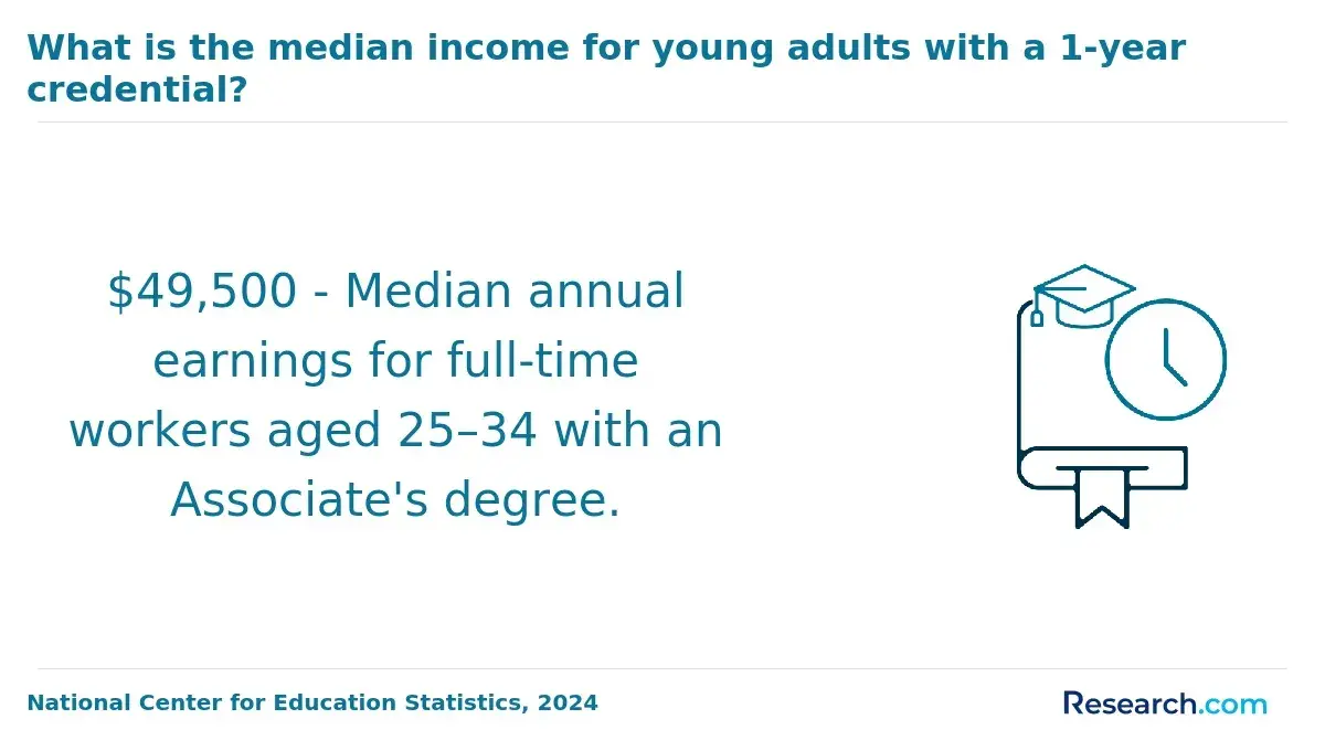
Many online bachelor's programs allow a high number of transfer credits, often up to 90 semester credits toward a 120-credit degree. However, the number that matters is the number that applies to the GIS degree. A school may accept a course as elective credit while still requiring you to complete the GIS major, upper-division credits, or specific general education categories.
The table below explains common transfer-credit categories and how they affect speed. Use it to distinguish a generous admissions policy from a genuinely fast degree-completion plan.
| Transfer-credit rule | Common range in U.S. bachelor's programs | Why it matters for GIS students |
| Maximum transfer allowed | Often up to 90 semester credits | This sets the ceiling, but it does not guarantee every prior credit will reduce remaining GIS requirements. |
| Residency requirement | Often about 30 semester credits | This is the minimum you must complete through the degree-granting school. |
| Community college transfer | Often strongest for lower-division general education | Useful for writing, math, social science, and electives, but upper-division GIS work may still remain. |
| Major or concentration credits | Varies widely by department | GIS courses may need close content matches, recent software experience, or upper-division equivalency. |
| Graduate transfer credit | Usually much lower than bachelor's transfer credit | Online master's in GIS programs may accept only a small number of prior graduate credits, so acceleration is more limited. |
One common mistake is assuming that a school accepting 90 credits means you automatically have 30 credits left. In practice, a student may transfer 90 credits but still need 36 to 45 credits if the remaining courses are required for the major. This is especially common when older credits do not match current GIS software, database, or remote-sensing expectations.
Before choosing the fastest-looking program, ask for a degree audit that separates accepted credits from applied credits. The audit should show which requirements are complete, which are waived, and which must still be taken at the new institution.
How Can You Verify Accreditation for Fast Online Geographic Information Systems Degree Programs?
Accreditation is the first filter for any fast online GIS degree. In the U.S., students should look for institutional accreditation from an accreditor recognized by the U.S. Department of Education or the Council for Higher Education Accreditation. Regional institutional accreditation is the standard expected by most employers, graduate schools, and transfer institutions.
GIS programs typically do not require a single field-specific accreditor in the way some professional fields do. That is why you should not confuse institutional accreditation with specialized accreditation in unrelated fields. For example, CACREP accredited counseling programs follow a field-specific model that does not directly apply to GIS bachelor's degrees.
Use the following verification steps before enrolling. They are especially important for accelerated programs because speed should never replace legitimacy.
- Search the U.S. Department of Education's Database of Accredited Postsecondary Institutions and Programs for the school's name.
- Confirm that the accreditor listed on the school's website matches the accreditor in the federal database.
- Check that the online program is offered by the accredited institution, not by an unaccredited third-party provider using similar branding.
- Verify that the degree title on the transcript will match the catalog description and not only a noncredit certificate.
- Ask whether online students have access to the same registrar, financial aid office, library, disability services, tutoring, and career services as campus students.
Red flags include unclear accreditation language, pressure to enroll before a transfer evaluation, vague promises that "most credits transfer," and programs that advertise extremely short completion times without explaining residency or major requirements.
Which Types of Transfer Credits Can Count Toward an Online Geographic Information Systems Degree?
Transfer credits can come from several sources, but each school decides what it will accept and where those credits apply. GIS students should pay special attention to technical course age because software platforms, spatial databases, and remote-sensing tools change over time.
The table below shows common credit sources and how they may affect an online GIS degree plan.
| Credit source | How it may apply | GIS-specific caution |
| Regionally accredited college courses | General education, electives, prerequisites, or major equivalents | GIS courses may require syllabus review to prove software, lab, and analysis coverage. |
| Associate degree | May satisfy many lower-division requirements | An associate degree does not always satisfy calculus, statistics, lab science, or programming requirements. |
| Prior bachelor's coursework | Can reduce general education and elective requirements | Upper-division residency and major requirements may still apply. |
| Military training | May count through Joint Services Transcript recommendations | Mapping, intelligence, surveying, or geospatial training may need department review. |
| Exam credit | May satisfy lower-division general education | Usually less helpful for upper-division GIS major courses. |
| Professional certifications | May support prior learning or elective credit | Certification alone may not replace graded GIS coursework unless the school has a formal policy. |
To improve your transfer outcome, gather documentation before you apply. Schools can evaluate credits faster and more accurately when you provide complete evidence.
- Official transcripts from every college attended, even if the credits seem unrelated.
- Course descriptions and syllabi for GIS, geography, statistics, programming, database, surveying, environmental science, or remote-sensing courses.
- Software details, such as ArcGIS Pro, QGIS, Python, SQL, GPS field methods, or image analysis tools used in prior coursework.
- Military transcripts, professional training records, certificates, and work samples if the school offers prior-learning assessment.
How Do Residency and Major Requirements Affect Transfer Credits for an Online Geographic Information Systems Degree?
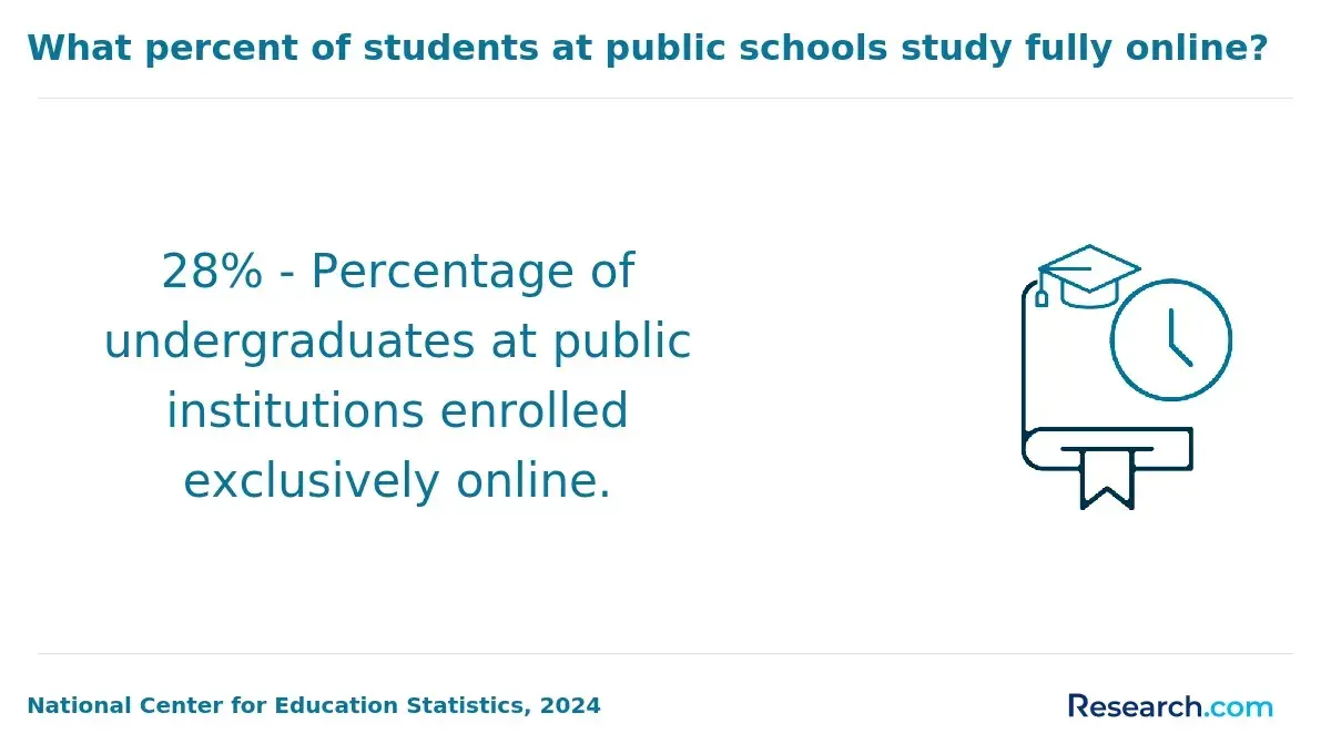
Residency requirements determine the minimum number of credits you must complete through the school awarding the degree. Major requirements determine the specific GIS-related courses you must complete regardless of how many credits you transfer. Together, these two rules often decide whether a program is truly fast.
The table below shows how residency and major rules can change the real time to completion for students with the same number of transfer credits.
| Student profile | Transfer-credit result | Likely outcome | Decision point |
| Student has 90 credits, including GIS, statistics, and programming | Many credits apply directly | May need only residency, capstone, and advanced major courses | Choose the school with the fewest required remaining sequences. |
| Student has 90 credits, mostly unrelated electives | Credits may transfer but not complete the major | May still need many GIS core courses | Do not choose based only on maximum transfer limit. |
| Student has an associate degree in geography or environmental science | General education may be mostly complete | Upper-division GIS and spatial analysis likely remain | Confirm whether associate-degree pathways or articulation agreements exist. |
| Student has older GIS coursework | Some technical courses may be accepted as electives | Current software or lab courses may need to be retaken | Ask whether a portfolio, placement review, or substitution is possible. |
A good transfer-friendly GIS program will give you a written degree plan showing all remaining courses. Be careful with programs that provide only a total number of accepted credits without showing how those credits fit the degree.
The most important questions are specific, not general. Use them to uncover hidden time requirements.
- What is the minimum number of credits I must complete at your institution?
- How many upper-division credits are required in the GIS major or concentration?
- Can transfer credits satisfy the capstone prerequisite courses?
- Are any required GIS courses offered only once per year?
- Do I need a minimum grade, such as C or higher, for transferred major courses to count?
Can Prior Learning, CLEP, Military Training, or Certifications Help You Finish an Online Geographic Information Systems Degree Faster?
Prior learning, CLEP exams, military training, and certifications can help some students finish faster, but they usually work best for lower-division general education, electives, or introductory requirements. They are less likely to replace advanced GIS labs, spatial modeling, programming, database, remote sensing, or capstone courses unless the school has a formal assessment process.
Credit for prior learning can be valuable for adult learners with mapping, surveying, planning, emergency management, military intelligence, environmental consulting, logistics, or public-works experience. The key is documentation. Schools rarely award credit for experience alone; they evaluate college-level learning demonstrated through exams, portfolios, training records, or reviewed credentials.
Here is how these options commonly support acceleration when the institution permits them.
- CLEP and DSST exams may reduce general education requirements such as humanities, social science, history, or basic college-level subjects.
- Military training may apply through American Council on Education credit recommendations listed on the Joint Services Transcript.
- Professional GIS training may support elective credit or portfolio review when it includes measurable learning outcomes, contact hours, and assessed work.
- Certifications and software badges may strengthen a portfolio, but they do not automatically replace degree requirements.
- Work samples, maps, scripts, databases, and technical reports may support prior-learning assessment if the school has a portfolio process.
The risk is paying for exams or portfolio reviews that do not apply to your degree. Before spending money, ask the registrar or academic advisor which exact requirement the credit would satisfy and whether it counts toward residency, electives, general education, or the major.
How Much Does a Fast Online Geographic Information Systems Degree Cost After Transfer Credits and Financial Aid?
The cost of a fast online GIS degree depends on how many credits remain after transfer, the school's per-credit tuition, online fees, software or lab costs, and financial aid eligibility. Transfer credits can reduce total tuition, but only if they apply to the degree plan. A low per-credit price can also become less attractive if the program requires many additional courses because major requirements were not satisfied.
College Board's 2024 Trends in College Pricing report lists average published tuition and fees for full-time undergraduates at public four-year in-state institutions at $11,610 for the academic year. That benchmark helps you judge whether an online public university is comparatively affordable, but your actual cost will depend on remaining credits, residency status, institutional aid, and fees.
Use these cost categories when comparing programs. Listing them separately helps you avoid focusing only on tuition.
- Remaining tuition after transfer credits: multiply the number of credits left by the program's per-credit rate.
- Online fees and technology fees: confirm whether they are charged per credit, per course, or per term.
- GIS software and equipment costs: ask whether ArcGIS, cloud storage, remote desktop access, GPS tools, or lab platforms are included.
- Transcript, graduation, portfolio, or prior-learning assessment fees: small charges can add up for transfer students.
- Financial aid impact: accelerated schedules may change full-time status, satisfactory academic progress, and annual aid timing.
Because GIS is a career-oriented technical field, compare net cost against the skills you will actually gain. The same affordability logic used when comparing a cheap online masters in counseling applies here: the lowest sticker price is not always the best value if course availability, accreditation, or career relevance is weak.
For a practical estimate, ask each school for a post-transfer cost projection in writing. It should show credits remaining, tuition rate, required fees, expected books or software costs, and whether your intended course load qualifies for the financial aid you plan to use.
How Do Accelerated, Competency-Based, and Self-Paced Online Geographic Information Systems Degree Programs Compare?
Accelerated, competency-based, and self-paced online programs all promise flexibility, but they are not the same. For GIS students, the fastest format depends on your prior credits, technical preparation, schedule, and ability to complete lab-based work without falling behind.
The table below compares the formats most relevant to transfer students seeking a fast online GIS degree.
| Format | How it works | Potential speed advantage | Main trade-off |
| Accelerated term-based | Courses run in shorter sessions, often 7 or 8 weeks. | Students can complete more courses across the year if they can handle the pace. | GIS labs and projects may feel intense in compressed terms. |
| Traditional asynchronous online | Courses have weekly deadlines but no required campus attendance. | Predictable and manageable for working adults. | May be slower if courses follow 15-week semesters or limited annual rotations. |
| Competency-based | Students progress by demonstrating mastery rather than only seat time. | Can be fast for students with strong prior knowledge. | Less common for full GIS bachelor's degrees, and transfer policies vary. |
| Self-paced or independent study | Students complete work within a broad completion window. | Helpful for motivated students with irregular schedules. | Can become slower without structure, advising, and course sequencing. |
Accelerated programs are not automatically easier. A compressed GIS course may require frequent map production, data cleaning, lab reports, software troubleshooting, and discussion posts in the same week. Students who are new to GIS software may learn better in a standard term, even if the calendar is longer.
When comparing formats, look at how other accelerated fields handle pacing. For example, an accelerated online finance degree may compress quantitative coursework, while a GIS degree compresses technical labs, spatial analysis, and software-heavy projects. The workload feels different even when the term length is similar.
The best format is the one that lets you complete remaining requirements without repeating courses. If you are transferring in 75 to 90 credits and already have GIS experience, an accelerated calendar may be ideal. If you are changing fields, a slightly slower program with stronger support may produce better results.
Are Fast Accredited Online Geographic Information Systems Degrees Respected by Employers and Graduate Schools?
Fast accredited online GIS degrees can be respected by employers and graduate schools when they come from a properly accredited institution and include rigorous geospatial coursework. Employers usually care less about whether the courses were online and more about whether you can use GIS software, analyze spatial data, manage geodatabases, communicate findings, and build a portfolio of maps and projects.
The labor-market context is also important. The BLS Occupational Outlook Handbook published in 2024 reported a median annual wage of $76,210 for cartographers and photogrammetrists using May 2023 wage data, with projected employment growth of 3% from 2023 to 2033. That figure should not be read as a guaranteed salary for GIS graduates, but it shows that GIS-related skills connect to recognized occupations in mapping, planning, environmental analysis, utilities, defense, transportation, and public administration.
Graduate schools typically review institutional accreditation, GPA, prerequisite coursework, recommendations, and writing or technical preparation. If you may pursue a master's degree later, make sure the fast bachelor's program includes enough statistics, research methods, programming, and upper-division spatial analysis to support graduate study.
The same recognition principle applies across online education levels. Students considering an online PhD leadership program, for instance, still need to verify accreditation, faculty fit, research expectations, and institutional reputation rather than relying only on online convenience.
To strengthen the value of a fast online GIS degree, build evidence of skill while you study. Employers often respond well to concrete work samples.
- Create a portfolio with web maps, spatial analysis reports, dashboards, remote-sensing outputs, and clearly documented data sources.
- Learn widely used tools such as ArcGIS Pro, ArcGIS Online, QGIS, Python, SQL, GPS data collection, and spatial databases when available in your program.
- Complete a capstone, internship, service-learning project, or employer-sponsored mapping project if your schedule allows.
- Ask faculty whether courses include current data ethics, privacy, AI-assisted geospatial workflows, and automation practices.
Other Things You Should Know About Geographic Information Systems
A certificate may be enough if you already have a bachelor's degree and only need GIS skills for your current field. A full degree is usually better for students who still need a bachelor's credential for analyst roles, graduate school, promotion requirements, or broader career mobility.
Sometimes. Some programs provide remote lab access or cloud-based software, while others expect students to run GIS applications locally. Before enrolling, ask for hardware requirements, operating system expectations, and whether software licenses are included.
Many online GIS programs use digital datasets, remote sensing imagery, web mapping tools, and virtual labs. Some courses may still include local field data collection or GPS assignments that can be completed near where you live.
Older general education credits often transfer more easily than older technical GIS credits. Departments may require recent coursework for software-heavy subjects, so provide syllabi and ask whether older GIS classes can count as electives, prerequisites, or major requirements.
References
- 2025 Best Online GIS Degrees https://www.onlineu.com/degrees/geographic-information-systems
- Best Online GIS Certificates - GISDegree.org https://www.gisdegree.org/online/certificates/
- Best Online GIS Degree Programs, Up to Date for 2025 https://www.gisdegrees.org/programs/online
- Navigating Financial Aid as a Transfer Student | Coalition for College https://www.coalitionforcollegeaccess.org/mycoalition-counselor-all/navigating-fa-as-a-transfer-student
- Transferology https://www.transferology.com/
- Earn Your GIS Degree or Certificate in GIS to Advance Your Career https://bootcampgis.com/get-your-degree-in-gis/
- Full Transfer Guide - OnlineDegree.com https://www.onlinedegree.com/full-transfer-guide/
- Top Online Schools That Accept Transfer Credits https://www.edvisorly.com/student-guides/online-schools-that-accept-transfer-credits
- Guide to Geographic Information Systems (GIS) Degrees https://www.umassglobal.edu/blog-news/guide-geographic-information-systems-gis-degrees
- Financial Aid For Online Colleges https://www.affordablecollegesonline.org/financial-aid/financial-aid-for-online-colleges/