2027 Cheapest Accredited Online Geographic Information Systems Degree Programs That Accept FAFSA

Co-Founder and Chief Data Scientist
Choosing an online GIS degree is really a cost-versus-career decision: you need a program that is accredited, FAFSA-eligible, affordable after aid, and respected by employers. The field remains timely because the U. S. Bureau of Labor Statistics reports that cartographers and photogrammetrists had a median wage of about $79,000 in 2024, reflecting the value of geospatial skills in government, logistics, utilities, environment, and planning. This guide helps online learners, transfer students, working adults, and career changers compare low-cost GIS options, verify aid eligibility, and avoid overpaying for a degree.
Key Things You Should Know
- The cheapest online GIS degree is not always the lowest published tuition; the better measure is net cost after Pell Grants, scholarships, transfer credits, fees, and borrowing.
- For 2025-26, the maximum Federal Pell Grant is $7,395, but receiving FAFSA aid depends on your Student Aid Index, enrollment level, program eligibility, and the school's cost of attendance.
- Accredited online GIS bachelor's programs often cost less when they accept large blocks of transfer credit, while GIS master's programs may offer faster completion but usually rely more heavily on loans or employer tuition assistance.
Which Are the Cheapest Accredited Online Geographic Information Systems Degree Programs That Accept FAFSA?
An affordable online Geographic Information Systems degree usually means a bachelor's or master's program in GIS, geospatial science, geography, geosciences, or environmental data analysis with enough GIS coursework to prepare students for mapping, spatial analysis, remote sensing, database work, and geospatial software roles. FAFSA eligibility generally requires the student to be admitted into a degree-granting program at a Title IV-participating institution, not just enrolled in a standalone certificate.
The programs below are examples of lower-cost, institutionally accredited online GIS-focused degree pathways from U.S. schools that participate in federal student aid. Tuition is based on published online tuition information available from 2024-25 or 2025-26 school materials where available, and students should confirm the exact program, residency rate, fees, and aid eligibility before applying.
| School | Online GIS-related degree pathway | Institutional accreditation | Published online tuition signal | Why it may be affordable |
| University of Florida Online | B.A. in Geography with geospatial coursework options | SACSCOC | About $129 per credit for Florida residents; higher nonresident rate | One of the lowest published online resident rates among major public universities |
| Fort Hays State University | Online geosciences/geography pathway with GIS emphasis options | Higher Learning Commission | About $257 per undergraduate credit | Flat-rate online pricing can help out-of-state students avoid high nonresident tuition |
| Southern New Hampshire University | B.S. in Geosciences with geospatial technology-related coursework | NECHE | About $330 per undergraduate credit | Private nonprofit pricing is transparent, and transfer-friendly policies can reduce total credits taken |
| Troy University | B.S. in Geographic Information Sciences | SACSCOC | About $424 per undergraduate credit | GIS-specific degree title may appeal to students who want a direct geospatial credential |
| Unity Environmental University | Online environmental GIS or geospatially focused environmental science pathway | NECHE | About $470 per undergraduate credit | May fit students who want GIS applied to conservation, climate, land use, and environmental analysis |
| Oregon State University Ecampus | B.A./B.S. in Geography and Geospatial Science | NWCCU | About $375 per quarter credit | Strong public-university online infrastructure and a clearly geospatial degree pathway |
| Arizona State University Online | B.S. in Geographic Information Science | Higher Learning Commission | Commonly listed in a per-credit online undergraduate range above many low-cost public options | GIS-specific curriculum and large online student support system may justify a higher price for some students |
Use this list as a starting point, not as a final ranking. A Florida resident at a public university, a military student using benefits, or a transfer student bringing in 60 to 90 credits may see a very different net price than a first-time, full-time, out-of-state student.
How Does FAFSA Eligibility Work for Online Geographic Information Systems Degree Programs?
FAFSA eligibility starts with the institution and the program. A school must participate in federal Title IV aid programs, and the student must be enrolled in an eligible degree or approved certificate program, meet basic federal aid requirements, and maintain satisfactory academic progress after enrolling.
For online GIS degrees, the biggest misunderstanding is assuming that "online" or "accredited" automatically means every course or credential qualifies for FAFSA. Many colleges offer GIS certificates, professional badges, or noncredit mapping courses that may be valuable but are not always federal-aid eligible unless they are attached to an approved program.
Before you apply, verify these items directly with the financial aid office and the GIS department. This is especially important if you are comparing GIS with other online degrees that pay well, because aid rules may be similar while career pathways and program structures differ.
- Confirm the school has a current federal school code and participates in Title IV aid.
- Ask whether the exact online GIS degree, not just the university, is eligible for FAFSA-based aid.
- Check whether you must be degree-seeking before aid can disburse.
- Ask how many credits count as full-time, half-time, and less-than-half-time enrollment for aid purposes.
- Review satisfactory academic progress rules, including GPA, completion pace, and maximum time frame.
A major red flag is a program that advertises "financial aid available" but cannot clearly explain whether it means federal aid, institutional scholarships, private loans, employer billing, or payment plans. FAFSA participation is helpful, but it does not mean the full degree will be free or fully funded.
How Much Does an Online Geographic Information Systems Degree Cost After Financial Aid?
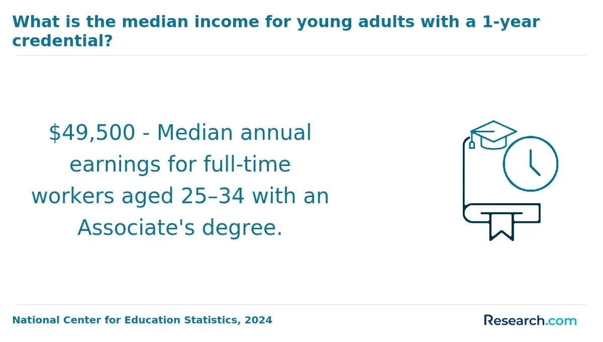
The cost of an online GIS degree after financial aid depends on tuition, mandatory fees, transfer credits, enrollment intensity, grants, scholarships, loans, and living expenses included in the school's cost of attendance. The most useful number is not the sticker price; it is the estimated net price plus any debt you would need to repay.
The table below shows how different affordability scenarios can change what a student actually pays. These are planning examples, not guarantees, because each school calculates aid based on its own cost of attendance and the student's FAFSA results.
| Cost factor | How it affects the final price | What to ask the school |
| Published tuition | Sets the baseline cost per credit or term | Is the online tuition rate the same for in-state and out-of-state students? |
| Mandatory fees | Can add technology, distance learning, lab, graduation, or proctoring charges | Can you provide a full fee schedule for online GIS students? |
| Pell Grant eligibility | Can reduce out-of-pocket cost for qualifying undergraduate students | How is Pell prorated if I enroll part time? |
| Institutional scholarships | May lower net price without repayment | Are online GIS students eligible for the same scholarships as campus students? |
| Transfer credits | Can remove entire courses from the remaining degree plan | How many credits can I transfer into this specific major? |
| Federal loans | Can cover remaining costs but increase long-term repayment obligations | What would my estimated total borrowing be at graduation? |
For a bachelor's degree, the total published tuition can vary sharply because some online GIS pathways charge resident tuition, others charge a flat online rate, and others use a private nonprofit rate. For graduate GIS programs, FAFSA may still apply, but Pell Grants generally do not; many master's students rely on Direct Unsubsidized Loans, employer assistance, military benefits, or departmental scholarships.
The practical comparison is simple: request a written degree plan and aid estimate from every school you are considering, then compare the remaining credits required, total tuition and fees, grants, scholarships, and expected borrowing. If one school costs more per credit but accepts far more transfer credit, it may be cheaper in total.
Which Affordable Online Geographic Information Systems Degree Programs Offer the Best Value?
The best-value online GIS program is the one that balances low net cost with credible accreditation, strong GIS coursework, transfer flexibility, career relevance, and student support. A cheap program with limited GIS labs, outdated software access, or poor advising can end up costing more if it delays graduation or leaves you underprepared for technical roles.
The table below compares value signals that matter more than tuition alone. These factors help separate genuinely affordable programs from programs that simply look inexpensive in an advertisement.
| Value factor | Strong sign | Possible concern |
| GIS curriculum depth | Courses in spatial analysis, remote sensing, cartography, geodatabases, Python or scripting, and web GIS | Only one or two GIS electives inside a broad geography degree |
| Software access | Students receive access to widely used GIS tools through the program | Students must separately buy expensive software or rely only on limited trials |
| Portfolio development | Projects produce maps, dashboards, spatial datasets, and analysis samples | Coursework is mostly theory with few demonstrable technical outputs |
| Transfer policy | Clear transfer evaluation before enrollment deposit | Transfer review happens late, after the student has already committed |
| Career alignment | Program prepares for analyst, technician, planning, environmental, logistics, or government roles | Program title sounds relevant but has weak job-market alignment |
A more expensive GIS program may be worth choosing if it offers a highly relevant curriculum, better transfer acceptance, stronger advising, or access to internships and applied projects. On the other hand, if your goal is simply to earn a bachelor's credential quickly for a data or business role, comparing GIS with another pathway such as an accelerated online finance degree can clarify which option fits your timeline and expected return.
Low-cost public universities often provide the best starting point for price-sensitive students, especially in-state residents. Private nonprofit programs can still be competitive when they offer generous transfer credit, predictable online tuition, employer partnerships, or shorter completion timelines.
Are the Cheapest Online Geographic Information Systems Degree Programs Properly Accredited?
Accreditation is the quality-control layer that matters most for federal aid, credit transfer, graduate admissions, and employer confidence. For GIS degrees, students should first verify institutional accreditation from a U.S. Department of Education-recognized accreditor, such as SACSCOC, Higher Learning Commission, NECHE, NWCCU, MSCHE, or WSCUC.
GIS does not have one universal programmatic accreditor that functions the way some licensed fields do. For example, counseling students may need to pay close attention to whether a program is CACREP accredited, but GIS students usually focus on institutional accreditation, curriculum quality, technical preparation, and employer recognition.
Use this verification sequence before you enroll. It takes only a few minutes and can prevent major financial and academic problems later.
- Search the school in the U.S. Department of Education's accreditation database or the accreditor's own directory.
- Confirm that the institution name, campus, and online division match the program you plan to attend.
- Ask the admissions office whether the online GIS program is offered by the accredited institution, not by an unaffiliated third-party provider.
- Check whether credits from the program are commonly accepted by graduate schools or public universities.
- Ask employers, local government GIS offices, or professional contacts whether they recognize the school and degree title.
Be cautious with schools that overemphasize speed, hide total costs, avoid accreditation details, or pressure you to enroll before reviewing transfer credits and financial aid. Proper accreditation does not guarantee employment, but lack of recognized accreditation can make federal aid, credit transfer, and graduate study much harder.
What FAFSA Grants and Federal Aid Can Pay for an Online Geographic Information Systems Degree?
FAFSA is the application, not the aid itself. After you submit it, the school uses your FAFSA data to determine eligibility for grants, federal loans, work-study, and sometimes institutional aid. For online GIS students, the most important distinction is between undergraduate and graduate aid.
The aid types below are the main federal options that may apply to eligible students in an online GIS degree. Amounts and eligibility can change by award year, dependency status, enrollment level, and federal rules.
| Aid type | Who it commonly serves | Repayment requirement | Important limitation |
| Federal Pell Grant | Eligible undergraduate students with financial need | No repayment if requirements are met | Maximum award is $7,395 for 2025-26 and is prorated by eligibility and enrollment |
| Federal Supplemental Educational Opportunity Grant | Undergraduates with exceptional financial need at participating schools | No repayment if requirements are met | Campus-based funds are limited and not available equally at every institution |
| Federal Work-Study | Eligible students at participating schools | Earned through approved work | Online students may have fewer location-compatible positions |
| Direct Subsidized Loan | Eligible undergraduate students with financial need | Must be repaid | Not available to graduate students |
| Direct Unsubsidized Loan | Undergraduate and graduate students | Must be repaid with interest | Interest generally accrues while enrolled |
| Direct PLUS Loan | Graduate students or parents of dependent undergraduates | Must be repaid | Credit check applies and borrowing can become expensive |
Students should also ask about state grants, institutional scholarships, military education benefits, tribal education funding, employer tuition reimbursement, and professional association scholarships. These sources can reduce borrowing, but they often have deadlines, GPA requirements, enrollment minimums, or reimbursement rules.
A common mistake is accepting the full loan amount offered without calculating the total debt over the entire degree. If the grant portion is small and the remaining cost is mostly loans, the program may still be FAFSA-eligible but not truly affordable for your situation.
How Do Transfer Credits Lower the Cost of an Online Geographic Information Systems Degree?
Transfer credit is one of the most powerful ways to lower the cost of an online GIS degree. It can reduce the number of credits you must pay for, shorten your time to graduation, and limit the amount you need to borrow.
The table below shows how transfer credits can change the remaining degree cost. The example uses a hypothetical $330-per-credit tuition rate to illustrate the math; your school's rate and transfer policy will determine the real savings.
| Transfer credits accepted | Credits remaining in a 120-credit bachelor's degree | Estimated tuition at $330 per credit | Planning takeaway |
| 0 credits | 120 credits | $39,600 | Most expensive path because the full degree is completed at the new school |
| 30 credits | 90 credits | $29,700 | Often possible for students with one year of prior college |
| 60 credits | 60 credits | $19,800 | Common target for associate degree graduates |
| 90 credits | 30 credits | $9,900 | Best-case upper-transfer scenario, but major requirements may limit applicability |
To make transfer credits work in your favor, do not rely on a general estimate from admissions. Ask for a program-specific transfer evaluation that shows exactly which credits apply to general education, electives, prerequisites, and GIS major requirements.
- Collect official transcripts from every college, military program, and approved exam provider you have used.
- Ask whether the GIS department separately reviews technical, geography, computer science, statistics, or environmental science credits.
- Confirm whether old GIS software courses expire or need to be repeated because technology has changed.
- Compare the number of remaining credits at each school, not just the number of credits accepted overall.
- Get the final transfer plan in writing before paying a deposit or registering for courses.
A higher-tuition program that accepts more credits can be cheaper than a lower-tuition program that forces you to retake core courses. This is especially true for students who already hold an associate degree or significant prior college credit.
Which Students Benefit Most From a Low-Cost Online Geographic Information Systems Degree With FAFSA?
A low-cost online GIS degree with FAFSA is most useful for students who need a flexible, career-relevant credential but cannot pause work or relocate for campus study. It is especially practical for learners who can combine transfer credits, grant aid, and part-time study without taking on excessive debt.
The best-fit students usually fall into one of these groups. Each group benefits from affordability in a different way, so the right program choice may vary.
- Community college transfer students who want to finish a bachelor's degree while applying prior credits.
- Working adults in planning, utilities, public safety, environmental services, transportation, or logistics who already use location data on the job.
- Military-affiliated students who can combine FAFSA with military education benefits or prior learning credit.
- Career changers who want technical mapping and spatial analysis skills without committing to a high-cost residential program.
- Students in rural areas who need online access to GIS coursework that may not be available locally.
Students should avoid choosing purely on low cost if they need intensive lab access, fieldwork, in-person networking, or a highly specialized research pathway. Some learners may also decide that another helping-profession or public-service pathway fits better; for example, someone comparing human services careers might look at a cheap online masters in counseling instead of a technical geospatial degree.
Online GIS programs can be a strong fit for self-directed students because many courses involve independent software practice, project work, and troubleshooting. If you need frequent live instruction, ask whether classes are asynchronous, synchronous, or hybrid before enrolling.
How Does the Cost of an Online Geographic Information Systems Degree Affect Career ROI?
The ROI of an online GIS degree depends on the total cost you pay, the debt you take on, and the type of role you pursue after graduation. GIS skills can support careers in mapping, planning, environmental analysis, emergency management, transportation, utilities, agriculture, defense contracting, real estate, and data visualization, but salaries vary by industry, location, experience, security clearance, and technical depth.
The U.S. Bureau of Labor Statistics reported a 2024 median wage of about $79,000 for cartographers and photogrammetrists. That figure is useful as a labor-market benchmark, but it should not be treated as a guaranteed outcome for every GIS graduate, especially for entry-level technician roles or jobs that require only limited geospatial analysis.
A low-cost program improves ROI by reducing the salary threshold needed to justify the degree. For example, a student who completes a GIS bachelor's with moderate grants and limited borrowing has more flexibility than a student who finances a high-cost program almost entirely with loans.
When comparing ROI, consider the credential level. An associate degree or certificate may support entry-level technician work, a bachelor's degree is often more versatile for analyst and planning roles, and a master's degree may help with advanced analysis, management, research, or specialized public-sector work. Students thinking far beyond the bachelor's level can compare how debt and career payoff are evaluated in other advanced online pathways, such as an online PhD leadership program.
GIS career value is increasingly shaped by automation, cloud mapping, AI-assisted image interpretation, open data, and employer demand for workers who can combine spatial reasoning with data skills. To strengthen ROI, prioritize programs that include spatial databases, Python or scripting, web GIS, remote sensing, statistics, and portfolio-ready projects.
How Should Students Choose the Cheapest FAFSA-Eligible Online Geographic Information Systems Degree?
The safest way to choose the cheapest FAFSA-eligible online GIS degree is to compare net price, accreditation, curriculum, transfer credit, flexibility, and career fit at the same time. Do not let one number, such as cost per credit, make the whole decision for you.
Use the following process before committing to a program. It turns a vague tuition comparison into a realistic cost-and-value decision.
- Shortlist only institutionally accredited schools that offer an online GIS, geospatial science, geography, geosciences, or closely related degree pathway.
- Confirm the exact program is eligible for federal student aid and ask for the school's federal code.
- Request a written total cost estimate that includes tuition, mandatory fees, software, books, graduation fees, and any residency requirements.
- Submit transcripts for an official or near-official transfer evaluation before enrolling.
- Compare net price after grants and scholarships, not just the published tuition rate.
- Estimate total borrowing across the full degree and compare it with realistic entry-level and mid-career GIS roles in your target region.
- Review the curriculum for applied GIS tools, spatial analysis, databases, remote sensing, scripting, and portfolio projects.
- Ask about online student support, tutoring, advising, internship help, and career services.
- Check whether courses are asynchronous, synchronous, accelerated, or term-based so the format fits your work schedule.
- Choose the program that gives you the lowest acceptable total cost for the strongest career-relevant preparation.
The biggest red flags are unclear accreditation, vague aid language, no written transfer plan, hidden fees, weak GIS coursework, and pressure to enroll quickly. If a school cannot explain your total cost and aid eligibility in plain language, keep comparing options.
Other Things You Should Know About Geographic Information Systems
Often, yes. GIS software can require more processing power, memory, and storage than basic online classes. Before enrolling, ask for the program's hardware specifications and whether cloud-based labs, remote desktops, or university software licenses are available.
A certificate may be enough if you already have a degree or need GIS skills for your current job. A full degree is usually stronger if you need a broader credential for analyst roles, career changing, graduate school, or positions that require a bachelor's degree.
Many universities do not label the diploma as online, but policies vary. Ask the registrar how the diploma and transcript list the program, campus, and delivery format before enrolling.
Not all GIS roles require advanced programming, but coding is increasingly useful. Programs that include Python, SQL, web mapping, or automation can better prepare students for analyst roles that go beyond basic map production.
References
- How to apply | GIS https://gis.sport/apply/how-to-apply/
- About GISDegree.org https://www.gisdegree.org/about-us/
- 2025 Most Affordable Online Colleges & Degrees https://www.onlineu.com/most-affordable-colleges
- Guide to Geographic Information Systems (GIS) Degrees https://www.umassglobal.edu/blog-news/guide-geographic-information-systems-gis-degrees
- A Career Guide to Geographic Information System https://www.discoverdatascience.org/articles/guide-to-geographic-information-system-careers/
- Cost of College by Country [2025]: Average Tuition Fees https://educationdata.org/average-cost-of-college-by-country
- GIS Degrees vs. Certificates | Choose the Right Path for You https://bootcampgis.com/comparing-gis-degrees-to-gis-certificates/
- Geographic Information Systems (GIS) Programs | Shasta College https://www.shastacollege.edu/academics/programs/geographic-information-systems/
- Best Masters in GIS Degree Programs Online for 2026 https://www.gisdegrees.org/programs/degree/masters
- Bachelor of Applied Technology Geographic Information Systems https://www.sait.ca/programs-and-courses/degrees/bachelor-of-applied-technology-geographic-information-systems