2027 Best Accredited Online Geographic Information Systems Degree Programs: Compare Tuition, Admissions, and Career Outcomes

Co-Founder and Chief Data Scientist
Choosing an online Geographic Information Systems degree means comparing more than maps and software courses. GIS now supports transportation planning, climate risk analysis, logistics, public safety, agriculture, and business location strategy. The U.S. Bureau of Labor Statistics projects 3% growth for cartographers and photogrammetrists from 2023 to 2033, signaling steady demand for geospatial skills.
This guide is for working adults, transfer students, first-time college students, and career changers who want to compare accredited online GIS programs by cost, admissions, flexibility, and career value before applying.
Key Things You Should Know
- The strongest online GIS degree value usually comes from a regionally accredited program that combines reasonable total cost, transfer-credit flexibility, hands-on GIS software training, and clear career support rather than tuition alone.
- College Board's 2024 pricing data lists average published tuition and fees at $11,610 for in-state public four-year colleges, $30,780 for out-of-state public colleges, and $43,350 for private nonprofit colleges, making residency rules and online tuition policies important cost drivers.
- GIS career outcomes vary by role: BLS 2024 labor data places cartography, photogrammetry, planning, surveying, and related geospatial roles across different salary bands, so students should match the degree level to the job they actually want.
Which Accredited Online Geographic Information Systems Degree Programs Offer the Best Overall Value?
The best accredited online Geographic Information Systems degree program is the one that fits your target role, budget, schedule, and prior credits. GIS, or Geographic Information Systems, is the field of collecting, managing, analyzing, and visualizing location-based data. In degree programs, students typically study cartography, remote sensing, spatial databases, geospatial programming, statistics, web mapping, and applied analysis using tools such as ArcGIS Pro, QGIS, Python, SQL, and cloud-based mapping platforms.
For most students, "best overall value" means the lowest total cost for a credible credential that leads to the right level of opportunity. A lower-priced bachelor's program may be the better choice for students without a degree, while an online master's in GIS may be more efficient for professionals who already hold a bachelor's degree and need advanced technical skills.
The table below summarizes common online GIS degree options and the type of student each one tends to serve best. These are representative accredited pathways, not a universal ranking, because published tuition, transfer policies, and course delivery change frequently.
| Program type | Best fit | Typical strengths | Value consideration |
| Online bachelor's in GIS, geography, or geospatial science | First-time college students, transfer students, and career changers without a bachelor's degree | Broad foundation in spatial analysis, earth systems, statistics, and mapping | Best value when the school accepts transfer credits and offers in-state or flat online tuition |
| Online master's in GIS or geospatial information science | Professionals with a bachelor's degree who want technical advancement | Advanced work in spatial databases, scripting, remote sensing, and project management | Best value when the program is short, career-focused, and aligned with employer software expectations |
| Online graduate certificate in GIS | Working professionals who need GIS skills without a full degree | Focused skill development in mapping, analysis, and geospatial tools | Best value when credits can later stack into a master's degree |
| Hybrid GIS degree | Students near campus who want online coursework plus labs, fieldwork, or faculty access | Hands-on collaboration, local field methods, and in-person networking | Best value when travel costs are low and the campus component improves learning outcomes |
Public universities often provide strong value for online GIS students, especially when they charge the same online tuition regardless of state residency or offer generous transfer-credit review. Private nonprofit institutions can also be worth the higher price when they provide smaller classes, specialized labs, strong employer connections, or an established geospatial brand. Institution type alone does not determine return on investment.
Students comparing GIS with other practical online options should consider both salary potential and fit. Research.com's guide to online degrees that pay well can help readers think about degree value across fields, but GIS is strongest for people who genuinely enjoy spatial reasoning, environmental or urban systems, data visualization, and technical problem-solving.
A good rule of thumb is to prioritize the program that gets you to a portfolio-ready skill set at the lowest realistic net price. Avoid choosing a program only because it appears in a ranking; instead, compare accreditation, total cost, transfer acceptance, software access, faculty expertise, student support, and the kinds of GIS projects students complete before graduation.
What Accreditation Should Students Look for in an Online Geographic Information Systems Degree Program?
Students should first look for institutional accreditation from a recognized U.S. accreditor. Institutional accreditation matters because it affects federal financial aid eligibility, credit transfer, graduate school admission, and employer confidence. In the U.S., GIS degree programs usually do not have a single mandatory programmatic accreditor in the way nursing, counseling, or engineering programs often do.
The most important accreditation check is simple: confirm that the college or university is listed as accredited by an agency recognized by the U.S. Department of Education or the Council for Higher Education Accreditation. Then verify the specific online GIS degree appears in the school catalog, not only as a certificate, minor, or concentration.
Use the checklist below before you apply, especially if a program advertises low tuition or unusually fast completion.
- Confirm the institution's accreditation status through official federal or accreditor records, not only the school's marketing page.
- Check that the online GIS degree, concentration, or certificate is listed in the current academic catalog with required courses and credit hours.
- Ask whether online students receive the same transcript notation and degree title as campus students.
- Review transfer policies, because some schools cap GIS, geography, computer science, or statistics credits differently.
- Look for evidence of applied geospatial work, such as capstone projects, lab assignments, internships, portfolios, or industry software access.
A common mistake is assuming that every field has specialized accreditation. For example, counseling students may specifically search for CACREP accredited programs because that accreditation can affect licensure pathways. GIS is different: institutional accreditation, curriculum quality, technical skill development, and employer relevance usually matter more than a field-specific accreditor.
Red flags include vague accreditation language, unclear degree names, missing faculty credentials, no published curriculum, pressure to enroll immediately, or a program that cannot explain whether credits transfer into graduate study. If a school is accredited but the GIS curriculum is thin, the degree may still be a poor fit for technical GIS roles.
How Do Tuition Costs Compare Across Accredited Online Geographic Information Systems Degree Programs?
Tuition for accredited online GIS degree programs varies widely because GIS can be offered through public universities, private nonprofit institutions, environmental science departments, geography departments, engineering schools, or professional graduate schools. The sticker price is only one part of the cost. Students should compare total program cost, technology fees, GIS software access, transfer credits, course load, and time to completion.
College Board's 2024 data shows why this comparison matters: average published tuition and fees for full-time undergraduates were $11,610 at in-state public four-year colleges, $30,780 at out-of-state public four-year colleges, and $43,350 at private nonprofit four-year colleges for the 2024-25 academic year. For online GIS students, the practical lesson is to ask whether the program charges in-state tuition, out-of-state tuition, or a separate online rate.
The table below shows the main cost categories students should compare before deciding whether a GIS program is affordable. It is more useful than comparing tuition per credit alone because GIS programs can include software, labs, field methods, and technology requirements.
| Cost factor | Why it matters in GIS | What to ask the school |
| Tuition per credit | GIS degrees may require 30 to 120 credits depending on level | Is the online rate fixed, residency-based, or program-specific? |
| Transfer credit | Accepted credits can reduce time and total cost | How many prior credits can apply to the GIS major or general education requirements? |
| Software and lab access | GIS courses often rely on commercial or cloud-based tools | Are ArcGIS, remote sensing tools, databases, or cloud platforms included in tuition? |
| Technology fees | Online programs may charge per-course or per-credit fees | Are fees included in the published tuition estimate? |
| Completion pace | Part-time study can reduce short-term burden but extend the timeline | Can students accelerate, pause, or take summer courses? |
| Residency or field requirements | Some hybrid programs require travel | Are any campus visits, field labs, or proctored exams required? |
Lower tuition is especially important for students entering technician, analyst, or public-sector roles where early-career salaries may be moderate. Paying more can make sense when the program offers advanced technical training, a strong geospatial network, portfolio development, or a credential that supports promotion. The key is to calculate net cost after aid and credits, not just the advertised price.
Students comparing price should follow a simple process before applying.
- Request a total program cost estimate based on your expected transfer credits and course load.
- Ask whether GIS software licenses are included or must be purchased separately.
- Compare net price after grants, scholarships, employer tuition assistance, and military benefits.
- Estimate lost income if the program requires internships, fieldwork, or reduced work hours.
- Compare the cost against realistic target roles, not the highest salary advertised by the school.
The biggest cost mistake is choosing the cheapest program without checking curriculum depth. A very low-cost program may still be a poor investment if it lacks spatial databases, programming, web GIS, remote sensing, or capstone work that employers expect.
How Competitive Is Admission to Accredited Online Geographic Information Systems Degree Programs?
Admission competitiveness varies by degree level. Online bachelor's programs in geography, geospatial science, or GIS are often more accessible than selective graduate GIS programs, especially when they are designed for adult learners or transfer students. Online master's programs may require a completed bachelor's degree, transcripts, a minimum GPA, prerequisite coursework, a résumé, a statement of purpose, and sometimes professional experience.
Admissions flexibility does not automatically mean weak academic quality. Many strong online programs are intentionally built for working adults and evaluate applicants through prior coursework, career goals, and readiness for quantitative or technical study rather than standardized test scores.
The table below compares common admissions expectations by program level. Requirements vary by school, so students should treat this as a planning guide rather than a substitute for the official catalog.
| Program level | Common requirements | Who is most competitive | Common risk for applicants |
| Online bachelor's degree | High school diploma or equivalent, transcripts, transfer records, and placement requirements | Students with solid math, science, geography, computer, or statistics preparation | Assuming all prior credits will apply to the major |
| Online bachelor's completion program | Prior college credits, minimum GPA, and general education progress | Transfer students with completed lower-division credits | Running out of eligible transfer credits because of residency rules |
| Online master's degree | Bachelor's degree, transcripts, résumé, statement of purpose, and sometimes prerequisites | Applicants with GIS, geography, environmental science, planning, data, engineering, or public-sector experience | Underestimating technical expectations in statistics, databases, or programming |
| Online graduate certificate | Bachelor's degree or professional experience depending on the school | Professionals who need targeted GIS skills quickly | Choosing a certificate that does not stack into a degree if future study is likely |
Applicants can improve their chances by showing evidence of readiness for spatial analysis. This can include coursework in statistics, computer science, geography, environmental science, urban planning, or data visualization. A small portfolio, even with introductory maps or open-source GIS projects, can also strengthen a graduate application when the program allows supplemental materials.
Before applying, ask admissions counselors these questions.
- Are GRE scores required, optional, or not considered?
- Can applicants without GIS experience take bridge or prerequisite courses?
- How are transfer credits evaluated for online students?
- Is admission rolling, cohort-based, or limited to specific start dates?
- What GPA or prerequisite issues most often delay admission?
The main admissions mistake is applying only to the easiest program without checking whether it supports your career goal. A flexible program can be excellent, but students who want advanced analyst, developer, or remote sensing roles should make sure the curriculum includes enough technical depth.
Which Learning Formats Offer the Greatest Flexibility in Online Geographic Information Systems Degree Programs?
The most flexible online GIS programs offer asynchronous coursework, multiple start dates, part-time pacing, and remote access to GIS software. Flexibility matters because many GIS students are already working in planning, environmental science, emergency management, surveying, logistics, public administration, or military roles.
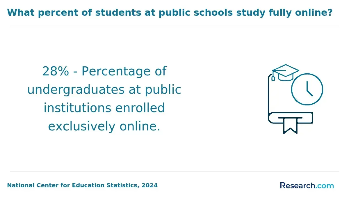
NCES distance education data released in recent federal reporting shows that online learning remains a mainstream enrollment pattern in U.S. higher education, with a large share of college students taking at least one distance course. For GIS students, this matters because schools now have more experience delivering technical labs, map critiques, and project-based assignments online than they did before online education became widespread.
The table below compares common learning formats and the trade-offs students should consider before enrolling.
| Format | Flexibility level | Best for | Potential drawback |
| Fully asynchronous online | Highest | Working adults, military students, caregivers, and students in different time zones | Requires strong self-management and comfort troubleshooting software independently |
| Synchronous online | Moderate | Students who want live discussion, faculty interaction, and structured deadlines | Scheduled meetings may conflict with work or family responsibilities |
| Hybrid online | Moderate | Students who benefit from fieldwork, labs, or local networking | Travel time and campus visits can reduce flexibility |
| Cohort-based online | Moderate | Students who want peer support and a predictable course sequence | Less room to accelerate or pause |
| Self-paced or accelerated online | High if well designed | Experienced students with transfer credits or prior GIS knowledge | Can be difficult for beginners who need more instructor feedback |
GIS is a technical field, so the most flexible program is not always the easiest. Students need reliable access to a computer that can run GIS software or cloud-based lab environments. They should also check whether exams are proctored, whether group projects require live coordination, and whether capstone presentations occur at fixed times.
AI and automation are changing GIS learning formats. Programs that teach students how to evaluate AI-assisted geocoding, automate workflows with Python, manage spatial data quality, and interpret machine-generated map outputs may provide stronger preparation than programs focused only on traditional desktop mapping. The goal is not to avoid automation but to learn how to supervise, validate, and explain geospatial outputs responsibly.
A good fit test is to review two sample syllabi before enrolling. If the course schedule, software access, feedback timeline, and project expectations match your weekly availability, the format is likely workable. If the program requires frequent live meetings during your work hours, a more asynchronous option may be safer.
What Student Support Services Improve Success in Online Geographic Information Systems Degree Programs?
Student support services can make a major difference in online GIS programs because students are learning both academic concepts and technical tools. Strong support reduces the risk of falling behind when software installation, spatial databases, coding assignments, or statistics become challenging.
The most useful services are the ones tied directly to online technical learning and career preparation. General advising matters, but GIS students should also look for geospatial-specific help.
- Dedicated online academic advising that helps students sequence GIS, statistics, programming, and capstone courses correctly.
- Remote technical support for GIS software, cloud labs, licensing, virtual desktops, and database access.
- Faculty office hours that are accessible across time zones or available by appointment.
- Career services with experience in geospatial résumés, portfolios, internships, government applications, and employer networking.
- Portfolio or capstone support that helps students produce work samples using real datasets and documented methods.
- Library and data support for finding public datasets, census data, environmental data, imagery, and local government geospatial resources.
Retention and completion are especially important for adult learners. If a school publishes graduation, persistence, or student outcome data for online programs, review it carefully. If it does not, ask whether outcomes are available for the GIS department, online division, or adult learner population.
Students should also ask how quickly instructors respond to technical questions. In a GIS course, a two-day delay can derail an assignment if the problem involves projections, broken data paths, licensing, or code errors. Strong programs make help accessible before deadlines, not only after grades are posted.
A common red flag is a program that advertises advanced GIS training but offers only generic online student support. If no one can explain how online students access lab software, spatial data, or project feedback, the learning experience may be frustrating even if the institution is accredited.
Which Financial Aid Options Are Available for Accredited Online Geographic Information Systems Degree Students?
Accredited online GIS degree students may qualify for the same broad categories of financial aid as campus students, including federal grants, federal loans, state aid, institutional scholarships, employer tuition assistance, military and veteran benefits, and private scholarships. Eligibility depends on the school, degree level, enrollment intensity, citizenship status, academic progress, and financial need.
Federal loan costs should be part of the affordability calculation. For the 2024-25 award year, Federal Direct Loan interest rates were 6.53% for undergraduate loans and 8.08% for graduate unsubsidized loans. This means graduate GIS students should be especially careful about borrowing more than they need, because interest can meaningfully increase the total cost of the degree.
The table below summarizes common aid options and how they apply to online GIS students.
| Aid option | Who may benefit | Key consideration |
| Federal Pell Grant | Eligible undergraduate students with financial need | Usually not available for graduate students |
| Federal Direct Loans | Undergraduate and graduate students who meet federal eligibility rules | Borrow only after comparing net cost and repayment impact |
| Institutional scholarships | Students at schools with merit, need-based, transfer, or program scholarships | Ask whether online GIS students are eligible |
| Employer tuition assistance | Working adults in government, utilities, planning, logistics, engineering, defense, or environmental fields | Confirm grade requirements, reimbursement timing, and service commitments |
| Military and veteran benefits | Eligible service members, veterans, and dependents | Check benefit certification, online housing rules, and program approval |
| Graduate assistantships or fellowships | Some master's students, usually in research-oriented programs | Less common in fully online professional programs |
Students should compare financial aid offers in net-cost terms. A scholarship at a high-tuition school may still leave a larger bill than a lower-cost public program. On the other hand, a more expensive program may be affordable if an employer covers tuition and the curriculum directly supports promotion.
Use this process to compare offers before enrolling.
- Complete the FAFSA if the school participates in federal student aid and you are eligible.
- Ask each school for a written estimate of tuition, mandatory fees, software costs, and expected aid.
- Separate gift aid from loans so you know what must be repaid.
- Check whether scholarships renew automatically or require a minimum GPA or credit load.
- Compare monthly loan repayment estimates against likely entry-level or advancement salaries in your target GIS role.
Students comparing affordability across fields may find useful parallels in Research.com's review of cheap online masters in counseling, especially the emphasis on net price, accreditation, and aid eligibility. The fields are different, but the financial decision process is similar: verify the credential, calculate total cost, and avoid borrowing based on optimistic salary assumptions.
Which Career Outcomes Are Associated With Accredited Online Geographic Information Systems Degree Programs?
Accredited online GIS degree programs can lead to roles in geospatial analysis, cartography, remote sensing, urban and regional planning, environmental analysis, emergency management, transportation, utilities, defense, public health, agriculture, and business analytics. Outcomes depend on degree level, technical portfolio, prior experience, location, and the student's ability to apply spatial methods to real problems.
BLS wage data released for 2024 places cartographers and photogrammetrists in a higher median-wage range than many technician roles, while surveying and mapping technician roles generally require less education and pay less. This means students should not treat "GIS jobs" as one salary category. A bachelor's degree, master's degree, certificate, and portfolio can each lead to different levels of responsibility.
The table below connects common GIS-related roles with typical education paths and skill expectations. It is designed to help students choose a degree level based on the work they want to do.
| Career path | Typical education path | Core responsibilities | Skills that improve competitiveness |
| GIS technician | Certificate, associate degree, bachelor's coursework, or entry-level bachelor's degree | Update maps, clean spatial data, digitize features, support mapping projects | ArcGIS, QGIS, data editing, coordinate systems, quality control |
| GIS analyst | Bachelor's degree or master's degree depending on employer | Analyze spatial patterns, build maps, manage datasets, support decisions | Python, SQL, spatial statistics, dashboards, web GIS, communication |
| Remote sensing analyst | Bachelor's or master's degree in GIS, geography, environmental science, or related field | Interpret imagery, monitor land use, assess environmental change | Imagery analysis, raster processing, machine learning basics, environmental data |
| Cartographer or photogrammetrist | Bachelor's degree commonly expected | Create maps, process imagery, compile geospatial information | Cartographic design, photogrammetry, geodesy, data visualization |
| Urban or regional planner with GIS specialization | Bachelor's degree for some roles, master's degree often preferred | Use spatial analysis for zoning, transportation, housing, and land-use decisions | Planning policy, demographics, public engagement, GIS modeling |
| Geospatial developer or data specialist | Bachelor's or master's degree with strong technical preparation | Build geospatial applications, automate workflows, manage spatial databases | Python, JavaScript, APIs, SQL, cloud GIS, version control |
Career outcomes improve when students graduate with evidence of applied skill. A strong GIS portfolio may include a web map, spatial database project, remote sensing analysis, Python automation script, dashboard, cartographic design sample, and a short explanation of data sources and methods. Employers often want to see how applicants think through messy spatial problems, not only that they completed courses.
Students aiming for leadership roles may eventually combine GIS expertise with management, public administration, data governance, or organizational strategy. For readers considering long-term advancement beyond technical roles, Research.com's online PhD leadership guide shows how doctoral study can support broader leadership goals, though most GIS positions do not require a doctorate.
The main career mistake is assuming the degree alone will create employment outcomes. GIS hiring is portfolio-driven and skill-sensitive. Students should graduate able to explain projections, data quality, uncertainty, ethics, privacy, and the business or public value of their analysis.
How Do Online and Campus-Based Geographic Information Systems Degree Programs Compare?
Online and campus-based GIS degree programs can lead to similar credentials when they are offered by the same accredited institution, but the learning experience can feel different. Online programs usually provide more scheduling flexibility, while campus programs may offer easier access to physical labs, field equipment, faculty research groups, and local internships.
The right format depends on the student's life situation and learning style. A working adult with GIS-related job duties may benefit more from an online program that allows immediate workplace application. A first-time student who wants residential life, research assistantships, or frequent in-person mentoring may prefer campus study.
The table below compares practical differences that matter when choosing between online and campus GIS programs.
| Factor | Online GIS program | Campus-based GIS program |
| Schedule | Often more flexible, especially if asynchronous | Usually follows fixed class meeting times |
| Software access | May use cloud labs, virtual desktops, or student licenses | May include physical labs and specialized workstations |
| Fieldwork | May be simulated, local, optional, or limited | Often easier to integrate with field methods and equipment |
| Networking | Depends on online events, discussion boards, alumni networks, and virtual career services | Often stronger for local internships, faculty projects, and peer interaction |
| Cost | Can reduce relocation and commuting costs | May include housing, transportation, and campus fees |
| Best fit | Working adults, remote students, transfer students, and self-directed learners | Students who want in-person structure, labs, and campus community |
Online GIS programs are not automatically easier. They may require more independence because students must manage software, deadlines, group work, and technical troubleshooting from home. Campus programs are not automatically better either; a campus program with limited GIS electives may be weaker than a well-designed online program with advanced geospatial databases, programming, and capstone work.
Students should avoid assuming that employers discount online degrees. What matters most is whether the institution is accredited, whether the transcript and degree are legitimate, and whether the student can demonstrate relevant skills. If the online program is from an accredited institution and includes rigorous applied GIS work, it can be a strong option.
How Should Students Choose the Best Accredited Online Geographic Information Systems Degree Program?
Students should choose an accredited online GIS degree program by starting with the career outcome they want and working backward. The best program for a future GIS technician may not be the best program for a remote sensing analyst, urban planner, geospatial developer, or public-sector manager.
A practical selection process helps students avoid being distracted by rankings, brand names, or promotional tuition claims. Use the steps below to narrow your options.
- Define your target role, such as GIS analyst, technician, planner, remote sensing analyst, or geospatial developer.
- Choose the right credential level: certificate for targeted skill-building, bachelor's for entry and mobility, or master's for advanced specialization.
- Verify institutional accreditation and confirm the exact GIS degree appears in the current catalog.
- Compare curriculum depth in spatial analysis, databases, programming, remote sensing, web GIS, statistics, and capstone projects.
- Calculate total net cost after transfer credits, aid, employer support, software, fees, and expected completion time.
- Review flexibility carefully, including asynchronous options, start dates, part-time pacing, and any campus or field requirements.
- Ask for career outcome information, portfolio expectations, internship support, and examples of recent student projects.
- Speak with an advisor before applying to confirm prerequisites, transfer policies, and course sequencing.
Students should also decide what they are willing to trade. A low-cost program may be worth it if it has solid technical coursework and good support. A higher-cost program may be worth it if it offers specialized training, a strong geospatial reputation, employer connections, or a faster path to completion. A highly flexible program may be ideal for working adults, but students who need structure may do better in a cohort-based format.
Acceleration can improve value only when the student can handle the workload. Research.com's guide to an accelerated online finance degree is a useful comparison point for understanding how shorter timelines can reduce opportunity cost, but GIS students should be cautious about rushing courses that build technical skills sequentially.
Before committing, ask the school for a sample degree plan, total cost estimate, software access details, and examples of capstone or portfolio work. If the program cannot answer these questions clearly, keep comparing. The best accredited online GIS degree program is the one that gives you a credible credential, marketable geospatial skills, manageable debt, and a realistic path to the role you want.
Other Things You Should Know About Geographic Information Systems
You do not need to be a mathematician, but you should be comfortable with quantitative thinking. GIS programs often use statistics, measurement, coordinate systems, spatial relationships, and data interpretation. Students who are willing to practice can usually build the required math skills over time.
Strong programs commonly include ArcGIS Pro, ArcGIS Online, QGIS, spatial databases, and at least some exposure to Python, SQL, or web mapping tools. The exact software matters less than whether students learn transferable concepts such as projections, data quality, spatial analysis, and cartographic communication.
Many students do, especially in asynchronous or part-time programs. The key is to check weekly workload expectations before enrolling. GIS labs can take longer than standard reading assignments because students may need to troubleshoot data, software, maps, and code.
A certificate may be enough if you already have a degree or professional background in planning, environmental science, public administration, engineering, or data analysis. A full degree is usually better for students who need a broader academic credential, want more career mobility, or plan to pursue advanced GIS roles.
References
- Directory of GIS Masters' courses https://www.rgs.org/choose-geography/choose-geography-as-a-postgraduate/gis-masters-courses-directory
- 2025 Best Online GIS Degrees https://www.onlineu.com/degrees/geographic-information-systems
- Geospatial & GIS Jobs Board | GEO CAREERS https://www.geo-careers.com/posts/geospatial-certificates-guide/
- Best Online GIS Certificate Programs: Graduate-level Paths in Geographic Information Systems https://www.directionsmag.com/articles/best-online-gis-certificate-programs-graduate-level-paths-in-geographic-information-systems
- Become a GIS Specialist: Job Overview, Requirements, and Salary https://www.gisdegree.org/careers/gis-specialist/
- Education Partner Directory https://thegpn.org/page/educationalpartners
- Want to be a GISP®? https://www.gisci.org/Want-to-be-a-GISP
- Bachelor of Applied Technology Geographic Information Systems https://www.sait.ca/programs-and-courses/degrees/bachelor-of-applied-technology-geographic-information-systems
- Guide to Geographic Information Systems (GIS) Degrees https://www.umassglobal.edu/blog-news/guide-geographic-information-systems-gis-degrees
- Bachelors in GIS Degrees, Online Included, Updated for 2026 https://www.gisdegrees.org/programs/degree/bachelors