2027 Best Online Bachelor's in Environmental Science With Data and Mapping Training

Co-Founder and Chief Data Scientist
Environmental science professionals increasingly encounter the challenge of integrating large datasets and geographic information systems (GIS) to address complex environmental issues like habitat fragmentation and climate risk mapping. Yet, many face inflexible traditional programs incompatible with work schedules or geographic constraints.
Recent data from the National Center for Education Statistics shows a sharp 35% increase in enrollments for online STEM bachelor's degrees among adult learners since 2022, signaling a shift toward remote credentials that balance career and education.
This article evaluates online bachelor's programs emphasizing data and mapping skills, guiding prospective students to navigate accessibility, skill relevance, and employability in their educational choices.
Key Things You Should Know
- Programs integrating spatial analysis increase employability by 24%, as 2024 EPA workforce data shows demand for GIS-savvy graduates across regulatory and private sectors, emphasizing quantitative skills over broad ecological theory.
- Choosing online degrees with real-time data projects reduces the typical two-year skill acquisition lag, enabling graduates to meet accelerated market needs but often sacrifices in-person networking found in traditional programs.
- Federal funding shifts post-2023 prioritize STEM-linked environmental programs with mapping, lowering student financial burdens by up to 15% versus conventional liberal arts degrees, accelerating career entry for cost-sensitive professionals.
What is an online environmental science degree with data and mapping training?
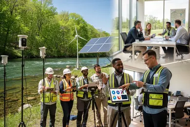
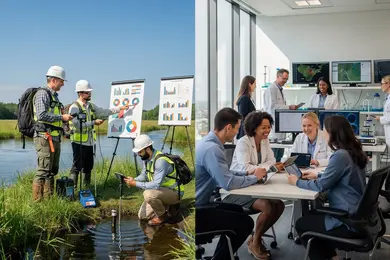
An online environmental science degree with data analysis skills strategically aligns foundational ecological knowledge with technical expertise in spatial data interpretation. Graduates emerge equipped to process complex datasets essential for addressing environmental challenges, including climate monitoring and resource management at local and regional levels.
Employers across sectors expect proficiency not only in environmental principles but also in geospatial tools like ArcGIS and QGIS, demanding graduates who can translate spatial analytics into actionable insights.
For example, an environmental consultant may leverage satellite imagery to identify deforestation trends, directly influencing policy recommendations for conservation efforts. Similarly, disaster response professionals apply mapping technologies to identify flood-prone areas, enhancing community safety through targeted evacuation plans.
These practical applications underline the importance of environmental science programs featuring mapping and spatial data training for workforce readiness.
However, prospective students should weigh the demands of remote learning formats, which require consistent computer access and the ability to manage intensive software use without traditional hands-on lab environments. Virtual internships or specialized remote labs often substitute for in-person fieldwork, creating tradeoffs between accessibility and experiential depth.
Growing industry momentum is reflected in the global geospatial analytics market, valued at $86.58 billion in 2024 and projected to grow at a 10.4% CAGR through 2030. For individuals seeking to navigate this evolving field, evaluating options such as the best online EHS programs can provide additional context for integrating environmental methodology with data-driven decision-making.
Which accreditation should this program have?
Employers prioritize environmental science degrees with robust, current accreditation frameworks. Regional accreditation recognized by the U.S. Department of Education or the Council for Higher Education Accreditation alone does not guarantee readiness, especially when pursuing specialized roles in geospatial data and mapping. Programs also need targeted endorsements from organizations like the Accreditation Board for Engineering and Technology (ABET) to verify technical rigor and applicability.
This dual accreditation is a decisive factor for jobs such as GIS analyst positions in state agencies, where compliance and spatial data proficiency are non-negotiable. Without it, graduates risk limited career mobility despite the U.S. Bureau of Labor Statistics projecting 6% growth and 6,900 new jobs for environmental scientists and specialists by 2032.
Students evaluating accredited online environmental science bachelor programs should confirm current software integration, ArcGIS and QGIS skills are often baseline requirements, and substantial coursework in data mapping. Such features directly affect employability and the ability to meet real-world job demands across fields like urban planning and natural resource management.
It is equally vital to verify that the program maintains active regional accreditation and that credits are transferable, impacting future credentialing and educational pathways. For those considering advanced data-focused environmental roles, comparing undergraduate options with pathways like an online doctorate data science can provide insight into long-term specialization and leadership opportunities within the growing environmental sector.
How do online and campus programs compare?
Online environmental science programs offer affordability and scheduling flexibility but frequently fail to provide the immersive, hands-on training found in campus options. This shortfall is crucial because employers increasingly prioritize demonstrated technical competencies in GIS and remote sensing, often cultivated through on-site fieldwork and access to specialized laboratories.
For example, urban planners and environmental compliance analysts typically expect candidates to have practical internship experience that campus programs facilitate more seamlessly through direct institutional partnerships.
The choice between online versus traditional environmental science degree benefits involves weighing tuition savings against practical skill development. Among online options, top public institutions average annual tuition around $8,000-$9,000, significantly lower than the often >$15,000 price tags at private providers. This matters for working professionals pursuing a strategic career pivot without accumulating debt, since return on investment depends on both cost and marketable skills.
For mid-career students balancing employment, online programs can be accessible but require proactive efforts to secure local or virtual internships to compensate for limited in-person mentorship. Decision-makers may benefit from combining online coursework with targeted in-person certificates or practicum to bridge this gap.
Those comparing the best online environmental science programs with campus alternatives should deliberately assess how each pathway equips them with tangible, employer-valued expertise. Likewise, applicants might consider emerging options like an accelerated bachelor's degree computer science online when aligned with environmental data roles demanding strong technical foundations.
What courses are in the curriculum?
Programs offering a bachelor's degree curriculum in environmental science with mapping and spatial data training equip graduates with technical competencies that significantly influence employability.
Graduates who master geographic information systems (GIS), remote sensing, and environmental data analysis are positioned for roles requiring advanced spatial data application, such as urban planning, disaster response, and resource management. For example, a GIS-trained professional can directly contribute to land use decisions or environmental modeling initiatives, distinguishing them from peers lacking such specialization.
The core curriculum typically begins with foundational courses in ecology, geology, chemistry, and environmental policy, then advances into specialized topics like Environmental Data Analysis using software such as R or Python.
These skills are increasingly vital as employers prioritize data-driven environmental decision-making. Key classes like GIS Fundamentals and Remote Sensing offer applied experience interpreting spatial data, essential for tasks ranging from climate monitoring to conservation strategies.
The labor market reflects this technical premium: workers in environmental science and geoscience occupations earn a median annual wage of $78,183, compared to the overall U.S. median of $48,200, indicating tangible value for data and GIS proficiency. Without this training, graduates face limited career mobility in environmental risk assessment and regulatory compliance sectors, where hands-on software skills and applied project experience are prerequisites.
Prospective students should weigh whether this pathway aligns with their career goals or if alternative degrees might suit them better. For context on broader degree evaluations, see is a library science degree worth it.
What admission requirements do schools usually ask for?
Admission to online bachelor's programs emphasizing environmental science with data and mapping training demands more than basic academic qualifications; applicants must demonstrate readiness to handle quantitative coursework and geospatial technology. The typical baseline includes a high school diploma or GED and a GPA near 2.5 to 3.0.
However, rigor comes through required transcripts showing proficiency in math and science fundamentals like Algebra II, Biology, and Chemistry, which serve as crucial foundations for GIS and spatial analysis work.
Programs increasingly prioritize evidence of quantitative aptitude and technical experience. Prospective students often must complete freshman-level math such as Statistics or Pre-Calculus and convincingly document their familiarity with relevant software through statements or portfolios, reflecting employer expectations for technical competence.
Letters of recommendation can provide an edge, especially when from professionals aware of an applicant's analytical or environmental skills, though these are not always mandatory for fully online tracks.
Applicants coming from non-science backgrounds, face additional hurdles, frequently requiring prerequisite science courses that can extend time to degree completion and delay entry into the workforce. This dynamic matters because the proliferation of online environmental and GIS/mapping programs, more than doubling since 2019, correlates with rising employer demand for graduates who merge environmental knowledge with data-savvy skills, making admissions more selective and practical readiness a critical factor.
How long does the degree take and what does it cost?
Completing a bachelor's degree in environmental science online generally requires four years full-time, paralleling traditional schedules, but the timeline varies with part-time pacing, often extending to five or six years for working students. This pacing significantly impacts financial outlay; longer enrollment periods mean paying additional tuition and technology fees, with total costs ranging from $30,000 to over $60,000 depending on institutional type and residency status.
By 2024, more than 70% of leading online environmental science bachelor's programs mandated courses in GIS, remote sensing, or spatial analysis, a curriculum element aligned with employer demand across resource management, urban planning, and environmental consulting roles that use geospatial data for operational decisions.
Students should anticipate extra annual costs of $1,000 to $2,000 for specialized GIS software licenses and computing hardware, expenses often overlooked but critical for skill development in these programs.
Tradeoffs between degree duration and workforce entry timing are key considerations: accelerated three-year paths speed up employment but can reduce opportunities for part-time work during study. Conversely, standard or extended pacing accommodates income generation but delays full-time career progression.
Transparent tuition and fee structures combined with flexible pacing options enhance strategic choice, directly affecting return on investment and readiness to meet employer expectations in data-intensive environmental roles.
What mapping and data skills will students learn?
Proficiency in geographic information systems (GIS) and spatial data analysis significantly influences employability in environmental science, with specialized online bachelor's programs offering focused training in these areas. Graduates armed with skills in software like ArcGIS, QGIS, and coding in Python or R consistently command median salaries 20-25% above those from more traditional environmental science tracks, according to Forbes Advisor's 2026 Best Online Environmental Science Degrees.
This premium stems from employer demand for candidates who convert complex datasets into actionable insights, particularly for resource management, urban planning, and environmental impact assessment.
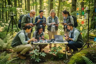
However, mastering these tools requires overcoming steep learning curves and dedicating effort to applying techniques in practical contexts. For example, consultants handling environmental remediation must produce precise spatial analyses that correlate pollution with ecosystem health, enabling credible reporting to regulatory bodies and informed decision-making.
Key workforce expectations extend beyond technical skills to include the ability to communicate spatial data clearly to non-technical stakeholders. Such interdisciplinary competence distinguishes candidates but can present challenges for students without experience in translating technical output into accessible reports.
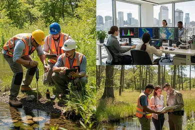
Despite these hurdles, integration of satellite imagery with field data remains critical for landscape-level monitoring and disaster response, reinforcing that graduates must balance technical, analytical, and interpersonal abilities within evolving environmental roles.
What careers can this degree lead to?
Specialized roles in environmental science increasingly require proficiency in spatial analysis and environmental data management.
Positions such as environmental consultants utilizing GIS for land use evaluation, conservation scientists leading habitat restoration with mapping tools, and urban planners embedding environmental datasets for sustainable design highlight how data skills shape occupational demands. Government agencies including the U.S. Environmental Protection Agency prioritize applicants adept in data visualization to support regulatory and impact assessments.
Employers expect graduates to maintain up-to-date capabilities in GIS software and remote sensing, essential for transforming complex environmental data into actionable reports. For instance, environmental impact consulting relies heavily on precise digital maps to facilitate project approvals. Graduates with combined environmental science and mapping expertise generally access better job prospects and enhanced wage potential relative to those with general environmental science backgrounds.
Workforce realities introduce tradeoffs. Balancing fieldwork with software mastery requires significant time investment, potentially narrowing focus on traditional lab or field assignments.
However, integrative skills meet employer demands for professionals who can navigate multidisciplinary teams addressing challenges from ecosystem management to infrastructure planning. Careers extend into climate research organizations where spatial data refine modeling and risk mitigation.
The 91% employment or continued education rate reported by Oregon State Ecampus graduates within six months confirms strong market absorption of these competencies. Data-savvy environmental professionals find roles in diverse settings, but must weigh software proficiency against hands-on experience development.
How much do environmental science jobs pay?
Environmental science roles that incorporate data and mapping skills command notably higher salaries, typically ranging from $55,000 at entry-level to over $95,000 for senior positions.
These wage disparities link directly to employers' growing demand for GIS and geospatial analysis competencies, skills mentioned in job postings that grew 42% between 2020 and 2024 according to Lightcast. Practical workforce outcomes favor professionals who blend traditional environmental knowledge with expertise in spatial statistics, remote sensing, and data visualization.
For instance, environmental consultants who integrate GIS to assess land use or pollution impacts are valued more than those relying solely on fieldwork; this skillset expands the scope of actionable insights available to agencies and sustainability firms. Conversely, nonprofit positions generally offer lower pay and less technical complexity, illustrating tradeoffs between mission orientation and compensation.
Key considerations for candidates include:
- Prioritizing educational programs that emphasize hands-on training in GIS and analytics to meet employer expectations.
- Targeting geographic regions with active environmental sectors, such as the Pacific Northwest or Northeastern U.S., where salaries are higher due to local demand and living costs.
- Obtaining certifications like ESRI ArcGIS or QGIS which complement degrees and often lead to immediate salary advantages.
Without these technical qualifications, professionals may find limited upward mobility and compressed pay scales, as traditional environmental roles increasingly require digital mapping proficiency to remain competitive in the job market.
What certifications or licenses may be needed?
Certification choices for graduates with a bachelor's in environmental science emphasizing data and mapping vary sharply with career focus and employer demand. For GIS-centric roles, the Geographic Information Systems Professional (GISP) certification is pivotal, confirming advanced expertise in spatial technology and increasing speed-to-hire in agencies and consulting firms immersed in a global GIS software market projected to nearly double by 2030.
Environmental scientists engaging with hazardous materials often face mandatory pathways requiring licenses such as Registered Environmental Manager (REM) or hazardous waste certifications, essential for safety compliance roles and sector-specific promotions. Broader credentials like Certified Environmental Scientist (CES) can support credibility beyond GIS niches.
Technical certifications tied to software platforms (e.g., Esri) have become practical prerequisites, reflecting employers' prioritization of immediate skill application over theoretical knowledge. For instance, urban environmental analysts might combine GISP with remote sensing certificates to satisfy complex project demands, illustrating how layered credentials drive multidisciplinary capability.
Because certification exams typically cost between $400 and $800, alongside ongoing education commitments, students must balance these upfront and recurring expenses against expected career trajectories. The absence of relevant certifications can substantially slow entry or progression in data-driven environmental roles.
Other Things You Should Know About Environmental Science Degrees
Most online programs incorporate virtual labs, software simulations, and project-based assignments to develop practical skills, but these cannot fully replicate on-site fieldwork or in-person lab environments. Students should prioritize programs that offer optional field components or partnerships with local organizations to gain direct experience. Employers in environmental science often value applied field skills, making it essential to supplement online coursework with real-world practice where possible.
Employers recognize the growing legitimacy of online degrees when they include rigorous training in data analysis and Geographic Information Systems (GIS). However, graduates must demonstrate proficiency through portfolios or certifications, as simply holding an online degree is rarely sufficient. Candidates who combine an online degree with verified technical skills or internships tend to have better job prospects than those relying on degree credentials alone.
Specialized data and mapping tracks in online environmental science degrees offer focused training in geospatial analysis, enhancing employability in environmental consulting and urban planning. These tracks provide in-depth skills in GIS and data interpretation, which are increasingly essential in addressing environmental challenges in 2027.
Students usually need a laptop with 8 GB RAM or more, reliable broadband internet, and software access for GIS work such as ArcGIS Pro or QGIS. Some programs also require a webcam, microphone, and a Windows-based system for mapping labs and data visualization assignments.
References
- The national curriculum https://www.gov.uk/national-curriculum
- Importance of Developing Your Students’ Use of Data and Map Skills - Explore Inside https://exploreinside.ngl.cengage.com/importance-of-developing-your-students-use-of-data-and-map-skills/
- Certificates, Certifications and Licenses https://trainingindustry.com/wiki/professional-development/certificates-certifications-and-licenses/
- The Difference between a Course and a Curriculum – Schoox Support Center https://support.schoox.com/hc/en-us/articles/203015332-The-Difference-between-a-Course-and-a-Curriculum
- Admissions Requirements https://www.aacom.org/become-a-doctor/apply-to-medical-school/admissions-requirements
- Best Online Bachelor's in GIS Degrees - GISDegree.org https://www.gisdegree.org/online/bachelors/